Sold18th C. Map, Engraving on Paper, Chios Greece18th Century map, engraving on paper, Chios Harbor, Greece, image 12 1/2" x 18 1/4", sheet 19 1/4" x 14 1/4", mounted on paper board. Folded in center; margins soiled; minor surface dirt.See Sold Price
SoldEARLY 18th C. MAP, WESTERN HEMISPHERE, DE FERTitle: Map: L'Amerique Meridionale et Septentrionale, Pub: Nicholas de Fer, Date: (1700) Circa 1705, Medium: HC Engraving, Paper size: 11 3/4 x 17, Inscribed: Publisher identified in the matrix, CondiSee Sold Price
SoldVAUGONDY ENGRAVING MAP CHARLEMAGNE EMPIRE, 18TH C.Unframed map, engraving on paper, "Imperium Caroli Magni Occidentis Imperatoris," Didier Robert de Vaugondy (French, 1723-1786), cartouche with title in upper left corner, held aloft by winged putti,See Sold Price
SoldHOMANN ENGRAVING MAP MOROCCO NORTH AFRICA, 18TH C.Unframed map, engraving on paper, "Statuum Marocca Norum," Johann Christoph Homann (German, 1703-1730), cartouche with title in upper left corner, showing Morocco, the Canary Islands, inset map of theSee Sold Price
JOHANN MATTHIAS HASE ENGRAVING MAP AFRICA, 18TH C.Unframed map, engraving on paper, "'Africa Secundum Legitimas Projectionis Stereographicae regulas," Johann Matthias Hase (German, 1684-1742), cartouche with title in lower left corner, illustrated wiSee Sold Price
SoldJohann Christoph Muller, 18th C. Map of BohemiaJohann Christoph Muller (Austrian, 1673-1721), "Mappa Totius Regni Bohemiae", hand colored engraving on paper. Circa 1742, Covens and Mortier edition of Muller's map depicting an early accurate map ofSee Sold Price
Sold18TH C. MAP OF JERUSALEM, UNFRAMED"A New Plan of Old Jerusalem, According to the Author", 1732, by Antoine Augustin Calmet (1672-1757), Leide, hand colored copperplate engraving, on wove paper, unframed, in mat, 13" x 17" image. VerySee Sold Price
SoldRARE 18TH C. MAP OF THE AMERICASHomann Heirs / Johann Matthaus Haas: "Americae Mappa generalis Secundum legimitas projectionis Stereiographiae regulas . . . MDCCXXXXVI". Nuremberg, 1746. Copperplate engraving on laid paper with handSee Sold Price
18th C. Map Italy: Etats du Roy de SardaigneHand colored copper engraving atlas map on laid paper, 1787, by Clouet, J. B. L. (Jean-Baptiste Louis,) entitled "Etats du Roy de Sardaigne. (with) Isle de Sardaigne". A beautiful map, with inset, shoSee Sold Price
SoldAlbrecht Carl Seutter, 18th C. Map of DenmarkAlbrecht Carl Seutter (German, 1722-1762), ""Daniae Regni Typus", engraving with hand coloring on paper, lower right margin with "A.C. Seutter delin 14". Hand colored map depicting Denmark, title in rSee Sold Price
18th C Zucchi Engraving w/ Map18th Century engraving by Zucchi showing a map of Netherlands from the German Sea. Fine, measures 7.25 x 11". Please note that this lot has a confidential reserve. When you leave a bid in advance of tSee Sold Price
Sold18th c. French map18th c. French map- ''Partie Meridonale de Picardie''- engraving with hand-coloring, center fold as should be, minor paper foxing, staining along upper edge, other minor soiling and staining throughouSee Sold Price
Sold18th C Engraving Zucchi w/ Map England18th Century engraving by Zucchi showing a map of England and Scotland from the German Sea. Fine ,measures 7.25 x 11". Please note that this lot has a confidential reserve. When you leave a bid in advSee Sold Price
18th C. Maps, Kent, Surrey, by Emanuel BowenEmanuel Bowen's 18th Century maps of Kent and Surrey are original engravings printed upon eighteenth century, hand-made, laid paper and with full margins as published in London by W. Owen in 1756 forSee Sold Price
Sold18th c. Florida Map - Herman MollFLORIDA, CALLED BY YE FRENCH LOUISIANA & C., hand colored engraved map by Herman Moll (1688-1732), originally appeared in Moll's Atlas Minor (1736). 8 1/8" x 11" plate, 8 3/8" x 11 1/8" sight, 15" x 1See Sold Price
Sold16C. Braun & Hogenberg Bird's Eye View Chios MapGermany,16th Century Bird's-eye view map of Chios, Greece depicting the island's coast with several vessels in the harbor. Engraving on paper Impression area 18 1/8" x 12 3/4",Frame 28" x 22" Signed wSee Sold Price
SoldFRAMED HOMANN ATLAS MAP ANCIENT GREECE, 18TH C.Framed Homann atlas map on paper, "Imperii Tvrcici Evropaei terra in primis Graecia," mid 18th c., Johann Christoph Harenberg (German, 1696-1774) cartographer, depicting Greece, as well as the easternSee Sold Price
Sold18th c. H/C Map Flamsteed and Fortin 177618th Century hand-colored engraved Celestial Map / Zodiac Map Entitled Le Lynx, Le Petit Lion (Lynx, Small Lion), plate 5, from "Atlas Céleste de Flamstéed, approuvé par l'Académie Royale des ScieSee Sold Price
SoldFRENCH BONNE MAP OF CHINA, KOREA & JAPAN, 18TH C.Framed engraving with hand coloring on paper, map of China, Korea, and Japan, "Empire De La Chine, Rme De Coree et Isles Du Japon," Rigobert Bonne (French, 1727-1794) cartographer, engraved by PietroSee Sold Price
Original 18th c. H/C Engraved Lattré Map of EuropeAntique Original Hand-colored Engraved Map of Europe from PETIT ATLAS MODERNE ou collection de cartes élémentaires dédié à la jeunesse | Engraved and published in Paris by Jean Lattr�See Sold Price
Lot of 18th C EngravingsA lot of five 18th century engravings including one map of Germany, various sizes, mostly Very Good. Reserve: $30.00 Shipping: Domestic: Flat-rate of $8.00 to anywhere within the contiguous U.S. InterSee Sold Price
SoldA New Map of the Cherokee Nation, 18th C."A New Map of the Cherokee Nation with the Names of the Towns & Rivers, engraved from an Indian Draught by T. Kitchin ." Depicts Native American villages in western North Carolina, Tennessee, KentuckySee Sold Price
Chart of the Entrances to the River ThamesChart of the Entrances to the River Thames. William Heather (18th cent.). Engraved map. London, c. 1791. 25 1/4 x 32 3/4 inches sheet. Numerous soundings and depictions of the well-knows sandbanks neaSee Sold Price
17TH C. WORLD MAP BY NICOLAES VISSCHER (NETHERLANDS, 1618-1709)Thomaston Place Auction Galleries4.4(394)See Sold PriceFeb 24, 2024
EARLY 18TH C. DUTCH CHART OF PACIFIC OCEAN BY FREDERIK DE WIT (1629-1706) WITH CALIFORNIA AS ANThomaston Place Auction Galleries4.4(394)See Sold PriceFeb 24, 2024
17TH C. ANTIQUE MAP SIEGE OF LA ROCHELLE, FRANCE, FRAMEDThomaston Place Auction Galleries4.4(394)See Sold PriceFeb 24, 2024
EARLY 18TH C. MAP OF ITALY, FRAMEDThomaston Place Auction Galleries4.4(394)See Sold PriceFeb 24, 2024
LATE 16TH C. MAP OF SCOTLAND BY MERCATOR, FRAMEDThomaston Place Auction Galleries4.4(394)See Sold PriceFeb 24, 2024
17TH C. MAP OF THE BERKSHIRES BY JOHN SPEED, FRAMEDThomaston Place Auction Galleries4.4(394)See Sold PriceFeb 24, 2024
18TH C. ANTIQUE MAP: FRENCH & INDIAN WAR, FRAMEDThomaston Place Auction Galleries4.4(394)See Sold PriceFeb 24, 2024
17TH C. ENGLISH LINEAR MAP BY OGILBY, FRAMEDThomaston Place Auction Galleries4.4(394)See Sold PriceFeb 24, 2024
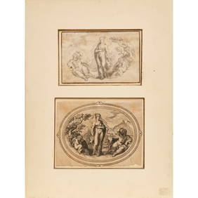
ANTIQUE ITALIAN ENGRAVING STATUE OF POPE URBAN PALAZZO CAPITOLINO ROMEMarnie Collection Auction4.5(70)See Sold PriceMar 10, 2024
ANTIQUE ITALIAN ENGRAVING STATUE OF SABINA WIFE OF EMPEROR ADRIANOMarnie Collection Auction4.5(70)See Sold PriceMar 10, 2024
ANTIQUE ITALIAN ENGRAVING STATUE OF CRISPINA WIFE OF EMPEROR COMMODUSMarnie Collection Auction4.5(70)See Sold PriceMar 10, 2024
ANTIQUE ITALIAN ENGRAVING ROMAN STATUE OF MUSE MELPOMENEMarnie Collection Auction4.5(70)See Sold PriceMar 10, 2024
ANTIQUE ITALIAN ENGRAVING GREEK ROMAN STATUE OF MUSE ERATOMarnie Collection Auction4.5(70)See Sold PriceMar 10, 2024
ANTIQUE ITALIAN ENGRAVING GREEK ROMAN STATUE OF A MUSE PALAZZO LANCELLOTTIMarnie Collection Auction4.5(70)See Sold PriceMar 10, 2024
ANTIQUE ITALIAN ENGRAVING STATUE OF POPE INNOCENTMarnie Collection Auction4.5(70)See Sold PriceMar 10, 2024
ANTIQUE ITALIAN ENGRAVING ROMAN STATUE OF LUCIO ANTONIOMarnie Collection Auction4.5(70)See Sold PriceMar 10, 2024
ANTIQUE ITALIAN ENGRAVING ROMAN STATUE OF SUSANA DI FRANCESCOMarnie Collection Auction4.5(70)See Sold PriceMar 10, 2024