ATLAS of ANTIENT GEOGRAPHY by SAMUEL BUTLER 1843John McInnis Auctioneers,LLC4.6(502)See Sold PriceFeb 24, 2024
18TH C. ANTIQUE MAP: FRENCH & INDIAN WAR, FRAMEDThomaston Place Auction Galleries4.4(386)See Sold PriceFeb 24, 2024
Rand McNally Railroad Map Cabinet w/ 21 Railroad MapsRail & Road Auctions4.6(165)See Sold PriceMar 08, 2024
Keith Haring - Ink on New York Map, Best Buddies, Inscribed, Signed, and DatedSapphire Auction Gallery4(67)See Sold PriceMar 02, 2024
LATE 17TH C. FRENCH MAP OF THE NEW WORLD BY ALEXIS-HUBERT JAILLOT (1632-1712)Thomaston Place Auction Galleries4.4(386)See Sold PriceFeb 24, 2024
Central Railroad of New Jersey Map of Sandy Hook Route-ca. 1903JM Hobby Supply and Railroad Artifact Auctions4.4(126)See Sold PriceFeb 24, 2024
Lot of Six Mixed Atlas Box Cars-HO Scale-New in BoxJM Hobby Supply and Railroad Artifact Auctions4.4(126)See Sold PriceFeb 25, 2024
Rand McNally/Santa Fe Railroad Map of Iowa-1912JM Hobby Supply and Railroad Artifact Auctions4.4(126)See Sold PriceFeb 24, 2024
NICOLAES VISSCHER (NETHERLANDS, 1618-1709) MAP OF THE NEW WORLDThomaston Place Auction Galleries4.4(386)See Sold PriceFeb 24, 2024
17TH C. WORLD MAP BY NICOLAES VISSCHER (NETHERLANDS, 1618-1709)Thomaston Place Auction Galleries4.4(386)See Sold PriceFeb 24, 2024
Lot of Six Mixed Atlas Cabooses-HO Scale-New in BoxJM Hobby Supply and Railroad Artifact Auctions4.4(126)See Sold PriceFeb 25, 2024
Two historical maps of the 19tTwo historical maps of the 19th century, map of Europe as part col. Steel engraving from: Levasseur ''Atlas National de la France Illustrée'' from 1952, behind glass a. Pp. Ger., As well as ''Map oSee Sold Price
SoldTwo historical maps of thTwo historical maps of the 17th century from Lithuania and Rügen, ''Magni Ducatus Lithuaniae et Regionum Adiacentium exacta Descriptio ...'', partly col. Copper engraving with title cartouche at BlaeSee Sold Price
SoldTwo historical maps of the 18th centTwo historical maps of the 18th century, map of Europe ''Europa secundum legitima'', partly col. copper engraving by Homann Erben about 1740, stained, backed and with missing parts at lower margin, anSee Sold Price
SoldTwo historical maps -- Holstein, ''HTwo historical maps -- Holstein, ''Holsatiae Ducatus'', border col. Engraving by Mercator circa 1620, and Elbe River map ''Albis Fluvius Germaniae celebris a Fontibus ad Ostia. Cum fluminibus ab utroqSee Sold Price
SoldTwo historical maps, IndiTwo historical maps, India u. Sri Lanka 'Peninsula Indiae citra Gangem, Hoc est Orae celeberrimae Malabar & Coromandel ... Ceylon', altkolor. Copper engraved map with figurative title cartouche by HomSee Sold Price
SoldTwo historical maps of BrTwo historical maps of Bremen, 1) ''Ducatus Bremae et Ferdae Nova tabula''. Copper engraving, col., Johann Bapt. Homann Nuremberg to 1740, blotchy, under Pp. Behind glass ger. 68 x 77 cm, neckline 50.See Sold Price
SoldTwo historical maps of the 18th century, Germany andTwo historical maps of the 18th century, Germany and Denmark, ''Imperium Romano-Germanicum ...'' (Central Germany). Copper engraving, Matthias Seutter c. 1730, ''Regni Daniae ...'', copperplate engravSee Sold Price
SoldTwo historical maps of the 18th cenTwo historical maps of the 18th century, Lower Saxony ''Circulus Saxoniae Inferioris...'', part col. Engraving by de Witt with decorative title cartouche and mileage indicator, and Norway ''Regni NorvSee Sold Price
SoldTwo historical maps of Brabant and the course of theTwo historical maps of Brabant and the course of the Moselle, partly col. Engravings from Nuremberg by Homann around 1720, ''Ducatus Brabantiae nova Tabula ...'', as well as ''Mosellae Fluminis ...'',See Sold Price
SoldTwo historical maps of HannovTwo historical maps of Hannover and Lüneburg, ''L'Electorat de Hannover'', part col. Engraving by Covens & Mortier in Amsterdam, dated 1745, with the area of the mouth of the Elbe, Minden, Kassel aSee Sold Price
SoldOrtelius, two historicalOrtelius, two historical maps of Indonesia and Greece from the ''Theatrum Orbis Terrarum'' around 1580, ''Indiae orientalis Insularumque Adiacientium type'' and ''Graeciae universae secundum hodiernumSee Sold Price
SoldOrtelius, two historicalOrtelius, two historical maps of North Africa and Austria from the ''Theatrum Orbis Terrarum'' around 1580, ''Barbariae et Biledulgerid nova descriptio'' and ''Austriae Ducatus Chorographia ...'', altSee Sold Price
SoldTwo small historical mapsTwo small historical maps of the 17th / 18th. Century, ''Svevia quae cis coda num suit sinum'', area of ??the later Pommern with the areas of the germansichen trunks, col. Copper engraving by PhilippSee Sold Price
SoldTwo 18th century historicTwo 18th century historical maps of France and England, ''Regnorum Magnae Britanniae sive Angliae Scotiae ...'', Bordercol. Copper engraving with figurative cartouche Detail map of the Orkney Islands,See Sold Price
SoldLot of 3 Pictures, Early unkown City photograph 28Lot of 3 Pictures, Early unkown City photograph 28 1/2x 18 1/2, two historical informational colorful maps of Scarborough, ME 24x18 and 32x24See Sold Price
SoldRussia - Convolute of twoRussia - Convolute of two 18th century historical maps, ''Tabula Geographica qua Pars Russiae Magnae'', partly col. Copper engraving with large figurative cartouche by Homann circa 1720, and ''ImperiiSee Sold Price
Lot of 3 Pictures, Early unkown City photograph 28Lot of 3 Pictures, Early unkown City photograph 28 1/2x 18 1/2, two historical informational colorful maps of Scarborough, ME 24x18 and 32x24See Sold Price
SoldTwo MapsTwo reproductions of historical United States maps. One reproduction of Captain John Smith's map of Virginia produced from an engraving held by the Library of Congress. Sight size 15 1/2 x 18 1/2 inchSee Sold Price
SoldVIRGINIANA - ARCHITECTURE - MAP VOLUMES, LOT OF TWVIRGINIANA - ARCHITECTURE - MAP VOLUMES, LOT OF TWO, (1). Smith, Charles W. A HISTORICAL MAP OF VIRGINIA, Richmond, VA: lithographed by A. Hoen & Co., Inc., 1930. Eight-page fold-out map. No. 237 of lSee Sold Price
SoldScarce Genealogical h/c chart of Anglo-Saxons, 1821Large format, two-page foldout showing the historical and chronological map of the Church. Historical and Chronological Map of the Church from the Ascension of Jesus Christ to the Year 1821, with a LiSee Sold Price
SoldTwo framed maps of Maine depicting: Chart of BoothTwo framed maps of Maine depicting: Chart of Boothbay, Historical Map of Arcadia in English and French 53 x 29 1/2 with Damariscotta, Sheepscot and Kennebec Rivers and soundings in feet other framed HSee Sold Price
Sold(3) Westermann's Historical Maps Of EuropeThree Westermann 's Classical & Historical Map Series, published by Rand McNally, cloth on two wooden dowels, to include an 1190 map at the time of the Crusades, of Europe & Western Asia, a Medieval CSee Sold Price
SoldTwo maps of South Carolina 19th centuryTwo maps of South Carolina 19th century 'GEOGRAPHICAL, STATISTICAL AND HISTORICAL MAP OF SOUTH CAROLINA'engraved by Samuel Huffy'NORTH CAROLINA, SOUTH CAROLINA AND GEORGIA'framed@Size:<$>sight size: HSee Sold Price
SoldTWO 1817 MAPS OF MARATHON AND SPARTAIncludes an historical map plan of the Battle of Marathon with the disposition of the army of the Greeks. 13.5 x 8.75 inch sight size. Also 'Essay on the Topography of Sparta and its Environs, for theSee Sold Price
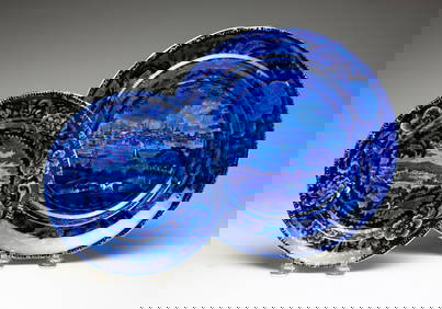
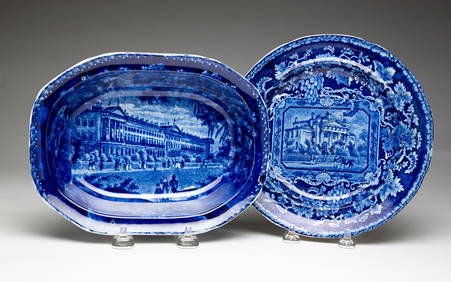
TWO STAFFORDSHIRE HISTORICAL BLUE PLATES.Amelia Jeffers, Auctioneers & Appraisers4.6(101)See Sold PriceMar 08, 2024
TWO STAFFORDSHIRE HISTORICAL PLATES.Amelia Jeffers, Auctioneers & Appraisers4.6(101)See Sold PriceMar 08, 2024
TWO STAFFORDSHIRE HISTORICAL BLUE PIECES.Amelia Jeffers, Auctioneers & Appraisers4.6(101)See Sold PriceMar 08, 2024
A quantity of World War II / Two military ephemera to include assorted 1940s newspapers pages toClaydon Auctioneers Ltd4.3(125)See Sold PriceFeb 26, 2024
Geographical, Statistical, and Historical Map of the Leeward Islands.Jasper524.5(9.8k)See Sold PriceFeb 27, 2024
Geographical Statistical and Historical Map of the Windward IslandsJasper524.5(9.8k)See Sold PriceFeb 27, 2024
Geographical, Statistical, and Historical Map of the West Indies.Jasper524.5(9.8k)See Sold PriceFeb 27, 2024
Antique "Magic Lantern" Glass Educational SlidesRapid Estate Liquidators and Auction Gallery4.5(1.1k)See Sold PriceFeb 25, 2024
George F. Cram - Historical Map of Pittsburgh Allegheny PennsylvaniaProverde Auctions4.3(3)See Sold PriceFeb 28, 2024
PRE WWII SOVIET CARICATURE PAINTING BY CHEREMNYKHAntique Arena Inc.4.5(852)See Sold PriceMar 09, 2024
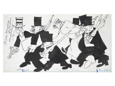
Jules Verne, L'Archipel en Feu, Au Steamer Red MacaronLion and Unicorn4.7(1.8k)See Sold PriceMar 10, 2024