ATLAS of ANTIENT GEOGRAPHY by SAMUEL BUTLER 1843John McInnis Auctioneers,LLC4.6(502)See Sold PriceFeb 24, 2024
18TH C. ANTIQUE MAP: FRENCH & INDIAN WAR, FRAMEDThomaston Place Auction Galleries4.4(386)See Sold PriceFeb 24, 2024
Rand McNally Railroad Map Cabinet w/ 21 Railroad MapsRail & Road Auctions4.6(165)See Sold PriceMar 08, 2024
Keith Haring - Ink on New York Map, Best Buddies, Inscribed, Signed, and DatedSapphire Auction Gallery4(67)See Sold PriceMar 02, 2024
LATE 17TH C. FRENCH MAP OF THE NEW WORLD BY ALEXIS-HUBERT JAILLOT (1632-1712)Thomaston Place Auction Galleries4.4(386)See Sold PriceFeb 24, 2024
Central Railroad of New Jersey Map of Sandy Hook Route-ca. 1903JM Hobby Supply and Railroad Artifact Auctions4.4(126)See Sold PriceFeb 24, 2024
Lot of Six Mixed Atlas Box Cars-HO Scale-New in BoxJM Hobby Supply and Railroad Artifact Auctions4.4(126)See Sold PriceFeb 25, 2024
Rand McNally/Santa Fe Railroad Map of Iowa-1912JM Hobby Supply and Railroad Artifact Auctions4.4(126)See Sold PriceFeb 24, 2024
NICOLAES VISSCHER (NETHERLANDS, 1618-1709) MAP OF THE NEW WORLDThomaston Place Auction Galleries4.4(386)See Sold PriceFeb 24, 2024
17TH C. WORLD MAP BY NICOLAES VISSCHER (NETHERLANDS, 1618-1709)Thomaston Place Auction Galleries4.4(386)See Sold PriceFeb 24, 2024
Lot of Six Mixed Atlas Cabooses-HO Scale-New in BoxJM Hobby Supply and Railroad Artifact Auctions4.4(126)See Sold PriceFeb 25, 2024
SoldMap of Louisiana, c. 1805, showing the parishes,Map of Louisiana, c. 1805, showing the parishes, presented in a walnut frame, H.- 16 3/4 in., W.- 20 5/8 in.See Sold Price
SoldColored Map of Louisiana, c. 1910, showing theColored Map of Louisiana, c. 1910, showing the parishes, gilt framed, H.- 13 in., W.- 10 in.See Sold Price
SoldRandy McNally Map of Louisiana, 1914, hand colored,Randy McNally Map of Louisiana, 1914, hand colored, showing the parishes, presented in a gilt frame, H.- 9 3/4 in., W.- 12 3/4 in.See Sold Price
SoldMap : The County of Buckingham by C J Greenwood engraveMap : The County of Buckingham by C J Greenwood engraved by J & C Walker, 1832-3, showing parish boundaries, railways, canals etc. with vignette of Stowe House. Framed and glazed. 23 1/4" x 26 3/4".See Sold Price
SoldVellum Map : A 17 th /18 th C hand annotated ' Map ofVellum Map : A 17 th /18 th C hand annotated ' Map of HEMEL HEMPSTEAD and BOVINGDON ' showing the Parish boundarys ( Sarratt, Kings Langley, Northchurch, Gaddesden etc), also shows individual houses aSee Sold Price
SoldLe Lievre Brothers (Publishers) Map of the IslandLe Lievre Brothers (Publishers) Map of the Island of Jersey,with all the Road, Lanes, Streams, &c., showing the island divided up into parishes, lithographed map with outline hand-colouring, 3See Sold Price
Sold[Map of Louisiana][Antique Map of Louisiana], "State of Louisiana", 1876, by C. Roeser, Department of the Interior, Washington, D.C., chromolithograph by Julius Bien, New York, showing details of towns, cities and railSee Sold Price
Sold[LOUISIANPLANTATION MAP] Armant St.[LOUISIANA PLANTATION MAP] Armant St. James Plantation , c. 1870, watercolor and ink on paper, showing details of acreage, buildings, forest and the Mississippi River, with decorative border incorporaSee Sold Price
SoldTUNISONS MAP ARKANSAS, LOUISIANA, FLORIDA, GEORGIA(lot) Tunison's map of "Arkansas, Louisiana, Mississippi" , the verso with maps of "Florida with inset showing "Mouths of the Mississippi River", Georgia, South Carolina:, c. 1903, repair at center foSee Sold Price
SoldGroup of Twenty-Four Hand-Colored MapsGroup of Twenty-Four Antique Hand-Colored Maps , 17th to 19th c., majority showing provinces of Europe, unframed. Provenance: Property deaccessioned from the Louisiana State Museum, proceeds to be useSee Sold Price
SoldColton Political Map of Louisiana, dated 1881Colton Political Map of Louisiana, dated 1881, indicating the parish areas obtainable for Homesteads of United States land, state land and both, prepared by G. W. and C. B. Colton & Co., 182 William SSee Sold Price
Sold"Map of the Parish of East Baton Rouge Louisiana," 20th"Map of the Parish of East Baton Rouge Louisiana," 20th c., after the 1895 original, presented in a burled wood frame, H.- 22 3/8 in., W.- 22 1/2 in.See Sold Price
Sold"Map of the Parish of East Baton Rouge Louisiana," 20th"Map of the Parish of East Baton Rouge Louisiana," 20th c., after the 1895 original by A. Kaiser & J. A. Swensson, presented in a wood frame with a gilt beaded edge and a gilt liner, H.- 23 in., W.- 2See Sold Price
SoldMAP OF NORTH AMERICA Hand colored, showing the EasternMAP OF NORTH AMERICA Hand colored, showing the Eastern part of North America, including the Louisiana and Florida Territory, c. 1740, large satirical title cartouche of the Mississippi Bubble investmeSee Sold Price
SoldGroup of Twenty-Four Antique Maps, consisting of "TheGroup of Twenty-Four Antique Maps, consisting of "The Mississippi River from its Mouth to Cairo, showing New Orleans, Harper's, May 10th, 1862; "Louisiana," by Geo. Cram, c. 1900; "Watson's Atlas MapSee Sold Price
SoldCoulton's Louisiana(New York: J. H. Coulton & Co., 1855), a detailed antebellum map showing each of the state's parishes. Unframed, under shrink wrap with backing. 14.5 x 17.25 in. The Lifelong Collection of Keith and CSee Sold Price
North America Sheet XIII Parts of Louisiana, Arkansas,Title/Content of Map: North America Sheet XIII Parts of Louisiana, Arkansas, Mississippi, Alabama & Florida Date: c1849 Cartographer: WALKER, J. & C. | TANNER | SMITH Size: 13.5X15.3 Map showing countSee Sold Price
SoldMAP C.1858, TEXAS, ARIZONA,, WEEKLY DISPATCH ATLASFramed map by the Weekly Dispatch Atlas, London, c. 1858, Edward Weller lithographer (British, 1819-1884) showing Texas, Arkansas, Louisiana and states and territories northward to the Canadian borderSee Sold Price
SoldT.S. Hardee, "Map of Louisiana showing topographicalT.S. Hardee, "Map of Louisiana showing topographical features, prepared for the medical and surgical memoirs of Joseph Jones, M.D. by T.S. Hardee, Civil Engineer," 1879, colored engraving, presented iSee Sold Price
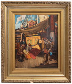
SoldMap of Louisiana, showing Missouri Territory,Map of Louisiana, showing Missouri Territory, Spanish Territory, and Mississippi Territory, H.- 15 in., W.- 16 3/4 in.See Sold Price
Lopez Map of Louisiana Showing New OrleansLOPEZ DE VARGAS MACHUCA, Tomas (1730-1802). La Luisiana cedida al Rei N. S. por S. M.. Christianisima, con la Nueva Orleans, e isla en que se halla esta ciudad. Engraved map. Madrid, 1762. 17 1/4" x 2See Sold Price
EDINBURGH antique town city map plan showing parishes.TITLE/CONTENT OF MAP: 'Plan of the City of Edinburgh' The top image on the right hand side shows the entire map. To view a close up of the map showing the level of printed detail, please click on theSee Sold Price
SoldAttributed to John Ogilby (1600-1676), "HemisphericAttributed to John Ogilby (1600-1676), "Hemispheric Astronomical Map," c. 1670, showing California as an island, mounted, H.- 8 1/4 in., W.- 10 in.See Sold Price
SoldHand Colored 'Gulf of Bengal' MapHand Colored 'Gulf of Bengal' Map c.1700, showing the east coast of India and Ceylon (Sri Lanka), oriented to the west by Jan Jansson Height: 18.25 inches, Width: 21.25 inches (sight) Frame Size: 27.0See Sold Price
HANNAH ADAMS c1805 View Of Religions & Essay On Truth Tan Calf No SpineLuis Porretta Fine Arts4.3(10)See Sold PriceMar 02, 2024
In the Manner of Bernard Buffet (French, 1928-1999), "Landscape with White Stallions Grazing ThroughCrescent City Auction Gallery4.3(229)See Sold PriceMar 01, 2024
Follower of Arthur David McCormick (British, 1860-1943), "Drake's Drum," 20th c., H.- 20 in., W.- 16Crescent City Auction Gallery4.3(229)See Sold PriceMar 01, 2024
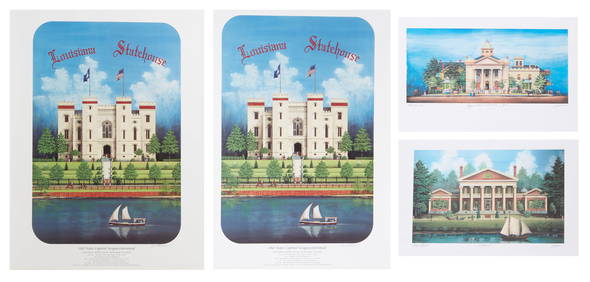
Jim Blanchard (American/Louisiana, b. 1955), Four Architectural Prints, 20th c., Smaller Prints-Crescent City Auction Gallery4.3(229)See Sold PriceMar 01, 2024
1764 Bellin Map of Western Guadeloupe in the Lesser Antilles -- Partie Occidentale de l'Isle de laJasper524.5(9.8k)See Sold PriceFeb 27, 2024
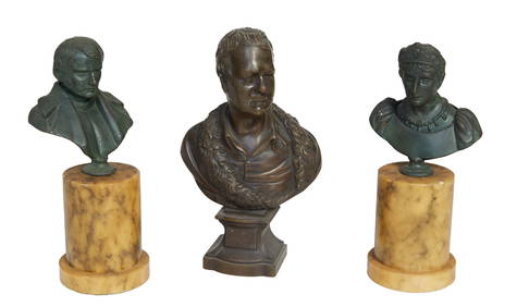
Group of Three Patinated Bronze Cabinet Figures, 19th c., Man- H.- 7 3/4 in., W.- 4 1/2 in., D.- 2Crescent City Auction Gallery4.3(229)See Sold PriceMar 08, 2024
T. F. Manson (American, late 19th/20th Century), "Ship at Sea," 1940, H.- 24 in., W.- 18 in., FramedCrescent City Auction Gallery4.3(229)See Sold PriceMar 08, 2024
French Gilt Ormolu Mounted Ebonized Pedestal, early 20th c., H.- 46 1/4 in., W.- 20 in., D.- 20 in.Crescent City Auction Gallery4.3(229)See Sold PriceMar 08, 2024
Pair of Chinese Carved Hardwood Side Chairs, early 20th c., H.- 38 in., W.- 20 1/2 in., D.- 16 1/2Crescent City Auction Gallery4.3(229)See Sold PriceMar 08, 2024
Continental School, "The Old Mill," 19th c., H.- 24 3/4 in., W.- 30 in., Framed- H.- 29 1/2 in., W.-Crescent City Auction Gallery4.3(229)See Sold PriceMar 08, 2024
Continental School, "Floral Still Life," 19th c., H.- 39 in., W.- 27 in., Framed- H.- 45 1/4 in.,Crescent City Auction Gallery4.3(229)See Sold PriceMar 09, 2024
British School, "Children Playing in the Farmyard Road," 19th c., H.- 19 in., W.- 27 in., Framed-Crescent City Auction Gallery4.3(229)See Sold PriceMar 09, 2024
After Emile Louis Picault (French, 1833-1915), "Art Nouveau Bust of a Young Woman," c. 1890,Crescent City Auction Gallery4.3(229)See Sold PriceMar 09, 2024
"Map of the Parishes of Iberville Most of West Baton Rouge and Including Parts of the Parishes ofCrescent City Auction Gallery4.3(229)See Sold PriceMar 09, 2024


![[Map of Louisiana] (1 of 3)](https://p1.liveauctioneers.com/268/27173/10262407_1_x.jpg?height=282&quality=70&version=1320495480)
![[LOUISIANPLANTATION MAP] Armant St. (1 of 2)](https://p1.liveauctioneers.com/268/1779/767581_1_x.jpg?height=282&quality=70)