ATLAS of ANTIENT GEOGRAPHY by SAMUEL BUTLER 1843John McInnis Auctioneers,LLC4.5(505)See Sold PriceFeb 24, 2024
18TH C. ANTIQUE MAP: FRENCH & INDIAN WAR, FRAMEDThomaston Place Auction Galleries4.4(394)See Sold PriceFeb 24, 2024
Rand McNally Railroad Map Cabinet w/ 21 Railroad MapsRail & Road Auctions4.6(165)See Sold PriceMar 08, 2024
Keith Haring - Ink on New York Map, Best Buddies, Inscribed, Signed, and DatedSapphire Auction Gallery4.1(67)See Sold PriceMar 02, 2024
LATE 17TH C. FRENCH MAP OF THE NEW WORLD BY ALEXIS-HUBERT JAILLOT (1632-1712)Thomaston Place Auction Galleries4.4(394)See Sold PriceFeb 24, 2024
Central Railroad of New Jersey Map of Sandy Hook Route-ca. 1903JM Hobby Supply and Railroad Artifact Auctions4.4(127)See Sold PriceFeb 24, 2024
Lot of Six Mixed Atlas Box Cars-HO Scale-New in BoxJM Hobby Supply and Railroad Artifact Auctions4.4(127)See Sold PriceFeb 25, 2024
Rand McNally/Santa Fe Railroad Map of Iowa-1912JM Hobby Supply and Railroad Artifact Auctions4.4(127)See Sold PriceFeb 24, 2024
NICOLAES VISSCHER (NETHERLANDS, 1618-1709) MAP OF THE NEW WORLDThomaston Place Auction Galleries4.4(394)See Sold PriceFeb 24, 2024
17TH C. WORLD MAP BY NICOLAES VISSCHER (NETHERLANDS, 1618-1709)Thomaston Place Auction Galleries4.4(394)See Sold PriceFeb 24, 2024
Lot of Six Mixed Atlas Cabooses-HO Scale-New in BoxJM Hobby Supply and Railroad Artifact Auctions4.4(127)See Sold PriceFeb 25, 2024
SoldGroup of Twenty-Four Hand-Colored MapsGroup of Twenty-Four Antique Hand-Colored Maps , 17th to 19th c., majority showing provinces of Europe, unframed. Provenance: Property deaccessioned from the Louisiana State Museum, proceeds to be useSee Sold Price
SoldA Group of Four Hand Colored Map Engravings by JohnA Group of Four Hand Colored Map Engravings by John Ogilby (British, 1600-1676),Depicting roads to and from London.Plate dimensions: H: 12 1/4 x W: 17 1/4 in.Framed dimensions: H: 20 3/4 x W: 25 1/8 iSee Sold Price
SoldA Group of Four Hand-colored Engraved Maps, 19th/20thA Group of Four Hand-colored Engraved Maps, 19th/20th Century, Including three maps by Gerardus Mercator depicting Austria Archiducatus, Saltzburg and Flanders, and one map by Frederick de Wit depictiSee Sold Price
Sold19th century group of four early hand colored maps19th century group of four early hand colored mapsSee Sold Price
SoldJOHN JAMES AUDUBON (American. 1785-1851)JOHN JAMES AUDUBON (American. 1785-1851) Assorted group of twenty-four Octavo Hand Colored Lithographs from The Birds of America and The Quadrupeds of North America. Circa 1855. Including: Plate 12, GSee Sold Price
SoldGrp: 4 Regional Maps Blaeu OrteliusGroup of four hand colored regional maps. Includes three maps by Willem Janszoon Blaeu (1571-1638), "Prima pars Brabantiae cuius caput Lovanium," a map depicting Tienen and Leuven in Belgium, and "ComSee Sold Price
Sold(MAP) ORTELIUS, ABRAHAM. Four copper-engraved hand(MAP) ORTELIUS, ABRAHAM A group of four hand-colored copper-engraved maps of the continents from Theatro del Mondo, on full sheets of Italian text, this edition, often referred to as the plagerized veSee Sold Price
SoldA GROUP OF FOUR CONTINENTAL HAND COLORED TOPOGRAPHA GROUP OF FOUR CONTINENTAL HAND COLORED TOPOGRAPHICAL MAPS BY MATTHEW SEUTTER including the following regions with surrounding areas: the Papal states, Luxembourg, Ukraine, and Austria, Latin text, 1See Sold Price
SoldA GROUP OF FOUR CONTINENTAL HAND COLORED TOPOGRAPHA GROUP OF FOUR CONTINENTAL HAND COLORED TOPOGRAPHICAL MAPS, each depicting an European region or Asia, with Latin descriptions, 18th/19th centuries, within a rectangular burl maple frame. Height: 5 1See Sold Price
SoldGROUP OF FOUR HAND COLORED TOPOGRAPHICAL ENGRAVINGSAll depicting Paris and environs after drawings made by A. Pugin. Styled for Continental House. Verso on each with labels from WKA Old Prints and Maps. Each measuring 3” by 5 1/2”. Framed under PlSee Sold Price
SoldBOOK CLUB OF CALIFORNIA--Explorers. Group of fourBOOK CLUB OF CALIFORNIA--Explorers. Group of four titles.1) The Letter of Amerigo Vespucci Describing his Four Voyages to the New World 1497-1504. Folio, 1926. Initials, drawings and haSee Sold Price
SoldGroup of French Maps Guillaume de l'Isle SansonGroup of four 17th and 18th century French maps. Guillaume Delisle (1675-1726) hand colored engraved map of Picardie, 1748. Two maps by Nicolas Sanson (1600-1677), "Le Roayaume de France" and "GouvernSee Sold Price
Sold(SET OF 6) FRAMED ENGLISH HERALDIC ENGRAVINGS BY JOHN17th c. Hand Colored Copperplate Engravings of British Family Heraldry, four per page, for a total of twenty-four in the entire group, by John Guillim, "A Display of Heraldry", published London 1619,See Sold Price
Sold(MAPS) MITCHELL, SAMUEL AUGUSTUS. 4 hand-colored(MAPS) MITCHELL, SAMUEL AUGUSTUS A group of four engraved maps with hand-coloring from varying editions of Mitchell's New General Atlas, including two with the elaborate vine border. (Philadelphia, c.See Sold Price
SoldFour Double-Page Maps of the Southeastern StatesGroup of Four Double-Page Maps of the Southeastern States, hand-colored lithographs, this lot includes "Arkansas, Mississippi, Louisiana", "Georgia, Alabama", "Kentucky, Tennessee", and "North and SouSee Sold Price
SoldGroup of Twenty-Six Antique French MapsGroup of Twenty-Six Antique French Maps, from Atlas National Illustre, hand-colored in outline, showing the people, products and sights of various departments, image 11 in. x 15 3/4 in., mattedSee Sold Price
[Maps & Atlases], Group of Four Engraved Maps of Iberia[Maps & Atlases] Group of Four Engraved Maps of Iberia and North Africa Bleau, Joan "Regnorum Hispsniae nova descriptio" Amsterdam, (ca. 1645). Old and presumably original hand-colored outline, includSee Sold Price
SoldFour 18th century maps by Zatta & Euler(lot of 4) Group of 18th century copper engraved maps, each handcolored, three maps produced under the supervision of Leonard Euler (1707-1783), the Swiss mathematician, including Regni Hiberniae (IreSee Sold Price
Sold7 SMALL MAPS, CAPTAIN COOK & POLAR PROJECTIONGroup of seven hand colored and uncolored small maps including Alain Manesson Mallet polar projection map, circa 1683, four maps featuring information on Captain Cook, and two small maps of the TropicSee Sold Price
SoldGroup of six maps of the Holy Lands, four are 14.Group of six maps of the Holy Lands, four are 14.25”x18.5” and two are hand-colored 8”x10”See Sold Price
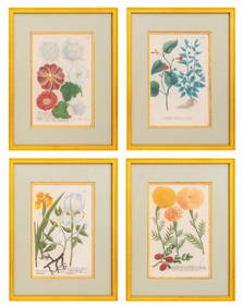
SoldCOLLECTION OF TWENTY GEORGE LODDIGES HANDCOLORED BOTANICOLLECTION OF TWENTY GEORGE LODDIGES HANDCOLORED BOTANICAL ILLUSTRATIONS. All etchings, engraving by George Cooke. Matted in groups of four. Board: 11.5" x 26.5" Sight: 4.5" x 7.25"See Sold Price
SoldFour Hand-Colored Maps of DelawareA grouping of four hand-colored maps of Delaware, to include a "Plan of Wilmington and its Environs", "A Geographical, Historical, and Statistical Map of Delaware", and two smaller colored maps. LargeSee Sold Price
SoldGroup Four Hand-Colored Engravings of Urn DesignsA Group of Four Hand-Colored Engravings of Urn Designs , after Giuseppe Passeri, Rome, 1786, sight 12 in. x 8 in., attractively matted and framed * NO RETURNS ARE ACCEPTED ON THE BASIS OF CONDITION *See Sold Price
SoldFirst Edition of Heideloff's "Gallery of Fashion"Rare 18th Century First Edition of Volume I of Heideloff's "Gallery of Fashion", Nicholas Wilhelm von Heideloff (1761-1839), publisher, April 1794-March 1795 [London], with twenty-four hand-colored enSee Sold Price
MARTINET / DE VRIES Catechism of Nature 4 Vol. Set c1788 Engravings Rare!Luis Porretta Fine Arts4.3(10)See Sold PriceMar 02, 2024
PIETER SCHENK / VALK / JANSSEN Hand Colored Map of Rhodes Greece ca1702 vgcLuis Porretta Fine Arts4.3(10)See Sold PriceMar 02, 2024
Hand Colored Map of the city of Amsterdam 1720Global Auctions Company4.3(36)See Sold PriceMar 03, 2024
[HAND-COLORED LEAVES]. Group of Four Double-Sided German Bo...Potter & Potter Auctions4.6(550)See Sold PriceMar 07, 2024
[MAPS]. DUFOUR, Auguste-Henri (1795-1865). Bound Volume of ...Potter & Potter Auctions4.6(550)See Sold PriceMar 07, 2024
[MAP]. [ALBRIZZI, Giambatista, 1698-1777]. Carta Geografica...Potter & Potter Auctions4.6(550)See Sold PriceMar 07, 2024
Johann Homann Hand-Colored Map Engraving, c. 1730Auctions at Showplace4.6(744)See Sold PriceMar 17, 2024
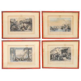
Hand-Colored Engravings of Thomas Allom Drawings, Group of FourNorthgate Gallery, Inc.4.5(36)See Sold PriceMar 02, 2024
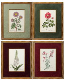
Georg Wolfgang Knorr (German, 1705-1761), Four Antique Hand Colored Botanical Engravings of Flowers,Hoch LTD.4.6(80)See Sold PriceFeb 25, 2024
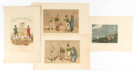
Henry Alken, The National Sports of Great Britain, Four Hand Colored Engravings Ca. 1821Hoch LTD.4.6(80)See Sold PriceFeb 25, 2024
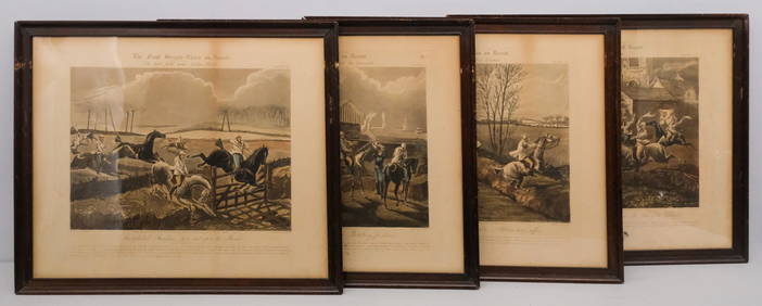
After H. Alken, Group of 4 Steeplechase PrintsOld Kinderhook Auction Company4.6(217)See Sold PriceMar 05, 2024
GROUP OF FOUR ANTIQUE HAND COLORED STEEL ENGRAVINGS OF FRENCH FASHIONChamberlain's Auction Galleries4.3(50)See Sold PriceFeb 24, 2024
Rare 19thc Colton Map, Argentine Republic, Chile, Uruguay, PataguayConnoisseur Auctions3.9(337)See Sold PriceMar 16, 2024
Galliae Regionis Nova Descriptio Hand Colored Map of France on Laid Paper, Ca. 16th Century, H 10" WDuMouchelles4.6(833)See Sold PriceMar 15, 2024


![[Maps & Atlases], Group of Four Engraved Maps of Iberia (1 of 4)](https://p1.liveauctioneers.com/65/159076/80333182_1_x.jpg?height=282&quality=70&version=1579108352)


![[HAND-COLORED LEAVES]. Group of Four Double-Sided German Bo... (1 of 9)](https://p1.liveauctioneers.com/928/318880/171360997_1_x.jpg?height=282&quality=70&version=1707501302)
![[MAPS]. DUFOUR, Auguste-Henri (1795-1865). Bound Volume of ... (1 of 2)](https://p1.liveauctioneers.com/928/318880/171361279_1_x.jpg?height=282&quality=70&version=1707501302)
![[MAP]. [ALBRIZZI, Giambatista, 1698-1777]. Carta Geografica... (1 of 1)](https://p1.liveauctioneers.com/928/318880/171361280_1_x.jpg?height=282&quality=70&version=1707501302)