ATLAS of ANTIENT GEOGRAPHY by SAMUEL BUTLER 1843John McInnis Auctioneers,LLC4.6(502)See Sold PriceFeb 24, 2024
18TH C. ANTIQUE MAP: FRENCH & INDIAN WAR, FRAMEDThomaston Place Auction Galleries4.4(386)See Sold PriceFeb 24, 2024
Rand McNally Railroad Map Cabinet w/ 21 Railroad MapsRail & Road Auctions4.6(165)See Sold PriceMar 08, 2024
Keith Haring - Ink on New York Map, Best Buddies, Inscribed, Signed, and DatedSapphire Auction Gallery4(67)See Sold PriceMar 02, 2024
LATE 17TH C. FRENCH MAP OF THE NEW WORLD BY ALEXIS-HUBERT JAILLOT (1632-1712)Thomaston Place Auction Galleries4.4(386)See Sold PriceFeb 24, 2024
Central Railroad of New Jersey Map of Sandy Hook Route-ca. 1903JM Hobby Supply and Railroad Artifact Auctions4.4(126)See Sold PriceFeb 24, 2024
Lot of Six Mixed Atlas Box Cars-HO Scale-New in BoxJM Hobby Supply and Railroad Artifact Auctions4.4(126)See Sold PriceFeb 25, 2024
Rand McNally/Santa Fe Railroad Map of Iowa-1912JM Hobby Supply and Railroad Artifact Auctions4.4(126)See Sold PriceFeb 24, 2024
NICOLAES VISSCHER (NETHERLANDS, 1618-1709) MAP OF THE NEW WORLDThomaston Place Auction Galleries4.4(386)See Sold PriceFeb 24, 2024
17TH C. WORLD MAP BY NICOLAES VISSCHER (NETHERLANDS, 1618-1709)Thomaston Place Auction Galleries4.4(386)See Sold PriceFeb 24, 2024
Lot of Six Mixed Atlas Cabooses-HO Scale-New in BoxJM Hobby Supply and Railroad Artifact Auctions4.4(126)See Sold PriceFeb 25, 2024
FRANCE. Regions Provinces Gouvernements'France en General'. MALLET 1683 mapTITLE OF THE MAP: 'France en General' (De L'Europe) DATE PRINTED: 1683 IMAGE SIZE: Approx Overall page size 13 x 21cm approximately (5 x 8 inches); image size 10.5 x 14.5cm approximately (4 x 5.5 inchSee Sold Price
Mallet: Antique Map 'France en General', 1683Title of the Map: 'France en General' Regions Provinces Gouvernements Date Printed: 1683 Image Size: Approx Overall page size 13 x 21cm approximately (5 x 8 inches); image size 10.5 x 14.5cm approximaSee Sold Price
FRANCE. Provinces. 'France par Gouvernmens Generaux'. MALLET 1683 old mapTITLE OF THE MAP: 'France par Gouvernmens Generaux' (De L'Europe) DATE PRINTED: 1683 IMAGE SIZE: Approx Overall page size 13 x 21cm approximately (5 x 8 inches); image size 10.5 x 14.5cm approximatelySee Sold Price
MAP OF FRANCE. in regions. MALLET 1683 old antique vintage plan chartTITLE OF THE MAP: 'France' (Du Globe Terrestre) DATE PRINTED: 1683 IMAGE SIZE: Approx Overall page size 13 x 21cm approximately (5 x 8 inches); image size 10.5 x 14.5cm approximately (4 x 5.5 inches)See Sold Price
CARTE GENERALE DE FRANCE' showing towns, rivers & provinces. MALLET 1683 mapTITLE OF THE MAP: 'Carte Generale de France' (De L'Europe) DATE PRINTED: 1683 IMAGE SIZE: Approx Overall page size 26 x 21cm approximately (10 x 8 inches); image size 21 x 14.5cm approximately (8 x 5.See Sold Price
SoldRoyaume de France, divisé en Gouvernements. Provinces.TITLE/CONTENT OF MAP: 'Royaume de France, divisé en Gouvernements [The Kingdom of France, divided into Provinces]' DATE PRINTED: 1789 IMAGE SIZE: Approx 24.5 x 36.0cm, 9.75 x 14.25 inches (Large); PlSee Sold Price
FRANCE. 'Carte Generale'. Towns, rivers & provinces. MALLET 1683 old mapTITLE OF THE MAP: 'Carte Generale de France' (De L'Europe) DATE PRINTED: 1683 IMAGE SIZE: Approx Overall page size 26 x 21cm approximately (10 x 8 inches); image size 21 x 14.5cm approximately (8 x 5.See Sold Price
SoldMallet: Antique Map of France in Regions, 1683TITLE OF THE MAP: 'France' DATE PRINTED: 1683 IMAGE SIZE: Approx Overall page size 13 x 21cm approximately (5 x 8 inches); image size 10.5 x 14.5cm approximately (4 x 5.5 inches) TYPE: Original 17th cSee Sold Price
SoldMallet: Antique Map of France in Regions, 1683Title of the Map: 'France' MAP OF FRANCE. in regions. old antique vintage plan chart Date Printed: 1683 Image Size: Approx Overall page size 13 x 21cm approximately (5 x 8 inches); image size 10.5 x 1See Sold Price
BENELUX Belgium Netherlands Flanders. 'Pays Bas en General'. MALLET 1683 mapTITLE OF THE MAP: 'Pays Bas en General' (De L'Europe) DATE PRINTED: 1683 IMAGE SIZE: Approx Overall page size 13 x 21cm approximately (5 x 8 inches); image size 10.5 x 14.5cm approximately (4 x 5.5 inSee Sold Price
BENELUX Belgium Netherlands Flanders. 'Pays Bas en General'. MALLET 1683 mapTITLE OF THE MAP: 'Pays Bas en General' (De L'Europe) DATE PRINTED: 1683 IMAGE SIZE: Approx Overall page size 13 x 21cm approximately (5 x 8 inches); image size 10.5 x 14.5cm approximately (4 x 5.5 inSee Sold Price
BENELUX Belgium Netherlands Flanders. 'Pays Bas en General'. MALLET 1683 mapTITLE OF THE MAP: 'Pays Bas en General' (De L'Europe) DATE PRINTED: 1683 IMAGE SIZE: Approx Overall page size 13 x 21cm approximately (5 x 8 inches); image size 10.5 x 14.5cm approximately (4 x 5.5 inSee Sold Price
GERMANY. Showing German states. 'Allemagne en General'. MALLET 1683 old mapTITLE OF THE MAP: 'Allemagne en General' (De L'Europe) DATE PRINTED: 1683 IMAGE SIZE: Approx Overall page size 13 x 21cm approximately (5 x 8 inches); image size 10.5 x 14.5cm approximately (4 x 5.5 iSee Sold Price
NORTH AFRICA. 'Biledulgerid', a former North African country. MALLET 1683 mapTITLE OF THE MAP: 'Biledulgerid en General; Partie Occidentale du Biledulgerid; Partie Orientale du Biledulgerid' (De L'Afrique) Biledulgerid (Bheladal Dsherid = country of dates) was formerly a countSee Sold Price
SoldMallet, Alain 1683 Map of Germany & Part of Poland"Allemagne en General" Copper Engraved Map Published 1683, Paris for "Description de l'Univers" by Alain Manesson Mallet. French text to verso. Paper Size: 8 x 5 inch (20 x 13cm) Good ConditionSee Sold Price
BENELUX & NE FRANCE. Burgundy. Comté/'Cercle de Bourgogne'. MALLET 1683 mapTITLE OF THE MAP: 'Cercle de Bourgogne' (De L'Europe) Includes Luxembourg. Belgium. Parts of France and Germany. DATE PRINTED: 1683 IMAGE SIZE: Approx Overall page size 13 x 21cm approximately (5 x 8See Sold Price
BENELUX & NE FRANCE. Burgundy. Comté/'Cercle de Bourgogne'. MALLET 1683 mapTITLE OF THE MAP: 'Cercle de Bourgogne' (De L'Europe) Includes Luxembourg. Belgium. Parts of France and Germany. DATE PRINTED: 1683 IMAGE SIZE: Approx Overall page size 13 x 21cm approximately (5 x 8See Sold Price
BENELUX & NE FRANCE. Burgundy. Comté/'Cercle de Bourgogne'. MALLET 1683 mapTITLE OF THE MAP: 'Cercle de Bourgogne' (De L'Europe) Includes Luxembourg. Belgium. Parts of France and Germany. DATE PRINTED: 1683 IMAGE SIZE: Approx Overall page size 13 x 21cm approximately (5 x 8See Sold Price
Map of France in 32 Governments. Europe. 1835.Print of hand colored steel engraving titled France en 32 Gouvernements“.Author C. V. Monin.Engraved by unknown.From the Atlas Universel de Geography“ by C. V. Monin. Parsi. 1835.France is a soverSee Sold Price
Map of France in 32 Governments. Europe. 1835.Print of hand colored steel engraving titled „France en 32 Gouvernements“.Author C. V. Monin.Engraved by unknown.From the „Atlas Universel de Geography“ by C. V. Monin. Parsi. 1835.France is aSee Sold Price
SoldFrance.- Brittany.- Jaillot (Alexis-Hubert) and JoshuaFrance.- Brittany.- Jaillot (Alexis-Hubert) and Joshua Ottens. La Bretagne Divisée en ses Neuf Eveschés, map of the Brittany region of France, engraving with early hand-colouring on laid papSee Sold Price
SoldDesnos Map of FranceDESNOS, Louis Charles (1725-1805). La France Divisee en toutes ses Provinces... Engraved map with original hand color. Paris, 1774. 22" x 30 1/2" sheet.See Sold Price
SoldDesnos Map of FranceDESNOS, Louis Charles (1725-1805). La france divisée en ses principaux gouvernements... Engraved map with original hand color. Paris, 1782 22" x 30 1/2" sheet. The maps shows 15 different city viewSee Sold Price
Map of Old FranceHand tinted and engraved map of Old France published by the Librairie Classique d'Eugene BELIN a Paris. With inscription "Ancienne France Divisee en 32 gouvernements par M.M Drioux et Ch. Leroy". SighSee Sold Price
MAP - Dufour, A. H. ( Malte / Brun ) :MAP - ESPAGNE PARTIE SUD DIVISEE EN PROVINCES ANCIENNES ( MAPLuis Porretta Fine Arts4.3(10)See Sold PriceMar 02, 2024
Stone Age 'Somme' Grey Speckled White Knapped Flint AxeheadTimeLine Auctions Ltd.4.5(183)See Sold PriceMar 05, 2024
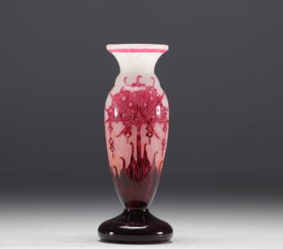
CHARDER, Charles SCHNEIDER (1881-1953) - French glass - Vase with floral decoration.GOLDFIELD AUCTION4.3(32)See Sold PriceMar 02, 2024
Set of five miniatures "Portraits en buste" signed.GOLDFIELD AUCTION4.3(32)See Sold PriceMar 02, 2024
Jean Laurent MONIER, Miniature "Portrait de Noble en habit rouge" 18th century.GOLDFIELD AUCTION4.3(32)See Sold PriceMar 02, 2024
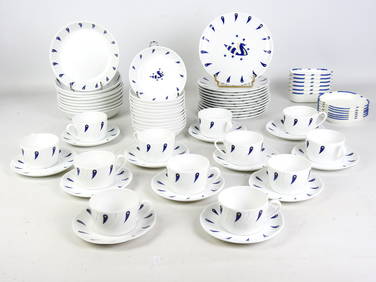
Jean PICART LE DOUX (1902-1982) d'après : Partie de service à thé-café et à dessert enValoir Pousse-Cornet4.3(4)See Sold PriceFeb 24, 2024
Duval - Pair: Map of Georgia & Map of Moscow, RussiaTrillium Antique Prints & Rare Books4.5(30)See Sold PriceFeb 24, 2024
Duval - Pair: Map of India & Map of MaldivesTrillium Antique Prints & Rare Books4.5(30)See Sold PriceFeb 24, 2024
Map: An 18thC engraved and hand coloured map of North America and South America, titled DeClaydon Auctioneers Ltd4.3(125)See Sold PriceFeb 26, 2024
DAUM SIGNED ORCHIDE ART GLASS BOWL MADE IN FRANCE WITH ORIG BOXSJ Auctioneers4.5(165)See Sold PriceMar 03, 2024
NORTH AFRICA. 'Biledulgerid', a former North African country. MALLET 1683 mapJasper524.5(9.8k)See Sold PriceFeb 28, 2024
Elisabeth Garouste (France, née en 1949) & Mattia Bonetti (Suisse, né en 1953). Paire ...Bonhams4.1(305)See Sold PriceMay 21, 2024


![Vintage Airplane Desk Model [Air France] (1 of 7)](https://p1.liveauctioneers.com/5755/320282/172113951_1_x.jpg?height=282&quality=70&version=1708463029)