ATLAS of ANTIENT GEOGRAPHY by SAMUEL BUTLER 1843John McInnis Auctioneers,LLC4.5(505)See Sold PriceFeb 24, 2024
18TH C. ANTIQUE MAP: FRENCH & INDIAN WAR, FRAMEDThomaston Place Auction Galleries4.4(394)See Sold PriceFeb 24, 2024
Rand McNally Railroad Map Cabinet w/ 21 Railroad MapsRail & Road Auctions4.6(165)See Sold PriceMar 08, 2024
Keith Haring - Ink on New York Map, Best Buddies, Inscribed, Signed, and DatedSapphire Auction Gallery4.1(67)See Sold PriceMar 02, 2024
LATE 17TH C. FRENCH MAP OF THE NEW WORLD BY ALEXIS-HUBERT JAILLOT (1632-1712)Thomaston Place Auction Galleries4.4(394)See Sold PriceFeb 24, 2024
Central Railroad of New Jersey Map of Sandy Hook Route-ca. 1903JM Hobby Supply and Railroad Artifact Auctions4.4(127)See Sold PriceFeb 24, 2024
Lot of Six Mixed Atlas Box Cars-HO Scale-New in BoxJM Hobby Supply and Railroad Artifact Auctions4.4(127)See Sold PriceFeb 25, 2024
Rand McNally/Santa Fe Railroad Map of Iowa-1912JM Hobby Supply and Railroad Artifact Auctions4.4(127)See Sold PriceFeb 24, 2024
NICOLAES VISSCHER (NETHERLANDS, 1618-1709) MAP OF THE NEW WORLDThomaston Place Auction Galleries4.4(394)See Sold PriceFeb 24, 2024
17TH C. WORLD MAP BY NICOLAES VISSCHER (NETHERLANDS, 1618-1709)Thomaston Place Auction Galleries4.4(394)See Sold PriceFeb 24, 2024
Lot of Six Mixed Atlas Cabooses-HO Scale-New in BoxJM Hobby Supply and Railroad Artifact Auctions4.4(127)See Sold PriceFeb 25, 2024
SoldScarce c1610 map of Scotland, Wm. HoleFirst map of Scotland made by an Englishman in England. Fine map of Scotland engraved by William Hole (one of the earliest English engravers) for the first illustrated edition of Camden’s Britannia,See Sold Price
Scarce 19th Century Maps Of ScotlandIncluding Scotland - Highlands J & C Walker - circa 1835 Steel engraving published in London by Baldwin & Gadock 1834, Edinburgh map Published by A & C Black, Ireland and Scotland by George F. Cram EnSee Sold Price
Scarce 1848 Mitchell map of Scotland w/huge marginsAuthentic vintage map of Scotland from S. Augustus Mitchell’s 1848 New Universal Atlas. Lovely full hand coloring. A nice example with huge margins and light tanning at the edges (won’t shSee Sold Price
William Hole: Antique Map of Scotland, 1610Map: Scotia Regnum (authentic Antique Map of Scotland) Cartographer: William Hole Illustrator: William Hole Edition: 1st Edition Publisher: William Camden Date: 1610 Size: 10.375 x 12.5 inches The firSee Sold Price
The Scotch Itinerary, 1805 scarce first edition.Scarce first edition of an early travel book on Scotland. Complete with original foldout map of Scotland. “The Scotch Itinerary, Containing the Roads Through Scotland, on a New Plan. With Copious obSee Sold Price
SoldScotch Itinerary, 1805 scarce 1st edition.Scarce first edition of an early travel book on Scotland. Complete with original foldout map of Scotland. “The Scotch Itinerary, Containing the Roads Through Scotland, on a New Plan. With Copious obSee Sold Price
Scotch Itinerary, 1805 scarce 1st edition.Scarce first edition of an early travel book on Scotland. Complete with original foldout map of Scotland. “The Scotch Itinerary, Containing the Roads Through Scotland, on a New Plan. With Copious obSee Sold Price
Scotch Itinerary, 1805 scarce 1st edition.Scarce first edition of an early travel book on Scotland. Complete with original foldout map of Scotland. “The Scotch Itinerary, Containing the Roads Through Scotland, on a New Plan. With Copious obSee Sold Price
Kingdom of Shivas Irons 1/500 signedTitle: The Kingdom of Shivas Irons Author: Murphy, Michael Description: [12], 314, [6] pp. Double-page map of Seamus MacDuff's Seven Hole Golf Course in front and back; frontispiece map of Scotland. 8See Sold Price
SoldMercator map of northern ScotlandHeading: Author: Mercator, Gerard Title: Scotiae Regnum Place Published: Antwerp Publisher: Date Published: c.1610 Description: Copper-engraved map, hand-colored. 35x45.5 cSee Sold Price
The very scarce England v Scotland wartime internaThe very scarce England v Scotland wartime international match programme played at Newcastle United 2nd December 1939, hand punched holes to lett margin The first wartime England home and not to be coSee Sold Price
Two Vintage Golf Theme Silk Scarves(1) Laura Borghese golf theme silk scarf. Very good condition with bright colors; two small pin holes lower right corner. 30" x 29.5" approx. (2) Silk scarf with map of St. Andrews, Scotland. Hand rolSee Sold Price
Englalond Anglia Anglosaxonvm Heptarchia Terra ArmisTitle/Content of Map: Englalond Anglia Anglosaxonvm Heptarchia Terra Armis Animisqve Potens Date: 1644 Cartographer: HOLE, WILLIAM Size: 10.75X12.5 National map from Camden's Britannia. Sculptor Wm. HSee Sold Price
SoldSaxton and Hole - Northumbriæ Comitatusengraved map, 275 x 295mm [Cambridge] [c.1610]See Sold Price
SoldSaxton (Christopher) & Hole (William) - A Group ofincluding Essexia, Glamorgan, Scotland and others, 17 engraved maps, uncoloured as published, engraved vignettes and title borders, some browning at edges, occasional marginal chipping, occasional spoSee Sold Price
Sold18th c. Purcell Map, "State of Franklin"Joseph Purcell: A MAP OF THE STATES OF VIRGINIA, NORTH CAROLINA, SOUTH CAROLINA, AND GEORGIA; Comprehending the SPANISH PROVINCES of EAST AND WEST FLORIDA. Scarce Edinburgh, Scotland imprint, circa 17See Sold Price
Northern England / Scotland 1636Map Title: Northumbria, Cumberlandia Et Dunelmensis Episcopatus Published: Jansson, J./ Hondius, H., Amsterdam Date: 1636 Size: 13.75 x 18.75 inches. Very scarce English Edition Northern England/ ScotSee Sold Price
SoldWWII 1944 BOUGAINVILLE TO ADMIRALTY PLOTTING MAPFolded 2 sided pilot plotting map, pocket size or knee board use size, when folded 3 3/4 x 4 1/4 opened 15 3/4 inches, has one small hole, very good otherwise, dated 1944,considered scarce.See Sold Price
SoldScotlandTitle/Content of Map: Scotland Date Printed: 1888 Cartographer: BRADLEY, WM. M. Size: 22.3 X 15.5 Extremely detailed. Shows railroads. Insets show Orkney Islands, Shetland Islands and the Hebrides. DoSee Sold Price
Eboracensis Comitatus ... East Riding. c.1610[England] Saxton, Christopher (English, 1540-1610) and William Hole (English, d.1624). "Eboracensis Comitatus pars Septentrionalis Vulgo North Riding." From Camden's "Brittania" atlas. Engraved map. 7See Sold Price
SoldFramed Cross-Stitch Map of England and WalesAlso "Part of Scotland", 20 1/4" x 15 1/2". Condition: some staining and small holes. Shipping: $28 plus insurance.See Sold Price
SoldScarce 1851 New Haven Broad SideVividly describes the Lobster price war of the period in Connecticut. Grievance filed against WM Read. Paper shows a water stain and a few small holes. Archive framed 18 X 23". For Bigger and Better pSee Sold Price
British BanknotesNational Commercial Bank of Scotland, £100, 16 September 1959, serial number A003466, pinholes, hole at centre, graffiti on obverse, a presentable very good, scarce PMS NC 5, Pick 268 £300See Sold Price
SoldScarce Map of Texas, New Mexico and ArizonaItem: Scarce Map of Texas, New Mexico and Arizona Description: Scarce Map of Texas, New Mexico and Arizona from Wallings's 1868 State Atlas of Ohio Dimensions: 14.25 x 26.25 Please note that this lotSee Sold Price
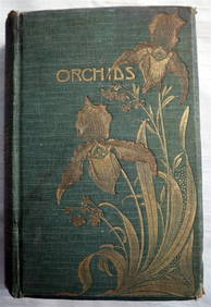
ORCHIDS Culture & Management 1st Edition c1903 ScarceLuis Porretta Fine Arts4.3(10)See Sold PriceMar 02, 2024
LATE 16TH C. MAP OF SCOTLAND BY MERCATOR, FRAMEDThomaston Place Auction Galleries4.4(394)See Sold PriceFeb 24, 2024
DUNLEVIE c1856 Map Counties Of Gaspe & Bonaventure Quebec Canada SCARCE! #2Luis Porretta Fine Arts4.3(10)See Sold PriceMar 02, 2024
DEVINE c1856 Dr Salters Map Of Lake Huron Ontario Indian Lands etc. No. 7 ScarceLuis Porretta Fine Arts4.3(10)See Sold PriceMar 02, 2024
MATTHEWS c1856 Map Of Upper Canada Ontario Indian Land Agency Divisions Scarce!Luis Porretta Fine Arts4.3(10)See Sold PriceMar 02, 2024
DUNLEVIE c1856 Map Counties Of Gaspe & Bonaventure Quebec Canada SCARCE! #1Luis Porretta Fine Arts4.3(10)See Sold PriceMar 02, 2024
CHARLES ROLLIN c1828 Ceasar Hand Colored Africa Military MapLuis Porretta Fine Arts4.3(10)See Sold PriceMar 02, 2024
Portfolio of 15 County Maps by Robert Morden (English 1650-1703)Nadeau's Auction Gallery4.7(410)See Sold PriceFeb 24, 2024
Arrowsmith & Lewis - Map of North AmericaTrillium Antique Prints & Rare Books4.5(33)See Sold PriceFeb 24, 2024
Arrowsmith & Lewis - Map of the World on Mercator's ProjectionTrillium Antique Prints & Rare Books4.5(33)See Sold PriceFeb 24, 2024
Arrowsmith & Lewis - Map of LouisianaTrillium Antique Prints & Rare Books4.5(33)See Sold PriceFeb 24, 2024
Arrowsmith & Lewis - Map of the United StatesTrillium Antique Prints & Rare Books4.5(33)See Sold PriceFeb 24, 2024
VARIOUS ARTISTS [BRITISH TRAVEL GUIDES]. Group of 6 map booklets and flyers. 1930s.Swann Auction Galleries4.4(71)See Sold PriceFeb 29, 2024
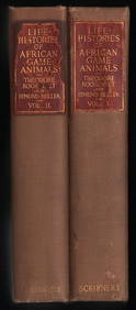
Scarce 1st ed. “Life Histories of African Game Animals?? – T. Roosevelt, E. HellerJasper524.5(9.9k)See Sold PriceFeb 27, 2024
Framed Space Age Rand McNally Map of Planets Poster, 1958PUBLIC SALE4.7(227)See Sold PriceMar 02, 2024
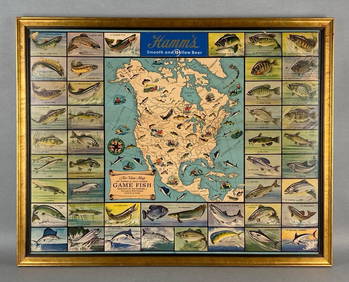
Hamms Air-View Map of Game Fish Advertising Beer PosterMatthew Bullock Auctioneers4.7(1.9k)See Sold PriceMar 02, 2024


![VARIOUS ARTISTS [BRITISH TRAVEL GUIDES]. Group of 6 map booklets and flyers. 1930s. (1 of 2)](https://p1.liveauctioneers.com/199/319703/171640571_1_x.jpg?height=282&quality=70&version=1707943705)