ATLAS of ANTIENT GEOGRAPHY by SAMUEL BUTLER 1843John McInnis Auctioneers,LLC4.6(502)See Sold PriceFeb 24, 2024
18TH C. ANTIQUE MAP: FRENCH & INDIAN WAR, FRAMEDThomaston Place Auction Galleries4.4(386)See Sold PriceFeb 24, 2024
Rand McNally Railroad Map Cabinet w/ 21 Railroad MapsRail & Road Auctions4.6(165)See Sold PriceMar 08, 2024
Keith Haring - Ink on New York Map, Best Buddies, Inscribed, Signed, and DatedSapphire Auction Gallery4(67)See Sold PriceMar 02, 2024
LATE 17TH C. FRENCH MAP OF THE NEW WORLD BY ALEXIS-HUBERT JAILLOT (1632-1712)Thomaston Place Auction Galleries4.4(386)See Sold PriceFeb 24, 2024
Central Railroad of New Jersey Map of Sandy Hook Route-ca. 1903JM Hobby Supply and Railroad Artifact Auctions4.4(126)See Sold PriceFeb 24, 2024
Lot of Six Mixed Atlas Box Cars-HO Scale-New in BoxJM Hobby Supply and Railroad Artifact Auctions4.4(126)See Sold PriceFeb 25, 2024
Rand McNally/Santa Fe Railroad Map of Iowa-1912JM Hobby Supply and Railroad Artifact Auctions4.4(126)See Sold PriceFeb 24, 2024
NICOLAES VISSCHER (NETHERLANDS, 1618-1709) MAP OF THE NEW WORLDThomaston Place Auction Galleries4.4(386)See Sold PriceFeb 24, 2024
17TH C. WORLD MAP BY NICOLAES VISSCHER (NETHERLANDS, 1618-1709)Thomaston Place Auction Galleries4.4(386)See Sold PriceFeb 24, 2024
Lot of Six Mixed Atlas Cabooses-HO Scale-New in BoxJM Hobby Supply and Railroad Artifact Auctions4.4(126)See Sold PriceFeb 25, 2024
1834 Map of ScotlandAuthor: Walker Title: 1834 Map of Scotland Medium: Ink on paper Dimensions: 14.5"X18" Map of Scotland dated 1834. Engraved by J.C. Walker. Published in Edinburgh. Key located lower left. Hand coloredSee Sold Price
1834 Map of ScotlandAuthor: Grigny Title: 1834 Map of Scotland Medium: Ink on Paper Dimensions: 13"X16" Map of Scotland dated 1832. Drawn by Th.Lejeune. Engraved by Grigny. Published in Brussels. Inset of Shetland Isles.See Sold Price
Sold1834 Malte-Brun Map of Scotland -- ScotlandTitle/Content of Map: 1834 Malte-Brun Map of Scotland -- Scotland Date: 1834, Boston Cartographer: M. Malte-Brun / S. Walker Size: 9.3 x 7.5 in. An attractive and highly detailed map with topographicaSee Sold Price
Edinburgh, Scotland Map 1834. Drawn by W.B. Clark.Edinburgh, Scotland. 1834. Colored. 12X15, Fine City Plan of Edinburgh in the early 19th century. Depicts streets, parks, theatres, monuments, schools, squares, the Royal Circle, the Canongate and ChuSee Sold Price
1834 Malte-Brun Map of Scotland -- ScotlandTitle/Content of Map: 1834 Malte-Brun Map of Scotland -- Scotland Date Printed: 1834, Boston Cartographer: M. Malte-Brun / S. Walker Size: 9.3 x 7.5 in. An attractive and highly detailed map with topoSee Sold Price
1834 Malte-Brun Map of Scotland -- ScotlandTitle/Content of Map: 1834 Malte-Brun Map of Scotland -- Scotland Date Printed: 1834, Boston Cartographer: M. Malte-Brun / S. Walker Size: 9.3 x 7.5 in. An attractive and highly detailed map with topoSee Sold Price
Malte-Brun: Antique Map of Scotland, 1834Title/Content of Map: 1834 Malte-Brun Map of Scotland -- Scotland Date Printed: 1834, Boston Cartographer: M. Malte-Brun / S. Walker Size: 9.3 x 7.5 in. An attractive and highly detailed map with topoSee Sold Price
Malte-Brun: Map of Scotland, 1834Title/Content of Map: 1834 Malte-Brun Map of Scotland -- Scotland Date Printed: 1834, Boston Cartographer: M. Malte-Brun / S. Walker Size: 9.3 x 7.5 in. Condition: Very Good. Nice strike, slight toninSee Sold Price
Malte-Brun: Antique Map of Scotland, 1834Title: 1834 Malte-Brun Map of Scotland -- Scotland Cartographer: M. Malte-Brun / S. Walker Year / Place: 1834, Boston Map Dimensions: 9.3 x 7.5 in. Condition: Very Good. Nice strike, slight toning andSee Sold Price
Malte-Brun: Antique Map of Scotland, 1834Title/Content of Map: 1834 Malte-Brun Map of Scotland -- Scotland Date Printed: 1834, Boston Cartographer: M. Malte-Brun / S. Walker Size: 9.3 x 7.5 in. An attractive and highly detailed map with topoSee Sold Price
Edinburgh, Scotland 1834. Colored Map by W.B. Clark.Edinburgh, Scotland. 1834. Colored. 12X15, Fine City Plan of Edinburgh in the early 19th century. Depicts streets, parks, theatres, monuments, schools, squares, the Royal Circle, the Canongate and ChuSee Sold Price
Edinburgh, Scotland 1834. Colored Map by W.B. Clark.Edinburgh, Scotland. 1834. Colored. 12X15, Fine City Plan of Edinburgh in the early 19th century. Depicts streets, parks, theatres, monuments, schools, squares, the Royal Circle, the Canongate and ChuSee Sold Price
Edinburgh, Scotland 1834. Colored Map by W.B. Clark.Edinburgh, Scotland. 1834. Colored. 12X15, Fine City Plan of Edinburgh in the early 19th century. Depicts streets, parks, theatres, monuments, schools, squares, the Royal Circle, the Canongate and ChuSee Sold Price
Edinburgh, Scotland 1834. Colored Map by W.B. Clark.Edinburgh, Scotland. 1834. Colored. 12X15, Fine City Plan of Edinburgh in the early 19th century. Depicts streets, parks, theatres, monuments, schools, squares, the Royal Circle, the Canongate and ChuSee Sold Price
Edinburgh, Scotland 1834. Colored Map by W.B. Clark.Edinburgh, Scotland. 1834. Colored. 12X15, Fine City Plan of Edinburgh in the early 19th century. Depicts streets, parks, theatres, monuments, schools, squares, the Royal Circle, the Canongate and ChuSee Sold Price
Edinburgh, Scotland 1834. Colored Map by W.B. Clark.Edinburgh, Scotland. 1834. Colored. 12X15, Fine City Plan of Edinburgh in the early 19th century. Depicts streets, parks, theatres, monuments, schools, squares, the Royal Circle, the Canongate and ChuSee Sold Price
SCOTLAND SOUTH. Shows castles & kirks. Inset formerReserve Reduced! TITLE/CONTENT OF MAP: 'SCOTLAND, I,. South to Perthshire; inset table of former county names' DATE PRINTED: This map was originally published by Baldwin & Cradock in 1834; this date iSee Sold Price
SCOTLAND SOUTH. Shows castles & kirks. Inset formerTITLE/CONTENT OF MAP: 'SCOTLAND, I,. South to Perthshire; inset table of former county names' Date: This map was originally published by Baldwin & Cradock in 1834; this date is printed on the map. ThiSee Sold Price
Scarce 19th Century Maps Of ScotlandIncluding Scotland - Highlands J & C Walker - circa 1835 Steel engraving published in London by Baldwin & Gadock 1834, Edinburgh map Published by A & C Black, Ireland and Scotland by George F. Cram EnSee Sold Price
Edinburgh, Scotland Map. Drawn by W.B. Clark. Fro“Edinburgh,” London. 1834. Colored. 12X15, Fine City Plan of Edinburgh in the early 19th century. Depicts streets, parks, theatres, monuments, schools, squares, the Royal Circle, the Canongate andSee Sold Price
ANCIENT BRITAIN.Caledonia-Scotland.Roman road townReserve Reduced! TITLE/CONTENT OF MAP: 'ANCIENT BRITAIN, II (Caledonia - Scotland)' DATE PRINTED: This map was originally published by Baldwin & Cradock in 1834; this date is printed on the map. ThisSee Sold Price
ScotlandTitle: Scotland Date: 1834 Cartographer: R. Campbell Phila. Publisher: Samuel Walker Size: 9.3Height - 7.5Width Additional Information: Attractive map from: System of Geography by M. Malte Brun contaiSee Sold Price
SoldTallis, John (Pub) 1852 Map. ScotlandSteel Engraved Map with Original Outline Hand Color Published 1852-56 by John Tallis, London for "The Universal Pronouncing Dictionary" by Thomas Wright. Drawn & Engraved by John Rapkin. Centre fold aSee Sold Price
SoldBarclay, James 1809 Antique Map. Scotland"Scotland or North Britain" Outline Hand Coloured Copper Engraved Map Published 1809, Leeds for "Barclay's Complete and Universal Dictionary of the English Language..." by the Rev. James Barclay. PapeSee Sold Price
ALEXANDER BALD 1780 1st Edition Scotland Corn Dealer Agriculture AssistantLuis Porretta Fine Arts4.3(10)See Sold PriceMar 02, 2024
LATE 16TH C. MAP OF SCOTLAND BY MERCATOR, FRAMEDThomaston Place Auction Galleries4.4(386)See Sold PriceFeb 24, 2024
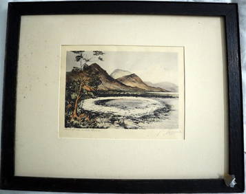
PHILIP NORMAN FSA Hand Colored Engraving c1910 Loch White Fairies SIGNED Listed ScotlandLuis Porretta Fine Arts4.3(10)See Sold PriceMar 02, 2024
Portfolio of 15 County Maps by Robert Morden (English 1650-1703)Nadeau's Auction Gallery4.7(401)See Sold PriceFeb 24, 2024
Chatelain - 3 Maps of the British Isles (England, Ireland, Scotland)Trillium Antique Prints & Rare Books4.5(30)See Sold PriceFeb 24, 2024
De Jode, Rare, pub. 1593 - Map of the British Isles [England, Scotland, Ireland] (Angliae Scotiae etTrillium Antique Prints & Rare Books4.5(30)See Sold PriceFeb 24, 2024
Karl Bodmer - A Young Mandan Indian. 24Trillium Antique Prints & Rare Books4.5(30)See Sold PriceFeb 24, 2024
Karl Bodmer - Assinboin Indians. 32Trillium Antique Prints & Rare Books4.5(30)See Sold PriceFeb 24, 2024
Karl Bodmer - Scalp Dance of the Minatarres. 27Trillium Antique Prints & Rare Books4.5(30)See Sold PriceFeb 24, 2024
Map: A 19thC engraved and hand coloured map of St. Petersburg / Sanktpeterburga by W. B. Clarke.Claydon Auctioneers Ltd4.3(125)See Sold PriceFeb 26, 2024
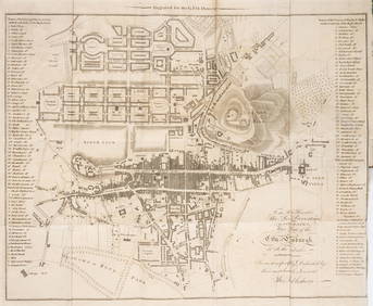
Map: A 17thC engraved and hand coloured map of Scotland titled Strath-Navernia / Strath Navern afterClaydon Auctioneers Ltd4.3(125)See Sold PriceFeb 26, 2024
VARIOUS ARTISTS [BRITISH TRAVEL GUIDES]. Group of 6 map booklets and flyers. 1930s.Swann Auction Galleries4.4(65)See Sold PriceFeb 29, 2024
Scotland.- Sir Walter Scott's Edinburgh.- The Post-Office annual directory, from Whitsunday 1808, toForum Auctions4.3(52)See Sold PriceFeb 29, 2024
1834 Malte-Brun Map of the Caribbean -- West India IslandsJasper524.5(9.8k)See Sold PriceFeb 27, 2024
(79) ALBUMEN PHOTO PRINTS 19TH C. EUROPE & BRITAINAustin Auction Gallery4.7(1.2k)See Sold PriceApr 12, 2024


![De Jode, Rare, pub. 1593 - Map of the British Isles [England, Scotland, Ireland] (Angliae Scotiae et (1 of 2)](https://p1.liveauctioneers.com/6581/319571/171593327_1_x.jpg?height=282&quality=70&version=1707853304)


![VARIOUS ARTISTS [BRITISH TRAVEL GUIDES]. Group of 6 map booklets and flyers. 1930s. (1 of 2)](https://p1.liveauctioneers.com/199/319703/171640571_1_x.jpg?height=282&quality=70&version=1707943705)