ATLAS of ANTIENT GEOGRAPHY by SAMUEL BUTLER 1843John McInnis Auctioneers,LLC4.6(502)See Sold PriceFeb 24, 2024
18TH C. ANTIQUE MAP: FRENCH & INDIAN WAR, FRAMEDThomaston Place Auction Galleries4.4(386)See Sold PriceFeb 24, 2024
Rand McNally Railroad Map Cabinet w/ 21 Railroad MapsRail & Road Auctions4.6(165)See Sold PriceMar 08, 2024
Keith Haring - Ink on New York Map, Best Buddies, Inscribed, Signed, and DatedSapphire Auction Gallery4(67)See Sold PriceMar 02, 2024
LATE 17TH C. FRENCH MAP OF THE NEW WORLD BY ALEXIS-HUBERT JAILLOT (1632-1712)Thomaston Place Auction Galleries4.4(386)See Sold PriceFeb 24, 2024
Central Railroad of New Jersey Map of Sandy Hook Route-ca. 1903JM Hobby Supply and Railroad Artifact Auctions4.4(126)See Sold PriceFeb 24, 2024
Lot of Six Mixed Atlas Box Cars-HO Scale-New in BoxJM Hobby Supply and Railroad Artifact Auctions4.4(126)See Sold PriceFeb 25, 2024
Rand McNally/Santa Fe Railroad Map of Iowa-1912JM Hobby Supply and Railroad Artifact Auctions4.4(126)See Sold PriceFeb 24, 2024
NICOLAES VISSCHER (NETHERLANDS, 1618-1709) MAP OF THE NEW WORLDThomaston Place Auction Galleries4.4(386)See Sold PriceFeb 24, 2024
17TH C. WORLD MAP BY NICOLAES VISSCHER (NETHERLANDS, 1618-1709)Thomaston Place Auction Galleries4.4(386)See Sold PriceFeb 24, 2024
Lot of Six Mixed Atlas Cabooses-HO Scale-New in BoxJM Hobby Supply and Railroad Artifact Auctions4.4(126)See Sold PriceFeb 25, 2024
1857 Colton Map of Kansas and Nebraska -- Kansas andTitle: 1857 Colton Map of Kansas and Nebraska -- Kansas and Nebraska Date: 1857, New York Cartographer: J Colton Size: 24.5 X 15. 9 in. Additional Information: This is an outstanding Colton map.It shoSee Sold Price
Sold1857 Colton Map of Kansas and Nebraska -- Kansas andTitle: 1857 Colton Map of Kansas and Nebraska -- Kansas and Nebraska Cartographer: J Colton Year / Place: 1857, New York Map Dimension (in.): 24.5 X 15. 9 in. This is an outstanding Colton map. It shoSee Sold Price
1857 Colton Map of Kansas and Nebraska -- Kansas andTitle/Content of Map: 1857 Colton Map of Kansas and Nebraska -- Kansas and Nebraska Date: 1857, New York Cartographer: J Colton Size: 24.5 X 15. 9 in. This is an outstanding Colton map. It shows the eSee Sold Price
1857 Colton Map of Kansas and Nebraska -- Kansas andTitle/Content of Map: 1857 Colton Map of Kansas and Nebraska -- Kansas and Nebraska Cartographer: J Colton Year/Place: 1857, New York Size: 24.5 X 15. 9 in. This is an outstanding Colton map. It showsSee Sold Price
1857 Colton Map of Kansas and Nebraska -- Kansas andReserve Reduced! Title/Content of Map: 1857 Colton Map of Kansas and Nebraska -- Kansas and Nebraska Date: 1857, New York Cartographer: J Colton Size: 24.5 X 15. 9 in. This is an outstanding Colton maSee Sold Price
SoldFramed Map of Nebraska & Kansas 1857Framed Map of Nebraska & Kansas 1857 Published by J.H. Colton and Co. , a Territory acquired from Mexico by the Gadsden Treaty - Frame Approx. 32" x 24", Map itself is approx. 19" x 25"See Sold Price
SoldColton Map of Nebraska and KansasCOLTON, Joseph H. (1800-1893). Nebraska & Kansas. Lithograph with handcolor in part. New York, 1857. 30 1/2 x 22 1/2 inches sheet, 40 x 32 inches framed Striking map of Kansas and Nebraska, includingSee Sold Price
Colton Map of Nebraska and Kansas*** START PRICE IS THE RESERVE *** [America] COLTON, Joseph H. (1800-1893). Nebraska & Kansas. Lithograph with original hand color. New York, 1857. 30” x 22 1/2” sheet, 39” x 31 1/2” fraSee Sold Price
SoldAn Excellent Mid-19th Century Lithographed Map ofNebraska & Kansas. Joseph H. Colton. Lithograph with watercolor wash. New York, 1857. 31 x 23 inches sheet, 40 x 32 inches framed. Striking map of Kansas and Nebraska, including the routes across theSee Sold Price
SoldJ.H. Colton & Co.: Kansas & Nebraska 1857Map: Kansas and Nebraska Publishing: J.H. Colton & Co., Colton, Joesph Hutchins Date: 1857 Size: 24.3 x 15.75 inches Early development of Kansas and Nebraska in 1857. Shows railroads and common roads.See Sold Price
Colton's Map of Kansas, Nebraska, DakotaTitle: Colton's Map of Kansas, Nebraska, Dakota & Indian Territory Author: Colton, J.H. Description: Lithographed map, hand-colored. 67x43 cm. (26½x17").The land between the Mississippi River and theSee Sold Price
Colton: Antique Map of Kansas & Nebraska, 1859Title/Content of Map: Kansas & Nebraska by Colton Date Printed: 1859 Cartographer: H.J Colton Size: 17" x 30" Material/Medium: Paper Provenance: New York Published in 'Colton's General Atlas.' Hand coSee Sold Price
Colton: Antique Map of Kansas & Nebraska, 1859Title/Content of Map: Kansas & Nebraska by Colton Date Printed: 1859 Cartographer: H. J. Colton Material/Medium: Paper Size: 35" x 15" Hand colored engraved. Published in New York in 'Colton's GeneralSee Sold Price
SoldMap. Colton. Nebraska and Kansas.First Map of Nebraska & Kansas Territories Early Map of the U.S. Showing the Gadsden Purchase86. [MAP]. COLTON, J[oseph] H[utchins]. Nebraska and Kansas. [center, below border] Published bySee Sold Price
SoldKansas & Nebraska by ColtonTitle/Content of Map: Kansas & Nebraska by Colton Date: 1859 Cartographer: H. J. Colton Material/Medium: Paper Size: 17 1/2" x 15" Provenance: New York Hand colored engraved Map. Piblished in New YorkSee Sold Price
Kansas & Nebraska by ColtonTitle/Content of Map: Kansas & Nebraska by Colton Date Printed: 1859 Cartographer: H.J. Colton Material/Medium: Paper Size: 17" x 30" Provenance: New York From Colton's 'General Atlas.' Published in NSee Sold Price
SoldMap of Kansas & Nebraska 1855Heading: (Kansas & Nebraska) Author: Colton, J[oseph] H[utchins] Title: Colton's Kansas and Nebraska Place Published: New York Publisher:J. H. Colton Date Published: 1855 Description: <See Sold Price
Colton map of Kans & Neb, by Johnson & BrowningEarly map in a vertical format covering the eastern quarter of the Kansas and Nebraska territories. A very striking map. The Santa Fe Road is shown in Kansas City. No sign of Wichita and Topeka is onlSee Sold Price
SoldOne of the most sought after maps of theCOLTON, Joseph H. (1800 - 1893). Nebraska and Kansas. Lithograph with original hand color. New York: 1857.31" x 22 3/4" sheet. 39 1/4" x 31 3/4" framed. Colton's map is the first printed map to show tSee Sold Price
SoldNebraska & Kansas: A Scarce Hand-colored 1855 MaNebraska & Kansas: A Scarce Hand-colored 1855 Map by J.H. Colton & Co. Measuring 15.25" xSee Sold Price
SoldMAP OF KANSAS AND NEBRASKA TERRITORIES 1857By J.H. Colton, 25.5 x 17 inch sight size, professionally matted and framed in archival material.See Sold Price
Joseph H. Colton, Nebraska and KansasCOLTON, Joseph H. (1800-1893). Nebraska and Kansas. New York, 1857. Lithograph with watercolor wash. Paper size: 31 x 23 inches. Framed size: 40 x 32 inches. Retail Price: $48,000.See Sold Price
Sold[MAP]. HALSALL & Colton. Kansas. 1857.308. [MAP]. HALSALL, John (publisher) and J[oseph] H[utchins] Colton (copyright holder). Sectional Map of the Territory of Kansas Compiled from the Field Notes in the Surveyor General’s Office.See Sold Price
SoldKansas & Nebraska with Gadsden purchase 1854Heading: Author: Colton, Joseph Hutchins Title: Nebraska and Kansas Place Published: New York Publisher: J.H.Colton & Co. Date Published: 1854 Description: Lithographed mapSee Sold Price
Official Railroad Map of Kansas-1907JM Hobby Supply and Railroad Artifact Auctions4.4(126)See Sold PriceFeb 24, 2024
Rand McNally County/Township/Railroad Map of Kansas-1911JM Hobby Supply and Railroad Artifact Auctions4.4(126)See Sold PriceFeb 24, 2024
August 1, 1878 Through Rates of Fare from Missouri/Kansas Broadside PosterJM Hobby Supply and Railroad Artifact Auctions4.4(126)See Sold PriceFeb 24, 2024
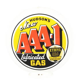
HUDSON'S NEW AAA-1 LUBRICATED GAS SINGLE 13.5" GLOBE LENS ON CAPCO BODY.Dan Morphy Auctions4.2(1.3k)See Sold PriceFeb 24, 2024
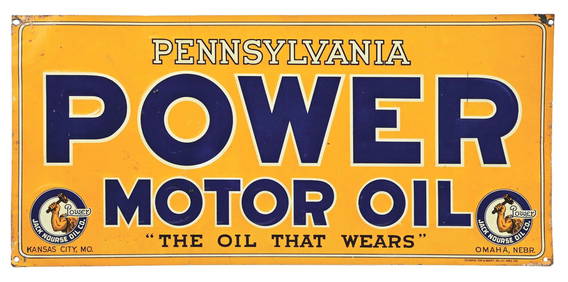
JACK NOURSE POWER MOTOR OIL "THE OIL THAT WEARS" EMBOSSED TIN SIGN.Dan Morphy Auctions4.2(1.3k)See Sold PriceFeb 24, 2024
19thc Colton Map, Comparitive Size of Lakes & IslandsConnoisseur Auctions4(333)See Sold PriceFeb 24, 2024
1853 Colton's Railroad & Township Map of Massachusetts, Rhode Island, and ConnecticutRail & Road Auctions4.6(165)See Sold PriceMar 07, 2024
Pair of Early Railroad Maps - 1862 Pittsburgh, Ft. Wayne & Chicago Railway and 1873 PennsylvaniaRail & Road Auctions4.6(165)See Sold PriceMar 07, 2024
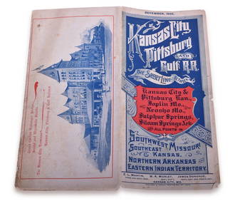
1895 Kansas City, Pittsburg & Gulf Railroad Public TimetableRail & Road Auctions4.6(165)See Sold PriceMar 08, 2024
Kansas City Southern Railway Timetable March 1910Rail & Road Auctions4.6(165)See Sold PriceMar 08, 2024
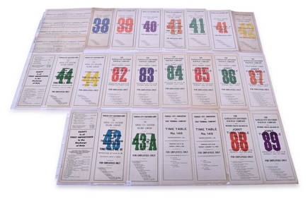
Twenty-Three Kansas City Southern and Kansas City, Shreveport & Gulf Railway Employee Timetables -Rail & Road Auctions4.6(165)See Sold PriceMar 08, 2024
War Diary of 354th Infantry - 89th Division 1919North American Artifact Auctions4.6(182)See Sold PriceApr 20, 2024
WEST AFRICA Explorers' routes Senegal Ashanti. Mountains of Kong. SDUK 1857 mapJasper524.5(9.8k)See Sold PriceFeb 28, 2024
West Africa. Liberia Sahara Senegambia Guinea. Mountains of Kong COLTON 1869 mapJasper524.5(9.8k)See Sold PriceFeb 28, 2024
North west Africa. Liberia inset. Sahara Senegambia Guinea. COLTON 1863 mapJasper524.5(9.8k)See Sold PriceFeb 28, 2024
Rare 19thc Colton Map, Argentine Republic, Chile, Uruguay, PataguayConnoisseur Auctions4(333)See Sold PriceMar 16, 2024
Francis McNally - Antique Map of Nebraska, Kansas, Dakota, Colorado & MontanaProverde Auctions4.3(3)See Sold PriceFeb 28, 2024
Reprint From The Original Coltons Map 1855 No.30 Copyright 1967Rapid Estate Liquidators and Auction Gallery4.5(1.1k)See Sold PriceFeb 29, 2024


![[MAP]. HALSALL & Colton. Kansas. 1857. (1 of 4)](https://p1.liveauctioneers.com/514/38482/16487220_1_x.jpg?height=282&quality=70&version=1363615005)