ATLAS of ANTIENT GEOGRAPHY by SAMUEL BUTLER 1843John McInnis Auctioneers,LLC4.5(505)See Sold PriceFeb 24, 2024
18TH C. ANTIQUE MAP: FRENCH & INDIAN WAR, FRAMEDThomaston Place Auction Galleries4.4(393)See Sold PriceFeb 24, 2024
Rand McNally Railroad Map Cabinet w/ 21 Railroad MapsRail & Road Auctions4.6(165)See Sold PriceMar 08, 2024
Keith Haring - Ink on New York Map, Best Buddies, Inscribed, Signed, and DatedSapphire Auction Gallery4.1(67)See Sold PriceMar 02, 2024
LATE 17TH C. FRENCH MAP OF THE NEW WORLD BY ALEXIS-HUBERT JAILLOT (1632-1712)Thomaston Place Auction Galleries4.4(393)See Sold PriceFeb 24, 2024
Central Railroad of New Jersey Map of Sandy Hook Route-ca. 1903JM Hobby Supply and Railroad Artifact Auctions4.4(127)See Sold PriceFeb 24, 2024
Lot of Six Mixed Atlas Box Cars-HO Scale-New in BoxJM Hobby Supply and Railroad Artifact Auctions4.4(127)See Sold PriceFeb 25, 2024
Rand McNally/Santa Fe Railroad Map of Iowa-1912JM Hobby Supply and Railroad Artifact Auctions4.4(127)See Sold PriceFeb 24, 2024
NICOLAES VISSCHER (NETHERLANDS, 1618-1709) MAP OF THE NEW WORLDThomaston Place Auction Galleries4.4(393)See Sold PriceFeb 24, 2024
17TH C. WORLD MAP BY NICOLAES VISSCHER (NETHERLANDS, 1618-1709)Thomaston Place Auction Galleries4.4(393)See Sold PriceFeb 24, 2024
Lot of Six Mixed Atlas Cabooses-HO Scale-New in BoxJM Hobby Supply and Railroad Artifact Auctions4.4(127)See Sold PriceFeb 25, 2024
SoldLyttleton, George 1810 Map of ScotlandCopper Engraved Map Published 1810, London for "The History of England..." by George Courtney Lyttleton. Folds as issued. Paper Size: 18.5 x 15.5 inch (47 x 39cm) Approx. Image very slightly off-centrSee Sold Price
SoldLyttleton, George 1810 Map of ScotlandCopper Engraved Map Published 1810, London for "The History of England..." by George Courtney Lyttleton. Folds as issued. Paper Size: 18.5 x 16 inch (47 x 40cm) Approx. Small closed tear, left backgroSee Sold Price
SoldLyttleton, George 1810 Map of England, Scotland, Wales"An Accurate Map of England, Scotland, and Wales" Copper Engraved Map Published 1810, London for "The History of England..." by George Courtney Lyttleton. Folds as issued. Paper Size: 18 x 14 inch (46See Sold Price
SoldLyttleton, George 1810 Map of England, Scotland, Wales"An Accurate Map of England, Scotland, and Wales" Copper Engraved Map Published 1810, London for "The History of England..." by George Courtney Lyttleton. Folds as issued. Paper Size: 18 x 14 inch (46See Sold Price
SoldLyttleton, George 1810 Map of England, Scotland, Wales"An Accurate Map of England, Scotland, and Wales" Copper Engraved Map Published 1810, London for "The History of England..." by George Courtney Lyttleton. Folds as issued. Paper Size: 18 x 14 inch (46See Sold Price
Lyttleton, George 1810 Map of England, Scotland, Wales"An Accurate Map of England, Scotland, and Wales" Copper Engraved Map Published 1810, London for "The History of England..." by George Courtney Lyttleton. Folds as issued. Paper Size: 18 x 14 inch (46See Sold Price
SoldLyttleton, George 1810 Map of Ireland by J. RussellCopper Engraved Map Published 1810, London for "The History of England..." by George Courtney Lyttleton. Folds as issued. Paper Size: 17 x 15 inch (43 x 38cm) Approx. Very minor toning, good conditionSee Sold Price
SoldLyttleton, George 1810 Map of The English Channel"Chart of the British Channel with the opposite Coast of the United Kingdom, and the Republic of France" Copper Engraved Map Published 1810, London for "The History of England..." by George Courtney LSee Sold Price
SoldLyttleton, George 1810 Map of Ireland by J. RussellCopper Engraved Map Published 1810, London for "The History of England..." by George Courtney Lyttleton. Folds as issued. Paper Size: 16.5 x 13.5 inch (42 x 34cm) Approx. Tiny right tear in border. GoSee Sold Price
SoldLyttleton, George 1810 Map of The English Channel"Chart of the British Channel with the opposite Coast of the United Kingdom, and the Republic of France" Copper Engraved Map Published 1810, London for "The History of England..." by George Courtney LSee Sold Price
SoldLyttleton, George 1810 Map of The English Channel"Chart of the British Channel with the opposite Coast of the United Kingdom, and the Republic of France" Copper Engraved Map Published 1810, London for "The History of England..." by George Courtney LSee Sold Price
SoldLyttleton, George 1810 Map of Denmark by Russell"Denmark, Divided into Dioceses and Prefectures" Copper Engraved Map Published 1810, London for "The History of England..." by George Courtney Lyttleton. Folds as issued. Paper Size: 17 x 14.5 inch (4See Sold Price
SoldLyttleton, George 1810 HCol Map of Cadiz, Spain"The Seat of War in the Environs of Cadiz" Hand Coloured Copper Engraved Map Published 1810, London for "The History of England..." by George Courtney Lyttleton. Paper Size: 10.5 x 8 inch (27 x 20cm)See Sold Price
SoldLyttleton, George 1810 HCol Map of Boulogne, France"Plan of the Harbour and Fortifications of Boulogne" Hand Coloured Copper Engraved Map Published 1810, London for "The History of England..." by George Courtney Lyttleton. Folds as issued. Paper Size:See Sold Price
SoldLyttleton, George 1810 HC Map. River Scheldt, Belgium"Sketch of the River Scheldt, from Flushing to Antwerp, with the Soundings Fortifications &c 1810" Hand Coloured Copper Engraved Map Published 1810, London for "The History of England..." by George CoSee Sold Price
SoldLyttleton, George 1810 HC Map of Walcheren Netherlands"Map of the Island of Walcheren with the Fortifications &c" Hand Coloured Copper Engraved Map Published 1810, London for "The History of England..." by George Courtney Lyttleton. Paper Size: 10.5 x 8See Sold Price
SoldLyttleton, George 1810 HCol Map of Spain & PortugalHand Coloured Copper Engraved Map Published 1810, London for "The History of England..." by George Courtney Lyttleton. Folds as issued. Paper Size: 19 x 17 inch (48 x 43cm) Approx. Minor offsetting anSee Sold Price
Lyttleton, George 1810 War Map of Germany, 1805"Germany Exhibiting the Present Seat of the War 1805" Copper Engraved Map Published 1810, London for "The History of England..." by George Courtney Lyttleton. Folds as issued. Paper Size: 17 x 14.5 inSee Sold Price
Lyttleton, George 1810 War Map of Germany, 1805"Germany Exhibiting the Present Seat of the War 1805" Copper Engraved Map Published 1810, London for "The History of England..." by George Courtney Lyttleton. Folds as issued. Paper Size: 17 x 14.5 inSee Sold Price
SoldLyttleton, George 1810 Hand Col Map of Sweden"Sweden Engraved from the best Authorities for the Continuation to Lyttletons History of England" Hand Coloured Copper Engraved Map Published 1810, London for "The History of England..." by George CouSee Sold Price
SoldLyttleton, George 1810 Hand Col Map of Portugal"The Present Seat of War in Portugal…" Hand Coloured Copper Engraved Map Published 1810, London for "The History of England..." by George Courtney Lyttleton. Paper Size: 10.5 x 8 inch (27 x 20cm) ApSee Sold Price
SoldLyttleton, George 1810 Hand Col Map of Denmark"Denmark divided into Dioceses and Prefectures" Hand Coloured Copper Engraved Map Published 1810, London for "The History of England..." by George Courtney Lyttleton. Map by J. Russell. Folds as issueSee Sold Price
SoldLyttleton, George 1810 Hand Col Map of Germany"Germany Exhibiting the present seat of War 1805"Hand Coloured Copper Engraved Map Published 1810, London for "The History of England..." by George Courtney Lyttleton. Folds as issued. Paper Size: 17.See Sold Price
SoldLyttleton, George 1810 Lot of 10 Prints. Ships, NavalCopper Plates Published 1810, London for "The History of England..." by George Courtney Lyttleton. Paper Size: 10.5 x 8 inch (27 x 20cm) Some toning in parts, good overallSee Sold Price
LATE 16TH C. MAP OF SCOTLAND BY MERCATOR, FRAMEDThomaston Place Auction Galleries4.4(393)See Sold PriceFeb 24, 2024
George Hayward - Map of the City of New York 1854Dane Fine Art Auctions4.4(498)See Sold PriceMar 07, 2024
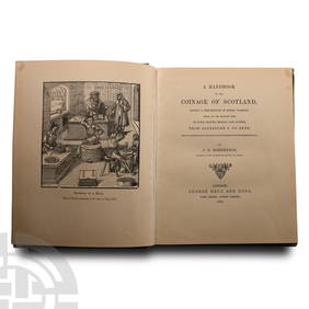
Numismatic Books - Robertson - A Handbook to the Coinage of ScotlandTimeLine Auctions Ltd.4.6(183)See Sold PriceMar 09, 2024
Pair of William Traies London Sterling Silver Berry Spoons 1810, George IIITaylor & Harris4.7(161)See Sold PriceMar 10, 2024
Map: A 17thC engraved and hand coloured map of Scotland titled Strath-Navernia / Strath Navern afterClaydon Auctioneers Ltd4.3(125)See Sold PriceFeb 26, 2024
Foulis.- Poetry.- Young (Edward) Poems on several occasions, Glasgow, Robert & Andrew Foulis, 1771;Forum Auctions4.3(53)See Sold PriceFeb 29, 2024
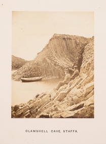
Scotland.- Wilson (George Washington) Photographs of English & Scottish Scenery: Staffa and Iona,Forum Auctions4.3(53)See Sold PriceFeb 29, 2024
Cooke, George 1801 Antique Map. United States of AmericaAlbion Auctions4.7(341)See Sold PriceMar 01, 2024
Cooke, George 1801 Antique Map. West Indies CaribbeanAlbion Auctions4.7(341)See Sold PriceMar 01, 2024
Cooke, George 1801 Antique Map. Italy, Sicily, Sardinia & CorsicaAlbion Auctions4.7(341)See Sold PriceMar 01, 2024