ATLAS of ANTIENT GEOGRAPHY by SAMUEL BUTLER 1843John McInnis Auctioneers,LLC4.5(505)See Sold PriceFeb 24, 2024
18TH C. ANTIQUE MAP: FRENCH & INDIAN WAR, FRAMEDThomaston Place Auction Galleries4.4(393)See Sold PriceFeb 24, 2024
Rand McNally Railroad Map Cabinet w/ 21 Railroad MapsRail & Road Auctions4.6(165)See Sold PriceMar 08, 2024
Keith Haring - Ink on New York Map, Best Buddies, Inscribed, Signed, and DatedSapphire Auction Gallery4(67)See Sold PriceMar 02, 2024
LATE 17TH C. FRENCH MAP OF THE NEW WORLD BY ALEXIS-HUBERT JAILLOT (1632-1712)Thomaston Place Auction Galleries4.4(393)See Sold PriceFeb 24, 2024
Central Railroad of New Jersey Map of Sandy Hook Route-ca. 1903JM Hobby Supply and Railroad Artifact Auctions4.4(127)See Sold PriceFeb 24, 2024
Lot of Six Mixed Atlas Box Cars-HO Scale-New in BoxJM Hobby Supply and Railroad Artifact Auctions4.4(127)See Sold PriceFeb 25, 2024
Rand McNally/Santa Fe Railroad Map of Iowa-1912JM Hobby Supply and Railroad Artifact Auctions4.4(127)See Sold PriceFeb 24, 2024
NICOLAES VISSCHER (NETHERLANDS, 1618-1709) MAP OF THE NEW WORLDThomaston Place Auction Galleries4.4(393)See Sold PriceFeb 24, 2024
17TH C. WORLD MAP BY NICOLAES VISSCHER (NETHERLANDS, 1618-1709)Thomaston Place Auction Galleries4.4(393)See Sold PriceFeb 24, 2024
Lot of Six Mixed Atlas Cabooses-HO Scale-New in BoxJM Hobby Supply and Railroad Artifact Auctions4.4(127)See Sold PriceFeb 25, 2024
SoldFour Large Maps of the Moon,Lunar Designations and Positions University of Arizona, c.1962, orthographic projection in four quadrants, quadrants 1, 2 and 3 compiled by D W G Arthur and A P Agnieray, 4 by Arthur and R H PellicoriSee Sold Price
The Photographic Lunar Atlas,University of Chicago, 1960, edited by Gerard P Kuiper, atlas consists of large loose leaf half-tone photographs, seven whole moon images 50.8cm x 40.5cm, with 9 fold-out sheets with four or more imagSee Sold Price
SoldFour large maps by A H Brue, 1826,L'Amerique Meridionale, L'Asie, L'Afrique and L'Oceanie, published by Goujon, Paris, all hand coloured and dissected, in modern frames, 87 x 57cm (image)See Sold Price
SoldFour large maps -Engravings. Temple Mount, Jerusalem,Four maps engravings. * Engraving depicting walled Jerusalem with its different quarters. Latin texts. 36x44 cm. Marginal tears. * Carte ou eft tracee la route que tenoient les flottes de Salomon.See Sold Price
SoldRelation de la Campagne de l'AnneÌe 1710.Relation de la Campagne de l'AnneÌe 1710, published by Husson, La Haye, [1711]. Book in 2vols about a siege during War of the Spanish Succession. Including text wol and vol with four large maps. LengSee Sold Price
Jedediah Smith and His Maps of the American WestJedediah Smith and His Maps of the American West. [Smith, Jedediah]. Morgan, Dale L. and WHEAT, Carl I. . San Francisco: California Historical Society, 1954. Illustrated with four large folding maps bSee Sold Price
Jedediah Smith and His Maps of the American West Book[SMITH, Jedediah]. MORGAN, Dale L. and WHEAT, Carl I. Jedediah Smith and His Maps of the American West. San Francisco : California Historical Society, 1954. Illustrated with four large folding maps boSee Sold Price
Franklin, Sir John (1786-1847) Narrative of a JourneyFranklin, Sir John (1786-1847) Narrative of a Journey to the Shores of the Polar Sea. London: Murray, 1824.Third edition, two octavo volumes, four large folding maps (one hand-colored map bound as froSee Sold Price
Vandermaelen large scale maps of parts of AsiaHeading: Author: Vandermaelen, Philippe Marie Guillaume Title: Four large-scale maps of parts of Asia Place Published: [Brussels] Publisher: Date Published: [c.1827] Description: <See Sold Price
England & Wales.- Lewis & Co. (Samuel) A Map of EnglandEngland & Wales.- Lewis & Co. (Samuel) A Map of England & Wales Divided into Counties, Parliamentary Dioceses, four large engraved maps with contemporary outline colouring, each approximately 1070 x 8See Sold Price
SoldMassachusetts. Walker, O.W. Atlas of MassachusettMassachusetts. Walker, O.W. Atlas of Massachusetts. Boston: George Walker, 1891. Folio format imprint; title page, index, and approximately fifty-four large color-printed maps of Massachusetts, rolledSee Sold Price
Large-scale blue-line maps of Richmond CAHeading: (California - Richmond) Author: Title: Four large-scale cadastral maps of portions of Richmond, Contra Costa County, California Place Published: No place Publisher: Date Published:See Sold Price
SoldLarge 1909 Adirondack Maps w/ Bound CoverFour Large Colorful 1909 Adirondack Maps by the State of New York Forest, Fish & Game Commission in a handsome bounded cover. Signed in ink Compliments S.O. Howard Four Maps Labeled N.W. 1-4, N.E. 1-4See Sold Price
SoldMaps. Armstrong, Capt. & Son The Map of the CountMaps. Armstrong, Capt. & SonThe Map of the County of Berwick, engraved map dissected and backed on linen, marbled slipcase, 1771; Stockdale, J. New Large Four-Sheet Map of the Country from Twenty to TSee Sold Price
SoldARROWSMITH, AARON. A Map of the Environs ofARROWSMITH, AARON. A Map of the Environs of Constantinople Drawn from a Great Number of Accurate Astronomical & Geographical Manuscripts and Printed Documents. Large four-sheet map of the Ottoman EmpiSee Sold Price
1755 Kitchin Four Panel Map EuropeLarge map in four panels "A Correct Map of Europe Divided into the Empires Kingdoms drawn from the most approved maps and charts…", by Thomas Kitchin, printed at London 1755. Commissioned by MalachySee Sold Price
SoldScotland.- Cary (John) A New Map of Scotland from theScotland.- Cary (John) A New Map of Scotland from the latest authorities, large four sheet map of Scotland, not joined, with inset maps of the Shetlands and Orkney, engravings with hand-colouring, eacSee Sold Price
SoldEurope.- Bertius (Petrus) Imperii Caroli Magni etEurope.- Bertius (Petrus) Imperii Caroli Magni et vicinarum regionum Descriptio, Dedicata et inscripta Ludovico, large four-sheet map covering the Empire of Charlemagne, including part of the EnglandSee Sold Price
SoldDerbyshire.- Greenwood (Christopher) Map of the CountyDerbyshire.- Greenwood (Christopher) Map of the County of Derby, from an actual Survey made in the Years 1824 & 1825, large map on four sheets, with decorative title upper right, and vignette showingSee Sold Price
SoldLondon.- Wyld (James) A New Map of the CountryLondon.- Wyld (James) A New Map of the Country Twenty-Five Miles Round London, large map in four sections, engraving with hand-colouring, each section approx. 540 x 650 mm. (21 1/4 x 25 1/2 in), eachSee Sold Price
Creighton (R.). A Map of England & WalesCreighton (R.). A Map of England & WalesDivided into Counties, Parliamentary Divisions & Dioceses shewing the Principal Roads, Railways, Rivers & Canals. . . . calligraphic title, large map in four shSee Sold Price
SoldItaly.- Jaillot (Alexis-Hubert) Le Royaume de NaplesNO RESERVE Italy.- Jaillot (Alexis-Hubert) Le Royaume de Naples divise en toutes ses Provinces dedie a Sa Majesté Catholique Philippe, V. Roy d'Espagne, large four-sheet map of Southern Italy, shSee Sold Price
Sold1835 Map of Spain & Portugal London; James WyldSpain & Portugal "Reduced from the large map in Four (4) sheets" . London: 1835 James Wyld. Four scales including Castilan legal leagues, 26 1/2" to a degree and each 5,000 varas.Dimensions: 21" X 30See Sold Price
Italy.- Jaillot (Alexis-Hubert) Le Royaume de NaplesItaly.- Jaillot (Alexis-Hubert) Le Royaume de Naples divise en toutes ses Provinces dedie a Sa Majesté Catholique Philippe, V. Roy d'Espagne, large four-sheet map of Southern Italy, showing partSee Sold Price
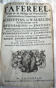
ACOBUS BASAGNE c1710 Theological History Numerous Engravings by De Hooghe Rare!Luis Porretta Fine Arts4.3(10)See Sold PriceMar 02, 2024
General Books - Four Maps of Great Britain Designed by Matthew Paris About A.D. 1250TimeLine Auctions Ltd.4.6(183)See Sold PriceMar 08, 2024
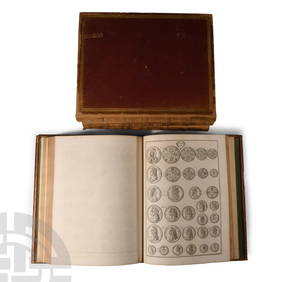
Numismatic Books - Rudding's Coinage of Britain Vol I-III, Plus SuplementTimeLine Auctions Ltd.4.6(183)See Sold PriceMar 09, 2024
Large Assortment of Railroad Items - Insulators, Globes, Hand Bell, Posters, Maps, Timetables,Rail & Road Auctions4.6(165)See Sold PriceMar 07, 2024
Kungrat Wool on Leather Embroidery, Uzbekistan, Late 19th C.Material Culture4.6(778)See Sold PriceFeb 29, 2024
Large Moorish Style Brass and Glass Hall Lantern, 20th c., H.- 44 in., W.- 18 in., D.- 18 in.Crescent City Auction Gallery4.3(231)See Sold PriceMar 01, 2024
Group of Four Large Color Lithographs, including: Le Diable...Potter & Potter Auctions4.6(545)See Sold PriceMar 07, 2024
[LITHOGRAPHY]. [TOBACCO]. Group of Four Large Tobacco or Ci...Potter & Potter Auctions4.6(545)See Sold PriceMar 07, 2024
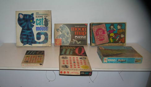
Large group of vintage games and puzzlesBaker's Antiques and Auctions3.2(471)See Sold PriceFeb 24, 2024
Pre-colonial Africa. Mountains of Kong/Moon. Caravan routes. THOMSON 1817 mapJasper524.5(9.9k)See Sold PriceFeb 28, 2024
AFRICA. 'Reptiles & Birds'. Snakes Cerastes Hair/hood/horn serpents. CHILD 1746Jasper524.5(9.9k)See Sold PriceFeb 28, 2024
Otto Brauer for Holmegaard. Four large vases / bottles in mouth-blown art glass with balls. Mid-20thJasper524.5(9.9k)See Sold PriceFeb 28, 2024
Stanford, Edward 1901 Large Map. Geological Map of the British IslesAlbion Auctions4.6(341)See Sold PriceMar 01, 2024
Perry, Matthew C. 1856 Large Map. Shah Bay, Lew Chew I. JapanAlbion Auctions4.6(341)See Sold PriceMar 01, 2024
FOUR LARGE ANTIQUE SILVER PLATED TUREENS AND COVERS. Largest 27 cm x 15 cm. (4)Hannam's Auctioneers Ltd4.3(396)See Sold PriceFeb 28, 2024
Large group of vintage games and puzzlesBaker's Antiques and Auctions3.2(471)See Sold PriceMar 03, 2024


![[LITHOGRAPHY]. [TOBACCO]. Group of Four Large Tobacco or Ci... (1 of 1)](https://p1.liveauctioneers.com/928/318880/171361087_1_x.jpg?height=282&quality=70&version=1707501302)