ATLAS of ANTIENT GEOGRAPHY by SAMUEL BUTLER 1843John McInnis Auctioneers,LLC4.5(494)See Sold PriceFeb 24, 2024
18TH C. ANTIQUE MAP: FRENCH & INDIAN WAR, FRAMEDThomaston Place Auction Galleries4.4(386)See Sold PriceFeb 24, 2024
Rand McNally Railroad Map Cabinet w/ 21 Railroad MapsRail & Road Auctions4.6(165)See Sold PriceMar 08, 2024
Keith Haring - Ink on New York Map, Best Buddies, Inscribed, Signed, and DatedSapphire Auction Gallery3.9(67)See Sold PriceMar 02, 2024
LATE 17TH C. FRENCH MAP OF THE NEW WORLD BY ALEXIS-HUBERT JAILLOT (1632-1712)Thomaston Place Auction Galleries4.4(386)See Sold PriceFeb 24, 2024
Central Railroad of New Jersey Map of Sandy Hook Route-ca. 1903JM Hobby Supply and Railroad Artifact Auctions4.4(126)See Sold PriceFeb 24, 2024
Lot of Six Mixed Atlas Box Cars-HO Scale-New in BoxJM Hobby Supply and Railroad Artifact Auctions4.4(126)See Sold PriceFeb 25, 2024
Rand McNally/Santa Fe Railroad Map of Iowa-1912JM Hobby Supply and Railroad Artifact Auctions4.4(126)See Sold PriceFeb 24, 2024
NICOLAES VISSCHER (NETHERLANDS, 1618-1709) MAP OF THE NEW WORLDThomaston Place Auction Galleries4.4(386)See Sold PriceFeb 24, 2024
17TH C. WORLD MAP BY NICOLAES VISSCHER (NETHERLANDS, 1618-1709)Thomaston Place Auction Galleries4.4(386)See Sold PriceFeb 24, 2024
Lot of Six Mixed Atlas Cabooses-HO Scale-New in BoxJM Hobby Supply and Railroad Artifact Auctions4.4(126)See Sold PriceFeb 25, 2024
SoldLarge 1909 Adirondack Maps w/ Bound CoverFour Large Colorful 1909 Adirondack Maps by the State of New York Forest, Fish & Game Commission in a handsome bounded cover. Signed in ink Compliments S.O. Howard Four Maps Labeled N.W. 1-4, N.E. 1-4See Sold Price
SoldKeeler's Map of the U. S. Territories. Large foKeeler's Map of the U. S. Territories. Large folding map bound into a book, titledSee Sold Price
SoldHENRY M. STANLEY THROUGH THE DARK CONTINENT 1878Two volumes. Published Harper Brother, New York, 1878. Decorative cloth covers. Includes large fold out map. Dimensions: H 9" x W 6" Condition: Covers with wear. Spines broken. Water staining to topsSee Sold Price
SoldHENRY M. STANLEY THROUGH THE DARK CONTINENT 1878Two volumes. Published Harper Brother, New York, 1878. Decorative cloth covers. Includes large fold out map. Dimensions: H 9" x W 6" Condition: Covers with wear. Spines broken. Water staining to topsSee Sold Price
SoldMaps and PapersLarge group of miniature maps, magazines, newspapers, etc., 4.75" x 5.5" largest map w/bookcase, most are covers onlySee Sold Price
Leather Bound Trunk w World Map Coffee TableLeather bound coffee table trunk. Coffee table on bun feet with a large drawer exterior is bound in leather applied with images of old world maps. Very good condition, (some wear, see photos). MeasureSee Sold Price
Sold1899 KINGSTON NY LARGE BOUND STREET MAPS OF THE CITY,1899 KINGSTON NY LARGE BOUND STREET MAPS OF THE CITY, SANBORN-PERRIS MAP. CO. OUTSIDE COVERS OF BOOK HAVE WEAR, INSIDE IS COMPLETE AND NICE OVERALL.See Sold Price
PRE WWII GERMAN MEMORABILIA ALBUM, C1936, H 12"PRE WWII GERMAN MEMORABILIA ALBUM, BOUND HARD COVER, C1936, H 12", W 9":includes 200 large size photos depicting Adolph Hitler and high ranking German officials. 133 pages. All text in German; bound iSee Sold Price
SoldPRE WWII GERMAN MEMORABILIA ALBUM, HARD COVERPRE WWII GERMAN MEMORABILIA ALBUM, BOUND HARD COVER, C1936, H 12", W 9":includes 200 large size photos depicting Adolph Hitler and high ranking German officials. 133 pages. All text in German; bound iSee Sold Price
SoldTHE MOOSE BOOK W/ Map Samuel Merrill, 1918THE MOOSE BOOK FACTS and STORIES from NORTHERN FORESTS by Samuel Morris, 1916. First Edition. Bound and profusely illustrated volume, covers the entire sport of moose hunting. Both the American mooseSee Sold Price
SoldBooks (14) Vols By Wilde, Ross edition authorizedDescription: (Vol. 1) The Poems of Oscar Wilde 345 pages. Published by John W. Luce & Company, Boston, 1909 (Volume 1). Leather bound hard cover.(Vol. 2) The House of Pomegranates, The Happy Prince, aSee Sold Price
SoldTaunt, Henry W., ''A New Map of The River ThameTaunt, Henry W., ''A New Map of The River Thames from Oxford to London'', Taunt & Co., London, 1897, 6th edition, 227pp, 12mo, soft bound in red leather cover and gilt lettering on spine, marble fabriSee Sold Price
SoldHandy Volume Atlas of the World W Cinnabar CoverHandy Volume Atlas of the World W Cinnabar Cover. This leather bound Handy Volume Atlas of the World features a carved cinnabar medallion detail on the front cover. Copyright 1933 by C. S. Hammond & CSee Sold Price
Handy Volume Atlas of the World W Cinnabar CoverHandy Volume Atlas of the World W Cinnabar Cover. This leather bound Handy Volume Atlas of the World features a carved cinnabar medallion detail on the front cover. Copyright 1933 by C. S. Hammond & CSee Sold Price
SoldBlack Horse Of The Sea Merritt-Chapman & Scott 1929Black Horse of the Sea, by Robert MacMillen. A much sought after large format book on the Merritt-Chapman & Scott Corporation. 1929 first edition in clean hard bound cover. 40 pages with numerous B&WSee Sold Price
SoldWith Buller in Natal by G.A. Henty with ten illusWith Buller in Natal by G.A. Henty with ten illustrations by W.Rainey, R. I., and a map. Blackie and Son, LTD, 50 Old Bailey, E.C. Glasgow London and Dublin. Book is cloth hard cover bound with untrimSee Sold Price
SoldColton's Traveler & Tourist Guide Atlas w/ Map 1856With beautiful large fold out map (J. Calvin Smith) intact with bright and strong colors. Condition is very good: tight binding, embossed front and back boards with gilt decorated cover. Pages foxed.See Sold Price
Sold1760 Algemeine Historie von Spanien w/ Map of Spain“Algemeine Historie von Spanien…”, by Johann von Ferreras, printed at Hulle bu Johann Justin Gebauern, 1760. FEATURES large folding map of Spain measuring 19 x 16”. The volume cover Spanish hiSee Sold Price
MORTON, W.H. Present Day Impressions of JapanMORTON, W.H. Present Day Impressions of Japan 931 pp. Extensively illustrated throughout, folding coloured map. Large 4to., bound in original publisher's full morocco over bevelled boards, gilt letterSee Sold Price
SoldBooks: "Buffalo Land " 1872, "The Grizzly Bear" 1909Buffalo Land Authentic Travels in the Wild by WE Webb, illustrated, Publ Hubbard Bros 1872, Leather Bound, Illustrated w/Buffalo, good cond. The Grizzly Bear the Narative of a Hunter Naturalist by WmSee Sold Price
SoldBook Shop Within Book DollhouseSmall bookshop made from a hollowed out antique leather bound book, front cover has a large bay window and door, interior includes a commode, armchair, assortment of books, pictures and a cat, 9.5"W,See Sold Price
SoldFLORIDA COUNTY MAP BOOK 1970'S LARGE LEATHER BOUNDFLORIDA COUNTY MAP BOOK 1970'S LARGE LEATHER BOUND BOOK OF MAPS OF THE COUNTIES IN FLORIDA IN THE 70'S INTERESTING BOOK 18 1/2"H X 29" WSee Sold Price
Iolanthe Or, The Peer and The Peri1882;Gilbert, W.S. & Sullivan, Arthur;Stoddart;;Large 4toWraps;;Full Score, authorized copyright edition. Bound in original blue wraps with label on cover from Tracy's book store in boston. closed teaSee Sold Price
Shirley, Rodney W. The Mapping of the World, EarlyShirley, Rodney W. The Mapping of the World, Early Printed World Maps, 1472 – 1700. London. 1984. Large 4to, hard cover with dust jacket, xlvi, 669 pp. with 440 plates and various charts. A beautifuSee Sold Price
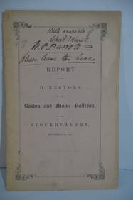
Boston and Maine RR Annual Report-September 12, 1849JM Hobby Supply and Railroad Artifact Auctions4.4(126)See Sold PriceFeb 24, 2024
Crams Colored Railway Map and Shippers Guide of South Dakota 1908-1909JM Hobby Supply and Railroad Artifact Auctions4.4(126)See Sold PriceFeb 24, 2024
925 STERLING SILVER HANDMADE CHASED LEAF APPLIQUE CROWN BESUMIM HOLDER W COVERMynt Auctions4.6(658)See Sold PriceFeb 23, 2024
1903 and 1904 Railroad Gazette Bound Volumes Number 35 and Number 36Rail & Road Auctions4.6(165)See Sold PriceMar 07, 2024
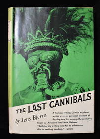
THE LAST CANNIBALS by JENS BJERRE 1957 Fine or Near FineNorth American Artifact Auctions4.7(175)See Sold PriceApr 20, 2024
U.S. NAVY - A Complete History by Goodspeed, M. Hill 2003 MintNorth American Artifact Auctions4.7(175)See Sold PriceApr 20, 2024
1738 BIBLE in DUTCH ILLUSTRATED w/ MAPS MASSIVE FOLIO in DUTCH antique BIBLIAJasper524.5(9.7k)See Sold PriceFeb 27, 2024
1736 LARGE MAP OF SILESIA POLAND OPPAVIENSIS antique 25 by 34 3/4"Jasper524.5(9.7k)See Sold PriceFeb 27, 2024
1729 GERMANIA SACRA by M. Hansiz BLINDSTAMPED PIGSKIN antique FOLIO w/ MAPJasper524.5(9.7k)See Sold PriceFeb 27, 2024
1711 GREEK BIBLE ILLUSTRATED w/ MAPS VELLUM BOUND antique NEW TESTAMENTJasper524.5(9.7k)See Sold PriceFeb 27, 2024
1738 RUSSIA SIBERIA & GREAT TARTARY Description illustrated ANTIQUE in ENGLISHJasper524.5(9.7k)See Sold PriceFeb 27, 2024
1736 LARGE MAP OF SILESIA POLAND KARNOVIENSIS antique 25 x 4 3/4" Duchy of KrnovJasper524.5(9.7k)See Sold PriceFeb 27, 2024
1709 GREEK BIBLE ILLUSTRATED w/ MAPS antique VELLUM BOUND Septuagint editionJasper524.5(9.7k)See Sold PriceFeb 27, 2024
CENTRAL EAST AFRICA French Belgian Congo British German Kenya Tanzania 1909 mapJasper524.5(9.7k)See Sold PriceFeb 28, 2024
Large Republic Period Chinese Famille Verte Vase w/ CoverChurchill Galleries3.7(208)See Sold PriceFeb 26, 2024
Antique Complete Edition Poetical Works WhittierRapid Estate Liquidators and Auction Gallery4.5(1.1k)See Sold PriceMar 03, 2024