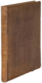
ATLAS of ANTIENT GEOGRAPHY by SAMUEL BUTLER 1843John McInnis Auctioneers,LLC4.6(502)See Sold PriceFeb 24, 2024
18TH C. ANTIQUE MAP: FRENCH & INDIAN WAR, FRAMEDThomaston Place Auction Galleries4.4(386)See Sold PriceFeb 24, 2024
Rand McNally Railroad Map Cabinet w/ 21 Railroad MapsRail & Road Auctions4.6(165)See Sold PriceMar 08, 2024
Keith Haring - Ink on New York Map, Best Buddies, Inscribed, Signed, and DatedSapphire Auction Gallery4(67)See Sold PriceMar 02, 2024
LATE 17TH C. FRENCH MAP OF THE NEW WORLD BY ALEXIS-HUBERT JAILLOT (1632-1712)Thomaston Place Auction Galleries4.4(386)See Sold PriceFeb 24, 2024
Central Railroad of New Jersey Map of Sandy Hook Route-ca. 1903JM Hobby Supply and Railroad Artifact Auctions4.4(126)See Sold PriceFeb 24, 2024
Lot of Six Mixed Atlas Box Cars-HO Scale-New in BoxJM Hobby Supply and Railroad Artifact Auctions4.4(126)See Sold PriceFeb 25, 2024
Rand McNally/Santa Fe Railroad Map of Iowa-1912JM Hobby Supply and Railroad Artifact Auctions4.4(126)See Sold PriceFeb 24, 2024
NICOLAES VISSCHER (NETHERLANDS, 1618-1709) MAP OF THE NEW WORLDThomaston Place Auction Galleries4.4(386)See Sold PriceFeb 24, 2024
17TH C. WORLD MAP BY NICOLAES VISSCHER (NETHERLANDS, 1618-1709)Thomaston Place Auction Galleries4.4(386)See Sold PriceFeb 24, 2024
Lot of Six Mixed Atlas Cabooses-HO Scale-New in BoxJM Hobby Supply and Railroad Artifact Auctions4.4(126)See Sold PriceFeb 25, 2024
SoldEngland & Wales.- Smith (Charles) Smith's New Map ofEngland & Wales.- Smith (Charles) Smith's New Map of the Inland Navigation of England & Wales, with details of the inland waterways, or rivers and canals, of England and Wales, engraving with originalSee Sold Price
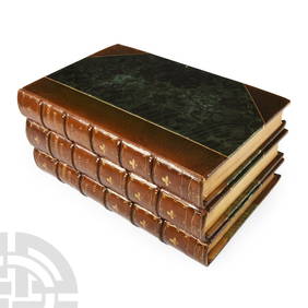
SoldSmith (Charles) - Smith's New English Atlas,first edition, bound as a folded-over travelling atlas, ornately lettered engraved title, 45 of 46 maps, including general map of England and Wales, Yorkshire on 4 sheets and Wales on 2 sheets, but laSee Sold Price
Smith (Charles) New English AtlasSmith (Charles) New English Atlas, engraved title, 25 engraved maps (of 42), including general map of England and Wales, and Yorkshire on 4 sheets, with original hand-colouring, the majority dSee Sold Price
Smith (Charles) - Smith's Map of England & Walesengraved map", with hand-colouring, on two sheets joined, 795 x 625mm., dissected and backed on linen, light spotting and browning, minor surface dirt, in contemporary cloth covered slipcase, with oriSee Sold Price
SoldBritish Isles.- Smith & Son (Charles) A GeologicalBritish Isles.- Smith & Son (Charles) A Geological Railway & Canal Map of England, Wales and part of Scotland, inset map of 'Canals and Railways around Birmingham' in the lower right corner, alongsideSee Sold Price
SoldJOHN SMITH'S MAP OF NEW ENGLAND"NEW ENGLAND The most remarqueable parts thus named by the high and might Prince CHARLES, Prince of Great Britaine", colored engraving, made by John Smith, engraved by Simon Passaeus, and printed by JSee Sold Price
SoldSMITH, JOHN. New England the most remarqueableSMITH, JOHN. New England the most remarqueable parts thus named by the high and mighty Prince Charles, Prince of great Britaine. Engraved folding map, 300x345, ample margins; very minor separations alSee Sold Price
SoldSmith (Charles) Smith's New Map of London and StreSmith (Charles) Smith's New Map of London and Street Indicator,from Islington to Kennington Oval, and from Commercial and Surrey Docks to Hyde Park, with indicator tape on original brass mountSee Sold Price
SoldLake District.- Smith (Charles) Smith's New and AcLake District.- Smith (Charles) Smith's New and Accurate Map of the Lakes,in the counties of Cumberland, Westmoreland and Lancaster, engraved map with original hand-colouring, 610 x 490mm., diSee Sold Price
SoldSmith (Charles) New Post Map of the Northern PartsSmith (Charles) New Post Map of the Northern PartsIncluding the whole of the United Netherlands and Switzerland, showing the post stations, engraved map with original hand-colouring, 1050 x 85See Sold Price
Smith (Charles) Post Map of France & GermanySmith (Charles) New Post Map of the Northern Parts of France and Germany, Including the whole of the United Netherlands and Switzerland, showing the post stations, engraved map with original hSee Sold Price
SoldSmith (Charles) Map of CumberlandSmith (Charles) A New Map of the County of Cumberland,engraved map with original outline hand-colouring, 495 x 440mm., central horizontal fold, slightly discoloured, 1808 Cary (John) A Map oSee Sold Price
SoldSmith (C) Map of the County of CumberlandSmith (Charles) A New Map of the County of Cumberland,engraved map with original outline hand-colouring, 495 x 440mm., central horizontal fold, slightly discoloured, 1808 Cary (John) A Map oSee Sold Price
SoldCharles Smith (18th-19th Century) British. "A New MapCharles Smith (18th-19th Century) British. "A New Map of the County of Rutland", 1801, Engraved Map, 17.25" x 19.25".See Sold Price
smith Smith's New English Atlassmith Smith's New English Atlas[Smith (Charles, bookseller) Smith's New English Atlas...], 43 engraved maps hand-coloured in outline, including one folding, engraved contents leaf, lacking titSee Sold Price
SoldSmith (Charles) Smith's New Plan of London, WestmiSmith (Charles) Smith's New Plan of London, Westminster and Southwark,showing from Pentonville down to Newington Butts, and Limehouse across to Brompton Row, engraved map with hand-colouring,See Sold Price
SoldSmith (Chalres) - Smith's Map of England & Walesengraved map, with hand-colouring, on two sheets joined, 795 x 625mm., dissected and backed on linen, light spotting and browning, minor surface dirt, in contemporary cloth covered slipcase, with origSee Sold Price
SoldAtlases.- Smith (Charles) Smith's New General Atlas, 45Atlases.- Smith (Charles) Smith's New General Atlas, engraved calligraphic title, 45 hand-coloured engraved maps, 2 double-page of Germany (numbered 19/20 & 21/22), occasional spotting, light marginalSee Sold Price
SoldAtlases.- Smith (Charles) - Smith's New General Atlas,title and 46 maps, including 2 double-page maps, hence numbered to 48, engraved maps with original hand-colouring, light surface dust and occasional marginal finger-soiling, contemporary half-calf oveSee Sold Price
SoldLondon.- Smith (Charles) Smith's New Plan of London,London.- Smith (Charles) Smith's New Plan of London, Westminster & Southwark, 1825, showing from Elephant & Castle to Islington, and Hyde Park to the East India Docks, with extensive key below featuriSee Sold Price
SoldSmith (Charles) Smith's New English AtlasSmith (Charles) Smith's New English Atlas, Being a Complete Set of County Maps, Divided into Hundreds, ornately lettered engraved title contents leaf, and 42 maps on 46 sheets, including YorksSee Sold Price
SoldCary (John) Cary's Six Sheet Map of England and WaCary (John) Cary's Six Sheet Map of England and Wales with Part of Scotland,engraved map, outline colouring, disected onto linen, 1350 x 1080mm, 1818 § Smith's New Map of England and Wales witSee Sold Price
SoldUK - Staffordshire 1808 Hand Col Map by Charles Smith"A New Map of the County of Stafford" Copper Engraved Map Published 1808, London. Printed for C. Smith. Dissected and linen backed. Original hand colour. Paper Size: 20.5 x 19 inch (52 x 48cm) Good coSee Sold Price
Smith (Charles) New English Atlas being a CompleteSmith (Charles) New English Atlas being a Complete Set of County Maps,first edition, engraved title, contents f., 46 hand-coloured double-page maps, modern half calf over contemporary boards,See Sold Price
Archaeological Books - Roach Smith - Collectanea Antiqua, etchings and notices of ancient remains,TimeLine Auctions Ltd.4.5(183)See Sold PriceMar 06, 2024
1950's Charles and Alice Smith Chalice California pottery tiki face vase. Vase has alternatingNeely Auction4.6(224)See Sold PriceFeb 25, 2024
1849 THE NEW-ENGLAND MERCANTILE UNIONNorth American Artifact Auctions4.6(182)See Sold PriceApr 20, 2024
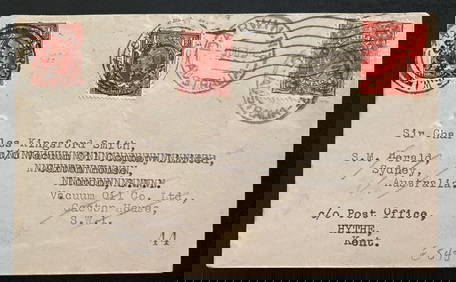
1935 Darwin Australia Experimental flight Cover To England Charles Smith Only 49Mynt Auctions4.6(680)See Sold PriceFeb 24, 2024
[MAP]. [ALBRIZZI, Giambatista, 1698-1777]. Carta Geografica...Potter & Potter Auctions4.6(539)See Sold PriceMar 07, 2024
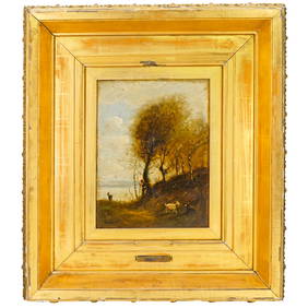
Attrib. Jean Baptiste Camille Corot (French, 1796-1875) Oil on Canvas PaintingAkiba Galleries4.7(1.7k)See Sold PriceFeb 29, 2024
Late 18th century map of England and Wales sampler and two printsFellows4.3(159)See Sold PriceMar 05, 2024
Dr. Charles Smith (American/Louisiana, b. 1940)Neal Auction Company4.6(348)See Sold PriceMar 14, 2024


![[MAP]. [ALBRIZZI, Giambatista, 1698-1777]. Carta Geografica... (1 of 1)](https://p1.liveauctioneers.com/928/318880/171361280_1_x.jpg?height=282&quality=70&version=1707501302)