SoldAtlases.- Smith (Charles) Smith's New General Atlas, 45Atlases.- Smith (Charles) Smith's New General Atlas, engraved calligraphic title, 45 hand-coloured engraved maps, 2 double-page of Germany (numbered 19/20 & 21/22), occasional spotting, light marginalSee Sold Price
SoldAtlases.- Smith (Charles) - Smith's New General Atlas,title and 46 maps, including 2 double-page maps, hence numbered to 48, engraved maps with original hand-colouring, light surface dust and occasional marginal finger-soiling, contemporary half-calf oveSee Sold Price
SoldCharles Smith mapCharles Smith map- ''Poland''- hand0colored engraving, 1808, from 'Smith's New General Atlas Containing Distinct Maps of All the Principal Empires, Kingdoms and States throughout the World...''- paperSee Sold Price
SoldSmith (Charles) - Smith's New English Atlas,first edition, bound as a folded-over travelling atlas, ornately lettered engraved title, 45 of 46 maps, including general map of England and Wales, Yorkshire on 4 sheets and Wales on 2 sheets, but laSee Sold Price
Smith (Charles) New English AtlasSmith (Charles) New English Atlas, engraved title, 25 engraved maps (of 42), including general map of England and Wales, and Yorkshire on 4 sheets, with original hand-colouring, the majority dSee Sold Price
smith Smith's New English Atlassmith Smith's New English Atlas[Smith (Charles, bookseller) Smith's New English Atlas...], 43 engraved maps hand-coloured in outline, including one folding, engraved contents leaf, lacking titSee Sold Price
SoldSMITH, Charles. General atlas signed in Congress atSMITH, Charles. General atlas signed in Congress at Vienna. Londra: 1822. Volume in-folio contenente 54 carte geografiche a colori fuori testo. Due piccoli disegni a matita e note manoscritte nella caSee Sold Price
SoldSmith (Charles) Smith's New English AtlasSmith (Charles) Smith's New English Atlas, Being a Complete Set of County Maps, Divided into Hundreds, ornately lettered engraved title contents leaf, and 42 maps on 46 sheets, including YorksSee Sold Price
Smith (Charles) New English Atlas being a CompleteSmith (Charles) New English Atlas being a Complete Set of County Maps,first edition, engraved title, contents f., 46 hand-coloured double-page maps, modern half calf over contemporary boards,See Sold Price
SoldSmith (Charles) - New General Atlas,engraved title, complete according to the Contents list of 56, with table of mountains and rivers, 9 double- and 38 single-page engraved maps with original hand-colouring, the world on Mercator's projSee Sold Price
SoldAtlases.- Smith (Charles) - New English Atlas,engraved title, contents f. and 43 maps (hand-coloured in outline), including a large folding map of Yorkshire, occasional spotting or marking, but generally clean, contemporary half calf, gilt, 1841See Sold Price
Smith (Charles) Smith's Classical Atlas ContainingSmith (Charles) Smith's Classical Atlas Containing District Maps of the Countries described in Ancient History both Sacred and Profane, second edition, engraved title, index, 14 hand-coloured engravedSee Sold Price
Smith, C. New General Atlas containing Distinc & MapsNew General Atlas containing Distinc & Maps of all principal Empires, Kingdoms & States throughout the worl arranged according to the general treaty signed in the congress at vienna with considerableSee Sold Price
SoldLondon.- Smith (Charles) Smith's New Plan of London,London.- Smith (Charles) Smith's New Plan of London, Westminster & Southwark, 1825, showing from Elephant & Castle to Islington, and Hyde Park to the East India Docks, with extensive key below featuriSee Sold Price
SoldEngland & Wales.- Smith (Charles) Smith's New Map ofEngland & Wales.- Smith (Charles) Smith's New Map of the Inland Navigation of England & Wales, with details of the inland waterways, or rivers and canals, of England and Wales, engraving with originalSee Sold Price
SoldCharles Smith (18th-19th Century) British. "A New MapCharles Smith (18th-19th Century) British. "A New Map of the County of Rutland", 1801, Engraved Map, 17.25" x 19.25".See Sold Price
Sold(3) SMITH'S ATLAS MAPS, EGYPT, ASIA & PERSIA(lot of 3) Unframed maps from Smith's Atlas, 19th c., published by Charles Smith, London, including: (1) "Persia, Arabia, and Cabul," engraved by W.R. Gardner, sheet: approx 12.5"h, 15.75"w, (1) "EgypSee Sold Price
(3) SMITH'S ATLAS MAPS, EGYPT, ASIA & PERSIA(lot of 3) Unframed maps from Smith's Atlas, 19th c., published by Charles Smith, London, including: (1) "Persia, Arabia, and Cabul," engraved by W.R. Gardner, sheet: approx 12.5"h, 15.75"w, (1) "EgypSee Sold Price
SoldBooth (Charles), Hubert Llewyllyn Smith and others. NewBooth (Charles), Hubert Llewyllyn Smith and others. New Survey of London Life and Labour, 9 vol. including 2 map vol., frontispieces, plates, some folding, tables and illustrations, 13 large maps foldSee Sold Price
A George III steel engraved map and other mapsA George III steel engraved map 'Atlantic Islands' (Cape Verdis, Canaries, Azores and Madeira) by T Clerk for Thomson's New General Atlas 50 x 60 cm, mounted framed and glazed to/w a French map enSee Sold Price
SoldAtlases.- World.- Black (Adam and Charles) Black'sAtlases.- World.- Black (Adam and Charles) Black's General Atlas of The World, New and Revised Edition, frontispiece with flags of nations, title, and complete with 52 maps on 55 sheets (numbered 2-56See Sold Price
SoldBLACK, ADAM and CHARLES. Black's General AtlasBLACK, ADAM and CHARLES. Black's General Atlas of the World. New and Revised Edition. Profusion of color mapsheets [complete]. Folio, publisher's 1/2 morocco, slight rubbing at extremities; crisp andSee Sold Price
SoldCHARLES SMITH (ENGLISH, 1768-1854) MAP OF THE WORLDCHARLES SMITH (ENGLISH, 1768-1854) MAP OF THE WORLD, hand-colored, depicting the Western and Eastern hemispheres, title centered above "The / WORLD / Engraved for Smith's Atlas", and centered below "PSee Sold Price
SoldMORSE'S GENERAL ATLAS OF THE WORLD...MORSE'S GENERAL ATLAS OF THE WORLD......CONTAINING SEVENTY MAPS, DRAWN AND ENGRAVED FROM THE LATEST AND BEST AUTHORITIES by Charles W. Morse (New York: D. Appleton and Company, 1856), large folio, cloSee Sold Price
1866 Philadelphia & Reading Railroad Annual PassRail & Road Auctions4.6(165)See Sold PriceMar 08, 2024
1868 and 1870 Philadelphia & Reading Railroad Annual PassesRail & Road Auctions4.6(165)See Sold PriceMar 08, 2024
Arrowsmith & Lewis - Map of PolynesiaTrillium Antique Prints & Rare Books4.5(30)See Sold PriceFeb 24, 2024
Arrowsmith & Lewis - Map of North AmericaTrillium Antique Prints & Rare Books4.5(30)See Sold PriceFeb 24, 2024
Arrowsmith & Lewis - Map of the World on Mercator's ProjectionTrillium Antique Prints & Rare Books4.5(30)See Sold PriceFeb 24, 2024
Arrowsmith & Lewis - Map of LouisianaTrillium Antique Prints & Rare Books4.5(30)See Sold PriceFeb 24, 2024
Arrowsmith & Lewis - Map of the United StatesTrillium Antique Prints & Rare Books4.5(30)See Sold PriceFeb 24, 2024
Carey, pub. 1796 - A Chart of the West IndiesTrillium Antique Prints & Rare Books4.5(30)See Sold PriceFeb 24, 2024
Carey, pub. 1796 - Map of the State of MarylandTrillium Antique Prints & Rare Books4.5(30)See Sold PriceFeb 24, 2024
Carey, pub. 1796 - Map of GeorgiaTrillium Antique Prints & Rare Books4.5(30)See Sold PriceFeb 24, 2024
Carey, pub. 1796 - Map of The State of South CarolinaTrillium Antique Prints & Rare Books4.5(30)See Sold PriceFeb 24, 2024
Carey, pub. 1796 - Map of KentuckyTrillium Antique Prints & Rare Books4.5(30)See Sold PriceFeb 24, 2024
Carey, pub. 1796 - Map of the Tennassee State formerly part of North Carolina (Tennessee)Trillium Antique Prints & Rare Books4.5(30)See Sold PriceFeb 24, 2024
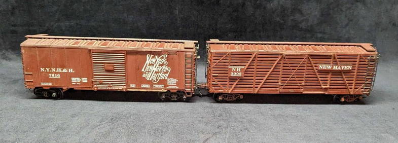
2 Vintage O Scale Atlas New Haven New York BoxcarsRapid Estate Liquidators and Auction Gallery4.5(1.1k)See Sold PriceFeb 24, 2024
West Indies Islands. Guadaloupe. | Mariegalante &C. | Antigua.Jasper524.5(9.8k)See Sold PriceFeb 27, 2024
Robert H Labberton - Map of The Territory of the Present United States - The territory of theProverde Auctions4.3(3)See Sold PriceFeb 28, 2024
Dr. Charles Smith (American/Louisiana, b. 1940)Neal Auction Company4.6(348)See Sold PriceMar 14, 2024