SoldSmith (Charles) Smith's New Map of London and StreSmith (Charles) Smith's New Map of London and Street Indicator,from Islington to Kennington Oval, and from Commercial and Surrey Docks to Hyde Park, with indicator tape on original brass mountSee Sold Price
SoldSmith (Charles) Smith's New Plan of London, WestmiSmith (Charles) Smith's New Plan of London, Westminster and Southwark,showing from Pentonville down to Newington Butts, and Limehouse across to Brompton Row, engraved map with hand-colouring,See Sold Price
SoldLondon.- Smith (Charles) Smith's New Plan of London,London.- Smith (Charles) Smith's New Plan of London, Westminster & Southwark, 1825, showing from Elephant & Castle to Islington, and Hyde Park to the East India Docks, with extensive key below featuriSee Sold Price
SoldUK - Staffordshire 1808 Hand Col Map by Charles Smith"A New Map of the County of Stafford" Copper Engraved Map Published 1808, London. Printed for C. Smith. Dissected and linen backed. Original hand colour. Paper Size: 20.5 x 19 inch (52 x 48cm) Good coSee Sold Price
SoldBooth (Charles), Hubert Llewyllyn Smith and others. NewBooth (Charles), Hubert Llewyllyn Smith and others. New Survey of London Life and Labour, 9 vol. including 2 map vol., frontispieces, plates, some folding, tables and illustrations, 13 large maps foldSee Sold Price
SoldEngland & Wales.- Smith (Charles) Smith's New Map ofEngland & Wales.- Smith (Charles) Smith's New Map of the Inland Navigation of England & Wales, with details of the inland waterways, or rivers and canals, of England and Wales, engraving with originalSee Sold Price
SoldSmith (Charles) Smith's New Plan of London, WestmiSmith (Charles) Smith's New Plan of London, Westminster & Southwark,comprehending all the New Buildings and 350 References to Principal Streets, with the New Docks at Wapping & Blackwall, fromSee Sold Price
Smith (Charles) Smith's New Plan of London, WestmiSmith (Charles) Smith's New Plan of London, Westminster and Southwark,comprehending, all the New Buildings, and 350 References to the Principal Streets, showing from Pentonville down to NewingSee Sold Price
SoldSmith (Charles) Smith's New Plan of London, WestmiSmith (Charles) Smith's New Plan of London, Westminster & Southwark,comprehending all the New Buildings and 350 References to Principal Streets, with the New Docks at Wapping & Blackwall, fromSee Sold Price
SoldSmith (Charles) Smith's New Plan of London, WestmiSmith (Charles) Smith's New Plan of London, Westminster & Southwark,comprehending all the New Buildings and 350 References to Principal Streets, with the New Docks at Wapping & Blackwall, fromSee Sold Price
SoldLake District.- Smith (Charles) Smith's New and AcLake District.- Smith (Charles) Smith's New and Accurate Map of the Lakes,in the counties of Cumberland, Westmoreland and Lancaster, engraved map with original hand-colouring, 610 x 490mm., diSee Sold Price
SoldSmith (Charles) New Post Map of the Northern PartsSmith (Charles) New Post Map of the Northern PartsIncluding the whole of the United Netherlands and Switzerland, showing the post stations, engraved map with original hand-colouring, 1050 x 85See Sold Price
Smith (Charles) Post Map of France & GermanySmith (Charles) New Post Map of the Northern Parts of France and Germany, Including the whole of the United Netherlands and Switzerland, showing the post stations, engraved map with original hSee Sold Price
SoldSmith (Charles) Map of CumberlandSmith (Charles) A New Map of the County of Cumberland,engraved map with original outline hand-colouring, 495 x 440mm., central horizontal fold, slightly discoloured, 1808 Cary (John) A Map oSee Sold Price
SoldSmith (C) Map of the County of CumberlandSmith (Charles) A New Map of the County of Cumberland,engraved map with original outline hand-colouring, 495 x 440mm., central horizontal fold, slightly discoloured, 1808 Cary (John) A Map oSee Sold Price
London.- Smith (Charles) Reynolds's Map of London withNO RESERVE London.- Smith (Charles, publisher) Reynolds's Map of London with the recent Improvements, lithographed map printed in colours, 605 x 880 mm. (23 3/4 x 34 3/4 in), dissected and mounted onSee Sold Price
SoldSmith (Charles) Map Twelve Miles Round LondonSmith (Charles) Map of the Country Twelve Miles Round London,extending from Hadley to Addington, and from Northolt to Hornchurch, engraved folding map, dissected and linen-backed, with originaSee Sold Price
SoldLondon.- Smith (Charles) Map of the Country TwelveLondon.- Smith (Charles) Map of the Country Twelve Miles Round London, showing from Ewell to Enfield, and from Southall to Hornchurch in the east, engraved map by W.R. Gardner, with early hand-colouriSee Sold Price
SoldCharles Smith (18th-19th Century) British. "A New MapCharles Smith (18th-19th Century) British. "A New Map of the County of Rutland", 1801, Engraved Map, 17.25" x 19.25".See Sold Price
smith Smith's New English Atlassmith Smith's New English Atlas[Smith (Charles, bookseller) Smith's New English Atlas...], 43 engraved maps hand-coloured in outline, including one folding, engraved contents leaf, lacking titSee Sold Price
SoldSmith (Charles) - Smith's New English Atlas,first edition, bound as a folded-over travelling atlas, ornately lettered engraved title, 45 of 46 maps, including general map of England and Wales, Yorkshire on 4 sheets and Wales on 2 sheets, but laSee Sold Price
SoldAtlases.- Smith (Charles) Smith's New General Atlas, 45Atlases.- Smith (Charles) Smith's New General Atlas, engraved calligraphic title, 45 hand-coloured engraved maps, 2 double-page of Germany (numbered 19/20 & 21/22), occasional spotting, light marginalSee Sold Price
SoldAtlases.- Smith (Charles) - Smith's New General Atlas,title and 46 maps, including 2 double-page maps, hence numbered to 48, engraved maps with original hand-colouring, light surface dust and occasional marginal finger-soiling, contemporary half-calf oveSee Sold Price
SoldSmith (Charles) Smith's New English AtlasSmith (Charles) Smith's New English Atlas, Being a Complete Set of County Maps, Divided into Hundreds, ornately lettered engraved title contents leaf, and 42 maps on 46 sheets, including YorksSee Sold Price
1885 CIVIL WAR 1ed Famous Memoirs US Grant Sheridan Sherman 6v RARE LOT MapsSchilb Antiquarian Rare Books4.8(421)See Sold PriceMar 10, 2024
Archaeological Books - Roach Smith & Fairholt - The Antiquities of Richborough, Reculver, and Lymne,TimeLine Auctions Ltd.4.5(183)See Sold PriceMar 06, 2024
Archaeological Books - Roach Smith - Collectanea Antiqua, etchings and notices of ancient remains,TimeLine Auctions Ltd.4.5(183)See Sold PriceMar 06, 2024
Archaeological Books - Inventorium Sepulchrale: an Account of Some AntiquitiesTimeLine Auctions Ltd.4.5(183)See Sold PriceMar 06, 2024
Archaeological Books - Roach Smith - Collectanea Antiqua, etchings and notices of ancient remains,TimeLine Auctions Ltd.4.5(183)See Sold PriceMar 06, 2024
Archaeological Books - Roach Smith - Catalogue of the Museum of London AntiquitiesTimeLine Auctions Ltd.4.5(183)See Sold PriceMar 06, 2024
1950's Charles and Alice Smith Chalice California pottery tiki face vase. Vase has alternatingNeely Auction4.6(224)See Sold PriceFeb 25, 2024
[ARCTIC]. BOWEN, Emanuel. A New & Accurate Map of the North...Potter & Potter Auctions4.6(539)See Sold PriceMar 07, 2024
1764 MAP OF COUNTRIES THIRTY MILES ROUND LONDON antique 12.5 by 15"Jasper524.5(9.8k)See Sold PriceFeb 27, 2024
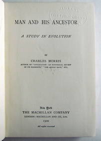
1900 MAN AND HIS ANCESTOR STUDY in EVOLUTION BY CHARLES MORRIS antiqueJasper524.5(9.8k)See Sold PriceFeb 27, 2024
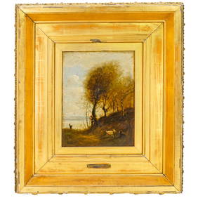
Attrib. Jean Baptiste Camille Corot (French, 1796-1875) Oil on Canvas PaintingAkiba Galleries4.7(1.7k)See Sold PriceFeb 29, 2024
1953 Street And Smiths New York Yankees Mickey Mantle Baseball Pictorial YearbookWeatherham Estate Treasures3.9(157)See Sold PriceMar 21, 2024
Buffon, Vaugody & Bell 1785 America - Map of the New ContinentAlbion Auctions4.6(336)See Sold PriceMar 01, 2024
Guthrie, William 1812 Antique Map. Spain and PortugalAlbion Auctions4.6(336)See Sold PriceMar 01, 2024
Dr. Charles Smith (American/Louisiana, b. 1940)Neal Auction Company4.6(348)See Sold PriceMar 14, 2024


![[ARCTIC]. BOWEN, Emanuel. A New & Accurate Map of the North... (1 of 1)](https://p1.liveauctioneers.com/928/318880/171360917_1_x.jpg?height=282&quality=70&version=1707501302)