ATLAS of ANTIENT GEOGRAPHY by SAMUEL BUTLER 1843John McInnis Auctioneers,LLC4.6(504)See Sold PriceFeb 24, 2024
18TH C. ANTIQUE MAP: FRENCH & INDIAN WAR, FRAMEDThomaston Place Auction Galleries4.4(389)See Sold PriceFeb 24, 2024
Rand McNally Railroad Map Cabinet w/ 21 Railroad MapsRail & Road Auctions4.6(165)See Sold PriceMar 08, 2024
Keith Haring - Ink on New York Map, Best Buddies, Inscribed, Signed, and DatedSapphire Auction Gallery4.1(67)See Sold PriceMar 02, 2024
LATE 17TH C. FRENCH MAP OF THE NEW WORLD BY ALEXIS-HUBERT JAILLOT (1632-1712)Thomaston Place Auction Galleries4.4(389)See Sold PriceFeb 24, 2024
Central Railroad of New Jersey Map of Sandy Hook Route-ca. 1903JM Hobby Supply and Railroad Artifact Auctions4.4(126)See Sold PriceFeb 24, 2024
Lot of Six Mixed Atlas Box Cars-HO Scale-New in BoxJM Hobby Supply and Railroad Artifact Auctions4.4(126)See Sold PriceFeb 25, 2024
Rand McNally/Santa Fe Railroad Map of Iowa-1912JM Hobby Supply and Railroad Artifact Auctions4.4(126)See Sold PriceFeb 24, 2024
NICOLAES VISSCHER (NETHERLANDS, 1618-1709) MAP OF THE NEW WORLDThomaston Place Auction Galleries4.4(389)See Sold PriceFeb 24, 2024
17TH C. WORLD MAP BY NICOLAES VISSCHER (NETHERLANDS, 1618-1709)Thomaston Place Auction Galleries4.4(389)See Sold PriceFeb 24, 2024
Lot of Six Mixed Atlas Cabooses-HO Scale-New in BoxJM Hobby Supply and Railroad Artifact Auctions4.4(126)See Sold PriceFeb 25, 2024
SoldLarge framed map, "New York City North of 93rd Street",Large framed map, "New York City North of 93rd Street", Colton's New Map of the City and County of New York Including Extensions North of the Harlem River, published by G.W. and C.B. Colton & Co.'s sSee Sold Price
SoldON 2, LARGE FRAMED MAP, INDIAN RESERVATIONS HON.HIRAM PRICE, 1884, PHOTO LITHOGRAPH, BELL BROS, WASHINGTON TOGETHER WITH PHOTO OF CHIEFS, MAP 21" X 33" SIGHT, PHOTO 7 1/2" X 9" SIGHT.See Sold Price
SoldLarge Framed Map of London, 1861Depicts London from the South Side of the Thames, this was a fold-out supplement to the illustrated London News, February 9, 1861, Rob Loudon Sr. Folds, creases, water stains in areas. Overall size: 2See Sold Price
SoldLarge Framed Map of Charleston HarborLarge framed map of Charleston Harbor. Approx. 36 inches x 50 inches. Overall good condition.See Sold Price
SoldLarge Framed MapLarge framed reprint map "PLANTATIONS / ON THE / MISSISSIPPI RIVER". Overall 56 3/4" x 34 1/2".See Sold Price
SoldLarge framed mapLarge framed and matted hand colored map of North America by "A. Walker" and engraved by "R.W. Seale". Sight 32.5" x 34.25"See Sold Price
SoldLARGE FRAMED MAP OF PARIS AND SURROUNDING AREASdated 1875, 23x34in., together with an offset map titled Magna Britannia et Hibernia Tabula, 12x15in.See Sold Price
Sold1853 Richard Clark Large Framed Map of New Milford1853 Richard Clark Framed Map of New Milford, CT(KRED2000) {TC} Measurements: 33x44, framed 44x48 Condition: readable, but fragile, losses, creases, heavily toned, some sections possibly hand-colored,See Sold Price
SoldLARGE FRAMED MAP ST GEORGES CHANNEL IRISH COASTLARGE FRAMED MAP OF ST GEORGES CHANNEL AND IRISH COAST - APPROX. 62" X 58" OVERALLSee Sold Price
SoldPENNSYLVANIA RR AND CONNECTIONS LARGE FRAMED MAP,PENNSYLVANIA RR AND CONNECTIONS LARGE FRAMED MAP, MEASURES 30" X 54". FRAME MEASURES 46" X 66". ( CAN'T SEE A DATE ). FROM ESTATE COLLECTION OF WALTER G. RICH.See Sold Price
Large Framed Map of TX RailroadsVintage large scale map of Tx showing the existing railroads and topographical features. Measures 26x37 inches. Archival framing. Good clean condition and easy to read.See Sold Price
Large, framed map of Gaul, Wells c1700Double page copper engraved map of France engraved by Robert Spofforth and published for "A new sett of maps both of antient and present geography.” Shows ancient political and administrative divisiSee Sold Price
SoldA large framed Map. W 114 x 91cm. approx.(1) (15/16A large framed Map. W 114 x 91cm. approx.(1) (15/16 window).See Sold Price
SoldMap, Suffolk Co. L. I.Large framed map from actual surveys, by John Douglass and J. Chance Jr. 517, 519, 521 Minor St., Philadelphia. 60" x 49". Worn condition.See Sold Price
SoldEarly 19th Century Map of "The Bosphorus"Large framed map of the "Canal De Constantinople" printed 1819. The full title is a "Plan Topographique du Bosphore de Thrace ou Canal de Constantinople et de ses Environs, Jusqu'a à la source des riSee Sold Price
Sold19TH C. MAP OF PARIS19TH C. MAP OF PARIS: Large framed map of Paris Circa Mid 1900's by Malte-Brun family, in frame. Approx. 35" h x 43" w.See Sold Price
SoldVINTAGE MARTHAS VINEYARD MAPLarge framed map of Martha's Vineyard circa 1993 by NOAA, 12th Edition 1987, 35.5 x 43 inches image size, plus frame.See Sold Price
SoldA large collection of Belgian engravings, maps andDim.: 68 x 52,5 cm (the large framed map)See Sold Price
SoldHubert Jaillot (1692) French Map of ChampagneThis large framed map by Hubert Jaillot is titled top left reads "Gouvernment General de Champagne out sont divisees Les Elections de la Generalite deChaalons...presenter a Monseigneur le Dauphin / HuSee Sold Price
Lot of 5 Maps of Eretz Israel, 19th-20th CenturyLot of 5 maps of Eretz Israel (Palestine), 19th-20th century. Including a map of Jerusalem, a large framed map of Eretz Israel (glass broken) and more. Dimensions: 25X19 - 43X35 cm. Large map in goodSee Sold Price
SoldWWII US D-DAY TOP SECRET INVASION MAPS, DOCUMENTSIncredible collection of 4 large framed maps, books, and 2 passenger lists for troop transport ship. Items belonged to a Capt. William E. Stahler, who was a Quartermaster officer who made "two trips tSee Sold Price
LARGE FRAMED ENGLISH PETIT POINT NEEDLEWORKThomaston Place Auction Galleries4.4(389)See Sold PriceFeb 24, 2024
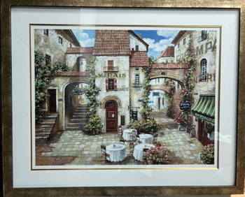
" Le MARAIS" BY ROBERT DUVAL LARGE FRAMED LITHOGRAPH SIGNED LOWER RIGHTAlice Callahan Auction House4.4(57)See Sold PriceMar 02, 2024
FRANK MARMINGTON c1910 National Gallery Canada Signed Engraving London St. Pauls 20" x 16"Luis Porretta Fine Arts4.3(10)See Sold PriceMar 02, 2024
Kilburg Geochron Lighted Scrolling Framed MapNadeau's Auction Gallery4.7(405)See Sold PriceFeb 24, 2024
Pair of Early Railroad Maps - 1862 Pittsburgh, Ft. Wayne & Chicago Railway and 1873 PennsylvaniaRail & Road Auctions4.6(165)See Sold PriceMar 07, 2024
1867 Map of the Railroads of The State of New YorkRail & Road Auctions4.6(165)See Sold PriceMar 08, 2024
LARGE FRAMED PAINTING OF THE ARCHANGEL MICHAEL, 59" X 39"Austin Auction Gallery4.7(1.2k)See Sold PriceFeb 25, 2024
LARGE FRAMED PAINTED TAPESTRY THE RAISING OF LAZARUS, 64" X 47.5"Austin Auction Gallery4.7(1.2k)See Sold PriceFeb 25, 2024
LARGE FRAMED PAINTING ON CANVAS BLACK STALLION, 66.5" X 46.5"Austin Auction Gallery4.7(1.2k)See Sold PriceFeb 25, 2024
LOIS BREZINSKI " CAYMAN ISLAND" GRAPETREES ON SEVEN MILE BEACH LARGE FRAMEDAlice Callahan Auction House4.4(57)See Sold PriceMar 02, 2024
Framed Large Douglas Edwards Lithograph Pond BRapid Estate Liquidators and Auction Gallery4.5(1.1k)See Sold PriceFeb 24, 2024
Framed Space Age Rand McNally Map of Planets Poster, 1958PUBLIC SALE4.7(225)See Sold PriceMar 02, 2024
Stanford, Edward 1901 Large Map. Geological Map of the British IslesAlbion Auctions4.6(341)See Sold PriceMar 01, 2024
Perry, Matthew C. 1856 Large Map. Shah Bay, Lew Chew I. JapanAlbion Auctions4.6(341)See Sold PriceMar 01, 2024
A large framed 19th Century Chinese silk embroidery depicting birds in foliage 140 x 60 cmHannam's Auctioneers Ltd4.3(391)See Sold PriceMar 01, 2024
Large Framed Andre Brasilier Lithographic Art PrintRapid Estate Liquidators and Auction Gallery4.5(1.1k)See Sold PriceFeb 28, 2024