ATLAS of ANTIENT GEOGRAPHY by SAMUEL BUTLER 1843John McInnis Auctioneers,LLC4.5(505)See Sold PriceFeb 24, 2024
18TH C. ANTIQUE MAP: FRENCH & INDIAN WAR, FRAMEDThomaston Place Auction Galleries4.4(393)See Sold PriceFeb 24, 2024
Rand McNally Railroad Map Cabinet w/ 21 Railroad MapsRail & Road Auctions4.6(165)See Sold PriceMar 08, 2024
Keith Haring - Ink on New York Map, Best Buddies, Inscribed, Signed, and DatedSapphire Auction Gallery4(67)See Sold PriceMar 02, 2024
LATE 17TH C. FRENCH MAP OF THE NEW WORLD BY ALEXIS-HUBERT JAILLOT (1632-1712)Thomaston Place Auction Galleries4.4(393)See Sold PriceFeb 24, 2024
Central Railroad of New Jersey Map of Sandy Hook Route-ca. 1903JM Hobby Supply and Railroad Artifact Auctions4.4(127)See Sold PriceFeb 24, 2024
Lot of Six Mixed Atlas Box Cars-HO Scale-New in BoxJM Hobby Supply and Railroad Artifact Auctions4.4(127)See Sold PriceFeb 25, 2024
Rand McNally/Santa Fe Railroad Map of Iowa-1912JM Hobby Supply and Railroad Artifact Auctions4.4(127)See Sold PriceFeb 24, 2024
NICOLAES VISSCHER (NETHERLANDS, 1618-1709) MAP OF THE NEW WORLDThomaston Place Auction Galleries4.4(393)See Sold PriceFeb 24, 2024
17TH C. WORLD MAP BY NICOLAES VISSCHER (NETHERLANDS, 1618-1709)Thomaston Place Auction Galleries4.4(393)See Sold PriceFeb 24, 2024
Lot of Six Mixed Atlas Cabooses-HO Scale-New in BoxJM Hobby Supply and Railroad Artifact Auctions4.4(127)See Sold PriceFeb 25, 2024
SoldPanoramic Map of Jerusalem - Sebastian Munster...Die heilige statt Jerusalem contrafehtet nach form uns gestalt wie sie ietz erbauwen ist [view of Jerusalem], Sebastian Munster. Basel, second half of 16th century. German. Panoramic map of JerusalemSee Sold Price
SoldMap of Jerusalem. Sebastian Munster. After 1550.Ierusalem. Miniature. Woodcut. Black and white. After, 1550. Surrounded by text. Engravings and text on reverse. Title on p.1088: "Terra Santa". Title on p. 1087: "Lib. V". Latin. 10.1x7.7 cm. (Leaf mSee Sold Price
SoldMap of Modern Jerusalem. Sebastian Munster. Basle,La Saincte cite de Ierusalem iadiz metropolitaine du royaunme des Juifz, & maintenant colonie du Turc. Jerusalem the Holy City, first the capital city of the Kingdom of Judah and now a Turkish Colony.See Sold Price
Map of Modern Jerusalem. Sebastian Munster. Basle,Ierusalem ciuitas sancta, olim metropolis regni iudaici, hodie uero colonia Turcae. Jerusalem the Holy City, first the capital city of the Kingdom of Judah and now a Turkish Colony. Map of modern JeruSee Sold Price
Statt Jerusalem - Basel, 1550 Map of the Holy City of JStatt Jerusalem - Basel, 1550 Map of the Holy City of Jerusalem, by Sebastian Münster. [Basel. 1550]. Size of the sheet: 35 x 42 cm.Imaginary map with drawings of buildings and the Old City wall. FroSee Sold Price
SoldMap, Sebastian MunsterSebastian Munster (German, 1488-1552), "Description Novelle d'Europe," 1552, woodcut map with text on verso, overall (with mat): 19"h x 21.5"wSee Sold Price
SoldMap, Sebastian MunsterSebastian Munster (German, 1488-1552), "Description Novelle d'Europe," 1552, woodcut map with text on verso, overall (with mat): 19"h x 21.5"wSee Sold Price
SoldMap, Sebastian MunsterSebastian Munster (German, 1488-1552), "Von den Britannischen Insuln," circa 1578, engraving, image (sight): 10.75"h x 6.75"w, overall (with frame): 18.75"h x 15"w. Provenance: Estate of Frank J. CaufSee Sold Price
SoldMunster. Americae Sive Novi Orbis...[Woodcut New World Map]. Sebastian Munster. AMERICAE SIVE NOVIS ORBIS NOVA. 12 x 14 ¼, uncolored, based on Ortelius. [Basle: 1588]. Second title in upper margin, Die Newen Inseln /So Hinder HispaniaSee Sold Price
SoldPanoramic Map of Jerusalem - WhittockPanoramic Map of Jerusalem and the Adjacent Towns and Villages, taken from the Heights of Bethlehem by the Librarian of the Armenian Convent. Drawn from the original and engraved by Nathaniel WhittockSee Sold Price
SoldPanoramic Map of Jerusalem. 18th Century?Ierusalem. Panoramic map of Jerusalem within the walls. Copperplate. Black and white. Following the map of J. Chereau from the 18th century. Page spread. German. 20.7x34 cm. Quality paper. ProfessionaSee Sold Price
Panoramic map of Jerusalem. Torino, 1834.Veduta di Gerusalemme. Panoramic map. Copperplate engraving. Black and white. Title page of periodical: Teatro Universale Rccolta Enciclopedica e Scenografica. First year, booklet 3, Torino, 19.7.1834See Sold Price
SoldPanoramic Map of Jerusalem - Leipzig, 1852Das Biblische Jerusalem aus der vogelschau, Adolf Eltzner. Published by J.J. Weber, Leipzig, 1852. Engraved panoramic map of Jerusalem, Folded. 41.5X58 cm. Good condition. Stains. Bound in hard cover.See Sold Price
SoldPost medieval Woodcut Munster's Map of the Holy LandPublished Basle, 1588 AD Second state map by Sebastian Munster (1488-1522) titled Palaestina, des heiligen Landes Beschreibung mit sampt den anstossenden Laendern und Voelctern alss die Ammoniter, priSee Sold Price
SoldA Map of Jerusalem. Hartmann Schedel. Incunabula.Desruccio Iherosolime. Wood carving. A panoramic map of Jerusalem at the time of the destruction of the Temple by Hartmann Schedel. Nuremberg, 1493. Incunabula. A double leaf. 40x56 cm. Latin. LXIISee Sold Price
SoldMap of Jerusalem. Hartmann Schedel. Incunabula.Desruccio Iherosolime. Panoramic map of Jerusalem during its destruction. By Hartmann Schedel. Nurnberg 1493. Incunabula. Folded leaf. 40x56 cm. Latin. View from east to west. Depicts the Holy TempleSee Sold Price
SoldMunster DES NOUVELLES ISLES. Woodcut map.[New World] DES NOUVELLES ISLES, COMMENT, QUAND & PAR QUI ELLES ONT ESTE TROUVEES. Woodcut map from Sebastian Munster’s “Cosmographia…” Text below woodcut and on verso. Several French editionsSee Sold Price
SoldSolinus (Caius Julius) Polyhistor, Rerum Toto Orbe Memorabilium Thesaurus Locupletissimus, Basel,Solinus (Caius Julius) Polyhistor, Rerum Toto Orbe Memorabilium Thesaurus Locupletissimus, second edition, collation: a6 B4 a-z4 Aa-Ff4, 2 folding woodcut maps by Sebastian Munster (one of which brownSee Sold Price
SoldSEBASTIAN MUNSTER, MAP OF THE WORLD, FRAMEDSebastian Munster (German, 1488-1552). "Map of the Ptolemaic World" from "Cosmographia", engraving with hand coloring, framed. Approx. 18.5" x 20.25" (frame), 12.75" x 14.5" (sight) Item from the EstaSee Sold Price
SoldSebastian Munster Map of Paris 1550Sebastian Munster (1488-1552), "La ville de Paris, par tout tant renommee, & principalle ville du royaulme de France," ca. 1568. This hand-colored woodcut map of Paris shows the city from a birdseye vSee Sold Price
Sebastian Munster: Map of Poland & Hungary. 1542, BaselPolonia Et Ungaria XV Nova Tabula. One of the earliest maps of Poland, with Lithuania to the North, south of the Danube, east to the Black Sea with river Dnieper basin and Bessarabia. CARTOGRAPHER SebSee Sold Price
SoldAntique Sebastian Munster Map of Ancient RomeAntique Sebastian Munster Map of Ancient Rome. Profeisonally matted and framed. Frame measures 21 inches x 26 inches.See Sold Price
SoldSebastian Munster Map of SpainHispania III Nova Tabula 10 3/4" x 13 3/4" (sight), 16th century together with Ortelius' Map of the Celtic Empire 13 7/8" x 18 1/2" (sight)See Sold Price
SoldSebastian Munster Map of the New World, ca 1550 Sebastian Munster Map of the New World, ca 1550 Munster, Sebastian (1488-1552) Die neuwen Inseln - So hinder Hispanien gegen Orient bey dem land Indie ligen. Basle, ca 1540-1556. Woodcut, not coloreSee Sold Price
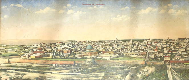
Panorama View of Jerusalem - L. Ferid - 19th CenturyLevy Auction House4.3(11)See Sold PriceFeb 27, 2024
Jerusalem Map for British Soldiers in Palestine - WW2Levy Auction House4.3(11)See Sold PriceFeb 27, 2024
1738 BIBLE in DUTCH ILLUSTRATED w/ MAPS antique MASSIVE FOLIO BIBLIAJasper524.5(9.9k)See Sold PriceFeb 27, 2024
1730 BIBLE in DUTCH ILLUSTRATED w/ MAPS antique MASSIVE FOLIO BIBLIAJasper524.5(9.9k)See Sold PriceFeb 27, 2024
Georg Bockler Map of Ancient Jerulsaem EtchingAuctions at Showplace4.6(740)See Sold PriceApr 07, 2024