ATLAS of ANTIENT GEOGRAPHY by SAMUEL BUTLER 1843John McInnis Auctioneers,LLC4.6(504)See Sold PriceFeb 24, 2024
18TH C. ANTIQUE MAP: FRENCH & INDIAN WAR, FRAMEDThomaston Place Auction Galleries4.4(389)See Sold PriceFeb 24, 2024
Rand McNally Railroad Map Cabinet w/ 21 Railroad MapsRail & Road Auctions4.6(165)See Sold PriceMar 08, 2024
Keith Haring - Ink on New York Map, Best Buddies, Inscribed, Signed, and DatedSapphire Auction Gallery4.1(67)See Sold PriceMar 02, 2024
LATE 17TH C. FRENCH MAP OF THE NEW WORLD BY ALEXIS-HUBERT JAILLOT (1632-1712)Thomaston Place Auction Galleries4.4(389)See Sold PriceFeb 24, 2024
Central Railroad of New Jersey Map of Sandy Hook Route-ca. 1903JM Hobby Supply and Railroad Artifact Auctions4.4(126)See Sold PriceFeb 24, 2024
Lot of Six Mixed Atlas Box Cars-HO Scale-New in BoxJM Hobby Supply and Railroad Artifact Auctions4.4(126)See Sold PriceFeb 25, 2024
Rand McNally/Santa Fe Railroad Map of Iowa-1912JM Hobby Supply and Railroad Artifact Auctions4.4(126)See Sold PriceFeb 24, 2024
NICOLAES VISSCHER (NETHERLANDS, 1618-1709) MAP OF THE NEW WORLDThomaston Place Auction Galleries4.4(389)See Sold PriceFeb 24, 2024
17TH C. WORLD MAP BY NICOLAES VISSCHER (NETHERLANDS, 1618-1709)Thomaston Place Auction Galleries4.4(389)See Sold PriceFeb 24, 2024
Lot of Six Mixed Atlas Cabooses-HO Scale-New in BoxJM Hobby Supply and Railroad Artifact Auctions4.4(126)See Sold PriceFeb 25, 2024
MAP - Rhine River. AllardRhine River. Hugo Allard, Totius Rheni Abeius Capitibus ad Oceanum Usque Germanicum in quem se Exonerat Novissima Descriptio, 1660 (circa). Hand Color. Two maps on one sheet, one above the other, charSee Sold Price
1680 Antique Map of Rhine River Frederik De Witt1680 ANTIQUE MAP OF RHINE RIVER TOTIUS FLUMINIS RHENI NOVISSIMA DESCRIPTIO EX OFFICINA F. de Wit Copper-plate engraved map printed on laid paper, hand colored, no text on the verso By Frederik de WittSee Sold Price
Antique Map of Rhine River Valley Germany - ColoniensisUp for sale from a recent client in Honolulu Hawaii this Antique framed map of the Rhine river Valley in Germany that is titled Coloniensis Archiepiscopatus. The map itself does not have additional inSee Sold Price
Sold1919 Rhine River Birds Eye View for Occupying US ForcesTitle/Content of Map: 1919 Rhine River Birds Eye View for Occupying US Forces -- Rhine Panorama for the Men of the American Army of OccupationÂ… Date: 1919 Cartographer: YMCA sponsored Size: 62.6 XSee Sold Price
1919 Rhine River Birds Eye View for Occupying US ForcesTitle/Content of Map: 1919 Rhine River Birds Eye View for Occupying US Forces -- Rhine Panorama for the Men of the American Army of Occupation… Date: 1919 Cartographer: YMCA sponsored Size: 62.6 X 8See Sold Price
SoldFramed map of the Rhine river area in Germany.Framed map of the Rhine river area in Germany. 38 1/2" x 15 1/2" .See Sold Price
Antique New Panorama Map Of The Rhine RiverAntique Panorama Map Of The Rhine River From Mannheim To Cologne With 45 Marginal Views And A Description, D. Kapp, Publisher, MayenceSee Sold Price
Antique New Panorama Map Of The Rhine RiverAntique Panorama Map Of The Rhine River From Mannheim To Cologne With 45 Marginal Views And A Description, D. Kapp, Publisher, MayenceSee Sold Price
SoldBESCHRYVING, naauwkeurige -, der overstroomingen, bLeyden & Amsterdam, F. de Does & I. de Jongh, 1785. 8vo. Later boards. Frontispiece, folding map of the Rhine river, 3 folding plates by M. Sallieth after H. Goblé, all engr. (16), 225, (10, 1 blank)See Sold Price
MAP, Western Europe, Homann HeirsWestern Europe, Rhine River. Homann Heirs, Cursus Rheni a Basilea Usque ad Bonnam, III. Sectionibus Exhibitus..., 1750 (circa). Hand Color. This impressive three-sheet map follows the Rhine River fromSee Sold Price
RARE map of north Rhine- Westphalia region of GermanyTitle: RARE map of north Rhine- Westphalia region of Germany Date/Period: 1596 Materials: Copperplate engraved Size: 14" x 10 1/4" Description: Detailed map shows Maas and Rhine rivers major cities InSee Sold Price
RARE map of north Rhine- Westphalia region of GermanyTitle:RARE map of north Rhine- Westphalia region of Germany Date/Period: 1596 Materials: Copperplate engraved Dimensions: 14" x 10 1/4" Detailed map shows Maas and Rhine rivers major cities Include BoSee Sold Price
RARE map of north Rhine- Westphalia region of GermanyTitle: RARE map of north Rhine- Westphalia region of Germany Date/Period: 1596 Materials: Copperplate engraved Size: 14" x 10 1/4" Detailed map shows Maas and Rhine rivers major cities Include Bonn, cSee Sold Price
RARE map of north Rhine- Westphalia region of GermanyTitle: RARE map of north Rhine- Westphalia region of Germany Date/Period: 1596 Materials: Copperplate engraved. Size: 14" x 10 1/4" Description: Detailed map shows Maas and Rhine rivers major cities ISee Sold Price
RARE map of north Rhine- Westphalia region of GermanyTitle: RARE map of north Rhine- Westphalia region of Germany Date/Period: 1596 Materials: Copperplate engraved Size: 14" x 10 1/4" Detailed map shows Maas and Rhine rivers major cities Include Bonn, cSee Sold Price
RARE map of north Rhine- Westphalia region of GermanyTitle: RARE map of north Rhine- Westphalia region of Germany Date/Period: 1596 Materials: Copperplate engraved Size: 14" x 10 1/4" Description: Detailed map shows Maas and Rhine rivers major cities InSee Sold Price
RARE map of north Rhine- Westphalia region of GermanyTitle: RARE map of north Rhine- Westphalia region of Germany Date/Period: 1596 Materials: Copperplate engraved Size: 14" x 10 1/4" Description: Detailed map shows Maas and Rhine rivers major cities InSee Sold Price
Tombleson, William 1834 Map of the River Rhine"Tombleson's Upper Rhine" Showing Germany and Switzerland. Steel Engraved Map Published 1832-34, London for "Tombleson's Upper Rhine" Edited by William Gray Fearnside. Illustrated by William TomblesonSee Sold Price
Antique Map Print - Europe - Map of France - Alsace, Strasbourg & Rhine RiverTitle: Antique Map Print - Europe - Map of France - Alsace, Strasbourg & Rhine River Date/Period: 1690 Dimension: 59 cm x 51 cm Material: Paper Additional Information: Alsatiae Landgraviatus, DucatusSee Sold Price
Tombleson, William 1834 Map of the River Rhine"Tombleson's Upper Rhine" Showing Germany and Switzerland. Steel Engraved Map Published 1832-34, London for "Tombleson's Upper Rhine" Edited by William Gray Fearnside. Illustrated by William TomblesonSee Sold Price
Tombleson, William 1834 Map of the River Rhine"Tombleson's Upper Rhine" Showing Germany and Switzerland. Steel Engraved Map Published 1832-34, London for "Tombleson's Upper Rhine" Edited by William Gray Fearnside. Illustrated by William TomblesonSee Sold Price
Mercator: Maps of northern Rhine, Ca. 1606-1623.[Germany]. Mercator. 2 Maps on 1 Sheet: Murs Comitatus and Regionum Urbium et fluminum que potissimu Comitatum Murs ambiunt breuis descriptio. Engraved maps, northern portion of the Rhine River regionSee Sold Price
1636 Jansson Map of the Course of the Rhine River -- Rhenus Fluviorum Europae CeleberrimusTitle: 1636 Jansson Map of the Course of the Rhine River -- Rhenus Fluviorum Europae Celeberrimus Cartographer: J. Jansson Year / Place: 1636 c. Amsterdam Map Dimension (in.): 16.3 X 37 in This is a sSee Sold Price
1636 Jansson Map of the Course of the Rhine River -- Rhenus Fluviorum Europae CeleberrimusTitle: 1636 Jansson Map of the Course of the Rhine River -- Rhenus Fluviorum Europae Celeberrimus Cartographer: J. Jansson Year / Place: 1636 c. Amsterdam Map Dimension (in.): 16.3 X 37 in This is a sSee Sold Price
18th Century Hess Germany Hand colored Engraved MapGlobal Auctions Company4.3(36)See Sold PriceMar 03, 2024
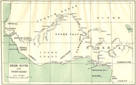
AFRICA. Niger River and Tributaries 1936 old vintage map plan chartJasper524.5(9.8k)See Sold PriceFeb 28, 2024
A LARGE ERRATA BOOK INDIAN MAPS AND STUDIES including the provinces of Bengal, Cossimbuzar Island, THannam's Auctioneers Ltd4.3(391)See Sold PriceFeb 27, 2024
John Senex Map of Louisiana & Mississippi RiverWillow Auction House4.5(284)See Sold PriceMar 14, 2024
Hudson River Map & North American Postcards, 45Auctions at Showplace4.6(731)See Sold PriceFeb 13, 2025