SoldPanoramic Map of Jerusalem. 18th Century?Ierusalem. Panoramic map of Jerusalem within the walls. Copperplate. Black and white. Following the map of J. Chereau from the 18th century. Page spread. German. 20.7x34 cm. Quality paper. ProfessionaSee Sold Price
SoldIerusalem - Panoramic Map View of Jerusalem, ProbablyIerusalem - Panoramic Map View of Jerusalem, Probably 18th Century. Following the map of Jacques Chereau (1688-1776) from the 18th century. Copperplate. Colored. 21x34cm.See Sold Price
SoldPanorama of Jerusalem - Augsburg, 18th CenturyIerusalem Hodierna, drawn by Georg Balthasar Probst. [Augsburg, ca. 1750]. Panoramic map which consists of two sheets of paper, portraying Jerusalem at the beginning of the 18th century, with 80 waypoSee Sold Price
Sold[Map] Map of Jerusalem, 18th centuryMap of Jerusalem. London, 1689 (but likely early 1700s). 21.5" x 17". On heavy laid paper. With stub along vertical crease and two other vertical creases (as once bound, folding), a few short closed tSee Sold Price
SoldMap of Jerusalem - Augsburg, 18th CenturyProspectus sanctae olim et celeberrimae urbis Hierosolymae [view of ancient and famous Jerusalem], by Matthaei Seuttrs, Augsburg, [ca. 1734]. (Latin, German). Hand colored Etching. An aerial view of JSee Sold Price
SoldPanoramic Map of Jerusalem - Sebastian Munster...Die heilige statt Jerusalem contrafehtet nach form uns gestalt wie sie ietz erbauwen ist [view of Jerusalem], Sebastian Munster. Basel, second half of 16th century. German. Panoramic map of JerusalemSee Sold Price
18th CENTURY MAP OF ROMAN JERUSALEM18th Century map of Roman Jerusalem, engraving, 13" x 18". Framed.See Sold Price
Santini / d'Anville: Antique Map of Palestine, 1784Title/Content of Map: 'La Palestine, les Tribus, et Jerusalem. Par le Sr. d'Anville. À Venise Chez Remondini 1783 [Palestine, the tribes, and Jerusalem]' A decorative 18th century map of Palestine, wSee Sold Price
Sold18th C Map Ancient World JerusalemEngraved plate showing maps of ancient world including inset of Judea and Samaria and one of Jerusalem. Early 18th century.Very Good, trimmed to plate lines, measures 7 x 5.5". Reserve: $20.00 ShippinSee Sold Price
AN 18TH CENTURY MAP OF NEW ENGLAND AND NAN 18TH CENTURY MAP OF NEW ENGLAND AND NEW YORK AND A 17TH CENTURY GERMAN MAP OF JERUSALEM. The first by F. Lamb, hand colored engraving; the second by Matthew Sutters - 19 1/2 x 22 in., the larger.See Sold Price
18th Century German Bible & ChaliceDESCRIPTION: An 18th century German bible. The bible is leather bound with engraved gothic accents and features illustrations of Biblical figures, along with maps of Jerusalem. First page of bible feaSee Sold Price
SoldLot of 2 16th and 18th Century Bibleswith etching maps of Jerusalem and promised landSee Sold Price
18th Century German BibleDESCRIPTION: An 18th century German bible. The bible is leather bound with engraved gothic accents and features illustrations of Biblical figures, along with maps of Jerusalem. First page of bible feaSee Sold Price
SoldLOT (6) INCLUDING (5) 19TH CENTURY MAPS OF RUSSIA ANDLOT (6) INCLUDING (5) 19TH CENTURY MAPS OF RUSSIA AND (1) 18TH CENTURY DUTCH HAND COLORED MAP OF JERUSALEMSee Sold Price
"La Palestine, les Tribus, et Jerusalem". Israel.Reserve Reduced! TITLE/CONTENT OF MAP: 'La Palestine, les Tribus, et Jerusalem. Par le Sr. d'Anville. À Venise Chez Remondini 1783 [Palestine, the tribes, and Jerusalem]' A decorative 18th century maSee Sold Price
SoldDaniel Stoopendaal & Jacob Keur 1702 Holy LandDaniel Stoopendaal & Jacob Keur 1702 Holy Land Jerusalem Tinted Map 14''x18.5'' Impression. An 18th century hand tinted map titled ''De Gelegentheyt van 't Paradys ende 't Land Canaan mitsgaders de eeSee Sold Price
Sold1747 HOLY LAND Jerusalem Tabernacle Judaism MAP Canaan1747 HOLY LAND Jerusalem Tabernacle Judaism MAP Canaan Egypt Jewish History ‘A Universal History’ is an impressive 18th-century work of geography and world history published by a variety of EnglisSee Sold Price
Sold1747 Middle East Jerusalem Temple Babylon MAP Mesopotam1747 Middle East Jerusalem Temple Babylon MAP Mesopotamia King Salomon Asia ‘A Universal History’ is an impressive 18th-century work of geography and world history published by a variety of EnglisSee Sold Price
Sold(8) 18TH CENTURY MAPS OF THE HOLY LAND(6) black and white, "De l'Asie" with maps of Syria and Jerusalem, 8 1/4" x 5 1/4" and (2) hand colored,"Terra Sancta" and "Judee on Terre Sainte" 7" x 9" and 11" x 15 1/2"; also (1) hand colored mapSee Sold Price
SoldA lot of 6 Maps of Israel and Jerusalemsix framed maps engravings and copies of Israel and Jerusalem. Made according to maps from the 17th and 18th century. All of the maps are in good condition and in quality framing.See Sold Price
SoldAntique map, 18th century, Italian, Mt. Aetna, frAntique map, 18th century, Italian, Mt. Aetna, framed & matted, image size 13.5" X 18"See Sold Price
SoldMAP (18TH CENTURY) OLISIPPO LISABONA - VIEW OFMAP (18TH CENTURY) OLISIPPO LISABONA - VIEW OF LISBON, PORTUGAL. Hand colored engraving; Frame: 16.25" x 20.50" 11.50" x 15"See Sold Price
SoldAntique Map (18th Century)IMPERII MAGNI MOGOLIS SIVE INDICI PADSCHACH, hand-colored double-page atlas engraving, engraved by Albrecht Carl Seutter, sheet 19 ½ x 22 ½”.See Sold Price
An early Dutch hand colored engraving map by Georg Balthasar Probst (1732-1801)Ostantix Auctions4.4(10)See Sold PriceFeb 27, 2024
18th Century Hess Germany Hand colored Engraved MapGlobal Auctions Company4.3(36)See Sold PriceMar 03, 2024
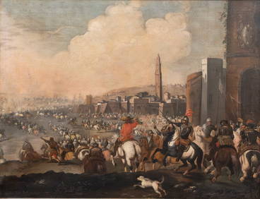
Exceptional large Detailed Panoramic Old Master (17th/18th century) Oil on Canvas Painting. BattleCollective Hudson4.5(54)See Sold PriceMar 01, 2024
18th century MAP of ARMENIA GEORGIA NATOLIA BLACK SEA ASIA MINOR antiqueJasper524.5(9.8k)See Sold PriceFeb 27, 2024
World map.- Macrobius (Ambrosius Aurelius Theodosius) In somnium Scipionis, Libri II. Saturnaliorum,Forum Auctions4.3(52)See Sold PriceFeb 29, 2024
La Basse-Guinée… Loango, Congo, AngoIa & Benguela Southern Africa BONNE 1790 mapJasper524.5(9.8k)See Sold PriceFeb 28, 2024
États du Roi de Maroc… d’Alger, Tunis & Tripoli. North Africa. BONNE 1790 mapJasper524.5(9.8k)See Sold PriceFeb 28, 2024
Le Canal de Mosambique, l'Isle de Madagascar… Mozambique. Africa. BONNE 1788 mapJasper524.5(9.8k)See Sold PriceFeb 28, 2024
Royaumes, Etats et Pays de la Haute Guinée. Gulf of Guinea. BONNE 1788 old mapJasper524.5(9.8k)See Sold PriceFeb 28, 2024
La Nubia ed Abissinia. Red Sea Ethiopia Sudan Eritrea Arabia. ZATTA 1785 mapJasper524.5(9.8k)See Sold PriceFeb 28, 2024
Le Royaume d’Adel… Ajan & Zanguebar. Adal Ajuran. Kenya Tanzania. BONNE 1788 mapJasper524.5(9.8k)See Sold PriceFeb 28, 2024
Le Canal de Mosambique, l'Isle de Madagascar… Mozambique. Africa. BONNE 1790 mapJasper524.5(9.8k)See Sold PriceFeb 28, 2024
Partie Occidentale de l’Afrique. West Africa coast Canary islands BONNE 1788 mapJasper524.5(9.8k)See Sold PriceFeb 28, 2024
Le Royaume d’Adel… Ajan & Zanguebar. Adal Ajuran. Kenya Tanzania. BONNE 1790 mapJasper524.5(9.8k)See Sold PriceFeb 28, 2024
États du Roi de Maroc… d’Alger, Tunis & Tripoli. North Africa. BONNE 1788 mapJasper524.5(9.8k)See Sold PriceFeb 28, 2024
La Basse-Guinée… Loango, Congo, AngoIa & Benguela Southern Africa BONNE 1788 mapJasper524.5(9.8k)See Sold PriceFeb 28, 2024
Egypte, Nubie et Abissinie. Egypt, Nubia & Abyssinia. Sudan. BONNE 1788 mapJasper524.5(9.8k)See Sold PriceFeb 28, 2024
Late 18th century map of England and Wales sampler and two printsFellows4.3(159)See Sold PriceMar 05, 2024
1774: AN ANTIQUE ILLUSTRATED TWO-VOLUME HISTORY OF PERUVIAN DISCOVERY AND CONQUEST WITH MAPNY Elizabeth 4.3(84)See Sold PriceMar 03, 2024
CURTIUS RUFUS QUINTUS, SIXTEENTH-CENTURY ELZEVIER HISTORIARUM LIBRI W/ MAP 16.33NY Elizabeth 4.3(84)See Sold PriceMar 03, 2024
Antoine Augustin Calmet (1672-1757) - Set of 6 Architecture Engraving - Temple of Jerusalem -Proverde Auctions4.3(3)See Sold PriceFeb 28, 2024


![[Map] Map of Jerusalem, 18th century (1 of 8)](https://p1.liveauctioneers.com/3532/146911/74242515_1_x.jpg?height=282&quality=70&version=1564368564)