Sold1742 Map of Louisiana and the Mississippi RiverHistoric Maps 1742 Map of Louisiana and the Mississippi River by Delisle with the First Published Map Reference to a Later “Texas” 1742, Handcolored Historic Map titled, “Carte de la Louisiane eSee Sold Price
Sold1742 Map of Louisiana and the Mississippi RiverHistoric Maps 1742 Map of Louisiana and the Mississippi River by Delisle with the First Published Map Reference to a Later “Texas” 1742, Handcolored Historic Map titled, “Carte de la Louisiane eSee Sold Price
SoldC.1721 MAP OF LOUISIANA AND MISSISSIPPI RIVERBy John Senex. Dimensions: (Frame) H 24" x W 27.5" (Sight) H 19.75" x W 23" Condition: Creases to paper from previous folds and discoloration and stains to the center of the paper. Wear to gilt frame.See Sold Price
SoldAntique map of Louisiana and the Mississippi riverAntique map of Louisiana and the Mississippi river, matted and framed, 28 x 25See Sold Price
SoldJohn Senex engraved map with outlined color Map ofJohn Senex engraved map with outlined color Map of Louisiana and the River Mississippi marked lower right: This map of the Mississippi is most humbly inscribed to William Law sight size 24" x 20"See Sold Price
SoldJohn Senex, "Map of Louisiana", 1721John Senex, "A Map of Louisiana and the River Mississippi", 1721, London, copper-plate engraved map, laid paper, watermarked with a fleur-de-lis and "HD", the map with interesting nomenclature of "ProSee Sold Price
SoldVintage map of Louisiana and river of MississippiVintage map of Louisiana and river of Mississippi, 18.8"x22"See Sold Price
SoldJohn Senex Map Of The MississippiJohn Senex colored engraved map. A Map of Louisiana And Of The River Mississippi. Marked lower right: This map of the Mississippi is most humbly inscribed to William Law. Unframed. 20-1/2 in x 24 in.See Sold Price
Sold1 piece. Engraved Map with Outline Color. Senex,1 piece. Engraved Map with Outline Color. Senex, John. A Map of Louisiana and of The River Mississippi." [London], [1719 or later.] 19 1/8 x 22 3/8 inches; 485 x 568 mm, margins. Slightly toned, someSee Sold Price
SoldMap of Carolina, Louisiana, and FloridaHand-Colored, Engraved and Framed Map of Carolina, Louisiana, and Florida, including the Mississippi River, Lake Pontchartrain, Mobile Bay and part of Georgia, sight 13-1/2" x 18".See Sold Price
SoldTUNISONS MAP ARKANSAS, LOUISIANA, FLORIDA, GEORGIA(lot) Tunison's map of "Arkansas, Louisiana, Mississippi" , the verso with maps of "Florida with inset showing "Mouths of the Mississippi River", Georgia, South Carolina:, c. 1903, repair at center foSee Sold Price
SoldGray's New Map of Louisiana, 19th c., handcolored, withGray's New Map of Louisiana, 19th c., handcolored, with insets of the City of New Orleans and the Passes of the Mississippi River, presented in an ebonized frame with a gilt liner, H.- 17 1/4 in., W.-See Sold Price
Sold[New Orleans and Carrollton Map][New Orleans and Carrollton Map] , "Official Map of South Eastern District of Louisiana - East of the Mississippi River - Comprising the Cities of New Orleans and Carrollton, with all the lands extendSee Sold Price
Maps & Charts of LouisianaMaps & fishing charts of Louisiana: large photo of the Gulf of Mexico, chart of Mississippi River to Galveston, Chart of Allens to Pensacola Cay, chart of Chandeleur & Breton Sound, Us Gulf Coast mapSee Sold Price
Sold[LOUISIANA MAPS] "A New Map of the River Mississi[LOUISIANA MAPS] "A New Map of the River Mississippi from the Sea to Bayagoulas" for the @London Magazine@, 8 1/2 in . x 10 in.; together with "Map of New Orleans Showing Drainage System", Dec. 31st,See Sold Price
Sold[LOUISIANPLANTATION MAP] Armant St.[LOUISIANA PLANTATION MAP] Armant St. James Plantation , c. 1870, watercolor and ink on paper, showing details of acreage, buildings, forest and the Mississippi River, with decorative border incorporaSee Sold Price
Sold1799 United States of America Antique Map1799 United States of America Antique Map. Interesing early map of U.S. with all beyond the Mississippi River labelled Louisiana. Sized: 14" H x 19 1/2" WSee Sold Price
SoldWestern Hemisphere Antique MapManuscript map, pen, ink, watercolor on paper of the Western Hemisphere. America west of Mississippi River called Louisiana. Cherokees indicated in southeast. Circa late 18th Century. 14 3/4" x 14".See Sold Price
SoldThe Expeditions of Zebulon Montgomery PikeHeading: Author: Pike, Zebulon Montgomery Title: The Expeditions of Zebulon Montgomery Pike, to Headwaters of the Mississippi River, Through Louisiana Territory, and in New Spain, During the Years 18See Sold Price
SoldNicholas de Fer, Engraved Map"Carte de la Nouvelle France", map by Nicholas de Fer, 1646-1720, paraphrased, including St. Lawrence and Mississippi Rivers, peoples of Florida, Louisiana, and Virginia, for the establishment of "ComSee Sold Price
SoldMississippi and Red River Maps and Books[Mississippi and Red River Maps and Books], incl. a Louisiana Senate pamphlet, 1840, with folding map by Andrew Talcott "Delta of the Mississippi...Devise a Plan for Improving...", litho. map 1840, wiSee Sold Price
Antique map of Arkansas, Mississippi and Louisiana, Mitchell 1874Attractive map of these southern states, with original hand coloring by counties. Shows towns, roads, railroads, rivers, lakes, forts, swamps, islands, bays, sounds and other coastal features. Drawn aSee Sold Price
SoldEarly 19th Century Louisiana Land SurveyDistrict North of Red River, La., 1829, hand drawn map depicting plots of land along the Mississippi River, one area labeled "Jon's Plantation", with central "Table of Contents" listing each land sectSee Sold Price
SoldGroup of Twenty-Four Antique Maps, consisting of "TheGroup of Twenty-Four Antique Maps, consisting of "The Mississippi River from its Mouth to Cairo, showing New Orleans, Harper's, May 10th, 1862; "Louisiana," by Geo. Cram, c. 1900; "Watson's Atlas MapSee Sold Price
Lake Superior and Mississippi River RR 1869 Seven Percent Bonds Book/Report-1869JM Hobby Supply and Railroad Artifact Auctions4.4(126)See Sold PriceFeb 24, 2024
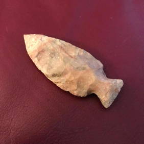
Archaic Native American Indian, Ohio Arrowhead PointConnoisseur Auctions4(333)See Sold PriceMar 02, 2024
1883 Mark Twain 1ed Life on the Mississippi St. Louis Missouri Steamboat CLASSICSchilb Antiquarian Rare Books4.8(421)See Sold PriceMar 31, 2024
2 Books: Olive Branch and Return to Olive BranchTony Putty Artifacts4.7(404)See Sold PriceMar 09, 2024
[BUSINESS]. Travel Guide of Negro Hotels and Guest Houses. Published by Afro-American Newspapers ofFreeman's | Hindman4.4(1.6k)See Sold PriceFeb 27, 2024
Steven Linder Photograph View of the Mississippi River, Signed and NumberedRapid Estate Liquidators and Auction Gallery4.5(1.1k)See Sold PriceFeb 24, 2024
After Adrien Persac (Louisiana/France, 1823-1873), "Plantations of the Mississippi River," 20th c.,Crescent City Auction Gallery4.3(229)See Sold PriceMar 08, 2024
Jim Blanchard (American/Louisiana, b. 1955), Four Architectural Plantation Prints, Sheet- H.- 8 1/2Crescent City Auction Gallery4.3(229)See Sold PriceMar 08, 2024
William Tolliver (American/Louisiana & Mississippi, 1951-2000), "Learning to Play," 20th c., H.- 44Crescent City Auction Gallery4.3(229)See Sold PriceMar 08, 2024
William Tolliver (American/Louisiana & Mississippi, 1951-2000), "Four Musicians," 20th c., H.- 30Crescent City Auction Gallery4.3(229)See Sold PriceMar 08, 2024
William Tolliver (Louisiana/Mississippi, 1951-2000), "Bass Player," 20th c., H.- 24 in., W.- 18 in.Crescent City Auction Gallery4.3(229)See Sold PriceMar 08, 2024
William Tolliver (American/Louisiana & Mississippi, 1951-2000), "Mother and Child," 20th c., H.- 30Crescent City Auction Gallery4.3(229)See Sold PriceMar 08, 2024
William Tolliver (Louisiana/Mississippi, 1951-2000), "Jazz Guitarist," 20th c., H.- 26 in., W.- 12Crescent City Auction Gallery4.3(229)See Sold PriceMar 09, 2024
John Senex Map of Louisiana & Mississippi RiverWillow Auction House4.5(283)See Sold PriceMar 14, 2024
Charles Gillam, Sr. (American/Louisiana, b. 1945)Neal Auction Company4.6(348)See Sold PriceMar 14, 2024


![[New Orleans and Carrollton Map] (1 of 1)](https://p1.liveauctioneers.com/268/13867/4259220_1_x.jpg?height=282&quality=70&version=1190671222)

![[LOUISIANA MAPS] "A New Map of the River Mississi (1 of 4)](https://p1.liveauctioneers.com/268/833/369133_1_x.jpg?height=282&quality=70)
![[LOUISIANPLANTATION MAP] Armant St. (1 of 2)](https://p1.liveauctioneers.com/268/1779/767581_1_x.jpg?height=282&quality=70)


![[BUSINESS]. Travel Guide of Negro Hotels and Guest Houses. Published by Afro-American Newspapers of (1 of 4)](https://p1.liveauctioneers.com/197/319238/171467937_1_x.jpg?height=282&quality=70&version=1707520367)