SoldJohn Senex, "Map of Louisiana", 1721John Senex, "A Map of Louisiana and the River Mississippi", 1721, London, copper-plate engraved map, laid paper, watermarked with a fleur-de-lis and "HD", the map with interesting nomenclature of "ProSee Sold Price
SoldJohn Senex, MapJohn Senex, "A Map of Louisiana and of the River Mississipi", London, 1721, famously plagiarized from Delisle's original 1718 map, mounted on board, framed, 19 in. x 23 in.,See Sold Price
SoldJOHN SENEX MAP OF LOUISIANA AND RIVER MISSISSIPI,Map of French Louisiana, reportedly derived from Delisle's 1718 map. Lists native settlements and areas of 'Wandering Indians and Man-eaters,' Promiscuous Nations,' and 'Nations destroyed.' Roads andSee Sold Price
1721 John Senex Map of the WorldItem: 1721 John Senex Map of the World Description: John Senex Map of the World Dimensions: 17 x 21.5 in Please note that this lot has a confidential reserve. When you leave a bid in advance of the auSee Sold Price
SoldSENEX, JOHN. A Map of Louisiana and of the RivSENEX, JOHN. A Map of Louisiana and of the River Mississipi. Double-page engraved map, 490x575 mm, wide margins; hand-colored in outline; light to moderate foxing, most heavy in margins, few scatteredSee Sold Price
Sold1 piece. Engraved Map with Outline Color. Senex,1 piece. Engraved Map with Outline Color. Senex, John. A Map of Louisiana and of The River Mississippi." [London], [1719 or later.] 19 1/8 x 22 3/8 inches; 485 x 568 mm, margins. Slightly toned, someSee Sold Price
SoldJohn Senex Map Of The MississippiJohn Senex colored engraved map. A Map of Louisiana And Of The River Mississippi. Marked lower right: This map of the Mississippi is most humbly inscribed to William Law. Unframed. 20-1/2 in x 24 in.See Sold Price
SoldJohn Senex engraved map with outlined color Map ofJohn Senex engraved map with outlined color Map of Louisiana and the River Mississippi marked lower right: This map of the Mississippi is most humbly inscribed to William Law sight size 24" x 20"See Sold Price
SoldJohn Senex Map of North and South America 1719-17John Senex (1678–1740), "A New Map of America from the Latest Observations," London, ca. 1719-1721. Hand colored copperplate engraved map of North and South America, from Senex's "New General ASee Sold Price
SoldC.1721 MAP OF LOUISIANA AND MISSISSIPPI RIVERBy John Senex. Dimensions: (Frame) H 24" x W 27.5" (Sight) H 19.75" x W 23" Condition: Creases to paper from previous folds and discoloration and stains to the center of the paper. Wear to gilt frame.See Sold Price
SoldMap of Greece 1721 by John Senex of LondonLarge, square-format, hand-tinted map of Greece by John Senex of London from 1721 measuring 20" high by 24" wide (not including mat). Very good condition, covered in protective plastic.See Sold Price
SoldMap of Greece 1721 by John Senex of LondonLarge, square-format, hand-tinted map of Greece by John Senex of London from 1721 measuring 20" high by 24" wide (not including mat). Very good condition, covered in protective plastic.See Sold Price
1721 Map of Turky, Arabia and Persia. & 1814 Arabia,Map of Turky, Arabia and Persia. Corrected from the latest Travels & from ye Observations of ye Royal Societys of London & Paris by G. de L’Isle Revised by I. John Senex In A New general atlas :See Sold Price
SoldWith Large Hand-Coloured Folding Maps Senex (John)With Large Hand-Coloured Folding Maps Senex (John) A New General Atlas, Containing a Geographical and Historical Account of All the Empires. Lg. Atlas folio L. 1721. Red & bl. title with engd. vignettSee Sold Price
SoldSenex, A New Map Of China & India c.1721[Asia/Indonesia]. John Senex. A New Map Of India & China From the latest Observations. Double-page engraved map, from ''A New General Atlas,'' Lon: c.1721. Early outline hand-coloring, 19 3/8 x 22 7/8See Sold Price
SoldSenex. A New Map of the World. 1721.[Map/World] John Senex (1678, London – 1740, London). London: Daniel Browne, Thomas Taylor, John Darby, John Senex and others, 1721. Handcolored copperplate engraved map. Four smaller projections wiSee Sold Price
SoldMap of Italy by John Senex 1721Heading: Author: Senex, John Title: Italy Distinguished According to the Extent of all the States, Kingdomes, Republicks, Dukedoms, Principalities &c. that do at Present Divide it... Revised by I. SeSee Sold Price
SoldJohn Senex (British, 1678-1740 ), hand colored map, "AJohn Senex (British, 1678-1740 ), hand colored map, "A Draft of the Golden & Adjacent Islands with Part of the Isthmus of Darien", published Daniel Browne, London: 1721, 11 1/4" x 18 3/4" sight, 22" xSee Sold Price
SoldSenex, John, after Gordon of Straloch A New Map ofSenex, John, after Gordon of Straloch A New Map of Scotland [N.p., 1721] 49.5 x 58.5cm, hand-coloured, framed and glazedSee Sold Price
Sold(Maps and Charts, Western Hemisphere), Senex, John(Maps and Charts, Western Hemisphere), Senex, John (d. 1740), A New Map of America from the Latest Observations, London. 1721, double page folio with hand coloring, showing insular California, 20 3/4See Sold Price
Senex Map of the Americas*** START PRICE IS THE RESERVE *** [America] SENEX, John (1678-1740). A New Map of America from the Latest Observations. Engraved map with hand color in outline. London, 1721. 21 1/8" x 23 3/4" sheet.See Sold Price
SoldMap of Turky, Arabia and Persia. Corrected from the[In A New general atlas : containing a geographical and historical account of all the empires, kingdoms and other dominions of the world, by John Senex][London, 1721]47 cm x 57 cm Watermarked paper. OSee Sold Price
SoldMap Early 18th Century "A New Map of the World",Most Humbly Inscribed to his Royal Highness George Prince of Wales", by John Senex, c.1721, from the New General Atlas of the World, handcoloured etching, framed, 42cm x 52cmSee Sold Price
SoldA New Map of the World...John Senex (1678, London – 1740, London). London: Daniel Browne, Thomas Taylor, John Darby, John Senex and others, 1721. 21 x 24 inches. A Fine engraved double-hemisphere map of the world surroundedSee Sold Price
John Korver (1910-1988, Louisiana/Indonesia), "Indonesian Boy with Rooster," 20th c., oil on canvas,Crescent City Auction Gallery4.3(229)See Sold PriceMar 01, 2024
Arrowsmith & Lewis - Map of PolynesiaTrillium Antique Prints & Rare Books4.5(30)See Sold PriceFeb 24, 2024
Arrowsmith & Lewis - Map of North AmericaTrillium Antique Prints & Rare Books4.5(30)See Sold PriceFeb 24, 2024
Arrowsmith & Lewis - Map of the World on Mercator's ProjectionTrillium Antique Prints & Rare Books4.5(30)See Sold PriceFeb 24, 2024
Arrowsmith & Lewis - Map of LouisianaTrillium Antique Prints & Rare Books4.5(30)See Sold PriceFeb 24, 2024
Arrowsmith & Lewis - Map of the United StatesTrillium Antique Prints & Rare Books4.5(30)See Sold PriceFeb 24, 2024
Louisiana Heron, Audubon, Royal Octavo hand-colored lithographPBA Galleries4.7(381)See Sold PriceMar 07, 2024
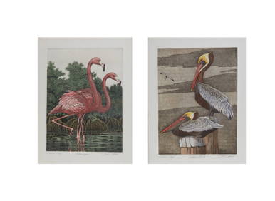
John Akers (American/Louisiana, 1944-2006), "Flamingos" and "Pelicans," H.- 15 in., W.- 11 1/4 in.Crescent City Auction Gallery4.3(229)See Sold PriceMar 08, 2024
Two Hand-Colored 19th Century Maps of New Orleans and Louisiana, Larger- H.- 12 1/2 in., W.- 15 1/2Crescent City Auction Gallery4.3(229)See Sold PriceMar 08, 2024
John Akers (American/Louisiana, 1944-2006), "Cypress Knees in Swamp," H.- 24 in., W.- 30 in.,Crescent City Auction Gallery4.3(229)See Sold PriceMar 09, 2024
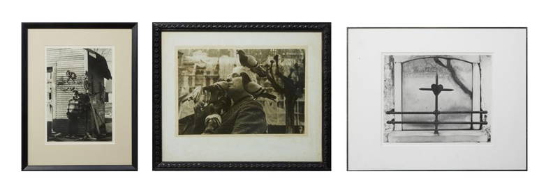
John Akers (American/Louisiana, 1944-2006), "Marsh with Egrets," H.- 18 in., W.- 24 in., Framed- H.-Crescent City Auction Gallery4.3(229)See Sold PriceMar 09, 2024
John Akers (American/Louisiana, 1944-2006), "Barn Owl with Mouse," H.-18 in., W.- 24 in., Framed-Crescent City Auction Gallery4.3(229)See Sold PriceMar 09, 2024
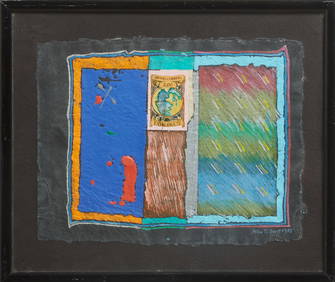
John Tarrell Scott (American/Louisiana, 1940-2007), "Letter to a Third World Friend 2#," 1985, H.- 8Crescent City Auction Gallery4.3(229)See Sold PriceMar 09, 2024
Clarence John Laughlin (American/Louisiana, 1905-1915), "The Mysterious Head, Orange GroveCrescent City Auction Gallery4.3(229)See Sold PriceMar 09, 2024
Three Silver Gelatin Photographs, 20th c., Smallest- H.- 8 3/4 in., W.- 13 1/4 in., Framed- H.- 15Crescent City Auction Gallery4.3(229)See Sold PriceMar 09, 2024
Guthrie, William 1812 Antique Map. Spain and PortugalAlbion Auctions4.6(336)See Sold PriceMar 01, 2024
John Senex Map of Louisiana & Mississippi RiverWillow Auction House4.5(283)See Sold PriceMar 14, 2024