SoldMap of Carolina, Louisiana, and FloridaHand-Colored, Engraved and Framed Map of Carolina, Louisiana, and Florida, including the Mississippi River, Lake Pontchartrain, Mobile Bay and part of Georgia, sight 13-1/2" x 18".See Sold Price
SoldTwo Copies of Emanuel Bowen (1693-1767), "A New Map ofTwo Copies of Emanuel Bowen (1693-1767), "A New Map of Georgia, Florida, Louisiana, Carolina," 1748, H.- 15 3/4 in., W.- 20 in.See Sold Price
SoldEmmanuel Bowen, Map of GeorgiaEmmanuel Bowen, Map of Georgia, Emmanuel Bowen (British, 1694-1767), "A New Map of Georgia with part of Carolina, Florida and Louisiana", hand-colored lithograph, published in "Complete Collection ofSee Sold Price
SoldEmmanuel Bowen, Geographer to HisMajesty, "A New Map of Georgia with Part of Carolina, Florida and Louisiana" London, 1748, drawn from the original drafts assisted by the most approved maps and charts, one of the earliest maps of theSee Sold Price
SoldA New Map of Georgia, 1748 Bowen"A New Map of Georgia, with Part of Carolina, Florida and Louisiana. Drawn from Original Draughts assisted by the most approved Maps and Charts" by Emanuel Bowen, London, 1748. From "Navigantium atqueSee Sold Price
SoldImportant map of U.S. Southeast 1748Heading: (United States - Southeast) Author: Bowen, Emanuel Title: A New Map of Georgia with Part of Carolina, Florida and Louisiana Place Published: London Publisher: Date Published: 1748See Sold Price
SoldEMMANUEL BOWEN (BRITISH, C. 1694-1767) MAP OF GEORGIAEMMANUEL BOWEN (BRITISH, C. 1694-1767) MAP OF GEORGIA, engraving on paper, titled "A New Map of Georgia, with Part of Carolina, Florida, and Louisiana. / Drawn from Original Draughts, Assisted by theSee Sold Price
SoldMap of Maryland, Virginia Texas +Map of South Carolina, Georgia, Florida, Alabama, Mississippi, Louisiana, Tennessee and Arkansas PLUS Maryland, Virginia, West Virginia & North Carolina [1 half sheet side] & Texas [1 half sheet side]See Sold Price
SoldBowen, A New Map Of Georgia...[U.S./Southeastern]. Emanuel Bowen. A New Map Of Georgia, With Part Of Carolina, Florida, Ad Louisiana. [on]: Eman Bowen, c.1748. 14 x 18 3/4 in. First map to feature Georgia. Portions of Carolina andSee Sold Price
SoldBOWEN, EMANUEL. A New Map of Georgia, with ParBOWEN, EMANUEL. A New Map of Georgia, with Part of Carolina, Florida and Louisiana. Engraved folding map, 370x485 mm, wide margins; scattered foxing and browning, few extraneous creases, short tear inSee Sold Price
SoldEmanuel Bowen, 1748Emanuel Bowen, "A New Map of Georgia, with Part of Carolina, Florida and Louisiana...", London, 1748, from Navigantium...Itinerantium..., 14 in. x 18 3/4 in., attractively framedSee Sold Price
Map of Maryland, Virginia Texas +Map of South Carolina, Georgia, Florida, Alabama, Mississippi, Louisiana, Tennessee and Arkansas PLUS Maryland, Virginia, West Virginia & North Carolina [1 half sheet side] & Texas [1 half sheet sideSee Sold Price
Map of Maryland, Virginia Texas +Map of South Carolina, Georgia, Florida, Alabama, Mississippi, Louisiana, Tennessee and Arkansas PLUS Maryland, Virginia, West Virginia & North Carolina [1 half sheet side] & Texas [1 half sheet sideSee Sold Price
Map of Maryland, Virginia Texas +Map of South Carolina, Georgia, Florida, Alabama, Mississippi, Louisiana, Tennessee and Arkansas PLUS Maryland, Virginia, West Virginia & North Carolina [1 half sheet side] & Texas [1 half sheet side]See Sold Price
Map of Maryland, Virginia Texas +Map of South Carolina, Georgia, Florida, Alabama, Mississippi, Louisiana, Tennessee and Arkansas PLUS Maryland, Virginia, West Virginia & North Carolina [1 half sheet side] & Texas [1 half sheet sideSee Sold Price
SoldMap of Maryland, Virginia Texas +Map of South Carolina, Georgia, Florida, Alabama, Mississippi, Louisiana, Tennessee and Arkansas PLUS Maryland, Virginia, West Virginia & North Carolina [1 half sheet side] & Texas [1 half sheet side]See Sold Price
Map of Maryland, Virginia Texas +Map of South Carolina, Georgia, Florida, Alabama, Mississippi, Louisiana, Tennessee and Arkansas PLUS Maryland, Virginia, West Virginia & North Carolina [1 half sheet side] & Texas [1 half sheet side]See Sold Price
SoldA New Map of Georgia, with Part ofCarolina, Florida and Louisiana by Eman. Bowen, 1748 Bowen (1694-1767), important early map of colonial Georgia, Cumming #267, this map first appeared in John Harris' Navigantium in the 1744-48 editioSee Sold Price
SoldA New Map of Georgia, with Part ofCarolina, Florida and Louisiana by Eman. Bowen, 1748 Bowen (1694-1767), important early map of colonial Georgia, Cumming #267, hand-colored, this map first appeared in John Harris' Navigantium in theSee Sold Price
SoldThree 19th Century Southern Mapsincluding: [Map of South Carolina, Georgia, Florida, Alabama, Mississippi, and Louisiana], page 14 from [People's Pictorial Atlas], 1873, partially colored map with an inset of the Southern Part of FlSee Sold Price
Map of South Carolina, Georgia, Florida, Alabama,Title: Map of South Carolina, Georgia, Florida, Alabama, Mississippi, and Louisiana. Date: 1875 Cartographer: HARDESTY, H. H. Publisher: H.H. HARDESTY & CO. Size: 12.25Height - 17Width Provenance: ScaSee Sold Price
SoldLate 18th Century British Map of the Caribbean andLate 18th Century British Map of the Caribbean and Adjacent LandsThe West Indies including Part of Virginia, North Carolina, South Carolina, Georgia, East Florida, West Florida, Louisiana and the GulfSee Sold Price
SoldZatta: Antique Map of English Louisiana, Florida, 1778Map: Luigiana Inglese, colla parte Occidentale, della Florida, della Georgia, e Carolina Merid[i]onale Cartographer: Zatta Place & Date: Venice / 1778 Size: 16 1/2" x 12 1/2" Condition: Original colorSee Sold Price
SoldTUNISONS MAP ARKANSAS, LOUISIANA, FLORIDA, GEORGIA(lot) Tunison's map of "Arkansas, Louisiana, Mississippi" , the verso with maps of "Florida with inset showing "Mouths of the Mississippi River", Georgia, South Carolina:, c. 1903, repair at center foSee Sold Price
H Douglas Pratt (LA,NC, b 1944) gouache paintingBroward Auction Gallery4.8(277)See Sold PriceApr 14, 2024
ANDREW RAYMOND JANSON OIL ON BOARD ADIRONDACKSCharleston Estate Services Ltd.4.5(58)See Sold PriceMar 03, 2024
Jacques Van Aalten (Belgian,Dutch,FL,LA,NY,1907-1997) oil paintingBroward Auction Gallery4.8(277)See Sold PriceMay 05, 2024
Arrowsmith & Lewis - Map of PolynesiaTrillium Antique Prints & Rare Books4.5(30)See Sold PriceFeb 24, 2024
Arrowsmith & Lewis - Map of North AmericaTrillium Antique Prints & Rare Books4.5(30)See Sold PriceFeb 24, 2024
Arrowsmith & Lewis - Map of the World on Mercator's ProjectionTrillium Antique Prints & Rare Books4.5(30)See Sold PriceFeb 24, 2024
Arrowsmith & Lewis - Map of LouisianaTrillium Antique Prints & Rare Books4.5(30)See Sold PriceFeb 24, 2024
Arrowsmith & Lewis - Map of the United StatesTrillium Antique Prints & Rare Books4.5(30)See Sold PriceFeb 24, 2024
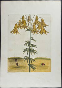
Catesby, Folio - Tumble-Turds (Dung Beetle) with Canada Lily. Sup-11Trillium Antique Prints & Rare Books4.5(30)See Sold PriceFeb 24, 2024
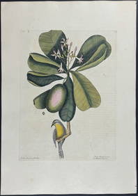
Catesby, Folio - American Goldfinch with Acacia. 1-43Trillium Antique Prints & Rare Books4.5(30)See Sold PriceFeb 24, 2024
Catesby, Folio - Bahama Titmouse with Seven Years Apple. 1-59Trillium Antique Prints & Rare Books4.5(30)See Sold PriceFeb 24, 2024
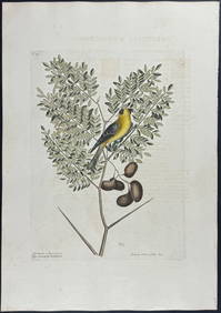
Catesby, Folio - American Partridge with Attamusco Lily. Sup-12Trillium Antique Prints & Rare Books4.5(30)See Sold PriceFeb 24, 2024
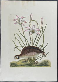
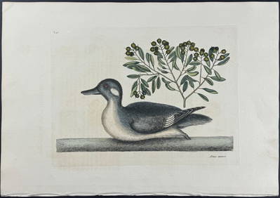
Catesby, Folio - Little Brown Duck with Soap-Wood. 1-98Trillium Antique Prints & Rare Books4.5(30)See Sold PriceFeb 24, 2024
Catesby, Folio - Red Bellied Woodpecker & Hairy Woodpecker with Black Oak. 1-19Trillium Antique Prints & Rare Books4.5(30)See Sold PriceFeb 24, 2024
Two Hand-Colored 19th Century Maps of New Orleans and Louisiana, Larger- H.- 12 1/2 in., W.- 15 1/2Crescent City Auction Gallery4.3(229)See Sold PriceMar 08, 2024
John Senex Map of Louisiana & Mississippi RiverWillow Auction House4.5(283)See Sold PriceMar 14, 2024
Jan Pawlowski (American, b.1949) "Horse" Oil on CanvasMarket Auctions4.5(133)See Sold PriceMar 06, 2024