ATLAS of ANTIENT GEOGRAPHY by SAMUEL BUTLER 1843John McInnis Auctioneers,LLC4.6(502)See Sold PriceFeb 24, 2024
18TH C. ANTIQUE MAP: FRENCH & INDIAN WAR, FRAMEDThomaston Place Auction Galleries4.4(386)See Sold PriceFeb 24, 2024
Rand McNally Railroad Map Cabinet w/ 21 Railroad MapsRail & Road Auctions4.6(165)See Sold PriceMar 08, 2024
Keith Haring - Ink on New York Map, Best Buddies, Inscribed, Signed, and DatedSapphire Auction Gallery4(67)See Sold PriceMar 02, 2024
LATE 17TH C. FRENCH MAP OF THE NEW WORLD BY ALEXIS-HUBERT JAILLOT (1632-1712)Thomaston Place Auction Galleries4.4(386)See Sold PriceFeb 24, 2024
Central Railroad of New Jersey Map of Sandy Hook Route-ca. 1903JM Hobby Supply and Railroad Artifact Auctions4.4(126)See Sold PriceFeb 24, 2024
Lot of Six Mixed Atlas Box Cars-HO Scale-New in BoxJM Hobby Supply and Railroad Artifact Auctions4.4(126)See Sold PriceFeb 25, 2024
Rand McNally/Santa Fe Railroad Map of Iowa-1912JM Hobby Supply and Railroad Artifact Auctions4.4(126)See Sold PriceFeb 24, 2024
NICOLAES VISSCHER (NETHERLANDS, 1618-1709) MAP OF THE NEW WORLDThomaston Place Auction Galleries4.4(386)See Sold PriceFeb 24, 2024
17TH C. WORLD MAP BY NICOLAES VISSCHER (NETHERLANDS, 1618-1709)Thomaston Place Auction Galleries4.4(386)See Sold PriceFeb 24, 2024
Lot of Six Mixed Atlas Cabooses-HO Scale-New in BoxJM Hobby Supply and Railroad Artifact Auctions4.4(126)See Sold PriceFeb 25, 2024
SoldNantucket, George H Walker 1891Title: Part of Massachusetts. Atlas Plate No. 10 Subject: Nantucket Maker: George H. Walker Date: 1891 Materials: Hand colored copperplate engraving Size: 27.5 x 19 inches Identifies the six principleSee Sold Price
Sold1891 Map of Nantucket, George H. Walker19th Century lithographic map of Nantucket depicts detailed image of Nantucket Island with shoals. "MASSACHUSETTS PLATE No 10", signed "GEO H. WALKER & Co BOSTON, MA". Light age tone. Measures 19.5 HSee Sold Price
SoldMartha's Vineyard, George H Walker 1891Title: Part of Massachusetts. Atlas Plate No. 11 Subject: Martha's Vineyard Maker: George H. Walker Date: 1891 Materials: Hand colored copperplate engraving Size: 27.5 x 19 inches Identifies the six pSee Sold Price
SoldBOUND ATLAS OF MASSACHUSETTS PUBLISHED BYGEORGE H. WALKER, BOSTON, 1891; 231 PAGES; 20" X 15 1/2"; CLOTH BOUND; SPINE IS SPLIT AND BADLY DETERIORATED; THE BOARDS HAVE BEEN RE-TAPED AND ARE SCUFFED THROUGHOUT; LIGHT FOXING; SOME OF THE PAGESSee Sold Price
Sold19th C. Map of the North Shore of Boston19th Century map of the North Shore of Boston, showing the waterfront of Marblehead, Salem, Beverly, Manchester and Gloucester. Published 1891 by George H. Walker and Co. of Boston, nicely matted andSee Sold Price
Sold1891 TRAVEL ATLAS OF MASSACHUSETTSGeorge H. Walker & Co., Boston. In leather roll case stamped "Railway Department".See Sold Price
Sold1891 George Walker Massachusetts Atlas Plate No. 10 Map of Nantucket1891 George Walker Massachusetts Atlas Plate No. 10 Map of Nantucket, copyright 1891 G.H. Walker & Co. Boston, Mass, showing Nantucket, Nantucket Sound, Tuckernuck and Muskeget Islands. Sight 19 iSee Sold Price
SoldMap of Martha's Vineyard IslandLater copy of an 1891 map of Nantucket Island by George Walker. Map shows Tuckerneck, Siasconset, Polpis, etc. Nicely framed. Dimensions: 32" L x 23" H Weight: 8lbsSee Sold Price
SoldNantucket mapGeorge Walker restrike from an 1891 chart showing Nantucket Island, Nantucket Sound and the edge of Edgartown, Martha's Vineyard. Details include Great Harbor, Tuckernuck Island, Sankaty Light, NantucSee Sold Price
SoldWalker's Map of Nantucket, 1891Walker's Map of Nantucket, 1891, Massachusetts Atlas, Plate No. 10, copyright 1891, 1902, 1904, and 1907, Geo. H. Walker & Co., Boston, in shadow box frame with UF-5 plexiglass , label verso, 20"h x 2See Sold Price
SoldMap of Nantucket IslandLater copy of an 1891 map of Martha's Vineyard by George Walker of Boston. Showing major roads of the day and villages of Edgartown, Cottage City, Tisbury, Chilmark and Chappaquidick. Nicely framed. DSee Sold Price
SoldGeorge H. Walker, Map of Boston ProperTitle: Map of Boston Proper.Cartographer: George H. Walker (1848-1927). Lithograph, c.1900. Published by the Walker Lithograph and Publishing Co., Boston. Image size 25 7/8 x 32 1/2" (65.7 x 82.4 cm)See Sold Price
SoldGeorge H. Walker, Map of Washington, D.C.Title: Map of Washington, D.C.Cartographer: George H. Walker (1848-1927) Multi-stone lithograph, c.1900. Published by the Walker Lith. & Pub. Co. Boston. Image size 21 1/2 x 26 1/4" ( 54.8 x 66.7 cm)See Sold Price
Boston Environs Map By George H. Walker Company 1905Description: Boston Environs Map By George H. Walker Company 1905. Measurement approximate: 28 x 22. Material: Cloth fabric. Shipping cost: $15 within the USASee Sold Price
Boston Environs Map By George H. Walker Company 1905Description: Boston Environs Map By George H. Walker Company 1905. Measurement approximate: 28 x 22. Material: Cloth fabric. Shipping cost: $15 within the USA. Note: This item has a reserve.See Sold Price
Boston Environs Map By George H. Walker Company 1905Description: Boston Environs Map By George H. Walker Company 1905. Measurement approximate: 28 x 22. Material: Cloth fabric. Shipping cost: $15 within the USASee Sold Price
SoldGeorge H. Walker Road Map of the Boston District SGeorge H. Walker Road Map of the Boston District Showing the Metropolitan Park System, 1894, printed, linen backed wall scroll, 26 x 35 in.See Sold Price
Sold1879 BOUND ATLAS OF PLYMOUTH COUNTYAtlas of Plymouth County, Massachusetts, 1879, published by George H. Walker & Co., Boston, Mass. Rough condition covers and detached, Missing some front pages. Loose first 10 pages. Hand coloredmaps.See Sold Price
Sold1881 bound atlas of New Bedford City, MA.Published by George H. Walker and Co. , Boston. 18" x 15". Contains 16 colored maps, 24 illustrated plates. Frontis page shows some tears and discoloration to the edges and minor paper loss to edge. MSee Sold Price
Sold19TH C BLACK AND WHITE LITHOGRAPH "VIEW OFNANTASKET BEACH" BY GEORGE H. WALKER CO., 1879, SHEET SIZE 17 1/2" X 28". GOOD CONDITION.See Sold Price
SoldTWO 19TH C BOUND ATLASES TO INCLUDE NEW BEDFORD1881, PUBLISHED BY GEORGE H. WALKER, BOSTON, MA, 79 PAGES WITH ILLUSTRATIONS AND MAPS. 18" X 14 1/4". SPINE IS BROKEN, CORNERS BADLY SCUFFED, BLANK FRONTISE AND TITLE PAGE ARE TORN. THE REST OF THE ATSee Sold Price
Map of Cape Cod - Barnstable Village, MAMaps of Cape Cod - Barnstable Village, MA. Bacon Farm Grist Mill, Huckins Creek S.B Phinney, Coggins Pond, Atlas of Barnstable County 1880: Plate 36. Publisher: George H. Walker, 1880. Size of OriginaSee Sold Price
SoldAtlas of MassachusettsAtlas of Massachusetts by George H. Walker & Co., 1904 edition, 20" x 15".See Sold Price
SoldMap of Massachusets Bay and Shore from Plymouth toMap of Massachusets Bay and Shore from Plymouth to Newburyport, 1898 ed George H. Walker and Co. slight tear on foldsSee Sold Price
After George H Boughton Rose Standish by C.L. Knapp (d'apres) Oil paintingGlobal Auctions Company4.3(36)See Sold PriceMar 03, 2024
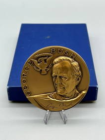
1988 George H. W. Bush Official Inauguration BronzeDana J. Tharp Auctions4.7(268)See Sold PriceFeb 24, 2024
1960's Cleveland Indians Team Signed BaseballDana J. Tharp Auctions4.7(268)See Sold PriceFeb 24, 2024
US PRESIDENT GEORGE H W BUSH VP & FIRST LADY AUTOGRAPHSOmnia Auctions4.7(324)See Sold PriceFeb 26, 2024
1920 The Adventurous Lady 1st EditionNorth American Artifact Auctions4.6(182)See Sold PriceApr 20, 2024
1889 Gerald Ffrench's Friends 1st EditionNorth American Artifact Auctions4.6(182)See Sold PriceApr 20, 2024
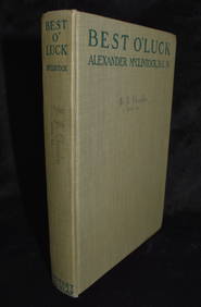
Best O' Luck by Alexander McClintock 1917 1st EditionNorth American Artifact Auctions4.6(182)See Sold PriceApr 20, 2024
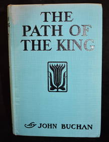
1921 The Path of the King 1st American EditionNorth American Artifact Auctions4.6(182)See Sold PriceApr 20, 2024
Doulton Lambeth George Tinworth Figurine, Boy MusicianLion and Unicorn4.7(1.8k)See Sold PriceFeb 25, 2024
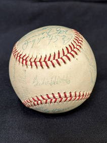
President George H W Bush Signed Baseball Autographed PSA/DNA AH51003 B29 60452Mynt Auctions4.6(680)See Sold PriceFeb 23, 2024
GEORGE H.W. BUSH d.2018 (41st President) signed Rawlings Baseball-BASMynt Auctions4.6(680)See Sold PriceFeb 26, 2024
George H.W. Bush (41) Autographed 34" Cooperstown Baseball Bat President PSA/DNAMynt Auctions4.6(680)See Sold PriceFeb 28, 2024
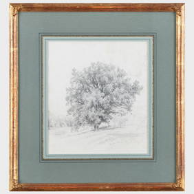
GEORGE WILLIAM WHITAKER (1841-1916) "LANDSCAPE".Amelia Jeffers, Auctioneers & Appraisers4.6(101)See Sold PriceMar 07, 2024
George H.W. Bush Original First Day Cover Vice-President 1985 Custom FramedBidhaus4.3(747)See Sold PriceFeb 28, 2024
Signed Presidential Photograph of George H. W. BushDalshire International4.6(2.2k)See Sold PriceFeb 25, 2024