ATLAS of ANTIENT GEOGRAPHY by SAMUEL BUTLER 1843John McInnis Auctioneers,LLC4.6(502)See Sold PriceFeb 24, 2024
18TH C. ANTIQUE MAP: FRENCH & INDIAN WAR, FRAMEDThomaston Place Auction Galleries4.4(386)See Sold PriceFeb 24, 2024
Rand McNally Railroad Map Cabinet w/ 21 Railroad MapsRail & Road Auctions4.6(165)See Sold PriceMar 08, 2024
Keith Haring - Ink on New York Map, Best Buddies, Inscribed, Signed, and DatedSapphire Auction Gallery4(67)See Sold PriceMar 02, 2024
LATE 17TH C. FRENCH MAP OF THE NEW WORLD BY ALEXIS-HUBERT JAILLOT (1632-1712)Thomaston Place Auction Galleries4.4(386)See Sold PriceFeb 24, 2024
Central Railroad of New Jersey Map of Sandy Hook Route-ca. 1903JM Hobby Supply and Railroad Artifact Auctions4.4(126)See Sold PriceFeb 24, 2024
Lot of Six Mixed Atlas Box Cars-HO Scale-New in BoxJM Hobby Supply and Railroad Artifact Auctions4.4(126)See Sold PriceFeb 25, 2024
Rand McNally/Santa Fe Railroad Map of Iowa-1912JM Hobby Supply and Railroad Artifact Auctions4.4(126)See Sold PriceFeb 24, 2024
NICOLAES VISSCHER (NETHERLANDS, 1618-1709) MAP OF THE NEW WORLDThomaston Place Auction Galleries4.4(386)See Sold PriceFeb 24, 2024
17TH C. WORLD MAP BY NICOLAES VISSCHER (NETHERLANDS, 1618-1709)Thomaston Place Auction Galleries4.4(386)See Sold PriceFeb 24, 2024
Lot of Six Mixed Atlas Cabooses-HO Scale-New in BoxJM Hobby Supply and Railroad Artifact Auctions4.4(126)See Sold PriceFeb 25, 2024
SoldWalker's Map of Nantucket, 1891Walker's Map of Nantucket, 1891, Massachusetts Atlas, Plate No. 10, copyright 1891, 1902, 1904, and 1907, Geo. H. Walker & Co., Boston, in shadow box frame with UF-5 plexiglass , label verso, 20"h x 2See Sold Price
SoldWalker's map of Nantucket." Later copy of a 1891 Walker's map of Nantucket. Showing the island as well as Tuckernuck and a sliver of Edgartown. The main roads are also shown. Matted and framed. 29"" tall x 38"" wide."See Sold Price
Sold1891 George Walker Massachusetts Atlas Plate No. 10 Map of Nantucket1891 George Walker Massachusetts Atlas Plate No. 10 Map of Nantucket, copyright 1891 G.H. Walker & Co. Boston, Mass, showing Nantucket, Nantucket Sound, Tuckernuck and Muskeget Islands. Sight 19 iSee Sold Price
SoldOLD NANTUCKET WALL MAPOld framed Atlas Plate 10 Nantucket Map from 1891 by GH Walker of Boston. Image size 19 x 27.5, overall 27 x 36 inchesSee Sold Price
SoldMap of Martha's Vineyard IslandLater copy of an 1891 map of Nantucket Island by George Walker. Map shows Tuckerneck, Siasconset, Polpis, etc. Nicely framed. Dimensions: 32" L x 23" H Weight: 8lbsSee Sold Price
Sold1891 Map of Nantucket, George H. Walker19th Century lithographic map of Nantucket depicts detailed image of Nantucket Island with shoals. "MASSACHUSETTS PLATE No 10", signed "GEO H. WALKER & Co BOSTON, MA". Light age tone. Measures 19.5 HSee Sold Price
Sold1891 Map of Nantucket Island19th century map of Nantucket Island by Walker showing all villages and roads of the day. Framed. 24 x 32See Sold Price
Map of Barnstable County, MassachusettsRestrike of an 1891 Walker's map of Barnstable county showing many Cape Cod towns including Chatham, Orleans, Brewster, Yarmouth, and Dennis. Also shows Nantucket Sound, Monomoy Island and highlightsSee Sold Price
SoldMap of Nantucket IslandLater copy of an 1891 map of Martha's Vineyard by George Walker of Boston. Showing major roads of the day and villages of Edgartown, Cottage City, Tisbury, Chilmark and Chappaquidick. Nicely framed. DSee Sold Price
SoldNantucket mapGeorge Walker restrike from an 1891 chart showing Nantucket Island, Nantucket Sound and the edge of Edgartown, Martha's Vineyard. Details include Great Harbor, Tuckernuck Island, Sankaty Light, NantucSee Sold Price
Sold(4) MAPS OF NANTUCKETIncluding: 1852 Sketch of Davis's Sound and Other Dangers 17 x 19 inches. Dept of the Government. framed 25 x 26 inches (overall), A second colored example dated 1853, 1891 Atlas Plate No. 10 Walker aSee Sold Price
SoldCape Cod map by Walker.Later copy of a 1891 map of Cape Cod showing Buzzards Bay, Vineyard Sound and Nantucket Sound. Communities shown include Falmouth, Mashpee, Sandwich, Osterville, Centerville and Hyannis. Showing majorSee Sold Price
SoldNantucket, George H Walker 1891Title: Part of Massachusetts. Atlas Plate No. 10 Subject: Nantucket Maker: George H. Walker Date: 1891 Materials: Hand colored copperplate engraving Size: 27.5 x 19 inches Identifies the six principleSee Sold Price
SoldWalker's Map of NantucketCopy after a 1902 map of Nantucket showing the full island along with Tuckernuck. The main island is shown with major roads and villages marked. Set into a rich burlwood frame. 27" tall x 35" wideSee Sold Price
1890's map of Martha's VineyardRestrike of a George Walker map from 1891 showing Martha's Vineyard and the Elizabeth Islands. Highlights include Tisbury, Cottage City, Gay Head, Chappaquiddic, Chilmark, Edgartown etc... Matted andSee Sold Price
Sold1891 Walker Map of Martha's VineyardLater copy of an 1891 Walker map of Martha's Vineyard with blue ocean, map shows Chilmark, Gay Head, Edgartown, Cottage city etc.. wood Frame. 32" x 24"See Sold Price
Sold1891 Walker Map of Martha’s VineyardLater copy of an 1891 Walker map of Martha’s Vineyard with blue ocean, map shows Chilmark, Gay Head, Edgartown, Cottage city etc.. wood Frame. 32” x 24”See Sold Price
Sold1891 Map of Plymouth CountyOriginal 1891 Walker's Map showing Kingston, Plymouth, Bourne, and parts of Middleboro, Halifax, Rochester and Sandwich. Major roads and railways of the day are shown. 31 x 23See Sold Price
Original 1891 map of Boston's south shoreOriginal 1891 Walker's map showing the south shore including Kingston, Plymouth, Bourne, Sandwich, along the coast as well as Plympton, Middleboro, Carver and parts of Rochester and Wareham. Matted anSee Sold Price
SoldCape Cod Map of BarnstableLater copy of an 1891 Walker’s map of Barnstable Massachusetts with Falmouth, Mashpee, Sandwich, Bourne, Barnstable, etc.. Also showing Buzzard’s Bay and Wareham. Nicely framed. 32” x 23 1/2”See Sold Price
Walker's map of Bristol County, MaRestrike of an 1891 Walker's map showing the towns of Bristol County, Massachusetts. Towns include Westport, Dartmouth, Fairhaven etc.. and lower Plymouth County with Rochester and Mattapoisett. AlsoSee Sold Price
Sold1891 Map of Plymouth CountyOriginal 1891 Walker’s Map showing Kingston, Plymouth, Bourne, and parts of Middleboro, Halifax, Rochester and Sandwich. Major roads and railways of the day are shown. 31” x 23”See Sold Price
Walker's map of Bristol County, MaRestrike of an 1891 Walker's map showing the towns of Bristol County, Massachusetts. Towns include Westport, Dartmouth, Fairhaven etc.. and lower Plymouth County with Rochester and Mattapoisett. AlsoSee Sold Price
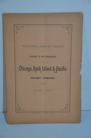
Chicago Rock Island and Pacific RR 11th Annual Report-April 1, 1891JM Hobby Supply and Railroad Artifact Auctions4.4(126)See Sold PriceFeb 24, 2024
Lehigh Valley RR 1891 PassJM Hobby Supply and Railroad Artifact Auctions4.4(126)See Sold PriceFeb 24, 2024
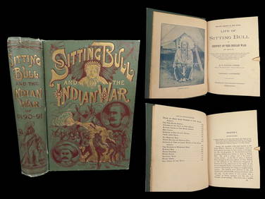
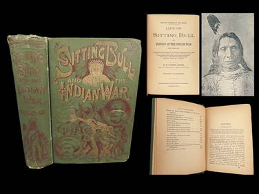
1891 Sitting Bull 1st ed Life Native American Sioux Indians DAKOTA Ghost DanceSchilb Antiquarian Rare Books4.8(421)See Sold PriceMar 10, 2024
LADIES LARGE OVAL NANTUCKET BASKET PURSE DECORATED WITH TWO WHALES BY DONNA CIFRANIC (1936-2022)Thomaston Place Auction Galleries4.4(386)See Sold PriceFeb 24, 2024
18TH C. ANTIQUE MAP: FRENCH & INDIAN WAR, FRAMEDThomaston Place Auction Galleries4.4(386)See Sold PriceFeb 24, 2024
TERENCE LAMBERT Eton College Engraving C1920 UK Listed ArtistLuis Porretta Fine Arts4.3(10)See Sold PriceMar 02, 2024
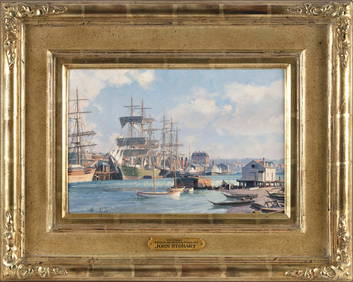
JOHN STOBART (Massachusetts/Florida/England, 1929-2023), "Victoria, View from Songhee Point, 1891".,Eldred's4.7(409)See Sold PriceFeb 27, 2024
Keith Haring - Ink on New York Map, Best Buddies, Inscribed, Signed, and DatedSapphire Auction Gallery4(67)See Sold PriceMar 02, 2024
1891 DAKOTA Indians 1st ed Life Sitting Bull Native American Sioux Ghost DanceSchilb Antiquarian Rare Books4.8(421)See Sold PriceMar 31, 2024
Rand McNally Railroad Map Cabinet w/ 21 Railroad MapsRail & Road Auctions4.6(165)See Sold PriceMar 08, 2024
Scotland.- Sir Walter Scott's Edinburgh.- The Post-Office annual directory, from Whitsunday 1808, toForum Auctions4.3(52)See Sold PriceFeb 29, 2024
1834 Malte-Brun Map of the Caribbean -- West India IslandsJasper524.5(9.8k)See Sold PriceFeb 27, 2024
NORTH AFRICA. Algeria Morocco Tunis Tunisia Maghreb. BARTHOLOMEW 1891 old mapJasper524.5(9.8k)See Sold PriceFeb 28, 2024
1880 WHAT MR. DARWIN SAW IN SHIP BEAGLE ANTIQUE DURING HIS WORLD TOURNY Elizabeth 4.3(84)See Sold PriceMar 03, 2024
Per Olof Christopher Aurivillius (1843-1928) - Set of 3 Prints - ButterfliesProverde Auctions4.3(3)See Sold PriceFeb 28, 2024
Per Olof Christopher Aurivillius (1843-1928) - Set of 3 Prints - Butterflies in SwedenProverde Auctions4.3(3)See Sold PriceFeb 28, 2024
Per Olof Christopher Aurivillius (1843-1928) - Set of 3 Prints - Butterflies - ScandinaviaProverde Auctions4.3(3)See Sold PriceFeb 28, 2024