SoldA handtinted and coloured map of 'Glocestraiae' byA handtinted and coloured map of 'Glocestraiae' by Christopher Saxton c1610, 29 x 31cmSee Sold Price
SoldA handtinted coloured map of Huntingdon ' both ShireA handtinted coloured map of Huntingdon ' both Shire and Shire Town with The Ancient Citie, Ely' described by John Speed c1627. 51 x 38cm.See Sold Price
SoldA handtinted coloured map of Huntingdonshire by J.A handtinted coloured map of Huntingdonshire by J. Blaeu c1746, 53 x 42cm.See Sold Price
A handtinted coloured map of Scotland by Robert MordenA handtinted coloured map of Scotland by Robert Morden c1695, 43 x 35cm.See Sold Price
A handtinted coloured map of Scotland dated 1752, 57 xA handtinted coloured map of Scotland dated 1752, 57 x 47cm.See Sold Price
A handtinted coloured map of Northamptonshire by JohnA handtinted coloured map of Northamptonshire by John Speed c1611, 51 x 39cm.See Sold Price
SoldA handtinted coloured map of Stafford 'Countie andA handtinted coloured map of Stafford 'Countie and Towne with the Ancient Citie Litchfield' described c1627, slightly AF to centrefold, 51 x 38cm.See Sold Price
SoldA handtinted, coloured map of Buckingham ' both ShyreA handtinted, coloured map of Buckingham ' both Shyre and Shyretowne' described by John Speed, 52 x 40cm.See Sold Price
SoldA handtinted coloured map of Wales and South WestA handtinted coloured map of Wales and South West England by F.de Wit, (P. Mortier) c1684, 50 x 58cm.See Sold Price
SoldA handtinted coloured strip map, 'The road from ExeterA handtinted coloured strip map, 'The road from Exeter to Truroe' by J. Ogleby c1679, 34 x 45cmSee Sold Price
A handtinted, part coloured New map of England andA handtinted, part coloured New map of England and Wales divided into it's Counties... by Thomas Kitchen, c1764, 40 x 49cm.See Sold Price
SoldA hand tinted and coloured map of Herefordshire by JohnA hand tinted and coloured map of Herefordshire by John Speed c1627, 51 x 41cm, slightly AF to centrefold.See Sold Price
SoldA 19thC hand coloured and tinted map ofA 19thC hand coloured and tinted map of Northamptonshire and similar map of Oxfordshire. Also six other 19thC handtinted maps. Eight items in total.See Sold Price
SoldLake District.- Hutchinson (William) - The History of2 vol., first edition , additional engraved titles, folding map hand-coloured in outline, 4 folding or double-page plans, 50 engraved plates including one double-page and one hand-tinted, vignette illSee Sold Price
SoldHutchinson (William) - The History of the County of2 vol., first edition , additional engraved titles, folding map hand-coloured in outline, 4 folding or double-page plans, 50 engraved plates including one double-page and one hand-tinted, vignette illSee Sold Price
SoldHutchinson (William) - The History of the County of2 vol., 2 additional engraved titles, folding map hand-coloured in outline, 4 folding or double-page plans, 50 engraved plates (1 double-page, 1 hand-tinted), 4 pages of tables, 1 extending table, andSee Sold Price
SoldKeppel.Personal Narr.Journey..India..EnglandKeppel (George) Personal Narrative of a Journey from India to England,2 vol., second edition, 2 hand-coloured lithographed frontispieces and hand-tinted lithographed plate, folding engraved maSee Sold Price
SoldSeutter Antique Hand Coloured Map of JamaicaMatthaeus Seutter (1678-1756) Antique Hand Coloured Map of Jamaica Titled Nova Designatio Insulae Jamaicae. Map measures 20 inches H x 23 within matting, frame measures 28 x 31 inches.See Sold Price
SoldToms & Badeslade 1742 Hand Coloured Map of Worcester"A Map of Worcestershire" Hand Coloured Copper Engraved Map Published 1742, London for "Chorographia Britanniae, or a set of maps of all the counties in England and Wales" by Thomas Badeslade & WilliaSee Sold Price
SoldMoll, Herman 1724 Hand Coloured Map of Somerset"Somersetshire" Hand Coloured Copper Engraved Map Published 1724, London for "A New Description of England and Wales" by Hermann Moll. Paper Size: 12.5 x 8 inch (32 x 20cm) A few discrete wormholes, oSee Sold Price
SoldKitchin, Thomas C1780 Hand Coloured Map of Worcester"Worcestershire Drawn from the best authorities" Hand Coloured Copper Engraved Map by Thomas Kitchin. Published London, C1780. Probably from The Antiquities of England and Wales by Francis Grose, or sSee Sold Price
SoldWyld, James C1840 Group of 4 Hand Coloured MapsIncl Spain/Portugal, Syria, Asia and Turkey in Asia. Hand Coloured Steel Engraved Map Published C1840, London for "Atlas of Modern Geography" by James Wyld. Centre fold as published. Paper Size: 11 xSee Sold Price
SoldHand-Tinted Map3/5" x 5" image, framed 7.75" x 9.5," book page, Anno 1646, map of America.See Sold Price
SoldClarke & Bingley 1824 Hand Coloured Map of MexicoHand Coloured Copper Engraved Map Published 1814-24, London for "A New Geographical Dictionary; Containing a Description of all the Empires, Kingdoms, States and Provinces..." by J. W. Clarke. EngraveSee Sold Price
Numismatic Books - Lelewel - Numismatique du Moyen-AgeTimeLine Auctions Ltd.4.6(184)See Sold PriceMar 09, 2024
JANSSONS - A COLOURED MAP OF THE COUNTY OF WETMORLANDHutchinson Scott Auctioneers4.4(42)See Sold PriceFeb 28, 2024
A 19TH CENTURY HAND COLOURED MAP OF ORKNEY AND SHETLANDHutchinson Scott Auctioneers4.4(42)See Sold PriceFeb 28, 2024
Map: An 18thC engraved and hand coloured map of Buckinghamshire after Robert Morden. Approx. 8 1/4"Claydon Auctioneers Ltd4.3(125)See Sold PriceFeb 26, 2024
Map: A 19thC engraved and hand coloured map of South America. Published by the Society for theClaydon Auctioneers Ltd4.3(125)See Sold PriceFeb 26, 2024
Map: An 18thC engraved and hand coloured map of Northamptonshire, with description ofClaydon Auctioneers Ltd4.3(125)See Sold PriceFeb 26, 2024
Map: A 19thC engraved and hand coloured map of St. Petersburg / Sanktpeterburga by W. B. Clarke.Claydon Auctioneers Ltd4.3(125)See Sold PriceFeb 26, 2024
Map: A 17thC engraved and hand coloured map of Scotland titled Strath-Navernia / Strath Navern afterClaydon Auctioneers Ltd4.3(125)See Sold PriceFeb 26, 2024
Map: An engraved and hand coloured map titled The Countie of Nottingham described The Shire TownesClaydon Auctioneers Ltd4.3(125)See Sold PriceFeb 26, 2024
Map: A 17thC engraved and hand coloured map of Bedfordshire after Robert Morden. Approx. 12 1/2" xClaydon Auctioneers Ltd4.3(125)See Sold PriceFeb 26, 2024
Map: An 18thC engraved and hand coloured map of North America and South America, titled DeClaydon Auctioneers Ltd4.3(125)See Sold PriceFeb 26, 2024
Map: A 19thC engraved and hand coloured map of Buckingham titled A New Map of BuckinghamshireClaydon Auctioneers Ltd4.3(125)See Sold PriceFeb 26, 2024
Map: A 17thC engraved and hand coloured map after Frederik de Wit (1630-1706) titled Nova Persiae,Claydon Auctioneers Ltd4.3(125)See Sold PriceFeb 26, 2024
Railways & Transport.- [Prospectus] The Dorking, Brighton, and Arundel Atmospheric Railway, byForum Auctions4.4(54)See Sold PriceFeb 29, 2024
Morocco, Algeria, Tunisia & Libya. North Africa. HUGHES 1876 old antique mapJasper524.5(9.9k)See Sold PriceFeb 28, 2024
CENTRAL EAST AFRICA French Belgian Congo British German Kenya Tanzania 1909 mapJasper524.5(9.9k)See Sold PriceFeb 28, 2024
Africa. French Equatorial Africa. Rhodesia. Belgian Congo. TIMES 1956 old mapJasper524.5(9.9k)See Sold PriceFeb 28, 2024
Morocco Algeria. French & Spanish West Africa. Sahara sand dunes. TIMES 1956 mapJasper524.5(9.9k)See Sold PriceFeb 28, 2024
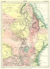
NILE VALLEY. Sudan Tanzania Ethiopia Uganda Lake Victoria. Britannica. 1898 mapJasper524.5(9.9k)See Sold PriceFeb 28, 2024
Central & East Africa. Zanzibar Tanganyika Rhodesia Congo. TIMES 1956 old mapJasper524.5(9.9k)See Sold PriceFeb 28, 2024
North west Africa. Liberia inset. Sahara Senegambia Guinea. COLTON 1863 mapJasper524.5(9.9k)See Sold PriceFeb 28, 2024
AFRICA. Africa. Britannica 9th edition 1898 old antique vintage map plan chartJasper524.5(9.9k)See Sold PriceFeb 28, 2024
French West Africa. Gold Coast. Sahara desert sand dunes. TIMES 1956 mapJasper524.5(9.9k)See Sold PriceFeb 28, 2024


![Railways & Transport.- [Prospectus] The Dorking, Brighton, and Arundel Atmospheric Railway, by (1 of 1)](https://p1.liveauctioneers.com/5458/319736/171654703_1_x.jpg?height=282&quality=70&version=1708010439)