Map of the Near East. Sebastian Munster. Basle, 1542.
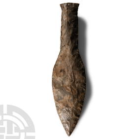
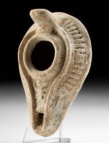
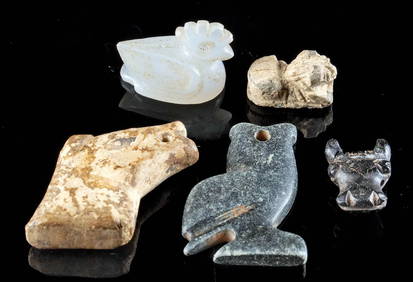
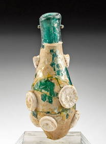
Stone Age Classic British Teardrop-Shaped Knapped Flint HandaxeMar 05, 2024Stone Age Classic Teardrop-Shaped Knapped Flint HandaxeMar 05, 2024Large Stone Age Danish Knapped Flint DaggerMar 05, 2024Palestine Annual Book - 1920sFeb 27, 2024WEST AFRICA Explorers' routes Senegal Ashanti. Mountains of Kong. SDUK 1857 mapFeb 28, 2024WEST AFRICA explorers' routes. Beaufort Gray Park Dochard Caillie. SDUK 1874 mapFeb 28, 2024WEST AFRICA I Explorers' routes Senegal Ashanti Ivory Gold Coast. SDUK 1851 mapFeb 28, 2024WEST AFRICA showing early explorers' routes & Mountains of Kong. SDUK 1844 mapFeb 28, 2024PRE COLONIAL WESTERN AFRICA. Shows Mountains of Kong. Tribes. WELLER 1863 mapFeb 28, 2024Roman Iron Nail + 4 Byzantine / Islamic RingsFeb 26, 2024Roman / Byzantine Oil Lamp - Interesting IconographyFeb 26, 2024Ancient Amulet Beads, Animal Forms (5)Feb 26, 20247th C. Islamic Glass Bottle w/ Applied DotsFeb 26, 202418th C. Ottoman Textile Embroidered w/ BirdsFeb 26, 2024MAP, Guyana, JanssonMar 12, 2024MAP, Europe, MunsterMar 12, 2024MAP, Belgium & Germany, MunsterMar 12, 2024MAP, Rhine River, MunsterMar 12, 2024MAP, Ukraine, SolinusMar 12, 2024MAP, Balkans, MunsterMar 12, 2024MAP, Greece, SolinusMar 12, 2024MAP, Greece, MunsterMar 12, 2024MAP, Middle East, SolinusMar 12, 2024MAP, Middle East, MunsterMar 12, 2024