ATLAS of ANTIENT GEOGRAPHY by SAMUEL BUTLER 1843John McInnis Auctioneers,LLC4.5(505)See Sold PriceFeb 24, 2024
18TH C. ANTIQUE MAP: FRENCH & INDIAN WAR, FRAMEDThomaston Place Auction Galleries4.4(393)See Sold PriceFeb 24, 2024
Rand McNally Railroad Map Cabinet w/ 21 Railroad MapsRail & Road Auctions4.6(165)See Sold PriceMar 08, 2024
Keith Haring - Ink on New York Map, Best Buddies, Inscribed, Signed, and DatedSapphire Auction Gallery4(67)See Sold PriceMar 02, 2024
LATE 17TH C. FRENCH MAP OF THE NEW WORLD BY ALEXIS-HUBERT JAILLOT (1632-1712)Thomaston Place Auction Galleries4.4(393)See Sold PriceFeb 24, 2024
Central Railroad of New Jersey Map of Sandy Hook Route-ca. 1903JM Hobby Supply and Railroad Artifact Auctions4.4(127)See Sold PriceFeb 24, 2024
Lot of Six Mixed Atlas Box Cars-HO Scale-New in BoxJM Hobby Supply and Railroad Artifact Auctions4.4(127)See Sold PriceFeb 25, 2024
Rand McNally/Santa Fe Railroad Map of Iowa-1912JM Hobby Supply and Railroad Artifact Auctions4.4(127)See Sold PriceFeb 24, 2024
NICOLAES VISSCHER (NETHERLANDS, 1618-1709) MAP OF THE NEW WORLDThomaston Place Auction Galleries4.4(393)See Sold PriceFeb 24, 2024
17TH C. WORLD MAP BY NICOLAES VISSCHER (NETHERLANDS, 1618-1709)Thomaston Place Auction Galleries4.4(393)See Sold PriceFeb 24, 2024
Lot of Six Mixed Atlas Cabooses-HO Scale-New in BoxJM Hobby Supply and Railroad Artifact Auctions4.4(127)See Sold PriceFeb 25, 2024
SoldLondon.- Smith (Charles) Map of the Country TwelveLondon.- Smith (Charles) Map of the Country Twelve Miles Round London, showing from Ewell to Enfield, and from Southall to Hornchurch in the east, engraved map by W.R. Gardner, with early hand-colouriSee Sold Price
SoldSmith (Charles) Map Twelve Miles Round LondonSmith (Charles) Map of the Country Twelve Miles Round London,extending from Hadley to Addington, and from Northolt to Hornchurch, engraved folding map, dissected and linen-backed, with originaSee Sold Price
SoldSmith (Charles) Map of the Country Twelve Miles RoSmith (Charles) Map of the Country Twelve Miles Round London,1st edition, from Enfield to Ewell and from Dartford to Southall, engraved map by W.R. Gardner, with original hand-colouring, 745 xSee Sold Price
Smith (Charles) Map of the Country Twelve Miles RoSmith (Charles) Map of the Country Twelve Miles Round London,1st edition, from Enfield to Ewell and from Dartford to Southall, engraved map by W.R. Gardner, with original hand-colouring, 745 xSee Sold Price
SoldSmith (C., & W.R. Gardner) Map of the Country TwelSmith (C., & W.R. Gardner) Map of the Country Twelve Miles Round London,showing from Enfield Wash through to Banstead Downs and Hornchurch through to Southall, engraved map, with original outlSee Sold Price
London.- Smith (Charles) Reynolds's Map of London withNO RESERVE London.- Smith (Charles, publisher) Reynolds's Map of London with the recent Improvements, lithographed map printed in colours, 605 x 880 mm. (23 3/4 x 34 3/4 in), dissected and mounted onSee Sold Price
SoldLondon.- Smith & Sons (Charles) Illustrated Map ofLondon.- Smith & Sons (Charles) Illustrated Map of London, map of London from Hyde Park to Islington, and Whitechapel to Vauxhall, with numerous bird's-eye view vignette illustrations showing sites ofSee Sold Price
SoldLondon.- Smith & Sons (Charles) Smith's Indicator MapNO RESERVE London.- Smith & Sons (C.) Smith's Indicator Map of London, showing from Hyde Park to Mile End, including Regents Park and part of Victoria Park with the City of London highlighted in red,See Sold Price
London.- Gardner (W.R.) Map of the Country Twelve MilesLondon.- Gardner (W.R.) Map of the Country Twelve Miles Round London, engraved map, with outline hand-colouring, 750 x 880 mm. (29 1/2 x 34 3/4 in), dissected and mounted on linen, surface dirt and liSee Sold Price
SoldJohn Fairburn, London.John Fairburn, London. 'The Travelling Handkerchief' - Fairburn's Map of the Country Twelve Miles Round London, circular map printed on calico, 1831, with vignettes of Chelsea and Greenwich to the lowSee Sold Price
SoldJohn Fairburn, London.John Fairburn, London. 'The Travelling Handkerchief' - Fairburn's Map of the Country Twelve Miles Round London, circular map printed on calico, 1831, with vignettes of Chelsea and Greenwich to the lowSee Sold Price
SoldSmith (Charles) Smith's New Map of London and StreSmith (Charles) Smith's New Map of London and Street Indicator,from Islington to Kennington Oval, and from Commercial and Surrey Docks to Hyde Park, with indicator tape on original brass mountSee Sold Price
SoldLondon.- Smith (Charles) Smith's New Plan of London,London.- Smith (Charles) Smith's New Plan of London, Westminster & Southwark, 1825, showing from Elephant & Castle to Islington, and Hyde Park to the East India Docks, with extensive key below featuriSee Sold Price
Smith (Charles) Smith's Classical Atlas ContainingSmith (Charles) Smith's Classical Atlas Containing District Maps of the Countries described in Ancient History both Sacred and Profane, second edition, engraved title, index, 14 hand-coloured engravedSee Sold Price
Sold(3) SMITH'S ATLAS MAPS, EGYPT, ASIA & PERSIA(lot of 3) Unframed maps from Smith's Atlas, 19th c., published by Charles Smith, London, including: (1) "Persia, Arabia, and Cabul," engraved by W.R. Gardner, sheet: approx 12.5"h, 15.75"w, (1) "EgypSee Sold Price
(3) SMITH'S ATLAS MAPS, EGYPT, ASIA & PERSIA(lot of 3) Unframed maps from Smith's Atlas, 19th c., published by Charles Smith, London, including: (1) "Persia, Arabia, and Cabul," engraved by W.R. Gardner, sheet: approx 12.5"h, 15.75"w, (1) "EgypSee Sold Price
SoldUK - Staffordshire 1808 Hand Col Map by Charles Smith"A New Map of the County of Stafford" Copper Engraved Map Published 1808, London. Printed for C. Smith. Dissected and linen backed. Original hand colour. Paper Size: 20.5 x 19 inch (52 x 48cm) Good coSee Sold Price
Sold(2) Antique Italy Maps, Thomas Kitchin, C. SmithDescription These beautiful maps have both been hand colored and represent Italy. There is one published in London by Charles Smith, possibly early 1800s, framed and discolored from age, but still disSee Sold Price
(2) Antique Italy Maps, Kitchin, C. SmithThese beautiful maps have both been hand colored and represent Italy. There is one published in London by Charles Smith, possibly early 1800s, framed and discolored from age, but still displays greatSee Sold Price
Punjab Map – ‘Punjab and Adjoining CountriesPunjab Map – ‘Punjab and Adjoining Countries 1849-1858’ Stanford’s Geographical Establishment - London: Smith, Elder & Co, framed measures 55x45cm approx.See Sold Price
SoldSmith (Charles) Smith's New Plan of London, WestmiSmith (Charles) Smith's New Plan of London, Westminster and Southwark,showing from Pentonville down to Newington Butts, and Limehouse across to Brompton Row, engraved map with hand-colouring,See Sold Price
Buckingham Palace Furniture Decoration and HistoryBuckingham Palace Furniture Decoration and History H Clifford Smith, Published London Country Limited, New York Charles Scribner and Son, 1930. Condition worn Dustjacket. Shipping $18 (60/80)See Sold Price
SoldDARWIN, Charles (1809-1882). Geological Observations onDARWIN, Charles (1809-1882). Geological Observations on the Volcanic Islands.... London: Smith, Elder & Co., 1876. 8vo (190 x 126 mm). 5 folding plates, 2 folding maps. (Second folding map with 4-in.See Sold Price
SoldPridham, Charles England's Colonial Empire... Vol. 1:Pridham, Charles England's Colonial Empire... Vol. 1: The Mauritius and its Dependencies London: Smith, Elder and Co., 1846. Volume 1 only, 8vo, folding map hand-coloured in outline, contemporary treeSee Sold Price
Archaeological Books - Roach Smith & Fairholt - The Antiquities of Richborough, Reculver, and Lymne,TimeLine Auctions Ltd.4.6(183)See Sold PriceMar 06, 2024
Archaeological Books - Inventorium Sepulchrale: an Account of Some AntiquitiesTimeLine Auctions Ltd.4.6(183)See Sold PriceMar 06, 2024
Archaeological Books - Roach Smith - Catalogue of the Museum of London AntiquitiesTimeLine Auctions Ltd.4.6(183)See Sold PriceMar 06, 2024
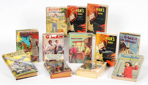
These United States 1968 Folio Size HardbackNorth American Artifact Auctions4.7(198)See Sold PriceApr 20, 2024
Schomburgk - The Comuti or Taquiare (Taquiari) Rock on the River EssequiboTrillium Antique Prints & Rare Books4.5(32)See Sold PriceFeb 24, 2024
Schomburgk - Pirara and Lake Amucu, The Site of El DoradoTrillium Antique Prints & Rare Books4.5(32)See Sold PriceFeb 24, 2024
Catesby, Folio - Tumble-Turds (Dung Beetle) with Canada Lily. Sup-11Trillium Antique Prints & Rare Books4.5(32)See Sold PriceFeb 24, 2024
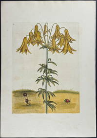
Catesby, Folio - American Goldfinch with Acacia. 1-43Trillium Antique Prints & Rare Books4.5(32)See Sold PriceFeb 24, 2024
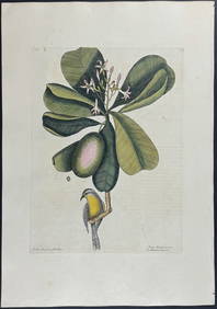
Catesby, Folio - Bahama Titmouse with Seven Years Apple. 1-59Trillium Antique Prints & Rare Books4.5(32)See Sold PriceFeb 24, 2024
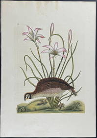
Catesby, Folio - American Partridge with Attamusco Lily. Sup-12Trillium Antique Prints & Rare Books4.5(32)See Sold PriceFeb 24, 2024
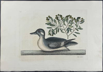
Catesby, Folio - Little Brown Duck with Soap-Wood. 1-98Trillium Antique Prints & Rare Books4.5(32)See Sold PriceFeb 24, 2024
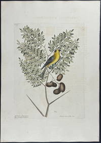
Catesby, Folio - Red Bellied Woodpecker & Hairy Woodpecker with Black Oak. 1-19Trillium Antique Prints & Rare Books4.5(32)See Sold PriceFeb 24, 2024
1764 MAP OF COUNTRIES THIRTY MILES ROUND LONDON antique 12.5 by 15"Jasper524.5(9.9k)See Sold PriceFeb 27, 2024
1800 MUNGO PARK TRAVELS to AFRICA 2 VOLS w/ MAP antique in ENGLISHJasper524.5(9.9k)See Sold PriceFeb 27, 2024
1738 RUSSIA SIBERIA & GREAT TARTARY Description illustrated ANTIQUE in ENGLISHJasper524.5(9.9k)See Sold PriceFeb 27, 2024
Stanford, Edward 1901 Large Map. Burma and Adjacent CountriesAlbion Auctions4.6(341)See Sold PriceMar 01, 2024