ATLAS of ANTIENT GEOGRAPHY by SAMUEL BUTLER 1843John McInnis Auctioneers,LLC4.5(505)See Sold PriceFeb 24, 2024
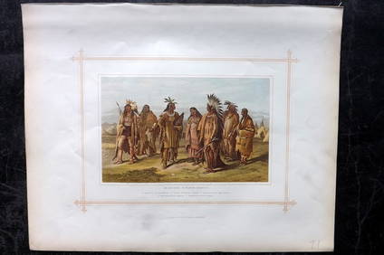
18TH C. ANTIQUE MAP: FRENCH & INDIAN WAR, FRAMEDThomaston Place Auction Galleries4.4(393)See Sold PriceFeb 24, 2024
Rand McNally Railroad Map Cabinet w/ 21 Railroad MapsRail & Road Auctions4.6(165)See Sold PriceMar 08, 2024
Keith Haring - Ink on New York Map, Best Buddies, Inscribed, Signed, and DatedSapphire Auction Gallery4(67)See Sold PriceMar 02, 2024
LATE 17TH C. FRENCH MAP OF THE NEW WORLD BY ALEXIS-HUBERT JAILLOT (1632-1712)Thomaston Place Auction Galleries4.4(393)See Sold PriceFeb 24, 2024
Central Railroad of New Jersey Map of Sandy Hook Route-ca. 1903JM Hobby Supply and Railroad Artifact Auctions4.4(127)See Sold PriceFeb 24, 2024
Lot of Six Mixed Atlas Box Cars-HO Scale-New in BoxJM Hobby Supply and Railroad Artifact Auctions4.4(127)See Sold PriceFeb 25, 2024
Rand McNally/Santa Fe Railroad Map of Iowa-1912JM Hobby Supply and Railroad Artifact Auctions4.4(127)See Sold PriceFeb 24, 2024
NICOLAES VISSCHER (NETHERLANDS, 1618-1709) MAP OF THE NEW WORLDThomaston Place Auction Galleries4.4(393)See Sold PriceFeb 24, 2024
17TH C. WORLD MAP BY NICOLAES VISSCHER (NETHERLANDS, 1618-1709)Thomaston Place Auction Galleries4.4(393)See Sold PriceFeb 24, 2024
Lot of Six Mixed Atlas Cabooses-HO Scale-New in BoxJM Hobby Supply and Railroad Artifact Auctions4.4(127)See Sold PriceFeb 25, 2024
WORLD. Mercator's projection. Ocean currents & shipping routes. BLACKIE 1882 mapTITLE/CONTENT OF MAP: 'The World on Mercators projection showing the courses of the chief ocean currents and the navigation tracks between the principal ports' DATE PRINTED: 1882 IMAGE SIZE: Approx 36See Sold Price
World on Mercator's Projection. Centred on Americas. BARTHOLOMEW 1898 old mapTITLE OF MAP (NOT PRINTED ON THE PAGE):'The World on Mercator's Projection, with Ocean currents' DATE PRINTED: 1898 IMAGE SIZE: Approx 43.0 x 58.0cm, 17 x 22.75 inches (Large); Please note that this iSee Sold Price
1890's Spanish American War World Mapc1890's original colored engraving, "Map Of the World On Mercator's Projection", from an 1890's addition of "Leslie's Official History of the Spanish American War". Bi-fold map showing ocean routes, aSee Sold Price
1890's Spanish American War World Mapc1890's original colored engraving, "Map Of the World On Mercator's Projection", from an 1890's addition of "Leslie's Official History of the Spanish American War". Bi-fold map showing ocean routes, aSee Sold Price
World on Mercator's Projection. West sheet. Americas. 67x55cm. STANFORD 1904 mapCAPTION PRINTED BELOW PICTURE: A Chart of the World on Mercator's Projection shewing the principal Ocean Steam Routes, the Submarine Telegraphs, &c. [West Sheet] DATE PRINTED: 1904 IMAGE SIZE: ApproxSee Sold Price
SoldMaps: A Chart of the World on Mercator's Projection,Maps: A Chart of the World on Mercator's Projection, showing the principle ocean steam routes, the submarine telegraphs, &c. Mounted on linen. By J.Arrowsmith. Published by Edward Stanford , London. 1See Sold Price
SoldARROWSMITH, JOHN; and EDWARD STANFORD. A Chart of theARROWSMITH, JOHN; and EDWARD STANFORD. A Chart of the World on Mercator's Projection Shewing the Principal Ocean Steam Routes, the Submarine Telegraph, &c. Large engraved case map of the world with deSee Sold Price
1895 Cram World Map On Mercator ProjectionMap by G Cram, 1895, Chicago, 17 x 24.3 in. Very nice world map, color-coding the countries of the world. This maps offers a wealth of information, including cities, key steamship routes, ocean currenSee Sold Price
BRITISH EMPIRE. World Mercator. Currents. Steamship routes. JOHNSTON 1899 mapTITLE/CONTENT OF MAP: 'The World (Mercator)' DATE PRINTED: 1899 IMAGE SIZE: Approx 20.5 x 26.0cm, 8 x 10.25 inches (Medium) TYPE: Colour antique map CONDITION: Good; suitable for framing. However, pleSee Sold Price
BRITISH EMPIRE. World Mercator. Currents. Steamship routes. JOHNSTON 1895 mapTITLE/CONTENT OF MAP: 'The World (Mercator)' DATE PRINTED: 1895 IMAGE SIZE: Approx 20.5 x 26.0cm, 8 x 10.25 inches (Medium) TYPE: Antique colour map CONDITION: Good; suitable for framing. However, pleSee Sold Price
BRITISH EMPIRE World Mercator Currents Steamship routes JOHNSTON 1892 old mapTITLE/CONTENT OF MAP: 'The World (Mercator)' DATE PRINTED: 1892 IMAGE SIZE: Approx 20.5 x 26.0cm, 8 x 10.25 inches (Medium) TYPE: Antique colour map CONDITION: Good; suitable for framing. However, pleSee Sold Price
SoldGeneral Chart on Mercators Projection. World. Cook's route. PAYNE 1798 old mapTITLE/CONTENT OF MAP: 'General Chart on Mercators Projection' DATE PRINTED: 1798 IMAGE SIZE: Approx 18.0 x 25.0cm, 7 x 9.75 inches (Medium) TYPE: Antique copperplate engraved map with original hand coSee Sold Price
Johnston: Antique Map of World on Mercator's ProjectionTITLE/CONTENT OF MAP: 'Chart of the World on Mercator's Projection' Steamer routes 50x60cm. DATE PRINTED: 1879 IMAGE SIZE: Approx 48.0 x 61.5cm, 19 x 24.25 inches (Large); Please note that this is a fSee Sold Price
The World on Mercator's Projection. Steamer routesTITLE/CONTENT OF MAP: 'Chart of the World on Mercator's Projection' Date: 1879 IMAGE SIZE: Approx 48.0 x 61.5cm, 19 x 24.25 inches (Large); Please note that this is a folding map. TYPE: Large, folio aSee Sold Price
Johnston: Antique Map of World on Mercator's ProjectionTitle/Content of Map: 'Chart of the World on Mercator's Projection', showing Steamer routes Date Printed: 1879 Image Size: Approx 48.0 x 61.5cm, 19 x 24.25 inches (Large); Please note that this is a fSee Sold Price
1882 Black World Map -- The World on Mercator's ProjectionTitle: 1882 Black World Map -- The World on Mercator's Projection Cartographer: A&C Black Year / Place: 1892, Edinburgh Map Dimension (in.): 16.8 X 22 in. This is an excellent world map, with color coSee Sold Price
SoldLattré (Jean) World map of Anson's voyageLattré (Jean) Carte dans laquelle on voit la route que le Centurion à tenu dans le voïage au tour du monde,the world on Mercator's projection, charting the route of George Anson's circumnavigaSee Sold Price
Rare Small School Wall Map With Current Events;Burr, David H. (1803-1875). Map of the World on Mercator's Projection. Engraved map. S. W. chandler & Bro., c. 1850. 17 â…›" x 21" sheet. A good quality steel engraved Burr wall map surrounded wiSee Sold Price
WORLD IN HEMISPHERES. Equatorial Antarctic London planes. BLACKIE 1882 old mapTITLE/CONTENT OF MAP: 'The World in Hemispheres, on various projections; The world on the plane of the Equator; Southern Circumpolar regions; The world on the plane on the horizon of London' DATE PRINSee Sold Price
Sold1890's Spanish American War World Mapc1890's original colored engraving, "Map Of the World On Mercator's Projection", from an 1890's addition of "Leslie's Official History of the Spanish American War". Bi-fold map showing ocean routes, aSee Sold Price
Eastern Hemisphere. New Holland. World on Mercator'sTITLE/CONTENT OF MAP: [Chart of the World on Mercator's Projection - Eastern Hemisphere]The routes taken by numerous explorers are shown, along with dates and various anecdotal notes about their voyagSee Sold Price
Sold1882 World MapTitle: 1882 World Map Author: Blackie Medium: Ink on Paper Dimensions: 22"X15" Description: World map dated 1882. Drawn on Mercator's Projection. Part of the Comprehensive Atlas & Geography of the WorSee Sold Price
SoldIllustrated Van Loon Hand-Colored World Map, 1932Hendrik Willem Van Loon (Dutch-American, 1882-1944). Illustrated World Map, 1932. A hand colored outlined pictorial map of the world on Mercator projections with topographical relief shown pictoriallySee Sold Price
Illustrated Van Loon Hand-Colored World Map, 1932Hendrik Willem Van Loon (Dutch-American, 1882-1944). Illustrated World Map, 1932. A hand colored outlined pictorial map of the world on Mercator projections with topographical relief shown pictoriallySee Sold Price
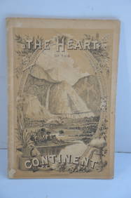
Chicago Burlington and Quincy RR The Heart of the Continent Book-1882JM Hobby Supply and Railroad Artifact Auctions4.4(127)See Sold PriceFeb 24, 2024
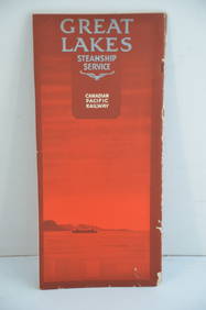
Canadian Pacific RY Great Lakes Steamship 1919 Brochure and TimetableJM Hobby Supply and Railroad Artifact Auctions4.4(127)See Sold PriceFeb 24, 2024
Chicago Rock Island and Pacific RY August 1, 1882 Public TimetableJM Hobby Supply and Railroad Artifact Auctions4.4(127)See Sold PriceFeb 24, 2024
Great Western RY November 1, 1880 Public TimetableJM Hobby Supply and Railroad Artifact Auctions4.4(127)See Sold PriceFeb 24, 2024
LATE 16TH C. MAP OF SCOTLAND BY MERCATOR, FRAMEDThomaston Place Auction Galleries4.4(393)See Sold PriceFeb 24, 2024
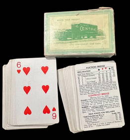
Vintage Remembrances Playing Cards Route Your Freight, Brown and BiglowCowboy Joe's Antiques4.7(201)See Sold PriceFeb 27, 2024
Arrowsmith & Lewis - Map of the World on Mercator's ProjectionTrillium Antique Prints & Rare Books4.5(32)See Sold PriceFeb 24, 2024
Carey, pub. 1796 - A Chart of the West IndiesTrillium Antique Prints & Rare Books4.5(32)See Sold PriceFeb 24, 2024
Carey, pub. 1796 - Map of GeorgiaTrillium Antique Prints & Rare Books4.5(32)See Sold PriceFeb 24, 2024
Carey, pub. 1796 - Map of The State of South CarolinaTrillium Antique Prints & Rare Books4.5(32)See Sold PriceFeb 24, 2024
Carey, pub. 1796 - Map of KentuckyTrillium Antique Prints & Rare Books4.5(32)See Sold PriceFeb 24, 2024
Carey, pub. 1796 - Map of the Tennassee State formerly part of North Carolina (Tennessee)Trillium Antique Prints & Rare Books4.5(32)See Sold PriceFeb 24, 2024
De Jode, Rare, pub. 1593 - Map of Africa (Africae Vera Forma, et Situs)Trillium Antique Prints & Rare Books4.5(32)See Sold PriceFeb 24, 2024
Blackie (Pub) 1882 Folio Print. Aborigines of South America. Brazil Patogonia Tierra del FuegoAlbion Auctions4.6(341)See Sold PriceMar 07, 2024
Blackie (Pub) 1882 Folio Print. Ethopian Race - Negros, KaffirsAlbion Auctions4.6(341)See Sold PriceMar 07, 2024
Blackie (Pub) 1882 Folio Print. Georgian, Circassian & Armenian RacesAlbion Auctions4.6(341)See Sold PriceMar 07, 2024
Blackie (Pub) 1882 Folio Print. Grecian Race - GreeceAlbion Auctions4.6(341)See Sold PriceMar 07, 2024
Blackie (Pub) 1882 Folio Print. Malay Race - Borneo, JavaAlbion Auctions4.6(341)See Sold PriceMar 07, 2024
Blackie (Pub) 1882 Folio Print. North American Indians, USAAlbion Auctions4.6(341)See Sold PriceMar 07, 2024
Blackie (Pub) 1882 Folio Map. World on Mercators ProjectionAlbion Auctions4.6(341)See Sold PriceMar 01, 2024