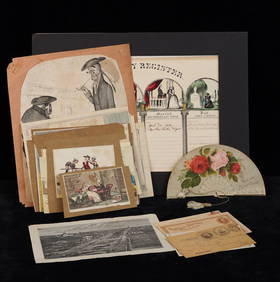
ATLAS of ANTIENT GEOGRAPHY by SAMUEL BUTLER 1843John McInnis Auctioneers,LLC4.5(505)See Sold PriceFeb 24, 2024
18TH C. ANTIQUE MAP: FRENCH & INDIAN WAR, FRAMEDThomaston Place Auction Galleries4.4(393)See Sold PriceFeb 24, 2024
Rand McNally Railroad Map Cabinet w/ 21 Railroad MapsRail & Road Auctions4.6(165)See Sold PriceMar 08, 2024
Keith Haring - Ink on New York Map, Best Buddies, Inscribed, Signed, and DatedSapphire Auction Gallery4.1(67)See Sold PriceMar 02, 2024
LATE 17TH C. FRENCH MAP OF THE NEW WORLD BY ALEXIS-HUBERT JAILLOT (1632-1712)Thomaston Place Auction Galleries4.4(393)See Sold PriceFeb 24, 2024
Central Railroad of New Jersey Map of Sandy Hook Route-ca. 1903JM Hobby Supply and Railroad Artifact Auctions4.4(127)See Sold PriceFeb 24, 2024
Lot of Six Mixed Atlas Box Cars-HO Scale-New in BoxJM Hobby Supply and Railroad Artifact Auctions4.4(127)See Sold PriceFeb 25, 2024
Rand McNally/Santa Fe Railroad Map of Iowa-1912JM Hobby Supply and Railroad Artifact Auctions4.4(127)See Sold PriceFeb 24, 2024
NICOLAES VISSCHER (NETHERLANDS, 1618-1709) MAP OF THE NEW WORLDThomaston Place Auction Galleries4.4(393)See Sold PriceFeb 24, 2024
17TH C. WORLD MAP BY NICOLAES VISSCHER (NETHERLANDS, 1618-1709)Thomaston Place Auction Galleries4.4(393)See Sold PriceFeb 24, 2024
Lot of Six Mixed Atlas Cabooses-HO Scale-New in BoxJM Hobby Supply and Railroad Artifact Auctions4.4(127)See Sold PriceFeb 25, 2024
WORLD MERCATOR showing mail routes to British colonies.TITLE/CONTENT OF MAP: 'The World on Mercator's Projection' Vignettes: Vesuvius; Gibraltar; London; Constantinople; Niagara; The Pyramids of Ghizeh; Pont Neuf, Paris. The steam ship routes to the colonSee Sold Price
WORLD MERCATOR showing mail routes to British colonies.TITLE/CONTENT OF MAP: 'The World on Mercator's Projection' Vignettes: Vesuvius; Gibraltar; London; Constantinople; Niagara; The Pyramids of Ghizeh; Pont Neuf, Paris. The steam ship routes to the colonSee Sold Price
WORLD MERCATOR showing mail routes to British colonies.TITLE/CONTENT OF MAP: 'The World on Mercator's Projection' Vignettes: Vesuvius; Gibraltar; London; Constantinople; Niagara; The Pyramids of Ghizeh; Pont Neuf, Paris. The steam ship routes to the colonSee Sold Price
WORLD MERCATOR showing mail routes to British colonies.TITLE/CONTENT OF MAP: 'The World on Mercator's Projection' Vignettes: Vesuvius; Gibraltar; London; Constantinople; Niagara; The Pyramids of Ghizeh; Pont Neuf, Paris. The steam ship routes to the colonSee Sold Price
WORLD MERCATOR showing mail routes to British colonies. RAPKIN/TALLIS 1851 mapTITLE/CONTENT OF MAP: 'The World on Mercator's Projection' Vignettes: Vesuvius; Gibraltar; London; Constantinople; Niagara; The Pyramids of Ghizeh; Pont Neuf, Paris. The steam ship routes to the colonSee Sold Price
AMERICAS. British colonies trade routes; European Colonization 1907 old mapTITLE/CONTENT OF MAP: 'The New World showing British Possessions and trade routes; European Colonization about 1800; The Colonial Empires at the present time' DATE PRINTED: 1907 IMAGE SIZE: Approx 53.See Sold Price
SoldWORLD/British Empire. 'Steam routes to the colonies'.TITLE/CONTENT OF MAP: 'The World on Mercator's Projection' Vignettes: Gibraltar; London; Constantinople; Niagara; The Pyramids of Ghizeh; Pont Neuf, Paris; Vesuvius. The steam ship routes to the colonSee Sold Price
EASTERN HEMISPHERE.Shows mail routes to British colonies. RAPKIN/TALLIS 1851 mapCAPTION PRINTED BELOW PICTURE: 'Eastern Hemisphere' The steamship mail route from Britain to Asia is indicated in blue. Marked on the map are the Mountains of Kong and the Mountains of the Moon, non-eSee Sold Price
EASTERN HEMISPHERE.Shows mail routes to British colonies. RAPKIN/TALLIS 1851 mapCAPTION PRINTED BELOW PICTURE: 'Eastern Hemisphere' The steamship mail route from Britain to Asia is indicated in blue. Marked on the map are the Mountains of Kong and the Mountains of the Moon, non-eSee Sold Price
E. Hemisphere Mail Route to British Colonies 1849 MapEastern Hemisphere. Mail Route to British Colonies. Asia.tallis/rapkin, 1849 Map. Title/content of Map: 'eastern Hemisphere' the Steamship Mail Route from Britain to Asia Is Indicated in Blue This MapSee Sold Price
SoldVan der Aa map showing route to British coloniesTitle: 't Noorder Gedeelte van Virginie door Bartholomeus Gosnol en Martin Pringe uyt Engeland Bevaaren Author: Van der Aa, Pieter Description: Copper-engraved map. 15x23 cm. (6x9").North Atlantic andSee Sold Price
EASTERN HEMISPHERE. Mail route to British colonies. Asia.TALLIS/RAPKIN 1849 mapTITLE/CONTENT OF MAP: 'Eastern Hemisphere' The steamship mail route from Britain to Asia is indicated in blue DATE PRINTED: 1849 IMAGE SIZE: Approx 26.5 x 34.5cm, 10.5 x 13.5 inches (Large); Please noSee Sold Price
WORLD ON MERCATOR'S PROJECTION showing the BRITISH EMPIRE by GW BACON 1891 mapCAPTION PRINTED BELOW PICTURE: 'The World on Mercator's Projection' DATE PRINTED: 1891 IMAGE SIZE: Approx 32.5 x 51.0cm, 12.75 x 20 inches (Large); Please note that this is a folding map. TYPE: ColourSee Sold Price
World on Mercator's Projection showing the British Empire. BARTHOLOMEW 1862 mapTITLE OF PRINT (NOT PRINTED ON THE PAGE):'The World on Mercator's Projection' DATE PRINTED: 1862 IMAGE SIZE: Approx 44.0 x 58.5cm, 17.25 x 23 inches (Large); Please note that this is a folding map. TYSee Sold Price
Johnston: Antique Map of World on Mercator's ProjectionTitle/Content of Map: 'Chart of the World on Mercator's Projection', showing Steamer routes Date Printed: 1879 Image Size: Approx 48.0 x 61.5cm, 19 x 24.25 inches (Large); Please note that this is a fSee Sold Price
SoldMaps: A Chart of the World on Mercator's Projection,Maps: A Chart of the World on Mercator's Projection, showing the principle ocean steam routes, the submarine telegraphs, &c. Mounted on linen. By J.Arrowsmith. Published by Edward Stanford , London. 1See Sold Price
World Mercator's on projection. India in relation to the British Empire 1909 mapTITLE/CONTENT OF MAP: 'Chart of the World on Mercator's Projection showing India in relation to the British Empire' DATE PRINTED: 1909 IMAGE SIZE: Approx 20.0 x 25.0cm, 7.75 x 10 inches (Medium); PleaSee Sold Price
World Mercator's on projection. India in relation to the British Empire 1931 mapCAPTION PRINTED BELOW PICTURE: 'Chart of the World on Mercator's Projection showing India in relation to the British Empire' DATE PRINTED: 1931 IMAGE SIZE: Approx 20.5 x 25.0cm, 8 x 10 inches (Medium)See Sold Price
BRITISH EMPIRE. World Mercator. Currents. Steamship routes. JOHNSTON 1899 mapTITLE/CONTENT OF MAP: 'The World (Mercator)' DATE PRINTED: 1899 IMAGE SIZE: Approx 20.5 x 26.0cm, 8 x 10.25 inches (Medium) TYPE: Colour antique map CONDITION: Good; suitable for framing. However, pleSee Sold Price
BRITISH EMPIRE World Mercator Currents Steamship routes JOHNSTON 1892 old mapTITLE/CONTENT OF MAP: 'The World (Mercator)' DATE PRINTED: 1892 IMAGE SIZE: Approx 20.5 x 26.0cm, 8 x 10.25 inches (Medium) TYPE: Antique colour map CONDITION: Good; suitable for framing. However, pleSee Sold Price
BRITISH EMPIRE. World Mercator. Currents. Steamship routes. JOHNSTON 1895 mapTITLE/CONTENT OF MAP: 'The World (Mercator)' DATE PRINTED: 1895 IMAGE SIZE: Approx 20.5 x 26.0cm, 8 x 10.25 inches (Medium) TYPE: Antique colour map CONDITION: Good; suitable for framing. However, pleSee Sold Price
OLD WORLD. British Spanish Portuguese empires trade routes 1500 1650 1907 mapTITLE/CONTENT OF MAP: 'The old World showing British Possessions and trade routes; Spanish and Portuguese Possessions about 1500; European Colonizations about 1650' DATE PRINTED: 1907 IMAGE SIZE: ApprSee Sold Price
Sold1872 MAP OF THE WORLD BY S.A. MITCHELLMercator projection of the world showing route of Lt Wilkes in 1840. Matted, 14.5 x 18.5 inches. Not examined outside of wrapping, appears excellent.See Sold Price
WORLD. Mercator's projection. Ocean currents & shipping routes. BLACKIE 1882 mapTITLE/CONTENT OF MAP: 'The World on Mercators projection showing the courses of the chief ocean currents and the navigation tracks between the principal ports' DATE PRINTED: 1882 IMAGE SIZE: Approx 36See Sold Price
Lake Superior and Mississippi River RR 1869 Seven Percent Bonds Book/Report-1869JM Hobby Supply and Railroad Artifact Auctions4.4(127)See Sold PriceFeb 24, 2024
CADILLAC "STANDARD OF THE WORLD" PORCELAIN NEON SIGN.Dan Morphy Auctions4.2(1.3k)See Sold PriceFeb 24, 2024
CHEW & SMOKE MAIL POUCH TOBACCO PORCELAIN SIGN.Dan Morphy Auctions4.2(1.3k)See Sold PriceFeb 25, 2024
COLLECTION OF 2: GULFPRIDE & AMERICAN BRAKEBLOK TIN SERVICE STATION SIGN & THERMOMETER.Dan Morphy Auctions4.2(1.3k)See Sold PriceFeb 25, 2024
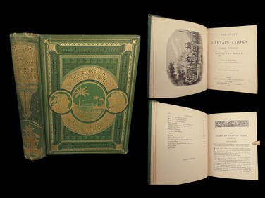
1871 Captain Cook Voyages Around the World Tahiti Hawaii Exploration AntarcticaSchilb Antiquarian Rare Books4.8(428)See Sold PriceMar 10, 2024
LATE 17TH C. FRENCH MAP OF THE NEW WORLD BY ALEXIS-HUBERT JAILLOT (1632-1712)Thomaston Place Auction Galleries4.4(393)See Sold PriceFeb 24, 2024
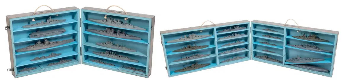
TWO CASED SETS OF WORLD WAR II-ERA U.S. NAVY RECOGNITION/TEACHING MODELS OF BRITISH AND FRENCH SHIPSEldred's4.7(419)See Sold PriceFeb 27, 2024
FOUR CASED SETS OF WORLD WAR II-ERA U.S. NAVY RECOGNITION/TEACHING MODELS 20th Century Model lengthsEldred's4.7(419)See Sold PriceFeb 27, 2024
GROUPING OF (19th c) BRITISH SATIRICAL PRINTS etcJohn McInnis Auctioneers,LLC4.5(505)See Sold PriceFeb 24, 2024
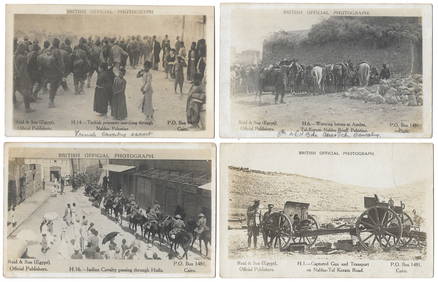
14 Official British Army Postcards - Palestine in WWILevy Auction House4.3(11)See Sold PriceFeb 27, 2024
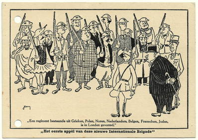
Antisemitic Postcard - Churchill's Jewish Army - WW2Levy Auction House4.3(11)See Sold PriceFeb 27, 2024
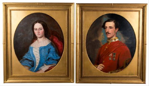
After Benjamin Hudson "Lady In Blue Dress & HerWorld of Antiques, Inc.3.9(74)See Sold PriceFeb 29, 2024
[WORLD WAR I]. True Blue. Chicago: E.G. Renesch, 1919.Freeman's | Hindman4.4(1.6k)See Sold PriceFeb 27, 2024
Antique Portrait of British Gentleman, Oil on Canvas, Featuring Man with BeardNorthgate Gallery, Inc.4.5(36)See Sold PriceMar 02, 2024
Arrowsmith & Lewis - Map of the World on Mercator's ProjectionTrillium Antique Prints & Rare Books4.5(32)See Sold PriceFeb 24, 2024
De Jode, Rare, pub. 1593 - Map of Africa (Africae Vera Forma, et Situs)Trillium Antique Prints & Rare Books4.5(32)See Sold PriceFeb 24, 2024
Map of Part of the West Indies, Etc., Showing the Exact Position Of The U.S. War Steamer SanJasper524.5(9.9k)See Sold PriceFeb 27, 2024
SECOND WORLD WAR AFRICA. European colonies & German mandates 1940 old mapJasper524.5(9.9k)See Sold PriceFeb 28, 2024


![[WORLD WAR I]. True Blue. Chicago: E.G. Renesch, 1919. (1 of 2)](https://p1.liveauctioneers.com/197/319238/171468135_1_x.jpg?height=282&quality=70&version=1707520367)


