ATLAS of ANTIENT GEOGRAPHY by SAMUEL BUTLER 1843John McInnis Auctioneers,LLC4.6(504)See Sold PriceFeb 24, 2024
18TH C. ANTIQUE MAP: FRENCH & INDIAN WAR, FRAMEDThomaston Place Auction Galleries4.4(389)See Sold PriceFeb 24, 2024
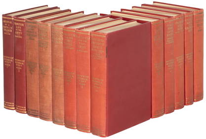
Rand McNally Railroad Map Cabinet w/ 21 Railroad MapsRail & Road Auctions4.6(165)See Sold PriceMar 08, 2024
Keith Haring - Ink on New York Map, Best Buddies, Inscribed, Signed, and DatedSapphire Auction Gallery4.1(67)See Sold PriceMar 02, 2024
LATE 17TH C. FRENCH MAP OF THE NEW WORLD BY ALEXIS-HUBERT JAILLOT (1632-1712)Thomaston Place Auction Galleries4.4(389)See Sold PriceFeb 24, 2024
Central Railroad of New Jersey Map of Sandy Hook Route-ca. 1903JM Hobby Supply and Railroad Artifact Auctions4.4(126)See Sold PriceFeb 24, 2024
Lot of Six Mixed Atlas Box Cars-HO Scale-New in BoxJM Hobby Supply and Railroad Artifact Auctions4.4(126)See Sold PriceFeb 25, 2024
Rand McNally/Santa Fe Railroad Map of Iowa-1912JM Hobby Supply and Railroad Artifact Auctions4.4(126)See Sold PriceFeb 24, 2024
NICOLAES VISSCHER (NETHERLANDS, 1618-1709) MAP OF THE NEW WORLDThomaston Place Auction Galleries4.4(389)See Sold PriceFeb 24, 2024
17TH C. WORLD MAP BY NICOLAES VISSCHER (NETHERLANDS, 1618-1709)Thomaston Place Auction Galleries4.4(389)See Sold PriceFeb 24, 2024
Lot of Six Mixed Atlas Cabooses-HO Scale-New in BoxJM Hobby Supply and Railroad Artifact Auctions4.4(126)See Sold PriceFeb 25, 2024
SoldHistorical map of Russia, Johann Matthias Hase,Historical map of Russia, Johann Matthias Hase, ''Imperii Russici'', map of Russia at the time of Empress Anna (1730-1740), partial col. Copper engraving with two allegorical cartridges, at Homann's hSee Sold Price
SoldTWO EARLY MAPS. Map of Africa by Johann Matthias HTWO EARLY MAPS. Map of Africa by Johann Matthias Hase (German, 1684-1742), engraving on laid paper with handcoloring, 18th Century, 24"h. 27"w. (framed); and a map of Greece and Crete by Guillaume DelSee Sold Price
JOHANN MATTHIAS HASE ENGRAVING MAP AFRICA, 18TH C.Unframed map, engraving on paper, "'Africa Secundum Legitimas Projectionis Stereographicae regulas," Johann Matthias Hase (German, 1684-1742), cartouche with title in lower left corner, illustrated wiSee Sold Price
Antique Colored Map - Europe - Balkans - Hungary - Romania - Bulgaria - HeirsOriginally colored engraved map of the Balkans by Johann Matthias Hase printed by Homann Heirs. Shows Hungary, Romania, Bulgaria, the former Yugoslavia (Croatia, Serbia, Bosnia, Macedonia), Albania anSee Sold Price
SoldJohann Matthias Hase - "The Kingdom of David andRegni Davidici Et Salomonaei Descriptio Geographica Et Historica [The Kingdom of David and Solomon, a Geographical and Historical Description], by Johanne Matthia Hasio (Johann Matthias Hase). NurembeSee Sold Price
SoldJohann Matthias Hase Homann Heirs World MapJohann Mathias Hase (1684-1742), "Planiglobii Terrestris Mappa Universalis: Utrumque Hemisphaerium Orient. et Occidentale Repraesentans," Nuremberg: Homann Heirs, 1746. Hand colored map of the world iSee Sold Price
SoldAfricaJohann Matthias Hase (1684-1742). engraved map with original hand-color in full. Nuremberg, c. 1740. 21 x 24 inches, 32 1/2 x 35 1/2 inches framed. Map of Africa by the first cartographer to use a sciSee Sold Price
Sold[Map of Russian Empire and Tartary]. Imperii Russici Et[Map of Russian Empire and Tartary]. Imperii Russici Et Tatariae Universal. Johann Matthias Hase. Nuremberg, 1739. - 54x62 cm. Engraving. Painted with watercolor. Decorative cartouche with dedicationSee Sold Price
SoldAN ANTIQUE MAP, "Americæ Mappa Generalis," 1746,AN ANTIQUE MAP, "Americæ Mappa Generalis," 1746, hand colored engraving, published by Johann Baptist Homann (1664-1724) with special acknowledgement to Johann Matthias Hase (1684-1742) and AugustSee Sold Price
SoldAN ANTIQUE MAP, "Americæ Mappa Generalis," 1746,AN ANTIQUE MAP, "Americæ Mappa Generalis," 1746, hand colored engraving, published by Johann Baptist Homann (1664-1724) with special acknowledgement to Johann Matthias Hase (1684-1742) and AugustSee Sold Price
SoldFramed "Planiglobii Terrestris Mappa Universalis" 1746"Planiglobii Terrestris Mappa Universalis Utrumqs Hemisphaerium Orient et Occidentale …. MDCCXXXXVI." Published in Nuremberg in 1746 by G.M. (George Moritz) Lowitz (1722-1774), Johann Matthias HaseSee Sold Price
Sold1739 Antique Handcolored Map of Russia & AsiaAntique map dated 1739 by Johann Matthias Haase. Not laid down. From an estate collection of antique maps, several of which are in today's auction. Measures 20" x 23" visible in 21-1/2" x 24-1/2" framSee Sold Price
Sold1739 Antique Handcolored Map of Russia & AsiaAntique map dated 1739 by Johann Matthias Haase. Not laid down. From an estate collection of antique maps. Measures 20" x 23" visible in 21-1/2" x 24-1/2" frame.See Sold Price
SoldHomann map, Imperii Russici et Tartariae, 1739[Russia & Asia]. Johann Matthias Haas. Imperii Russici Et Tatariae Universal Tam Majoris Et Asiaticae, Quam Minoris Et Europaeae Tabula.... Double-page map engraved by K.A. Schneider, revision of an eSee Sold Price
Johann Matthias Hasii (1684-1742) Engraved map ofJohann Matthias Hasii (1684-1742) Engraved map of Russia with a portrait of the Empress Anna Ioanovna in cartouch Engraving, etching, watercolour First half of XVIII c The workshop of the followers ofSee Sold Price
Hasas Europe Lithuanian Polish[1743 Map of Europe with the Lithuanian-Polish State in it] Creator Johanas Matias Hasas (Johann Matthias Haas; Hassius Hase Hasio Haase) 1684-1742). Cartoon entry: "Europa Secundum legitimas ProjectiSee Sold Price
SoldMap, Johann Matthias Haase/ Homann Heirs, ImperiiJohann Matthias Haase (German, 1684-1742)/ Homann Heirs, "Imperii Russici et Tatariae Universae tam majoris et Asiaticae quam minoris et Europae Tabula..." 1739, hand-colored copper engraved map, sheeSee Sold Price
David & Solomon Kingdoms Map, Johann Matthias Haas 1739Map of the Kingdoms of David and Solomon, Johann Matthias Haas, Nurnberg, 1739. Regni Davidici et Salomonaei Descriptio Geographica cum Vicinis regionibus Syriae et Aegypti. Colored copper plate engraSee Sold Price
SoldHaas & Heirs, map of AfricaHaas & Heirs, map of Africa, Johann Matthias Haas (German, 1684-1742), "Leonis Africani", 1737, 21"h x 25.25"w (sheet), unframed Provenance: Property from a major corporate art collection, NYSee Sold Price
SoldEurasia. Homann Heirs, 1744.[Asia]. Homann Heirs. Asia Secundum Legitimas Projectionis Stereographicae Regulas et Juxta Recentissimas Observation... Double-page engraved map A.G. Boehme after a map drawn by Johann Matthias Haas.See Sold Price
Russia (Historical - 13th Century)Title/Content of Map: Russia (Historical - 13th Century) Date: c1960 Publisher: G.U.G.K. Size: 41Height - 53Width Russian Principalities and the Golden Horde. Reserve: $165.00 Shipping: Domestic: FlSee Sold Price
Russia (Historical Russian Empire 1801-1861)Title: Russia (Historical Russian Empire 1801-1861) Cartographer: Date: c1950 Publisher: G.U.G.K. Size: 64Height - 46Width Additional Info: Russian text. Historical wall map of Russia (1801-1861), shoSee Sold Price
Historical map of Europe, Franz Johann Joseph vonHistorical map of Europe, Franz Johann Joseph von Reilly (1766-1820), ''The Eastern andNorthern Europe Third introductory and overview map ... to Büschings large earth description'', border colored cSee Sold Price
SoldHomann - Heirs of . Africa Secundum legitimasHeirs of . Africa Secundum legitimas Projectionis Stereographicæ regulas , map of the continent by Johann Matthias Haas, large title vignette with exotic birds and animals, African and European mSee Sold Price
1875 Rand Avery and Co. Map of Express Companies and Railroads of the USA and CanadaJM Hobby Supply and Railroad Artifact Auctions4.4(126)See Sold PriceFeb 24, 2024
Medieval Printed Paper Bible Page by Johann GrüningerTimeLine Auctions Ltd.4.6(182)See Sold PriceMar 07, 2024
Group of Ten Railroad Photographs, Maps, and Prints - New Jersey, Long Island, and New YorkRail & Road Auctions4.6(165)See Sold PriceMar 07, 2024
1977 JRR Tolkien 1st ed Silmarillion Lord of the Rings Middle Earth + MAPSchilb Antiquarian Rare Books4.8(422)See Sold PriceMar 31, 2024
[ARCTIC]. BOWEN, Emanuel. A New & Accurate Map of the North...Potter & Potter Auctions4.6(544)See Sold PriceMar 07, 2024
[JUDAICA]. Group of Nearly 20 Items Related to Emigration f...Potter & Potter Auctions4.6(544)See Sold PriceMar 07, 2024
[CHICAGO]. Rare Pre-Fire Illinois Map: “Blanchard’s Map of ...Potter & Potter Auctions4.6(544)See Sold PriceMar 07, 2024
[MAPS]. DUFOUR, Auguste-Henri (1795-1865). Bound Volume of ...Potter & Potter Auctions4.6(544)See Sold PriceMar 07, 2024
[MAP]. [ALBRIZZI, Giambatista, 1698-1777]. Carta Geografica...Potter & Potter Auctions4.6(544)See Sold PriceMar 07, 2024
[MAP]. NICHOLLS, Sutton (1668-1729). An Epitome of Sr. Will...Potter & Potter Auctions4.6(544)See Sold PriceMar 07, 2024
Johann Homann Hand-Colored Map Engraving, c. 1730Auctions at Showplace4.6(731)See Sold PriceMar 17, 2024
1822 MAP of LEEWARD ISLANDS GEOGRAPHICAL STATISTICAL HISTORICAL antique 17.5x22"Jasper524.5(9.8k)See Sold PriceFeb 27, 2024
1816 MAP SOUTHERN PART OF RUSSIA or MUSCOVY in EUROPE copper engraving ANTIQUEJasper524.5(9.8k)See Sold PriceFeb 27, 2024
1736 LARGE MAP OF SILESIA POLAND OPPAVIENSIS antique 25 by 34 3/4"Jasper524.5(9.8k)See Sold PriceFeb 27, 2024
1816 MAP NORTHERN PART OF RUSSIA or MUSCOVY in EUROPE copper engraving ANTIQUEJasper524.5(9.8k)See Sold PriceFeb 27, 2024
1822 MAP of NORTH & SOUTH AMERICA GEOGRAPHICAL STATISTICAL HISTORICAL antiqueJasper524.5(9.8k)See Sold PriceFeb 27, 2024
1738 RUSSIA SIBERIA & GREAT TARTARY Description illustrated ANTIQUE in ENGLISHJasper524.5(9.8k)See Sold PriceFeb 27, 2024
Geographical Statistical and Historical Map of the Windward IslandsJasper524.5(9.8k)See Sold PriceFeb 27, 2024
1792 OLD INDIA HISTORY ANTIQUE ILLUSTRATED WITH MAPS OF THE EIGHTEENTH CENTURY IN FRENCHNY Elizabeth 4.3(85)See Sold PriceMar 03, 2024


![[Map of Russian Empire and Tartary]. Imperii Russici Et (1 of 2)](https://p1.liveauctioneers.com/6171/172047/86669617_1_x.jpg?height=282&quality=70&version=1593095278)


![[ARCTIC]. BOWEN, Emanuel. A New & Accurate Map of the North... (1 of 1)](https://p1.liveauctioneers.com/928/318880/171360917_1_x.jpg?height=282&quality=70&version=1707501302)
![[JUDAICA]. Group of Nearly 20 Items Related to Emigration f... (1 of 1)](https://p1.liveauctioneers.com/928/318880/171361008_1_x.jpg?height=282&quality=70&version=1707501302)
![[CHICAGO]. Rare Pre-Fire Illinois Map: “Blanchard’s Map of ... (1 of 2)](https://p1.liveauctioneers.com/928/318880/171361260_1_x.jpg?height=282&quality=70&version=1707501302)
![[MAPS]. DUFOUR, Auguste-Henri (1795-1865). Bound Volume of ... (1 of 2)](https://p1.liveauctioneers.com/928/318880/171361279_1_x.jpg?height=282&quality=70&version=1707501302)
![[MAP]. [ALBRIZZI, Giambatista, 1698-1777]. Carta Geografica... (1 of 1)](https://p1.liveauctioneers.com/928/318880/171361280_1_x.jpg?height=282&quality=70&version=1707501302)
![[MAP]. NICHOLLS, Sutton (1668-1729). An Epitome of Sr. Will... (1 of 1)](https://p1.liveauctioneers.com/928/318880/171361281_1_x.jpg?height=282&quality=70&version=1707501302)