ATLAS of ANTIENT GEOGRAPHY by SAMUEL BUTLER 1843John McInnis Auctioneers,LLC4.5(505)See Sold PriceFeb 24, 2024
18TH C. ANTIQUE MAP: FRENCH & INDIAN WAR, FRAMEDThomaston Place Auction Galleries4.4(393)See Sold PriceFeb 24, 2024
Rand McNally Railroad Map Cabinet w/ 21 Railroad MapsRail & Road Auctions4.6(165)See Sold PriceMar 08, 2024
Keith Haring - Ink on New York Map, Best Buddies, Inscribed, Signed, and DatedSapphire Auction Gallery4(67)See Sold PriceMar 02, 2024
LATE 17TH C. FRENCH MAP OF THE NEW WORLD BY ALEXIS-HUBERT JAILLOT (1632-1712)Thomaston Place Auction Galleries4.4(393)See Sold PriceFeb 24, 2024
Central Railroad of New Jersey Map of Sandy Hook Route-ca. 1903JM Hobby Supply and Railroad Artifact Auctions4.4(127)See Sold PriceFeb 24, 2024
Lot of Six Mixed Atlas Box Cars-HO Scale-New in BoxJM Hobby Supply and Railroad Artifact Auctions4.4(127)See Sold PriceFeb 25, 2024
Rand McNally/Santa Fe Railroad Map of Iowa-1912JM Hobby Supply and Railroad Artifact Auctions4.4(127)See Sold PriceFeb 24, 2024
NICOLAES VISSCHER (NETHERLANDS, 1618-1709) MAP OF THE NEW WORLDThomaston Place Auction Galleries4.4(393)See Sold PriceFeb 24, 2024
17TH C. WORLD MAP BY NICOLAES VISSCHER (NETHERLANDS, 1618-1709)Thomaston Place Auction Galleries4.4(393)See Sold PriceFeb 24, 2024
Lot of Six Mixed Atlas Cabooses-HO Scale-New in BoxJM Hobby Supply and Railroad Artifact Auctions4.4(127)See Sold PriceFeb 25, 2024
Geographical, Statistical, and Historical Map of theTitle/Content of Map: Geographical, Statistical, and Historical Map of the West Indies. Date: 1827 Cartographer: LUCAS, FIELDING, JR. Publisher: CAREY & LEA Size: 12Height - 9.5Width Map on double-folSee Sold Price
Geographical, Statistical, and Historical Map of theTitle: Geographical, Statistical, and Historical Map of the West Indies. Cartographer: LUCAS, FIELDING, JR. Publisher: CAREY & LEA Height: 12 Width: 9.5 Map on double-folio sheet, surrounded by text.See Sold Price
Geographical and Historical Map of the West IndiesTitle/Content of Map: Geographical, Statistical, and Historical Map of the West Indies. Date Printed: 1827 Cartographer: LUCAS, FIELDING, JR. Size (inches): 11.5x18.5 Map on double-folio sheet, surrouSee Sold Price
SoldCarey & Lea: Antique Map of the West Indies, 1826Map: Geographical Statistical and Historical Map of the West Indies Publication Date: 1826 Authors: CAREY & LEA, CAREY & LEA Publisher: CAREY & LEA Size: Folio – 12.00 H x 15.80 W Inches Map detailiSee Sold Price
4 Maps (1838) North America, 2 Canada, West Indies[North America] 4 Maps from T. G. Bradford, “An Illustrated Atlas, Geographical, Statistical, And Historical, Of The United States, And Adjacent Countries,” Bos: Weeks, Jordan, and Company/ NY: WiSee Sold Price
Sold19TH C. MAPS OF THE WEST AND INDIAN TERRITORIESMexico and Internal Provinces," map no. 38, 'Geographical, Statistical and Historical map of Mexico,' engraved by Young & Delleker, 'prepared from Humboldt's map and other documents by J. Finlayson.'See Sold Price
SoldKitchin, Thomas 1785 Antique Map of The West Indies"The West Indies Drawn and Engrav'd from the most approv'd Maps and Charts" Copper Engraved Map Published 1783-85, London for "A New Geographical, Historical and Commercial Grammar..." by William GuthSee Sold Price
Bradford: Antique Map of the West Indies, 1835Map: West Indes Date Printed: 1835 Cartographer: Thomas G. Bradford Material/Medium: Paper Size: 12 1/2" x 9 3/4" Condition: Excellent Hand colored outlines. A comprehensive Atlas Geographical HistoriSee Sold Price
Sold(4) 1838 BRADFORD Maps: KY, IL, MO, WI and Iowa.[United States/West] 4 Maps (maps 21, 27, 34, and 38) from T. G. Bradford, “An Illustrated Atlas, Geographical, Statistical, And Historical, Of The United States, And Adjacent Countries,” Bos: WeeSee Sold Price
SoldBook of MapsBook of Maps ""A Complete Historical, Chronological, and Geographical American Atlas Being a Guide to the History of North and South America and the West Indies. According to the Plan of Le Sage's AtlSee Sold Price
SoldWest Indies.- Breen (Henry H.) St. Lucia: HistoricWest Indies.- Breen (Henry H.) St. Lucia: Historical, Statistical, and Descriptive,first edition, half-title, engraved map, slight spotting, original cloth, a little sunned, spine faded, spineSee Sold Price
Sold1795 History of the United States, (4pc)For Volume set, "An Historical, Geographical, Commercial and Philosophical View of the American United States, and of the European Settlements in America and the West Indies" by W. Winterbotham. 4 volSee Sold Price
SoldA Complete Historical, Chronological, and GeographicalA Complete Historical, Chronological, and Geographical American Atlas, being a Guide to the History of North and South America, and the West Indies ... to the Year 1822.CAREY, Henry Charles (1793-1879See Sold Price
Cary and Lea 1822 American Atlas[CAREY AND LEA]. A Complete Historical, Chronological, and Geographical American Atlas, Being a Guide to the History of North and South America, and the West Indies...to the year 1822. Philadelphia: HSee Sold Price
SoldA Complete Historical, Chronological,and Geographical American Atlas, Being A Guide to the History of North and South America, and the West Indies by H. C. Carey and I. Lea, 1822, Philadelphia, 46 double-page hand-colored engraved map shSee Sold Price
Geographical Statistical & Historical Map of Peru, 1822Map: Geographical Statistical & Historical Map of Peru Maker: Carey & Lea, Finlayson, J. Publisher: Carey & Lea, Philadelphia 1822 Size: Double Folio – 13.60 H x 12.50 W Inches No. 50. Most conciseSee Sold Price
SoldGeographical, Statistical & Historical Map Canada, 1823Map: Geographical, Statistical and Historical Map of Upper and Lower Canada, and the other British Possessions in North America Cartographer: F. Lucas Publishing: Philadelphia / Baltimore, 1823 Size:See Sold Price
Geographical, Statistical, Historical Map of BrazilMap: Geographical, Statistical, Historical Map of Brazil Maker: Carey & Lea, Finlayson Date: 1825 Size: Double Folio, 11.6 inches high x 11.25 inches wide Only eleven states or territories. Most conciSee Sold Price
Geographical, Statistical & Historical Map Canada, 1826Map: Geographical, Statistical, and Historical Map of Upper and Lower Canada, and the Other British Possessions in North America Publishing: Carey & Lea, Lucas, Fielding, Jr. / Young & Delleker, sc.,See Sold Price
Geographical Statistical & Historical Map of Peru, 1828Map: Geographical, Statistical and Historical Map of Peru Maker: Carey & Lea, Finlayson, J. Publisher: Carey & Lea, Philadelphia 1828 Size: Quarto – 13.30 H x 12.50 W Inches From the third edition CSee Sold Price
SoldGeographical, Statistical & Historical Map of VT1825 Geographical, Statistical and Historical Map of Vermont published by Young and Dellecker, hand colored with Historical Sketch in surround. 18 x 22"See Sold Price
Geographical, Statistical, Historical Map of AmericaTitle/Content of Map: Geographical, Statistical, and Historical Map of America. Date Printed: 1820 Cartographer: FINDLAYSON, J./YOUNG & DELLEKER, sc. Size: 8.75X15.75 Maps of both North and South AmerSee Sold Price
Geographical, Statistical, & Historical Map of AmericaTitle/Content of Map: Geographical, Statistical, and Historical Map of America. Date Printed: 1820 Cartographer: FINDLAYSON, J./YOUNG & DELLEKER, sc. Size (inches): 10.3x10.6 Maps of both North and SoSee Sold Price
Sold1826 Geographical Map of Vermont1826 hand-colored Geographical, Statistical, & Historical map of Vermont, engraved by Young & Delleker, Carey & Lea atlas page, creased, unframed, 17 3/4" x 22 1/4"See Sold Price
[ARCTIC]. BOWEN, Emanuel. A New & Accurate Map of the North...Potter & Potter Auctions4.6(545)See Sold PriceMar 07, 2024
1822 MAP of LEEWARD ISLANDS GEOGRAPHICAL STATISTICAL HISTORICAL antique 17.5x22"Jasper524.5(9.9k)See Sold PriceFeb 27, 2024
1822 MAP of SOUTH AMERICA GEOGRAPHICAL STATISTICAL HISTORICAL antique 17.5x 22"Jasper524.5(9.9k)See Sold PriceFeb 27, 2024
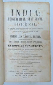
1858 INDIA HISTORY ILLUSTRATED antique Geographical, Statistical, and HistoricalJasper524.5(9.9k)See Sold PriceFeb 27, 2024
1822 MAP of NORTH & SOUTH AMERICA GEOGRAPHICAL STATISTICAL HISTORICAL antiqueJasper524.5(9.9k)See Sold PriceFeb 27, 2024
1822 MAP of CHILI GEOGRAPHICAL STATISTICAL HISTORICAL antique 17.5x 22" CHILEJasper524.5(9.9k)See Sold PriceFeb 27, 2024
Geographical, Statistical, and Historical Map of the Leeward Islands.Jasper524.5(9.9k)See Sold PriceFeb 27, 2024
Geographical Statistical and Historical Map of the Windward IslandsJasper524.5(9.9k)See Sold PriceFeb 27, 2024
Map of Part of the West Indies, Etc., Showing the Exact Position Of The U.S. War Steamer SanJasper524.5(9.9k)See Sold PriceFeb 27, 2024
West Indies. Rand, McNally & Co.'S Indexed Atlas Map of the West Indies.Jasper524.5(9.9k)See Sold PriceFeb 27, 2024
Geographical, Statistical, and Historical Map of the West Indies.Jasper524.5(9.9k)See Sold PriceFeb 27, 2024
OLD MAP of the West Indies/ Carta Esperica/ 1804Churchill Galleries3.7(217)See Sold PriceFeb 26, 2024
Cooke, George 1801 Antique Map. West Indies CaribbeanAlbion Auctions4.6(341)See Sold PriceMar 01, 2024
Framed Tropical West Indies Map PrintRapid Estate Liquidators and Auction Gallery4.5(1.1k)See Sold PriceFeb 26, 2024


![[ARCTIC]. BOWEN, Emanuel. A New & Accurate Map of the North... (1 of 1)](https://p1.liveauctioneers.com/928/318880/171360917_1_x.jpg?height=282&quality=70&version=1707501302)