17TH C. ENGLISH LINEAR MAP BY OGILBY, FRAMEDThomaston Place Auction Galleries4.4(393)See Sold PriceFeb 24, 2024
MAP - PIETER SCHENK / VALK / JANSSEN Hand Colored superb Map Central Italy c1702Luis Porretta Fine Arts4.3(10)See Sold PriceMar 02, 2024
OGILVY & BOWEN c1736 Original Map of Oxfordshire Berkshire Etc.Luis Porretta Fine Arts4.3(10)See Sold PriceMar 02, 2024
CHARLES ROLLIN c1828 Ceasar Hand Colored Africa Military MapLuis Porretta Fine Arts4.3(10)See Sold PriceMar 02, 2024
MAP - Dufour, A. H. ( Malte / Brun ) :MAP - ESPAGNE PARTIE SUD DIVISEE EN PROVINCES ANCIENNES ( MAPLuis Porretta Fine Arts4.3(10)See Sold PriceMar 02, 2024
RIGOBERT BONNE c1787 Original Colored Map Germany & Region 15" x 12"Luis Porretta Fine Arts4.3(10)See Sold PriceMar 02, 2024
AMBROISE TARDIEU c1822 Napoleonic War Map GermanyLuis Porretta Fine Arts4.3(10)See Sold PriceMar 02, 2024
MAP - AMBROISE TARDIEU c1822 Napoleonic Miltary Map GermanyLuis Porretta Fine Arts4.3(10)See Sold PriceMar 02, 2024
1822 Rare Map by Ambroise Tardieu Napoleon Caldiero Battle of Vento 17" x 11Luis Porretta Fine Arts4.3(10)See Sold PriceMar 02, 2024
THOMAS MOULE 1837 Colored Map of Warwickshire Framed vgcLuis Porretta Fine Arts4.3(10)See Sold PriceMar 02, 2024
PIETER SCHENK / VALK / JANSSEN Hand Colored Map of Rhodes Greece ca1702 vgcLuis Porretta Fine Arts4.3(10)See Sold PriceMar 02, 2024
STICH & DRUCK c1888 Map Austrian Alps 20" x 16"Luis Porretta Fine Arts4.3(10)See Sold PriceMar 02, 2024
SoldCarey: Geographical & Statistical Map of Europe, 1822Geographical and Statistical Map of Europe. M. Carey, Young & Delleker 1822. Restriking of map, Europe: drawn from the best authorities for the illustration of Lavoisne's genealogical, historical, chrSee Sold Price
Lavoisne: Geographical & Statistical Map of Europe 1821Map: 1821 Lavoisne Map of Europe -- Geographical and Statistical Map of Europe Cartographer: M. Lavoisne Year / Place: 1821, Philadelphia Dimensions: 20.5 x 16.5 in. Condition: Very good, slight age tSee Sold Price
1831 Woodbridge Map of Europe -- Geographical & Statistical Map of EuropeTitle: 1831 Woodbridge Map of Europe -- Geographical & Statistical Map of Europe Cartographer: W. Woodbridge Year / Place: 1831, Hartford Map Dimension (in.): 8.2 X 10.8 in. This is a very nice map ofSee Sold Price
1831 Woodbridge Map of Europe -- Geographical & Statistical Map of EuropeTitle: 1831 Woodbridge Map of Europe -- Geographical & Statistical Map of Europe Cartographer: W. Woodbridge Year / Place: 1831, Hartford Map Dimension (in.): 8.2 X 10.8 in. This is a very nice map ofSee Sold Price
Geographical and Statistical Map of EuropeMap: Geographical and Statistical Map of Europe Publisher: M. Carey US edition after English edition of this originally French Atlas map Hand colored Description: This copper plate map shows geographiSee Sold Price
1821 GEOGRAPHICAL AND STATISTICAL MAP OF EUROPE...GEOGRAPHICAL AND STATISTICAL MAP OF EUROPE. Europe: Drawn from the best Authorities for the Illustration of Lavoisne's Genealogical, Historical, Chronological & Geographical Atlas. Improved to 1821. BSee Sold Price
Sold1820 MAP OF EUROPE AFTER NAPOLEON BY MATTHEW CAREYGeographical and statistical map of Europe after Napoleon, matted, 16.75 x 20.75 inches.See Sold Price
SoldLavoisne: Antique Map of Europe, 1821Map: 1821 Lavoisne Map of Europe -- Geographical and Statistical Map of Europe Cartographer: M. Lavoisne Year / Place: 1821, Philadelphia Dimensions: 20.5 x 16.5 in. Condition: Very good, slight age tSee Sold Price
SoldGeographical and Statistical Map of Turkey.Title: Geographical and Statistical Map of Turkey. Publication Date: 1822 Cartographer: GROS, C./J. YEAGER Publisher: M. CAREY Size: 8.25Height - 17.75Width Restriking of Gros's Map of Turkey in EuropSee Sold Price
Geographical and Statistical Map of Turkey, 1820Title/Content of Map: Geographical, Historical, and Statistical Map of Turkey. Cartographer: GROS, C./J. YEAGER Size: 8.5X18.25 "Turkey in Europe and Asia. Including the places celebrated for battlesSee Sold Price
Geographical and Statistical Map of Turkey.Title/Content of Map: Geographical and Statistical Map of Turkey. Date: 1822 Cartographer: GROS, C./J. YEAGER Size: 8.25x17.75 Restriking of Gros's Map of Turkey in Europe and Turkey in Asia... intendSee Sold Price
Geographical, Historical, and Statistical Map ofMap Title: Geographical, Historical, and Statistical Map of Turkey. Publication Date: 1820Cartographer: GROS, C./J. YEAGER Publisher: MATHEW CAREY Size: 8.5 X 18.25 "Turkey in Europe and Asia. IncludiSee Sold Price
Geographical, Historical, and Statistical Map ofMap: Geographical, Historical, and Statistical Map of Turkey. Date: 1820 Cartographer: GROS, C./J. YEAGER Publisher: MATHEW CAREY Size (inches): 8.5X18.25 "Turkey in Europe and Asia. Including the plaSee Sold Price
Geographical, Historical, and Statistical Map of TurkeyTitle/Content of Map: Geographical, Historical, and Statistical Map of Turkey. Date Printed: 1820 Cartographer: GROS, C./J. YEAGER Size (inches): x9.75 "Turkey in Europe and Asia. Including the placesSee Sold Price
Sold1831 Woodbridge Map of the United States -- Geographical & Statistical Map of the United States.Title: 1831 Woodbridge Map of the United States -- Geographical & Statistical Map of the United States. Adapted to Woodbridge's Geography Cartographer: W. Woodbridge Year / Place: 1831, Hartford Map DSee Sold Price
SoldGEOGRAPHICAL & STATISTICAL MAPS OF DENMARK, SWEDEN & NODenmark, Sweden and Norway after the fall of Napolean 1820 by M. Carey & Son, hand-colored map surrounded by statistical data. Sight size 17 x 21 inches, overall 26.75 x 29.See Sold Price
Sold1815 POLAND HUNGARY GEOGRAPHICAL & STATISTICAL MAP1815 POLAND HUNGARY GEOGRAPHICAL & STATISTICAL MAP Size: 27.5 x 23.5" including frame Condition: Very good, crease to center.See Sold Price
Lavoisne: Geographical & Statistical Map of France 1820Map: Geographical and Statistical Map of France Cartographer: M. Lavoisne Date: 1820 Origin: Philadelphia Size: 16.5 x 20.5 inches Colorful map of France. This Copper Plate map shows geographical featSee Sold Price
SoldGEOGRAPHICAL & STATISTICAL MAP OF RUSSIA 1820The Russian Empire after the fall of Napolean 1820 by M. Carey & Son, hand-colored map surrounded by statistical data. Sight size 16.5 x 21 inches, overall 26.75 x 29.See Sold Price
SoldGeographical & Statistical Map of England for theGeographical and Statistical Map of England for the Elucidation of Lavoisne's Genealogical Historical Chronological and Geographical Atlas, 1828, printed by J. Barfield, hand-colored copper engraved mSee Sold Price
SoldGEOGRAPHICAL & STATISTICAL MAP OF CANADA, 1823Hand-colored map surrounded by statistical data, 'Geographical, Statistical and Historical Map of Upper and Lower Canada, and the Other British Possessions in North America.' Sight size 17 x 21, overaSee Sold Price
Geographical Statistical Map of Denmark & Sweden, 1822Map: Geographical and Statistical Map of Denmark and Sweden. Publication Date: 1822 Author: M. CAREY, GROS, C./J. YEAGER Publisher: M. CAREY Size: Quarto – 10.75 H x 14.50 W Inches Restriking of GroSee Sold Price
Buchon: Geographical Statistical Map of Peru, 1825Map: 1825 Carte Geographique, Statistique et Historique Du Perou. By: Jean Alexandre Buchon Date: 1825 (Published) Paris Dimensions: 18.5 x 24.5 inches (47 cm x 62 cm) Condition: This map is in A condSee Sold Price
Buchon: Geographical Statistical Map of Martinique 1825Map: 1825 Carte Geographique, Statistique, et Historique de la Martinique By: Jean Alexandre Buchon Date: 1825 (Published) Paris Dimensions: 18 x 24 inches (45.72 x 60.96 cm) Condition: Map is in A+ cSee Sold Price
Nova Totius Full Color Geographical World MapThe Benefit Shop Foundation Inc.4.3(2.9k)See Sold PriceFeb 28, 2024
Vintage County Map Of NY State Plate EngravingThe Benefit Shop Foundation Inc.4.3(2.9k)See Sold PriceFeb 28, 2024
Vintage Framed Pine Island & Lacoste Island MapThe Benefit Shop Foundation Inc.4.3(2.9k)See Sold PriceMar 06, 2024
Hand Colored Engraved Map of Europe, Jean Baptiste Bourguignon Anville 1754Global Auctions Company4.3(36)See Sold PriceMar 03, 2024
1822 MAP of LEEWARD ISLANDS GEOGRAPHICAL STATISTICAL HISTORICAL antique 17.5x22"Jasper524.5(9.9k)See Sold PriceFeb 27, 2024
1822 MAP of SOUTH AMERICA GEOGRAPHICAL STATISTICAL HISTORICAL antique 17.5x 22"Jasper524.5(9.9k)See Sold PriceFeb 27, 2024
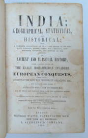
1858 INDIA HISTORY ILLUSTRATED antique Geographical, Statistical, and HistoricalJasper524.5(9.9k)See Sold PriceFeb 27, 2024
1822 MAP of NORTH & SOUTH AMERICA GEOGRAPHICAL STATISTICAL HISTORICAL antiqueJasper524.5(9.9k)See Sold PriceFeb 27, 2024
1822 MAP of CHILI GEOGRAPHICAL STATISTICAL HISTORICAL antique 17.5x 22" CHILEJasper524.5(9.9k)See Sold PriceFeb 27, 2024
1738 RUSSIA SIBERIA & GREAT TARTARY Description illustrated ANTIQUE in ENGLISHJasper524.5(9.9k)See Sold PriceFeb 27, 2024
Geographical, Statistical, and Historical Map of the Leeward Islands.Jasper524.5(9.9k)See Sold PriceFeb 27, 2024
Geographical Statistical and Historical Map of the Windward IslandsJasper524.5(9.9k)See Sold PriceFeb 27, 2024
Geographical, Statistical, and Historical Map of the West Indies.Jasper524.5(9.9k)See Sold PriceFeb 27, 2024
Clarke & Neele 1815 Map. Europe - Recent Political ChangesAlbion Auctions4.6(341)See Sold PriceMar 01, 2024