ATLAS of ANTIENT GEOGRAPHY by SAMUEL BUTLER 1843John McInnis Auctioneers,LLC4.5(505)See Sold PriceFeb 24, 2024
18TH C. ANTIQUE MAP: FRENCH & INDIAN WAR, FRAMEDThomaston Place Auction Galleries4.4(393)See Sold PriceFeb 24, 2024
Rand McNally Railroad Map Cabinet w/ 21 Railroad MapsRail & Road Auctions4.6(165)See Sold PriceMar 08, 2024
Keith Haring - Ink on New York Map, Best Buddies, Inscribed, Signed, and DatedSapphire Auction Gallery4(67)See Sold PriceMar 02, 2024
LATE 17TH C. FRENCH MAP OF THE NEW WORLD BY ALEXIS-HUBERT JAILLOT (1632-1712)Thomaston Place Auction Galleries4.4(393)See Sold PriceFeb 24, 2024
Central Railroad of New Jersey Map of Sandy Hook Route-ca. 1903JM Hobby Supply and Railroad Artifact Auctions4.4(127)See Sold PriceFeb 24, 2024
Lot of Six Mixed Atlas Box Cars-HO Scale-New in BoxJM Hobby Supply and Railroad Artifact Auctions4.4(127)See Sold PriceFeb 25, 2024
Rand McNally/Santa Fe Railroad Map of Iowa-1912JM Hobby Supply and Railroad Artifact Auctions4.4(127)See Sold PriceFeb 24, 2024
NICOLAES VISSCHER (NETHERLANDS, 1618-1709) MAP OF THE NEW WORLDThomaston Place Auction Galleries4.4(393)See Sold PriceFeb 24, 2024
17TH C. WORLD MAP BY NICOLAES VISSCHER (NETHERLANDS, 1618-1709)Thomaston Place Auction Galleries4.4(393)See Sold PriceFeb 24, 2024
Lot of Six Mixed Atlas Cabooses-HO Scale-New in BoxJM Hobby Supply and Railroad Artifact Auctions4.4(127)See Sold PriceFeb 25, 2024
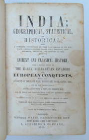
Geographical, Historical, and Statistical Map of TurkeyTitle/Content of Map: Geographical, Historical, and Statistical Map of Turkey. Date Printed: 1820 Cartographer: GROS, C./J. YEAGER Size (inches): x9.75 "Turkey in Europe and Asia. Including the placesSee Sold Price
Geographical, Historical, and Statistical Map ofMap Title: Geographical, Historical, and Statistical Map of Turkey. Publication Date: 1820Cartographer: GROS, C./J. YEAGER Publisher: MATHEW CAREY Size: 8.5 X 18.25 "Turkey in Europe and Asia. IncludiSee Sold Price
Geographical and Statistical Map of Turkey, 1820Title/Content of Map: Geographical, Historical, and Statistical Map of Turkey. Cartographer: GROS, C./J. YEAGER Size: 8.5X18.25 "Turkey in Europe and Asia. Including the places celebrated for battlesSee Sold Price
Geographical, Historical, and Statistical Map ofMap: Geographical, Historical, and Statistical Map of Turkey. Date: 1820 Cartographer: GROS, C./J. YEAGER Publisher: MATHEW CAREY Size (inches): 8.5X18.25 "Turkey in Europe and Asia. Including the plaSee Sold Price
Geographical, Historical and Statistical Map ofTitle: Geographical, Historical and Statistical Map of Massachusetts Publication Date: 1827 Cartographer: LUCAS, FIELDING JR. Publisher: CAREY & LEA Brief Descriptions: Map detailing counties, towns,See Sold Price
Geographical, Historical and Statistical Map ofTitle: Geographical, Historical and Statistical Map of Massachusetts Publication Date: 1827 Cartographer: LUCAS, FIELDING JR. Publisher: CAREY & LEA Brief Description: Map detailing counties, towns, rSee Sold Price
Geographical, Historical, and Statistical Map of IndiaTitle/Content of Map: Geographical, Historical, and Statistical Map of India. Date Printed: 1820 Cartographer: ASPIN, JEHOSOPHAT/J. KNEASS Size (inches): 13.6x12.75 "Hindoostan; or India: drawn from tSee Sold Price
Sold1821 Carey & Lea Map of North and South America1821 Carey & Lea map of North and South America. 1821 Geographical, Historical, and Statistical Map of America. from the third Philadelphia Edition. Printed by T. H. Palmer for M. Carey & Son, from thSee Sold Price
SoldMap of Pennsylvania, Carey & Lea 1828Title: Geographical, Historical and Statistical Map of Pennsylvania Subject: Pennsylvania Maker: Carey & Lea Date: 1827, Carey & Lea: Philadelphia Size: 11.8 x 17.8 inches Map detailing topography, toSee Sold Price
SoldMap of Massachusetts, Carey & Lea 1827Title: Geographical, Historical and Statistical Map of Massachusetts Subject: Massachusetts Maker: Carey & Lea Date: 1827, Carey & Lea: Philadelphia Size: 11.8 x 18.3 inches Map detailing counties, toSee Sold Price
SoldMap of New Hampshire, Carey & Lea 1829Title: Geographical, Historical and Statistical Map of New Hampshire Subject: New Hampshire Maker: Carey & Lea Date: 1827, Carey & Lea: Philadelphia Size: 11.8 x 8.8 inches Very detailed map showing cSee Sold Price
SoldFour Hand-Colored Maps of DelawareA grouping of four hand-colored maps of Delaware, to include a "Plan of Wilmington and its Environs", "A Geographical, Historical, and Statistical Map of Delaware", and two smaller colored maps. LargeSee Sold Price
SoldSet of four colored copper engraved geographical,Set of four colored copper engraved geographical, historical and statistical map of New Hampshire, Florida, Indiana and Michigan. sight size: 17" x 21 1/4"See Sold Price
SoldLavoisne: North and South America, 1821Map: Geographical, Historical, and Statistical Map of America. North America / South America Maker: Lavoisne Publisher: "Aspin, J. / E. Paguenaud. Philadelphia. M. Carey & Son. 1821 Size: North AmericSee Sold Price
Sold(2) EARLY 1800'S MAPS OF DELAWAREIncludes: "Geographical, Historical, and Statistical Map of Delaware"; pencil writing identifies it as from Delaware - Carey and Lea, Philadelphia, 1822, (page 19); drawn by F. Lucas Jr., Engraved bySee Sold Price
SoldEngraved Map of AmericaYoung & Delleker, 1821, "Geographical, Historical, and Statistical Map of America" with engraved maps, original coloring, 17" x 21 1/2" sight size, 24" x 29 3/4" framed.See Sold Price
Sold15 maps [mid-19th Century].[State Maps]. 15 maps mostly in color, early to mid-19th century. Largest two (listed first below) 17 3/8 x 11 11 1/4 in., smallest 6 1/4 x 5 1/4 in. ++ Geographical, Historical, And Statistical Map OSee Sold Price
1822 Atlas Map of Colombia, UnframedAmerican (Philadelphia, PA), 19th century. "Geographical, Historical, And Statistical Map Of Colombia". Colombia. No. 47. Map drawn by J. Finlayson and engraved by J. Yeager, published by Henry CharleSee Sold Price
1822 MAP: J FINLAYSON'S MEXICO AND INTERNAL PROVINCES 1Geographical, Historical and Statistical Map of Mexico and Internal Provinces. No. 38. from American Atlas, prepared from Humboldt's Map & other Documents by J. Finlayson. Engraved by Young & DellekerSee Sold Price
SoldSTATE I MAP OF CAREY AND LEA'S 1822 MAP OF MAINE.A geographical, historical and statistical map of Maine. The image of the state is color coded to conform to the text that surrounds the map in the original. This map can be found on pages 130-131 inSee Sold Price
Set of three colored copper engraved geographical,Set of three colored copper engraved geographical, historical and statistical maps of Virginia, Maryland, and Delaware. sight size: 17" x 21 1/4".See Sold Price
SoldGeographical and Statistical Map of Turkey.Title: Geographical and Statistical Map of Turkey. Publication Date: 1822 Cartographer: GROS, C./J. YEAGER Publisher: M. CAREY Size: 8.25Height - 17.75Width Restriking of Gros's Map of Turkey in EuropSee Sold Price
Geographical and Statistical Map of Turkey.Title/Content of Map: Geographical and Statistical Map of Turkey. Cartographer: GROS, C./J. YEAGER Date: 1822 Publisher: M. CAREY Size: 8.25Height - 17.75Width Restriking of Gros's Map of Turkey in EuSee Sold Price
Geographical and Statistical Map of Turkey.Title/Content of Map: Geographical and Statistical Map of Turkey. Date: 1822 Cartographer: GROS, C./J. YEAGER Size: 8.25x17.75 Restriking of Gros's Map of Turkey in Europe and Turkey in Asia... intendSee Sold Price
Nova Totius Full Color Geographical World MapThe Benefit Shop Foundation Inc.4.3(2.9k)See Sold PriceFeb 28, 2024
Vintage County Map Of NY State Plate EngravingThe Benefit Shop Foundation Inc.4.3(2.9k)See Sold PriceFeb 28, 2024
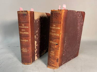
THE POPULAR AND CRITICAL BIBLE ENCYCLOPEDIA Scriptural Dictionary, 1901Neo FineArts Inc4.4(13)See Sold PriceFeb 25, 2024
Vintage Framed Pine Island & Lacoste Island MapThe Benefit Shop Foundation Inc.4.3(2.9k)See Sold PriceMar 06, 2024
1822 MAP of LEEWARD ISLANDS GEOGRAPHICAL STATISTICAL HISTORICAL antique 17.5x22"Jasper524.5(9.9k)See Sold PriceFeb 27, 2024
1822 MAP of SOUTH AMERICA GEOGRAPHICAL STATISTICAL HISTORICAL antique 17.5x 22"Jasper524.5(9.9k)See Sold PriceFeb 27, 2024
1858 INDIA HISTORY ILLUSTRATED antique Geographical, Statistical, and HistoricalJasper524.5(9.9k)See Sold PriceFeb 27, 2024
1908 KING COTTON HISTORICAL & STATISTICAL REVIEW J. WATKINS antique ILLUSTRATEDJasper524.5(9.9k)See Sold PriceFeb 27, 2024
1822 MAP of NORTH & SOUTH AMERICA GEOGRAPHICAL STATISTICAL HISTORICAL antiqueJasper524.5(9.9k)See Sold PriceFeb 27, 2024
1822 MAP of CHILI GEOGRAPHICAL STATISTICAL HISTORICAL antique 17.5x 22" CHILEJasper524.5(9.9k)See Sold PriceFeb 27, 2024
Geographical, Statistical, and Historical Map of the Leeward Islands.Jasper524.5(9.9k)See Sold PriceFeb 27, 2024
Geographical Statistical and Historical Map of the Windward IslandsJasper524.5(9.9k)See Sold PriceFeb 27, 2024
Geographical, Statistical, and Historical Map of the West Indies.Jasper524.5(9.9k)See Sold PriceFeb 27, 2024
Guthrie, William 1812 Antique Map. Spain and PortugalAlbion Auctions4.6(341)See Sold PriceMar 01, 2024
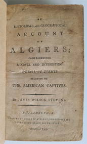
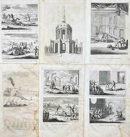
1797 PIRACY: A HISTORICAL & GEOGRAPHICAL ACCOUNT OF ANCIENNY Elizabeth 4.2(86)See Sold PriceMar 03, 2024
Antoine Augustin Calmet (1672-1757) - Set of 6 Religious Engravings - Tomb of Zechariah - Grotto ofProverde Auctions4.3(3)See Sold PriceFeb 28, 2024
Antoine Augustin Calmet (1672-1757) - Set of 6 Jewish Engravings - Tomb monument of the kings ofProverde Auctions4.3(3)See Sold PriceFeb 28, 2024
Antoine Augustin Calmet (1672-1757) - Set of 6 Architecture Engraving - Temple of Jerusalem -Proverde Auctions4.3(3)See Sold PriceFeb 28, 2024
George F. Cram - Historical Map of Pittsburgh Allegheny PennsylvaniaProverde Auctions4.3(3)See Sold PriceFeb 28, 2024
Map of Turkey from Arabic and Persia, 1701 by Gillaume de Lisle, ParisAntiques Online Auctions4.6(415)See Sold PriceMar 14, 2024


![15 maps [mid-19th Century]. (1 of 8)](https://p1.liveauctioneers.com/179/12368/3397009_1_x.jpg?height=282&quality=70&version=1175725014)