ATLAS of ANTIENT GEOGRAPHY by SAMUEL BUTLER 1843John McInnis Auctioneers,LLC4.6(502)See Sold PriceFeb 24, 2024
18TH C. ANTIQUE MAP: FRENCH & INDIAN WAR, FRAMEDThomaston Place Auction Galleries4.4(386)See Sold PriceFeb 24, 2024
Rand McNally Railroad Map Cabinet w/ 21 Railroad MapsRail & Road Auctions4.6(165)See Sold PriceMar 08, 2024
Keith Haring - Ink on New York Map, Best Buddies, Inscribed, Signed, and DatedSapphire Auction Gallery4(67)See Sold PriceMar 02, 2024
LATE 17TH C. FRENCH MAP OF THE NEW WORLD BY ALEXIS-HUBERT JAILLOT (1632-1712)Thomaston Place Auction Galleries4.4(386)See Sold PriceFeb 24, 2024
Central Railroad of New Jersey Map of Sandy Hook Route-ca. 1903JM Hobby Supply and Railroad Artifact Auctions4.4(126)See Sold PriceFeb 24, 2024
Lot of Six Mixed Atlas Box Cars-HO Scale-New in BoxJM Hobby Supply and Railroad Artifact Auctions4.4(126)See Sold PriceFeb 25, 2024
Rand McNally/Santa Fe Railroad Map of Iowa-1912JM Hobby Supply and Railroad Artifact Auctions4.4(126)See Sold PriceFeb 24, 2024
NICOLAES VISSCHER (NETHERLANDS, 1618-1709) MAP OF THE NEW WORLDThomaston Place Auction Galleries4.4(386)See Sold PriceFeb 24, 2024
17TH C. WORLD MAP BY NICOLAES VISSCHER (NETHERLANDS, 1618-1709)Thomaston Place Auction Galleries4.4(386)See Sold PriceFeb 24, 2024
Lot of Six Mixed Atlas Cabooses-HO Scale-New in BoxJM Hobby Supply and Railroad Artifact Auctions4.4(126)See Sold PriceFeb 25, 2024
SoldCram's Map of Pittsburgh (and Allegheny City), 1887Map: Pittsburgh (and Allegheny City) Maker: George F. Cram Date: 1887 Size: 21.5 x 14.5 in Please note that this lot has a confidential reserve. When you leave a bid in advance of the auction, submitSee Sold Price
SoldPittsburgh and Allegheny CityTitle: Pittsburgh and Allegheny City Publication Date: 1900 Cartographer: CRAM, GEORGE F. Publisher: CRAM, GEORGE F. Dimensions: 12.5 X 18.3 Additional Information: 104, 105Shows streets, railroads, pSee Sold Price
Sold1914 Plat Map City Of Pittsburgh North Side, AlleghenyArtist: G. M. Hopkins Company Maps Title: Plat Map of City Of Pittsburgh North Side (Allegheny City) newly accessioned by the City of Pittsburgh in 1914 , showing Real estate plat-book of the city ofSee Sold Price
SoldEarly 1900's Pittsburgh North Shore Plot Map AlleghenyPittsburgh North Shore Plot Map Allegheny City, Volume 1, Plate 1, circa early 1900's, print on paper with colored additions, 18.5 x 26.25, black matte frame: 26 x 34.25 x 0.75 inchesSee Sold Price
1887 Map of PittsburghAuthor: Cram Title: 1887 Map of Pittsburgh Medium: Ink on Paper Dimensions: 22"X15" Map of Pittsburgh dated 1887. Engraved and published by George Cram in Chicago. Part of his World Atlas. Double foliSee Sold Price
Sold1855 Colton Map of Cincinnati and Pittsburgh -- TheTitle/Content of Map: 1855 Colton Map of Cincinnati and Pittsburgh -- The Cities of Pittsburgh and Allegheny… [with] The City of Cincinnati Ohio Date: 1855, New York Cartographer: J ColtonSize: 13.8See Sold Price
1855 Colton Map of Cincinnati and Pittsburgh -- TheTitle: 1855 Colton Map of Cincinnati and Pittsburgh -- The Cities of Pittsburgh and Allegheny… [with] The City of Cincinnati Ohio Date: 1855, New York Cartographer: J Colton Size: 13.8 X 11.8 in. AdSee Sold Price
1855 Colton Map of Cincinnati and Pittsburgh -- TheTitle: 1855 Colton Map of Cincinnati and Pittsburgh -- The Cities of Pittsburgh and Allegheny… [with] The City of Cincinnati Ohio Date: 1855, New York Cartographer: J Colton Size: 13.8 X 11.8 in. AdSee Sold Price
1857 Colton Map of Cincinnati and Pittsburgh -- TheReserve Reduced! Title/Content of Map: 1857 Colton Map of Cincinnati and Pittsburgh -- The Cities of Pittsburgh and Allegheny… [with] The City of Cincinnati Ohio Date: 1855, New York Cartographer: JSee Sold Price
Cities of Pittsburgh and Allegheny (and) The City ofTitle: Cities of Pittsburgh and Allegheny (and) The City of Cincinnati Ohio. Publication Date: c1855 Cartographer: COLTON, G.W. & C.B. Publisher: G.W. & C.B. COLTON & CO. Size: 14 X 11 Two maps on samSee Sold Price
Sold1887 Map of LondonAuthor: Cram Title: 1887 Map of London Medium: Ink on Paper Dimensions: 22"X14.5" Map of city of London dated 1887. Double folio map engraved and published by George Cram in Chicago. Part of Cram's WoSee Sold Price
Sold1874 Colton Map of Pittsburgh and Cincinnati -- TheTitle/Content of Map: 1874 Colton Map of Pittsburgh and Cincinnati -- The Cities of Pittsburgh with Allegheny [on a sheet with] The City of Cincinnati Date: 1874 Philadelphia Cartographer: J Colton SiSee Sold Price
SoldColton: Antique Map of Cincinnati and Pittsburgh, 1856Title/Content of Map: 1856 Colton Map of Cincinnati and Pittsburgh -- The Cities of Pittsburgh and Allegheny... on sheet with The City of Cincinnati Ohio Date Printed: 1856, New York Cartographer: J CSee Sold Price
Colton: Antique Map of Pittsburgh and Cincinnati, 1874Title/Content of Map: 1874 Colton Map of Pittsburgh and Cincinnati -- The Cities of Pittsburgh with Allegheny [on a sheet with] The City of Cincinnati Date Printed: 1874 Philadelphia Cartographer: J CSee Sold Price
SoldPittsburgh/Allegheny, Pennsylvania. Cincinnati, OhioTITLE OF MAP (NOT PRINTED ON THE PAGE):'The Cities of Pittsburgh and Allegheny with parts of adjacent boroughs, Pennsylvania, and the City of Cincinnati, Ohio' DATE PRINTED: 1863 IMAGE SIZE: Approx 41See Sold Price
Sold1855 Map PITTSBURG AND ALLEGHENY.& Opening Of TheArtist: Colton's General Atlas Title: THE CITIES OF PITTSBURG AND ALLEGHENY...PENNSYLVANIA, Pittsburgh is shown here colored by ward, showing streets, main buildings, railroads, stations etc. Scale:See Sold Price
Sold1914 Plat Map of Pittsburgh Allegheny River BankArtist: G. M. Hopkins Company Maps Title: 1914 Plat Map of Pittsburgh Allegheny River Bank with Jos. Hornes, Fulton Building, and (Thomas) Jenkins Building (Arcade) Date: 1914 Medium: lithography DimeSee Sold Price
Sold 1898 Map of Pittsburgh, Allegheny and EnvironsArtist: R.L. Polk and Co., Publishers Title: 1898 Map of Pittsburgh, Allegheny and Environs Medium: lithograph Dimensions: 28 x 39 inches (sight) Signature: Copyrighted 1898 by R.L. Polk and Co, MadeSee Sold Price
Directory of Pittsburgh and Allegheny Cities, 1860-61Directory of Pittsburgh and Allegheny Cities and surrounds for 1860-61, published by Geo. H. Thurston 1860._x005F_x000D_ _x005F_x000D_ 364 pages plus ads. Reinforced binding. City: Pittsburgh and AlleSee Sold Price
Directory of Pittsburgh and Allegheny Cities, 1869-70Directory of Pittsburgh and Allegheny Cities, the Adjacent Burroughs, and Parts of the Adjacent Townships for 1869-70, compiled and published by Geo. H. Thurston, 1869._x005F_x000D_ _x005F_x000D_ 528See Sold Price
Directory of Pittsburgh and Allegheny Cities, 1868-69Directory of Pittsburgh and Allegheny Cities in the Adjacent Burroughs, Also Parts of the Adjacent Townships, for 1868-69, published by Geo. H. Thurston, 1868._x005F_x000D_ _x005F_x000D_ 440 pages pluSee Sold Price
Directory of Pittsburgh and Allegheny Cities, 1864-65Directory of Pittsburgh and Allegheny Cities, the Surrounding Burroughs and Villages, also Parts of the Adjacent Townships, for 1864-65. Published by Geo. H. Thurston, 1864._x005F_x000D_ _x005F_x000D_See Sold Price
Directory of Pittsburgh and Allegheny Cities, 1860-61Directory of Pittsburgh and Allegheny Cities and surrounds for 1860-61, published by Geo. H. Thurston 1860._x005F_x000D_ _x005F_x000D_ 364 pages plus ads. Reinforced binding. Provenance: Country (if nSee Sold Price
Directory of Pittsburgh and Allegheny Cities, 1874-75Directory of Pittsburgh and Allegheny Cities and Parts of Adjoining Townships for 1874-75, published and compiled by Thurston and Dieffenbacher, 1874._x005F_x000D_ _x005F_x000D_ Once owned by McFarlanSee Sold Price
Crams Colored Railway Map and Shippers Guide of South Dakota 1908-1909JM Hobby Supply and Railroad Artifact Auctions4.4(126)See Sold PriceFeb 24, 2024
Crams Map of North Dakota-Complete Railroad System and County Map-1907JM Hobby Supply and Railroad Artifact Auctions4.4(126)See Sold PriceFeb 24, 2024
Crams Railroad Map of New York-1881JM Hobby Supply and Railroad Artifact Auctions4.4(126)See Sold PriceFeb 24, 2024
Crams Township and Railroad Map of New York-1890JM Hobby Supply and Railroad Artifact Auctions4.4(126)See Sold PriceFeb 24, 2024
Crams Township and Railroad Map of Pennsylvania-1898JM Hobby Supply and Railroad Artifact Auctions4.4(126)See Sold PriceFeb 24, 2024
Kenyons Pocket Map and Shippers Guide of Wisconsin-1914JM Hobby Supply and Railroad Artifact Auctions4.4(126)See Sold PriceFeb 24, 2024
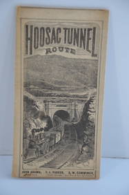
Fitchburg Railroad 1880 Hoosac Tunnel Route Public TimetableJM Hobby Supply and Railroad Artifact Auctions4.4(126)See Sold PriceFeb 24, 2024
1888 Hand Book of the Pennsylvania Lines Containing Maps of Principal Cities - First EditionRail & Road Auctions4.6(165)See Sold PriceMar 07, 2024
Pair of Early Railroad Maps - 1862 Pittsburgh, Ft. Wayne & Chicago Railway and 1873 PennsylvaniaRail & Road Auctions4.6(165)See Sold PriceMar 07, 2024
Hand Colored Map of the city of Amsterdam 1720Global Auctions Company4.3(36)See Sold PriceMar 03, 2024
Kansas City Southern Railway Pittsburgh Ticket Office Round Wax SealerRail & Road Auctions4.6(165)See Sold PriceMar 08, 2024
Kansas City Southern Lines Cram's Universal Terrestrial Globe 10 1/2"Rail & Road Auctions4.6(165)See Sold PriceMar 08, 2024
1887 Appletons' General Guide to the United State and Canada Part IIRail & Road Auctions4.6(165)See Sold PriceMar 08, 2024
William Pfahl 4 Views of the Pittsburgh Courthouse Pastel PtgsConcept Art Gallery4.7(508)See Sold PriceMar 06, 2024
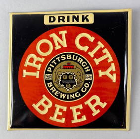
Vintage Iron City Beer TOC Advertising Beer SignMatthew Bullock Auctioneers4.7(1.8k)See Sold PriceMar 17, 2024
George F. Cram - Historical Map of Pittsburgh Allegheny PennsylvaniaProverde Auctions4.3(3)See Sold PriceFeb 28, 2024
Vintage Street Map of Pittsburgh, Pennsylvania - Rand McNallyProverde Auctions4.3(3)See Sold PriceFeb 28, 2024