Sold1914 Plat Map City Of Pittsburgh North Side, AlleghenyArtist: G. M. Hopkins Company Maps Title: Plat Map of City Of Pittsburgh North Side (Allegheny City) newly accessioned by the City of Pittsburgh in 1914 , showing Real estate plat-book of the city ofSee Sold Price
Sold1914 Plat Map of Pittsburgh Allegheny River BankArtist: G. M. Hopkins Company Maps Title: 1914 Plat Map of Pittsburgh Allegheny River Bank with Jos. Hornes, Fulton Building, and (Thomas) Jenkins Building (Arcade) Date: 1914 Medium: lithography DimeSee Sold Price
Sold1914 Plat Map City Of Pittsburgh TownArtist: G. M. Hopkins Company Maps Title: Plat Map City Of Pittsburgh Town showing many old landmarks , showing Real estate plat-book of the city of Pittsburgh : from official records, private plans aSee Sold Price
Sold1914 Plat Maps City Of Pittsburgh Lower Hill District &Artist: G. M. Hopkins Company Maps Title: Plat Maps City Of Pittsburgh Lower Hill District & Strip District Railroad yards and Lower Hill District and PRR Freight Depot Date: 1914 Medium: lithographySee Sold Price
Sold1914 Plat Maps City Of Pittsburgh Hill DistrictArtist: G. M. Hopkins Company Maps Title: Plat Maps of City Of Pittsburgh Upper and Lower Hill District, showing many old landmarks including Kosher Street, Wylie Avenue, Ebenezer Baptist Church , shoSee Sold Price
VICTORIAN DOG TOMBSTONE 19TH C. carved marble dogVICTORIAN DOG TOMBSTONE 19TH C. carved marble dog tombstone by Edward L. Kibel, sculptor, 240 West End Ave. Allegheny City, Pa. (North Side Pittsburgh). Reclining dog resting on scroll and acanthus deSee Sold Price
SoldEarly 1900's Pittsburgh North Shore Plot Map AlleghenyPittsburgh North Shore Plot Map Allegheny City, Volume 1, Plate 1, circa early 1900's, print on paper with colored additions, 18.5 x 26.25, black matte frame: 26 x 34.25 x 0.75 inchesSee Sold Price
Victorian Memento Mori shadow boxTitle: Victorian Memento Mori shadow box with carved and preserved natural flowers Box with original 19th Century Allegheny City funerary provider label (North Side, Pittsburgh) Medium: mixed media DiSee Sold Price
SoldColton: Antique Map of Cincinnati and Pittsburgh, 1856Title/Content of Map: 1856 Colton Map of Cincinnati and Pittsburgh -- The Cities of Pittsburgh and Allegheny... on sheet with The City of Cincinnati Ohio Date Printed: 1856, New York Cartographer: J CSee Sold Price
SoldAntique Eberhardt & Ober Brewing Co ChromolithographTitle: Eberhardt & Ober Brewing Company billboard print, showing the company in Allegheny PA, ( Pittsburgh's North Side) Date: undated, ca 1890's Medium: chromolithograph Dimensions: 27 x 42 inches DeSee Sold Price
Sold1855 Colton Map of Cincinnati and Pittsburgh -- TheTitle/Content of Map: 1855 Colton Map of Cincinnati and Pittsburgh -- The Cities of Pittsburgh and Allegheny… [with] The City of Cincinnati Ohio Date: 1855, New York Cartographer: J ColtonSize: 13.8See Sold Price
Sold1874 Colton Map of Pittsburgh and Cincinnati -- TheTitle/Content of Map: 1874 Colton Map of Pittsburgh and Cincinnati -- The Cities of Pittsburgh with Allegheny [on a sheet with] The City of Cincinnati Date: 1874 Philadelphia Cartographer: J Colton SiSee Sold Price
SoldCram's Map of Pittsburgh (and Allegheny City), 1887Map: Pittsburgh (and Allegheny City) Maker: George F. Cram Date: 1887 Size: 21.5 x 14.5 in Please note that this lot has a confidential reserve. When you leave a bid in advance of the auction, submitSee Sold Price
Colton: Antique Map of Pittsburgh and Cincinnati, 1874Title/Content of Map: 1874 Colton Map of Pittsburgh and Cincinnati -- The Cities of Pittsburgh with Allegheny [on a sheet with] The City of Cincinnati Date Printed: 1874 Philadelphia Cartographer: J CSee Sold Price
1855 Colton Map of Cincinnati and Pittsburgh -- TheTitle: 1855 Colton Map of Cincinnati and Pittsburgh -- The Cities of Pittsburgh and Allegheny… [with] The City of Cincinnati Ohio Date: 1855, New York Cartographer: J Colton Size: 13.8 X 11.8 in. AdSee Sold Price
1855 Colton Map of Cincinnati and Pittsburgh -- TheTitle: 1855 Colton Map of Cincinnati and Pittsburgh -- The Cities of Pittsburgh and Allegheny… [with] The City of Cincinnati Ohio Date: 1855, New York Cartographer: J Colton Size: 13.8 X 11.8 in. AdSee Sold Price
1857 Colton Map of Cincinnati and Pittsburgh -- TheReserve Reduced! Title/Content of Map: 1857 Colton Map of Cincinnati and Pittsburgh -- The Cities of Pittsburgh and Allegheny… [with] The City of Cincinnati Ohio Date: 1855, New York Cartographer: JSee Sold Price
SoldPittsburgh/Allegheny, Pennsylvania. Cincinnati, OhioTITLE OF MAP (NOT PRINTED ON THE PAGE):'The Cities of Pittsburgh and Allegheny with parts of adjacent boroughs, Pennsylvania, and the City of Cincinnati, Ohio' DATE PRINTED: 1863 IMAGE SIZE: Approx 41See Sold Price
Cities of Pittsburgh and Allegheny (and) The City ofTitle: Cities of Pittsburgh and Allegheny (and) The City of Cincinnati Ohio. Publication Date: c1855 Cartographer: COLTON, G.W. & C.B. Publisher: G.W. & C.B. COLTON & CO. Size: 14 X 11 Two maps on samSee Sold Price
SoldBoat and Barge Traffic on the AlleghenyArtist: 20th Century Western Pa. Title: Nocturnal View of Pittsburgh from The Northside Medium: oil on canvas Dimensions: 23 x 30 inches Signature: unsigned Frame Type: gilded wood frame <See Sold Price
SoldPlan of the City of Philadelphia and CamdenTitle: Plan of the City of Philadelphia and Camden Publication Date: 1879 ca. Cartographer: GAMBLE, W. H. Publisher: S. Augustus Mitchell, Jr. Size: 13.75x20.6 The city shown north to Allegheny AvenueSee Sold Price
SoldOriginal 1888 Butte City Mont. Territory Plat MapThis is an original plat map of Butte City, Montana Territory from 1888. The map shows what was once a bustling business district in Butte that included saloons, cigar stores, billiard halls, brewerieSee Sold Price
SoldRollandet Map of Denver, COROLLANDET, Edward (1852-1914). Rollandet's Map of the City of Denver Colorado (Fourth Edition, February 1, 1889). Photolithograph with color. Julius Bien & Co., 1889. 27" x 25" sheet. Rare 1889 map ofSee Sold Price
SoldPittsburgh and Allegheny CityTitle: Pittsburgh and Allegheny City Publication Date: 1900 Cartographer: CRAM, GEORGE F. Publisher: CRAM, GEORGE F. Dimensions: 12.5 X 18.3 Additional Information: 104, 105Shows streets, railroads, pSee Sold Price
Crawfordsville and Southwestern RY First Mortgage Bond Prospectus Book-1872JM Hobby Supply and Railroad Artifact Auctions4.4(126)See Sold PriceFeb 24, 2024
Hammonds Map of Kentucky and Tennessee Railroads-1910JM Hobby Supply and Railroad Artifact Auctions4.4(126)See Sold PriceFeb 24, 2024
Kenyons Pocket Map and Shippers Guide of Wisconsin-1914JM Hobby Supply and Railroad Artifact Auctions4.4(126)See Sold PriceFeb 24, 2024
Northern Pacific RR Washington and Northern Idaho Map Folder-1941JM Hobby Supply and Railroad Artifact Auctions4.4(126)See Sold PriceFeb 24, 2024
Erie Railway Tourist Book/Magazine-1874JM Hobby Supply and Railroad Artifact Auctions4.4(126)See Sold PriceFeb 24, 2024
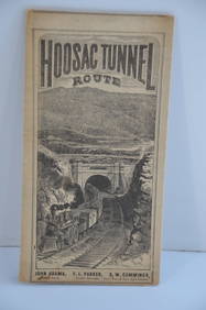
Fitchburg Railroad 1880 Hoosac Tunnel Route Public TimetableJM Hobby Supply and Railroad Artifact Auctions4.4(126)See Sold PriceFeb 24, 2024
Lake Shore and Michigan Southern RR Special Excursions Timetable-July 7-13, 1892JM Hobby Supply and Railroad Artifact Auctions4.4(126)See Sold PriceFeb 24, 2024
Pennsylvania Central/Pittsburgh Ft Wayne and Chicago 1870 Public TimetableJM Hobby Supply and Railroad Artifact Auctions4.4(126)See Sold PriceFeb 24, 2024
No Reserve Antique North West Persian Rug 10 ft 6 in x 5 ft 1 in (3.2 m x 1.54 m)Nazmiyal Auctions4.4(34)See Sold PriceFeb 25, 2024
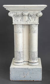
Neoclassical Painted Wood Plant Stand PedestalAuctions at Showplace4.5(726)See Sold PriceMar 12, 2024
Westland Oil Company North Dakota Road MapCheck the Oil Promotions, LLC4.6(275)See Sold PriceFeb 25, 2024
Large lot of assorted prints. 18th-20th century. To include: North American and other maps, CivilTremont Auctions4.6(293)See Sold PriceFeb 25, 2024
A "Red Book" of the Greatest War of History 1914North American Artifact Auctions4.6(182)See Sold PriceApr 20, 2024
[ARCTIC]. BOWEN, Emanuel. A New & Accurate Map of the North...Potter & Potter Auctions4.6(539)See Sold PriceMar 07, 2024
William Pfahl 4 Views of the Pittsburgh Courthouse Pastel PtgsConcept Art Gallery4.7(508)See Sold PriceMar 06, 2024
Herman Moll A New Map of Ye North Parts of AmericaWillow Auction House4.5(283)See Sold PriceMar 14, 2024


![[ARCTIC]. BOWEN, Emanuel. A New & Accurate Map of the North... (1 of 1)](https://p1.liveauctioneers.com/928/318880/171360917_1_x.jpg?height=282&quality=70&version=1707501302)