ATLAS of ANTIENT GEOGRAPHY by SAMUEL BUTLER 1843John McInnis Auctioneers,LLC4.5(505)See Sold PriceFeb 24, 2024
18TH C. ANTIQUE MAP: FRENCH & INDIAN WAR, FRAMEDThomaston Place Auction Galleries4.4(393)See Sold PriceFeb 24, 2024
Rand McNally Railroad Map Cabinet w/ 21 Railroad MapsRail & Road Auctions4.6(165)See Sold PriceMar 08, 2024
Keith Haring - Ink on New York Map, Best Buddies, Inscribed, Signed, and DatedSapphire Auction Gallery4(67)See Sold PriceMar 02, 2024
LATE 17TH C. FRENCH MAP OF THE NEW WORLD BY ALEXIS-HUBERT JAILLOT (1632-1712)Thomaston Place Auction Galleries4.4(393)See Sold PriceFeb 24, 2024
Central Railroad of New Jersey Map of Sandy Hook Route-ca. 1903JM Hobby Supply and Railroad Artifact Auctions4.4(127)See Sold PriceFeb 24, 2024
Lot of Six Mixed Atlas Box Cars-HO Scale-New in BoxJM Hobby Supply and Railroad Artifact Auctions4.4(127)See Sold PriceFeb 25, 2024
Rand McNally/Santa Fe Railroad Map of Iowa-1912JM Hobby Supply and Railroad Artifact Auctions4.4(127)See Sold PriceFeb 24, 2024
NICOLAES VISSCHER (NETHERLANDS, 1618-1709) MAP OF THE NEW WORLDThomaston Place Auction Galleries4.4(393)See Sold PriceFeb 24, 2024
17TH C. WORLD MAP BY NICOLAES VISSCHER (NETHERLANDS, 1618-1709)Thomaston Place Auction Galleries4.4(393)See Sold PriceFeb 24, 2024
Lot of Six Mixed Atlas Cabooses-HO Scale-New in BoxJM Hobby Supply and Railroad Artifact Auctions4.4(127)See Sold PriceFeb 25, 2024
SoldColton. Map of New York... Adjacent Counties.1856.[America/ New York] Colton, George Woolworth. “Map of New York and the Adjacent Counties.” New York, J.H. Colton, 1856. Engraved map. 24 1/2” x 15 1/8”. Framed: 34” x 24&See Sold Price
SoldColton's Map of New YorkTitle: Colton's Map of New York and the Adjacent Cities Author: Colton, J.H. Description: Lithographed map, hand-colored. 37x62 cm. (14½x24½") plus decorative border.New York City oriented to the weSee Sold Price
New York & Adjacent Cities J. H. Colton. 1885Item: New York & Adjacent Cities J. H. Colton. 1885 Description: A rare and beautiful example of J. H. Colton map of New York City and vicinity, including Manhattan as well as parts of Brooklyn, JerseSee Sold Price
Map of New York & Adjacent Cities 1864Map: Map of New York and the Adjacent Cities Maker: Johnson & Ward, Colton, Joseph Hutchins Publishing: New York 1864 Size: 16 x 26 inches Colton plan reissued by Johnson with a different border PleasSee Sold Price
Sold1855 Colton Map of New York City and Parts of BrooklynReserve Reduced! Title/Content of Map: 1855 Colton Map of New York City and Parts of Brooklyn -- Map of New York and the Adjacent Cities Date: 1855, New York Cartographer: J Colton Size: 15.5 X 25.1 iSee Sold Price
SoldAntebellum Colton Map of New York CityAntebellum Colton Map of New York CityMap of New York and the Adjacent Cities (New York: J. R. Colton & co., 1855), steel engraving with color from Colton's General Atlas; presented in two-sided woodeSee Sold Price
Near Fine example 1st ed. of Colton’s 1855 map of New YorkNear fine 1855 first edition example of Colton's map of New York from the first edition of Colton’s Atlas of the World. Covers the entire state as well as adjacent parts of Vermont, MassachusettSee Sold Price
J.H. Colton: New York & Adjacent Cities 1856Map: Map of New York and the Adjacent Cities Maker: J.H. Colton Publishing: J.H. Colton & Co.: New York Date: 1856 Size: 14.3 x 24.5 inches Map showing wards separately colored, streets, squares, etc.See Sold Price
SoldMap of New York and the Adjacent Cities.Title: Map of New York and the Adjacent Cities. Date: 1858 Cartographer: COLTON, JOSEPH HUTCHINS Size: 15.75 X 25 Browned. Margin spotted. Centerfold repaired. Please note that this lot has a confidenSee Sold Price
Map of New York and the Adjacent Cities.Publication Date: 1864 Title: Map of New York and the Adjacent Cities. Cartographer: COLTON, JOSEPH HUTCHINS Height: 16Width: 26 Colton plan reissued by Johnson with a different border. The plan is idSee Sold Price
1855 Colton Map of Boston -- Map of Boston and AdjacentTitle: 1855 Colton Map of Boston -- Map of Boston and Adjacent Cities Date: 1855, New York Cartographer: J Colton Size: 14.7 X 12 in. Additional Information: This is a very attractive city map. It isSee Sold Price
1855 Colton Map of Boston -- Map of Boston and AdjacentTitle: 1855 Colton Map of Boston -- Map of Boston and Adjacent Cities Date: 1855, New York Cartographer: J Colton Size: 14.7 X 12 in. Additional Information: This is a very attractive city map. It isSee Sold Price
SoldPocket map of New England 1867Heading: (New England) Author: Colton, G. Woolworth Title: G. Woolworth Colton's railroad, township & distance map of New England with adjacent portions of New York, Canada & New Brunswick Place PubliSee Sold Price
SoldG. Woolworth Colton's Railroad Map. New England.[New England] Colton, George Woolworth (American, 1827-1901). "G. Woolworth Colton's Railroad, Township and Distance Map of New England with Adjacent Portions of New York, Canada and New Brunswick." GSee Sold Price
SoldColton (G.W. and C.B.) - G.Woolworth Colton's New Planfolding pocket map with inset plan of The Upper Part of New York City with the adjacent portion of Westchester County, upper left, engraved plan with original hand-colouring, the full sheet 630 x 480mSee Sold Price
SoldColton, G. W.; & C. B.40. Colton, G. W.; & C. B..Railroad, Township & Distance Map of New England with adjacent portions of New York, Canada & New Brunswick. 40 x 28 inches, folding into an 8vo cloth holder (moderate wear)See Sold Price
1855 Colton Map of New York -- New YorkReserve Reduced! Title/Content of Map: 1855 Colton Map of New York -- New York Date: 1855, New York Cartographer: J Colton Size: 11.8 X 14.7 in. This is a very nice map of New York state with the inseSee Sold Price
Sold1855 Colton Map of New York -- New YorkTitle: 1855 Colton Map of New York -- New York Date: 1855, New York Cartographer: J Colton Size: 11.8 X 14.7 in. Additional Information: This is a very nice map of New York state with the insets of NeSee Sold Price
Colton: Map of New York New Jersey Pennsylvania, 1860Map: New York, New Jersey, Pennsylvania & Delaware Date: 1860 Size: 11.5 x 13.5 inches From Colton's "School Atlas". With Inset of Vicinity of New York City and inset of Philadelphia. Please note thatSee Sold Price
1855 Colton Map of New York -- New YorkTitle/Content of Map: 1855 Colton Map of New York -- New York Date: 1855, New York Cartographer: J Colton Size: 11.8 X 14.7 in. This is a very nice map of New York state with the insets of New York CiSee Sold Price
SoldHand Painted Colton Map of New York GeographicusThis lot features a hand painted Colton Map of New York. This is the uncommon 1857 issue of J. H. Colton’s map of New York. Covers the entire state including Lake Ontario, Long Island, and detailedSee Sold Price
Colton Map of New York 1870Colton, George W. (1827 - 1901). Colton's Railroad & Township Map of the State of New York With Parts Of the Adjoining States and Canada. Lithographed map. Colton & Co., 1870. 23" x 24 ¾" sheet. HiSee Sold Price
Colton Map of New York 1871Colton, George W. (1827 - 1901). Colton's Railroad & Township Map of the State of New York With Parts Of the Adjoining States and Canada. Lithographed map. Colton & Co., 1871. 23" x 24 ¾" sheet. HiSee Sold Price
Colton Map of New York 1870Colton, George W. (1827 - 1901). Colton's Railroad & Township Map of the State of New York With Parts Of the Adjoining States and Canada. Lithographed map. Colton & Co., 1870. 24" x 28" sheet. Map folSee Sold Price
1892 Adams and Bowles New Road Map of the State of New YorkJM Hobby Supply and Railroad Artifact Auctions4.4(127)See Sold PriceFeb 24, 2024
Crams Railroad Map of New York-1881JM Hobby Supply and Railroad Artifact Auctions4.4(127)See Sold PriceFeb 24, 2024
Crams Township and Railroad Map of New York-1890JM Hobby Supply and Railroad Artifact Auctions4.4(127)See Sold PriceFeb 24, 2024
Erie Railway Tourist Book/Magazine-1874JM Hobby Supply and Railroad Artifact Auctions4.4(127)See Sold PriceFeb 24, 2024
19thc Colton Map, Comparitive Size of Lakes & IslandsConnoisseur Auctions3.9(336)See Sold PriceFeb 24, 2024
George Hayward - Map of the City of New York 1854Dane Fine Art Auctions4.4(498)See Sold PriceMar 07, 2024
Vintage County Map Of NY State Plate EngravingThe Benefit Shop Foundation Inc.4.3(2.9k)See Sold PriceFeb 28, 2024
1855 Map of New York & Erie Railroad and 1917 Trespassing On Railway Property Is A MisdemeanorRail & Road Auctions4.6(165)See Sold PriceMar 07, 2024
Keith Haring - Ink on New York Map, Best Buddies, Inscribed, Signed, and DatedSapphire Auction Gallery4(67)See Sold PriceMar 02, 2024
1867 Map of the Railroads of The State of New YorkRail & Road Auctions4.6(165)See Sold PriceMar 08, 2024
1919 The Story of The Great War by Official Sources Volumes 1,2,3,8.North American Artifact Auctions4.7(198)See Sold PriceApr 20, 2024
Keith Haring Artwork Signed on a Shell Oil New York Road Map 18 in. x 24 in.Donny Malone Auctions4.4(1.8k)See Sold PriceMar 04, 2024
Group of Vintage travel maps and bookletsBaker's Antiques and Auctions3.2(471)See Sold PriceFeb 25, 2024
Black and white map of part of New York City (mostly Manhattan)Proverde Auctions4.3(3)See Sold PriceFeb 28, 2024
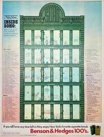
Map Inside Soho - Manhattan - New York Magazine 1974Proverde Auctions4.3(3)See Sold PriceFeb 28, 2024
Laminated Unique Media New York City MapRapid Estate Liquidators and Auction Gallery4.5(1.1k)See Sold PriceFeb 29, 2024