ATLAS of ANTIENT GEOGRAPHY by SAMUEL BUTLER 1843John McInnis Auctioneers,LLC4.5(505)See Sold PriceFeb 24, 2024
18TH C. ANTIQUE MAP: FRENCH & INDIAN WAR, FRAMEDThomaston Place Auction Galleries4.4(393)See Sold PriceFeb 24, 2024
Rand McNally Railroad Map Cabinet w/ 21 Railroad MapsRail & Road Auctions4.6(165)See Sold PriceMar 08, 2024
Keith Haring - Ink on New York Map, Best Buddies, Inscribed, Signed, and DatedSapphire Auction Gallery4(67)See Sold PriceMar 02, 2024
LATE 17TH C. FRENCH MAP OF THE NEW WORLD BY ALEXIS-HUBERT JAILLOT (1632-1712)Thomaston Place Auction Galleries4.4(393)See Sold PriceFeb 24, 2024
Central Railroad of New Jersey Map of Sandy Hook Route-ca. 1903JM Hobby Supply and Railroad Artifact Auctions4.4(127)See Sold PriceFeb 24, 2024
Lot of Six Mixed Atlas Box Cars-HO Scale-New in BoxJM Hobby Supply and Railroad Artifact Auctions4.4(127)See Sold PriceFeb 25, 2024
Rand McNally/Santa Fe Railroad Map of Iowa-1912JM Hobby Supply and Railroad Artifact Auctions4.4(127)See Sold PriceFeb 24, 2024
NICOLAES VISSCHER (NETHERLANDS, 1618-1709) MAP OF THE NEW WORLDThomaston Place Auction Galleries4.4(393)See Sold PriceFeb 24, 2024
17TH C. WORLD MAP BY NICOLAES VISSCHER (NETHERLANDS, 1618-1709)Thomaston Place Auction Galleries4.4(393)See Sold PriceFeb 24, 2024
Lot of Six Mixed Atlas Cabooses-HO Scale-New in BoxJM Hobby Supply and Railroad Artifact Auctions4.4(127)See Sold PriceFeb 25, 2024
Sold1855 Colton Map of Boston -- Map of Boston and AdjacentTitle/Content of Map: 1855 Colton Map of Boston -- Map of Boston and Adjacent Cities Date: 1855, New York Cartographer: J ColtonSize: 14.7 X 12 in. This is a very attractive city map. It is full of deSee Sold Price
1855 Colton Map of Boston -- Map of Boston and AdjacentTitle: 1855 Colton Map of Boston -- Map of Boston and Adjacent Cities Date: 1855, New York Cartographer: J Colton Size: 14.7 X 12 in. Additional Information: This is a very attractive city map. It isSee Sold Price
1855 Colton Map of Boston -- Map of Boston and AdjacentReserve Reduced! Title/Content of Map: 1855 Colton Map of Boston -- Map of Boston and Adjacent Cities Date: 1855, New York Cartographer: J Colton Size: 14.7 X 12 in. This is a very attractive city mapSee Sold Price
1855 Colton Map of Boston -- Map of Boston and AdjacentReserve Reduced! Title/Content of Map: 1855 Colton Map of Boston -- Map of Boston and Adjacent Cities Date: 1855, New York Cartographer: J Colton Size: 14.7 X 12 in. This is a very attractive city mapSee Sold Price
1855 Colton Map of Boston -- Map of Boston and AdjacentTitle: 1855 Colton Map of Boston -- Map of Boston and Adjacent Cities Date: 1855, New York Cartographer: J Colton Size: 14.7 X 12 in. Additional Information: This is a very attractive city map. It isSee Sold Price
SoldJ.H. COLTON HAND COLORED MAP OF BOSTON, 1855Joseph Hutchins Colton, American (1800-1893). Hand-colored engraving titled "Colton's Map of Boston and Adjacent Cities". Plate No. 13 from Colton's "Atlas of the World", published by Johnson & BrowniSee Sold Price
SoldColton's Map of Boston 1855Title: Colton's Map of Boston and Adjacent Cities Author: Colton, J.H. Description: Lithographed map, hand-colored. 35x28 cm. (14x11") plus decorative border.Plan of the city prior to filling in the BSee Sold Price
Colton's Map of Boston 1855Title: Colton's Map of Boston and Adjacent Cities Author: Colton, J.H. Description: Lithographed map, hand-colored. 35x28 cm. (14x11") plus decorative border.Plan of the city prior to filling in the BSee Sold Price
SoldJ. H. COLTON MAP OF BOSTON AND ADJACENT CITIESJ. H. COLTON MAP OF BOSTON AND ADJACENT CITIES, hand-colored. Modern frame. Published 1855. 18" x 15 1/4" sight.Excellent condition.Provenance: From the collection of the late Ed Kleppinger of New OrlSee Sold Price
Sold''Colton's Map of Boston and Adjacent Cities''Colton's Map of Boston and Adjacent Cities''- lithographed map with hand-coloring, with decorative border. 1855. 14 x 11 1/4'' together with ''Map of the Mining Clains adjoining Leadville'' by EduarSee Sold Price
SoldMap of Boston and adjacent cities.Title: Map of Boston and adjacent cities. Publication Date: 1856 Publisher: J. H. Colton & Company Dimensions: 15.6 X 11.75 Additional Information: First edition. Decorated border.Edges browned. ReserSee Sold Price
Boston and Adjacent Cities.Title/Content of Map: Boston and Adjacent Cities. Date: 1876 Cartographer: GRAY, ORMANDO W. Publisher: O.W. GRAY & SON Size: 16.75Height - 21.75Width 36-37. On reverse only text. Short fold repair ResSee Sold Price
Sold1861 & 1855 Maps of Boston(1) 1861 map by W. C. Sharp, Boston. Advertising to reverse. Fold crease separations, some with tape repairs. 10 1/2" x 11 1/4" approx. (2) 1855 map engraved by G. W. Boynton. Very good condition; ageSee Sold Price
SoldColton: Antique Map of Boston, 1861Title/Content of Map: Boston by Colton Date Printed: 1861 Cartographer: J.H. Colton Material/Medium: Paper Size: 14" x 17 1/4" Hand colored, steel engraved. From Colton's 'General Atlas'. Published inSee Sold Price
SoldBoston.Map of Boston and the Country Adjacent fromBoston.Map of Boston and the Country Adjacent from Actual Surveys. 45 x 43-1/2 inches 36 sections, linen-backed; moderate wear. Boston: A. Williams, 1881See Sold Price
Sold1886 Williams Pocket Map of Greater BostonTitle: 1886 Williams Pocket Map of Greater Boston -- Map of Boston and the Country Adjacent, from Actual Surveys Cartographer: A Williams Origin/Date: 1886, Boston Size: 31 inches x 21 inches folded oSee Sold Price
SoldBOSTON MAPS. Map of Boston and the Country Adjacent, from Actual Surveys published by the Bosto...BOSTON MAPS. Map of Boston and the Country Adjacent, from Actual Surveys published by the Boston Map Store. Boston: Damrell & Upham, 1888. Engraved maps in colors, on paper backed with linen, foldingSee Sold Price
Scarce Plan of Boston & Adj. Cities, c1886Colton’s scarce, detailed map of Boston and vicinity. Colored by wards. Includes streets, wharfs, Railroad lines, public buildings and many other details. This authentic vintage map comes from tSee Sold Price
SoldGroup of (3) Boston Ship's Maps Circa 1850's. IncludesGroup of (3) Boston Ship's Maps Circa 1850's. Includes ''A Map of Boston, County of suffolk and the Adjacent Towns'' 13''x13.75'', ''Boston Harbor, Charts of the Coast and Harbors of New England AprilSee Sold Price
Sold1855 Colton Map of New York City and Parts of BrooklynReserve Reduced! Title/Content of Map: 1855 Colton Map of New York City and Parts of Brooklyn -- Map of New York and the Adjacent Cities Date: 1855, New York Cartographer: J Colton Size: 15.5 X 25.1 iSee Sold Price
SoldMap of Boston, 1806Title: Boston, and its Environs Author: Phillips, Richard Description: Copper-engraved map. 20x32 cm. (8x12½"). Boston, the harbor, and adjacent areas. From Marshall's Life of Washington. Place PubliSee Sold Price
Soldlarge Hampden County, MA map made in Boston dated 1855large Hampden County, MA map made in Boston dated 1855 featuring Springfield, Longmeadow & numerous other Western MA townsSee Sold Price
SoldFramed c. 1855 Colton Map of ChinaHand colored in pink and green, inset maps in lower left quadrant "Harbor & Island of Amoy" and "Canton and Adjacent Islands", under glass in wood frame; 18"W, 15"HSee Sold Price
Sold18TH C. MAPS OF PHILADELPHIA & BOSTONMap of Philadelphia and parts adjacent, by N. Scull and G. Heap and Boston town plan and harbor chart; Hand-colored engravings (framed separately); Each: 12" x 14"See Sold Price
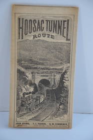
Fitchburg Railroad 1880 Hoosac Tunnel Route Public TimetableJM Hobby Supply and Railroad Artifact Auctions4.4(127)See Sold PriceFeb 24, 2024
19thc Colton Map, Comparitive Size of Lakes & IslandsConnoisseur Auctions3.9(336)See Sold PriceFeb 24, 2024
1818 RARE Geography Made Easy MAPS Jedidiah Morse Boston Indians Atlas AsiaSchilb Antiquarian Rare Books4.8(428)See Sold PriceMar 31, 2024
1853 Colton's Railroad & Township Map of Massachusetts, Rhode Island, and ConnecticutRail & Road Auctions4.6(165)See Sold PriceMar 07, 2024
1855 Map of New York & Erie Railroad and 1917 Trespassing On Railway Property Is A MisdemeanorRail & Road Auctions4.6(165)See Sold PriceMar 07, 2024
Pair of Early Railroad Maps - 1862 Pittsburgh, Ft. Wayne & Chicago Railway and 1873 PennsylvaniaRail & Road Auctions4.6(165)See Sold PriceMar 07, 2024
[CHICAGO]. Rare Pre-Fire Illinois Map: “Blanchard’s Map of ...Potter & Potter Auctions4.6(545)See Sold PriceMar 07, 2024
1855 NOTES ON CENTRAL AMERICA by E. G. Squier antique w/ MAPSJasper524.5(9.9k)See Sold PriceFeb 27, 2024
1834 Malte-Brun Map of the Caribbean -- West India IslandsJasper524.5(9.9k)See Sold PriceFeb 27, 2024
West Africa. Liberia Sahara Senegambia Guinea. Mountains of Kong COLTON 1869 mapJasper524.5(9.9k)See Sold PriceFeb 28, 2024
North west Africa. Liberia inset. Sahara Senegambia Guinea. COLTON 1863 mapJasper524.5(9.9k)See Sold PriceFeb 28, 2024
Carte de la Guinée, contenant…'. Guinea & Cape Verde islands. BONNE 1771 mapJasper524.5(9.9k)See Sold PriceFeb 28, 2024
Stanford, Edward 1901 Large Map. Burma and Adjacent CountriesAlbion Auctions4.6(341)See Sold PriceMar 01, 2024
Rare 19thc Colton Map, Argentine Republic, Chile, Uruguay, PataguayConnoisseur Auctions3.9(336)See Sold PriceMar 16, 2024
Reprint From The Original Coltons Map 1855 No.30 Copyright 1967Rapid Estate Liquidators and Auction Gallery4.5(1.1k)See Sold PriceFeb 29, 2024


![[CHICAGO]. Rare Pre-Fire Illinois Map: “Blanchard’s Map of ... (1 of 2)](https://p1.liveauctioneers.com/928/318880/171361260_1_x.jpg?height=282&quality=70&version=1707501302)


