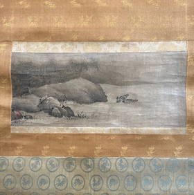
Soldc. 1650 MOSCOVI, Map of Moscow and LithuaniaMapsc. 1650 Map of “Moscow” and Lithuania c. 1650 “MOSCOVI”, Map of Moscow & Lithuania, [France?], Choice Very Fine. Handcolored in outline, 5” x 6.75” image on 6.5See Sold Price
SoldP. Buache Map of RussiaCartographer: Buache, Philippe (after Guillaume de L'Isle) Title: Carte de Moscovie (Map of Russia) Subject: Russia, Moscow, Ukraine, Lithuania Published: Paris: Li‚baux le fils Date: c. 1780 DeSee Sold Price
Sold1730 Covens & Mortier Map of Poland, Lithuania, LatviaTitle: 1730 Covens & Mortier Map of Poland, Lithuania, Latvia to Moscow -- Tabula Regni Poloniae Ducatus Lithuaniae &c. / La Pologne Dressee sur ce qu'en ont donne Starovolsk, Beauplan, Hartnoch, et aSee Sold Price
SoldJANSON C. 1650 MAP OF STAFFORDSHIRE ETCHand colored engraved map. Attractive coloring. Center fold. Dimensions: (Frame) H 24" x W 28" (Sight) H 17.5" x W 21.5" Condition: Paper generally clean and bright. Bright coloring.See Sold Price
SoldJANSON, HONDIAS C. 1650 MAP OF NORTH AMERICAOriginal hand colored engraving with center fold. French text verso. Titled "America Septentrionalis." Famous map with California as an island. Dimensions: (Frame) H 26" x W 29", (Sight) H 19.25" x WSee Sold Price
Soldc. 1650 Map: Mar del Zur Hispanis Mare PacificumHistoric Maps c. 1650 Hand-Colored Map "Mar del Zur Hispanis Mare Pacificum" by Joannes Jansson with California as an Island Earliest Pacific Sea Chart of the to Appear in a Dutch Atlas c. 1650, Hand-See Sold Price
c. 1650 Map - NY & New England“Upside Down” Map of New York and New England! c. 1650, [NEW YORK & NEW ENGLAND]: “NOVA BELGICA ET ANGLIA NOVA,” by Willem Blaeu, Amsterdam, Fine. 15.25” x 20” handSee Sold Price
JANSON C. 1650 MAP OF STAFFORDSHIRE ETCHand colored engraved map. Attractive coloring. Center fold. Dimensions: (Frame) H 24" x W 28" (Sight) H 17.5" x W 21.5" Condition: Paper generally clean and bright. Bright coloring.See Sold Price
SoldJansson Map of Overijssel, c. 1650,Jansson Map of Overijssel, c. 1650,map, "Ditio Trans-Isulana", by Johannes Jansson, Holland, c. 1650, colored map showing Overijssel Region of the Netherlands, top oriented to the west, three decoratiSee Sold Price
SoldG. Valk & P. Schenk Map of Ancient Spain C.1650G. Valk & P. Schenk Map of Spain of the Ancient Roman Province, c. 1650. Map titled "Parte de Casiglga". Map measures 24-3/8" x 20-3/8" sheet size. Unframed, loose and not glued or mounted. ProvenanceSee Sold Price
SoldG. Valk & P. Schenk Map of Ancient Spain C.1650G. Valk & P. Schenk Map of Spain of the Ancient Roman Province, c. 1650. Map titled "Parte de Casiglga". Map measures 24-3/8" x 20-3/8" sheet size. Unframed, loose and not glued or mounted. If lot isSee Sold Price
Soldc 1650 Color Map, NOVA VIRGINIAE TABULA, MontanusHistoric Maps "NOVA VIRGINIAE TABULA" by Arnoldus Montanus c. 1650, Early Hand-Colored Map of America titled, "NOVA VIRGINIAE TABULA", by Arnoldus Montanus, after John Smith's Map, Choice Very Fine. TSee Sold Price
SoldRobert Morden (c. 1650-1703) Map of ScotlandRobert Morden (c. 1650-1703) Map of Scotland Hand-colored engraving. 14 x 17 in.See Sold Price
SoldJansson. Virginiae Partis Australis... c.1650.[America/ Virginia] Jansson, Jan. “Virginiae Partis Australis et Floridae Partis Orientalis interjacentiumque regionum Nova Descriptio.” Amsterdam, c. 1650. Engraved map. 15” x 19 5/See Sold Price
SoldJansson. Virginiae Partis Australis... c.1650.[America/ Virginia] Jansson, Jan. “Virginiae Partis Australis et Floridae Partis Orientalis interjacentiumq regionum Nova Descriptio.” Amsterdam, c. 1650. Engraved map. 19 3/4” x 15See Sold Price
Sold(MAP) BLAEU, J. AND C. 18 x 23 inches.(MAP) BLAEU, J. AND C. Thuringia landgraviatus. Amsterdam, c. 1650. Hand-colored map of Thuringa, showing Weimar and Erffurd. Text to verso. Chipping to edges; some soiling; creased to center with 1 1See Sold Price
SoldW.J. BLAEU DARBIENSIS COMITATUS VERNACULI DARBIEW.J. Blaeu Darbiensis Comitatus Vernaculi Darbie Shire hand coloured engraved map c.1650 37.5 x 49cm (plate)See Sold Price
1650 c. Stella Map of Germany's Harz Mountain Area --Title/Content of Map: 1650 c. Stella Map of Germany's Harz Mountain Area -- Comitatus Mansfeldiae Descriptio Cartographer: T Stella Year/Place: 1650 c. Size: 14.7 X 18,8 in This is an excellent doubleSee Sold Price
SoldBradshaw (George) Map & Sections of the Railways ofBradshaw (George) Map & Sections of the Railways of Great Britain..., folding hand-coloured engraved map, c.1650 x1400mm, dissected and mounted on linen, some light offsetting, folding into contemporaSee Sold Price
1650 c. Stella Map of Germany's Harz Mountain Area --Title/Content of Map: 1650 c. Stella Map of Germany's Harz Mountain Area -- Comitatus Mansfeldiae Descriptio Cartographer: T Stella Year/Place: 1650 c. Size: 14.7 X 18,8 in This is an excellent doubleSee Sold Price
1650 c. Stella Map of Germany's Harz Mountain Area -- Comitatus Mansfeldiae DescriptioTitle: 1650 c. Stella Map of Germany's Harz Mountain Area -- Comitatus Mansfeldiae Descriptio Cartographer: T Stella Year / Place: 1650 c. Map Dimension (in.): 14.7 X 18,8 in This is an excellent doubSee Sold Price
Sold1720 c. Homann Map of Poland, Lithuania to the BlackTitle/Content of Map: 1720 c. Homann Map of Poland, Lithuania to the Black Sea -- Regni Poloniae Magnique Ducatus Lithuaniae Nova et Exacta Tabula Cartographer: J Homann Year/Place: 1720 c. Nurnberg SSee Sold Price
1812 Napoleon Russia Moscow map Vilna LithuaniaKarta Kovenskoy gubernii. SPb.: Kartograficheskoye zavedeniye A.Il'ina, [1876]. Masshtab: 1 : 840000 (v 1 angl. dyuyme 20 verst). Compiled and drawn Sergey Valerianovich Tomilin, (1875 - after1918) ScSee Sold Price
1650 c. Stella Map of Germany's Harz Mountain Area --Title: 1650 c. Stella Map of Germany's Harz Mountain Area -- Comitatus Mansfeldiae Descriptio Cartographer: T Stella Year/Place: 1650 c. Dimensions: 14.7 X 18,8 in Descriptions: This is an excellent dSee Sold Price
17TH C. WORLD MAP BY NICOLAES VISSCHER (NETHERLANDS, 1618-1709)Thomaston Place Auction Galleries4.4(393)See Sold PriceFeb 24, 2024
LATE 17TH C. FRENCH MAP OF THE NEW WORLD BY ALEXIS-HUBERT JAILLOT (1632-1712)Thomaston Place Auction Galleries4.4(393)See Sold PriceFeb 24, 2024
17TH C. ANTIQUE MAP SIEGE OF LA ROCHELLE, FRANCE, FRAMEDThomaston Place Auction Galleries4.4(393)See Sold PriceFeb 24, 2024
EARLY 18TH C. MAP OF ITALY, FRAMEDThomaston Place Auction Galleries4.4(393)See Sold PriceFeb 24, 2024
LATE 16TH C. MAP OF SCOTLAND BY MERCATOR, FRAMEDThomaston Place Auction Galleries4.4(393)See Sold PriceFeb 24, 2024
17TH C. MAP OF THE BERKSHIRES BY JOHN SPEED, FRAMEDThomaston Place Auction Galleries4.4(393)See Sold PriceFeb 24, 2024
18TH C. ANTIQUE MAP: FRENCH & INDIAN WAR, FRAMEDThomaston Place Auction Galleries4.4(393)See Sold PriceFeb 24, 2024
17TH C. ENGLISH LINEAR MAP BY OGILBY, FRAMEDThomaston Place Auction Galleries4.4(393)See Sold PriceFeb 24, 2024
A BLUE AND WHITE 'GARLIC NECK' BOTTLE VASE, TRANSITIONAL PERIODGalerie Zacke 4.4(50)See Sold PriceMar 01, 2024
Johann Homann Hand-Colored Map Engraving, c. 1730Auctions at Showplace4.6(740)See Sold PriceMar 17, 2024
Willem Blaeu, Etc. 17th C. Antiquarian Maps, 2Auctions at Showplace4.6(740)See Sold PriceMar 17, 2024
Two (2) Antique 18th C. Copper Engraved Framed Maps - America & EuropeMagnusson Art Group4.5(53)See Sold PriceMar 14, 2024
Perry, Matthew C. 1856 Large Map. Shah Bay, Lew Chew I. JapanAlbion Auctions4.6(341)See Sold PriceMar 01, 2024