ATLAS of ANTIENT GEOGRAPHY by SAMUEL BUTLER 1843John McInnis Auctioneers,LLC4.5(505)See Sold PriceFeb 24, 2024
18TH C. ANTIQUE MAP: FRENCH & INDIAN WAR, FRAMEDThomaston Place Auction Galleries4.4(393)See Sold PriceFeb 24, 2024
Rand McNally Railroad Map Cabinet w/ 21 Railroad MapsRail & Road Auctions4.6(165)See Sold PriceMar 08, 2024
Keith Haring - Ink on New York Map, Best Buddies, Inscribed, Signed, and DatedSapphire Auction Gallery4.1(67)See Sold PriceMar 02, 2024
LATE 17TH C. FRENCH MAP OF THE NEW WORLD BY ALEXIS-HUBERT JAILLOT (1632-1712)Thomaston Place Auction Galleries4.4(393)See Sold PriceFeb 24, 2024
Central Railroad of New Jersey Map of Sandy Hook Route-ca. 1903JM Hobby Supply and Railroad Artifact Auctions4.4(127)See Sold PriceFeb 24, 2024
Lot of Six Mixed Atlas Box Cars-HO Scale-New in BoxJM Hobby Supply and Railroad Artifact Auctions4.4(127)See Sold PriceFeb 25, 2024
Rand McNally/Santa Fe Railroad Map of Iowa-1912JM Hobby Supply and Railroad Artifact Auctions4.4(127)See Sold PriceFeb 24, 2024
NICOLAES VISSCHER (NETHERLANDS, 1618-1709) MAP OF THE NEW WORLDThomaston Place Auction Galleries4.4(393)See Sold PriceFeb 24, 2024
17TH C. WORLD MAP BY NICOLAES VISSCHER (NETHERLANDS, 1618-1709)Thomaston Place Auction Galleries4.4(393)See Sold PriceFeb 24, 2024
Lot of Six Mixed Atlas Cabooses-HO Scale-New in BoxJM Hobby Supply and Railroad Artifact Auctions4.4(127)See Sold PriceFeb 25, 2024
Bacon's Gem Map of London and SuburbsTitle: Bacon's Gem Map of London and Suburbs Publication Date: 1910 ca. Publisher: G.W. BACON & CO. LTD. Size: 21x23.3 Street plan of greater London with its railways in red, folding into a 24mo clothSee Sold Price
SoldBACON'S LARGE PRINT MAP OF LONDON AND SUBURBS, 1921Printed by G.W. Bacon & Co., London, sight size 28 x 35.5 inches, 38 x 43.5 inches overall. Professionally matted in archival material.See Sold Price
Bacon (George W.) London and SuburbsBacon (George W.) Large Scale Map of London and Suburbs,with 15 of the 18 double sheets, lacking 1 to 3, on a scale of 9 inches to a mile, showing every street name and property, from PentonviSee Sold Price
SoldLondon.- Bacon (George W.) New Large-Scale Ordnance***Please note, the description of this lot has changedLondon.- Bacon (George W.) New Large-Scale Ordnance Atlas of London & Suburbs with Supplementary Maps..., title, contents, two index maps, one foSee Sold Price
SoldLondon.- Bacon (George W., publisher) Bacon's New LargeLondon.- Bacon (George W., publisher) Bacon's New Large Scale Atlas of London and Suburbs with Supplementary Maps, Letterpress Descriptions and Alphabetical Index, complete with title, contents, threeSee Sold Price
SoldLondon.- Bacon (George W.) Bacon's New Large ScaleLondon.- Bacon (George W., publisher) Bacon's New Large Scale Atlas of London and Suburbs with Supplementary Maps, Letterpress Descriptions and Alphabetical Index, complete with title, contents, threeSee Sold Price
SoldLondon.- Bacon (George W.) Bacon's New Large-ScaleLondon.- Bacon (George W.) Bacon's New Large-Scale Atlas of London and Suburbs..., complete with title, contents, three sets of index, key map of London, 25 double-page maps, six geological maps of LoSee Sold Price
Sold1912 Bacon's Atlas of London and Suburbs Book1912 "Bacon's Large Scale Atlas of London and Suburbs" Hardcover edited by William Stanford.See Sold Price
SoldBACON (G W & Co) Bacon's New Large Scale Ordance SurveyBACON (G W & Co) Bacon's New Large Scale Ordance Survey Atlas of London and Suburbs, 1880, large folio, double page index plan of London, and 25 coloured double page sheets including railways, all inSee Sold Price
SoldLondon.- Bacon (George W., publisher) Bacon's LargeLondon.- Bacon (George W., publisher) Bacon's Large Scale Atlas of London and Suburbs (revised edition), complete with title, contents, 7 maps of the home counties, and 46 double-page maps including 1See Sold Price
SoldLondon.- Stanford (William, editor) Bacon's Large ScaleLondon.- Stanford (William, editor) Bacon's Large Scale Atlas of London and Suburbs (Revised Edition), 61 double-page lithographed maps, original cloth, rubbed, slight bumping to corners and extremitiSee Sold Price
HAMPSTEAD HEATH Highgate Golders Green Hampstead Garden Suburb 1900 mapTitle: HAMPSTEAD HEATH Highgate Golders Green Hampstead Garden Suburb 1900 map Description: Sheet 31 from Bacon's 1900 London street atlas covering part of North London including Highgate, Hampstead HSee Sold Price
A group of 10 folding maps and plans of London anA group of 10 folding maps and plans of London and environs,including Bacon's Map of London with the Railways in Operation and Constructing, 1868; Rugg's Handy Reference Map of London, 1890;See Sold Price
Sold19th Century GW Bacon New Map of London LargeGW Bacon, "New Map of London," 19th century. This large engraved map of London is from Cassel's "Old and New London." Dimensions: Sight; height: 28 1/2 in x width: 39 1/2 in. Framed; height: 30 1/2 inSee Sold Price
SoldStanford Library Map of London & its SuburbsStanford (Edward) Stanford's Library Map of London and its Suburbs,large scale map from Hornsey to South Norwood, and from Hammersmith to Greenwich, engraved map with original hand-colouring,See Sold Price
Map – Bacon’s New Map of London c.1880s...Map – Bacon’s New Map of London c.1880s, divided into half mile squares and circles, scale 4”to the mile, back with linen and folded in 16 sections, 76x98cm approx., small tears in places alongSee Sold Price
Bacon: Antique Map of LONDON GAS SUPPLY areas +TITLE/CONTENT OF MAP: 'London Gas Supply "Underground" & Electrified Railways' DATE: 1927 IMAGE SIZE: Approx 33.0 x 48.5cm, 13 x 19 inches (Large); Please note that this is a folding map. TYPE: VintagSee Sold Price
SoldBacons New Map of London and IllustratedBacons New Map of London and Illustrated Guide, pocket edition c1900; St Albans Ordnance Survey map, linen backed 1908 also other items of topographical interest.See Sold Price
SoldBicycle Maps & Club BooksLot (9) items including (3) ANERLY BICYCLE CLUB handbooks (1895, 96, 97), "The "COUNTOUR" ROAD BOOK OF ENGLAND", "THE "SAFETY" CYCLING MAP OF SCOTLAND", "CYCLING & TOURING MAP...LONDON", "BACON'S COUNSee Sold Price
SoldLarge framed 19th Century hand coloured canvas backedLarge framed 19th Century hand coloured canvas backed Bacons new map of London, printed by G.W. Bacon and Co. Ltd, 26.5ins x 33.5insSee Sold Price
SoldPhilip (Geroge, & Son) - Philip's New Map of Centralshowing from Holland Park to Shadwell, and Kentish Town to Camberwell, engraved map, printed on silk, 420 x 560 mm., some rubbing, minor surface dirt, c.1898; with Bacon's 'Sketch-Map of London', engrSee Sold Price
SoldSmall Collection of 19th century travel guides &Small Collection of 19th century travel guides & photobooks,comprising: Bacon's New Map of London & illustrated guide, large colour folding map, with advertisements, original cloth, rubbed, nSee Sold Price
Sold7V ANTIQUE ATLASES Folio Color Maps Geographia Greater7V ANTIQUE ATLASES Folio Color Maps Geographia Greater London Suburbs London Postal Area L L Pates & Co′s Handy Atlas of the World City Guide Physical Geography Edwin J Houston PictorialSee Sold Price
SoldCoghlan's New of Map of London and Its Suburbs, withCoghlan's New of Map of London and Its Suburbs, with the Improvements to 1836, Published by H. Hughes, 15, St. Martin-le-Grand, ten-fold, hand-coloured engravings laid on canvas, 26.5cm x 41.5cm, contSee Sold Price
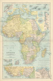
BACON'S ILLUSTRATED MAP OF YORKSHIRE 1876 BY EDWARD WELLER F.R.G.SHutchinson Scott Auctioneers4.4(42)See Sold PriceFeb 28, 2024
27.1 ctw London Topaz & Diamond Bracelet 14K Yellow GoldPacific Global Auction3.9(280)See Sold PriceFeb 28, 2024
11.24 ctw London Topaz & Diamond Earrings 14K Rose GoldPacific Global Auction3.9(280)See Sold PriceFeb 28, 2024
CENTRAL AFRICA. French Congo German east British Angola Tanzania. BACON 1893 mapJasper524.5(9.9k)See Sold PriceFeb 28, 2024
AFRICA French Congo State Soudan Nile Delta Suez canal by GW BACON 1898 mapJasper524.5(9.9k)See Sold PriceFeb 28, 2024
Stanford, Edward 1901 Large Map. Geological Map of the British IslesAlbion Auctions4.7(341)See Sold PriceMar 01, 2024
Stanford, Edward 1901 Large Map. Hydrographical Map of the British IslesAlbion Auctions4.7(341)See Sold PriceMar 01, 2024
Stanford, Edward 1901 Large Map. Stereographical Map of The British IslesAlbion Auctions4.7(341)See Sold PriceMar 01, 2024
Guthrie, William 1812 Antique Map. Spain and PortugalAlbion Auctions4.7(341)See Sold PriceMar 01, 2024
OLD ILLUSTRATED 1902 CROSS-COVERED LANDS JOURNEY TO CALCUTTA, INDIA, 2 VOLUMESNY Elizabeth 4.2(86)See Sold PriceMar 03, 2024
An amber bangle, with certificate of gem identification (London antique market)Arete Art Limited4.3(9)See Sold PriceMar 28, 2024