ATLAS of ANTIENT GEOGRAPHY by SAMUEL BUTLER 1843John McInnis Auctioneers,LLC4.5(505)See Sold PriceFeb 24, 2024
18TH C. ANTIQUE MAP: FRENCH & INDIAN WAR, FRAMEDThomaston Place Auction Galleries4.4(393)See Sold PriceFeb 24, 2024
Rand McNally Railroad Map Cabinet w/ 21 Railroad MapsRail & Road Auctions4.6(165)See Sold PriceMar 08, 2024
Keith Haring - Ink on New York Map, Best Buddies, Inscribed, Signed, and DatedSapphire Auction Gallery4(67)See Sold PriceMar 02, 2024
LATE 17TH C. FRENCH MAP OF THE NEW WORLD BY ALEXIS-HUBERT JAILLOT (1632-1712)Thomaston Place Auction Galleries4.4(393)See Sold PriceFeb 24, 2024
Central Railroad of New Jersey Map of Sandy Hook Route-ca. 1903JM Hobby Supply and Railroad Artifact Auctions4.4(127)See Sold PriceFeb 24, 2024
Lot of Six Mixed Atlas Box Cars-HO Scale-New in BoxJM Hobby Supply and Railroad Artifact Auctions4.4(127)See Sold PriceFeb 25, 2024
Rand McNally/Santa Fe Railroad Map of Iowa-1912JM Hobby Supply and Railroad Artifact Auctions4.4(127)See Sold PriceFeb 24, 2024
NICOLAES VISSCHER (NETHERLANDS, 1618-1709) MAP OF THE NEW WORLDThomaston Place Auction Galleries4.4(393)See Sold PriceFeb 24, 2024
17TH C. WORLD MAP BY NICOLAES VISSCHER (NETHERLANDS, 1618-1709)Thomaston Place Auction Galleries4.4(393)See Sold PriceFeb 24, 2024
Lot of Six Mixed Atlas Cabooses-HO Scale-New in BoxJM Hobby Supply and Railroad Artifact Auctions4.4(127)See Sold PriceFeb 25, 2024
Sold
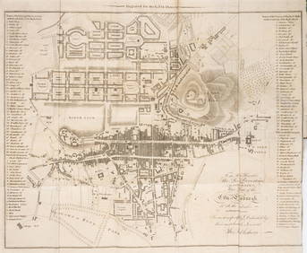
Arrowmith, Aaron Map of Scotland, constructed fromthe authority of the Parliamentary Commissioners for making Roads and building Bridges in the Highlands of Scotland. London: G. F. Cruchley, 1840 "Additions to 1849", hand-coloured engraved map, dividSee Sold Price
SoldArrowsmith (Aaron) Map of ScotlandArrowsmith (Aaron) Map of Scotland... obtained by the Parliamentary Commissioners for Highland Roads and Bridges,showing Roads and Bridges made, contracted for, or under construction, c.14 engSee Sold Price
SoldArrowsmith's large map of Scotland with MemoirHeading: Author: Arrowsmith, Aaron Title: Map of Scotland Constructed from Original Materials Obtained under The Authority of The Parliamentary Commissioners For making Roads and building Bridges InSee Sold Price
SoldTallis, John (Pub) 1852 Map. ScotlandSteel Engraved Map with Original Outline Hand Color Published 1852-56 by John Tallis, London for "The Universal Pronouncing Dictionary" by Thomas Wright. Drawn & Engraved by John Rapkin. Centre fold aSee Sold Price
SoldBarclay, James 1809 Antique Map. Scotland"Scotland or North Britain" Outline Hand Coloured Copper Engraved Map Published 1809, Leeds for "Barclay's Complete and Universal Dictionary of the English Language..." by the Rev. James Barclay. PapeSee Sold Price
SoldGuthrie, William 1790 Antique Map. ScotlandCopper Engraved Map Published 1790, London for "A New Geographical, Historical and Commercial Grammar..." by William Guthrie. The maps are by John Senex, Thomas Kitchin and others. Folds as issued. EaSee Sold Price
SoldAlps.- Arrowsmith (Aaron) Map of the Alpine Country inAlps.- Arrowsmith (Aaron) Map of the Alpine Country in the South of Europe, showing from Florence to Regensburg, and Geneva across to Vienna, with large vignette of the village of Chamouny by Webber iSee Sold Price
SoldMAP, Scotland, Robert de VaugondyScotland. Gilles Robert de Vaugondy, Le Royaume d'Ecosse Divise en Shires ou Comtes, from Atlas Universel, 1751 (dated). Hand Color. This handsome map of Scotland delineates the counties and shows couSee Sold Price
SoldRare Map Scotland by Alan Bell 1839Bell, Alan : MAP - RUSSIA IN EUROPE - FROM BELL'S ATLAS PUBLISHED IN 1839 Published in 1839, 1st Edition drawn by Allan Bell. This map is in very good condition, full borders as published, folded as pSee Sold Price
SoldArrowsmith (Aaron) - Map of Europe Drawn from all thewall map with inset oval portrait of the dedicatee, Sir Joseph Banks, lower left, and title vignette of Iron Bridge, lower right, engraved map with hand-colouring, 1270 x 1470mm., dissected and linen-See Sold Price
Sold(MAP, SCOTLAND) BLEAU, J. A group of 2 hand-colore(MAP, SCOTLAND) BLEAU, J. A group of two hand-colored copper engraved maps of British Isles. (Amsterdam: J. Blaeu, 1654). Each with richly hand-colored borders, forests, mountain ranges and towns, decSee Sold Price
Sold(MAP, SCOTLAND) BLEAU, J. Scotia Antiqua. (Amsterd(MAP, SCOTLAND) BLEAU, J. Scotia Antiqua, qualis priscis temporibus, Romanis praesertim, cognita fuit quam in lucem eruere conabatur. (Amsterdam, 1643 or later). Hand-colored copper engraved map of ScSee Sold Price
Sold(MAP, SCOTLAND) BLAEU, J. A group of three maps of(MAP, SCOTLAND) BLAEU, J. A group of three hand-colored copper engraved maps of British Isles. (Amsterdam: J. Blaeu, 1654). French text to verso of one, Latin text to verso of others. Each with richlySee Sold Price
SoldArrowsmith (Aaron) Map of the Countries lying betwArrowsmith (Aaron) Map of the Countries lying between the Euphrates and Indus on the East and West,and the Oxus and Terek and Indian Ocean on the North and South, showing Iran and its environsSee Sold Price
SoldEngraved hand colored maps, Scotland, Britain(Lot of 3) Framed engraved hand colored maps, 18th and 19th centuries, ''O Rcadum et Schetlandiae,'' an English map, including Lincolnshire Derby, Stafford, Notingham, and ''The Occidental and OrientaSee Sold Price
SoldAntique Map ScotlandScotland Northern & Southern Part. 2 hand colored engravings. From Pinkerton's Modern Atlas, London, early 19th C.See Sold Price
SoldMap, Scotland, after Mercator, Isle Skye, HebridesFramed double-sided engraved and handcolored map, Scotiae Regnum (Southern section including the Isle of Skye and the Southern Hebrides), after Gerardus Mercator (Flemish, 1512-1594), text verso beginSee Sold Price
SoldArrowsmith (Aaron) Map of the Countries lying betwArrowsmith (Aaron) Map of the Countries lying between the Euphrates and Indus on the East and West,and the Oxus and Terek and Indian Ocean on the North and South, showing Iran and its environsSee Sold Price
SoldArrowsmith (Aaron) Map of Asia Minor, Armenia, andArrowsmith (Aaron) Map of Asia Minor, Armenia, and Koordistan,Illustrative of the Marches of Alexander, Xenophon, Julian and Heraclius, showing from Lemnos across to Gorgan and the Caspian SeaSee Sold Price
K. Johnston, W. Blackwood and Sons Map [Scotland]Keith Johnston's General Atlas, published by William Blackwood and Sons, Edinburgh, two-part map of Scotland, circa mid-19th century. Second page depicts area south of first page. Each measures 17.25-See Sold Price
SoldArrowsmith (Aaron) Map of England and WalesArrowsmith (Aaron) Map of England and Wales, The Result Of Fifteen Years Labour, engraved map with original outline hand-colouring, overall size 3530 x 2740mm., in 17 sections, including titleSee Sold Price
SoldArrowsmith (Aaron) Map of North ItalyArrowsmith (Aaron) Map of North Italy [&]Map of South Italy & Adjacent Coasts, 2 engraved maps in 4 parts, original outline hand-colouring, dissected and linen-backed, first with largeSee Sold Price
Arrowsmith (Aaron) Map of EuropeArrowsmith (Aaron) Map of Europe, large map of Europe from the Atlantic to the Caspian Sea, on 4 sheets, joined, with original hand-colouring, pictorial cartouche (uncoloured), 1230 x 1450mm.,See Sold Price
SoldMAPS, Scotland, SansonScotland. N. Sanson/Mariette, [Lot of 2] L'Escosse dela le Tay, Divisee en Toutes ses Provinces: Tirees des Cartes Particulieres de Timot Pont, de R. Gordon a Straloch &c. [and] L'Escosse deca le Tay,See Sold Price
LATE 16TH C. MAP OF SCOTLAND BY MERCATOR, FRAMEDThomaston Place Auction Galleries4.4(393)See Sold PriceFeb 24, 2024
Portfolio of 15 County Maps by Robert Morden (English 1650-1703)Nadeau's Auction Gallery4.7(409)See Sold PriceFeb 24, 2024
Chatelain - 3 Maps of the British Isles (England, Ireland, Scotland)Trillium Antique Prints & Rare Books4.5(32)See Sold PriceFeb 24, 2024
Arrowsmith & Lewis - Map of PolynesiaTrillium Antique Prints & Rare Books4.5(32)See Sold PriceFeb 24, 2024
Arrowsmith & Lewis - Map of North AmericaTrillium Antique Prints & Rare Books4.5(32)See Sold PriceFeb 24, 2024
Arrowsmith & Lewis - Map of the World on Mercator's ProjectionTrillium Antique Prints & Rare Books4.5(32)See Sold PriceFeb 24, 2024
Arrowsmith & Lewis - Map of LouisianaTrillium Antique Prints & Rare Books4.5(32)See Sold PriceFeb 24, 2024
Arrowsmith & Lewis - Map of the United StatesTrillium Antique Prints & Rare Books4.5(32)See Sold PriceFeb 24, 2024
De Jode, Rare, pub. 1593 - Map of the British Isles [England, Scotland, Ireland] (Angliae Scotiae etTrillium Antique Prints & Rare Books4.5(32)See Sold PriceFeb 24, 2024
Map: A 17thC engraved and hand coloured map of Scotland titled Strath-Navernia / Strath Navern afterClaydon Auctioneers Ltd4.3(125)See Sold PriceFeb 26, 2024
VARIOUS ARTISTS [BRITISH TRAVEL GUIDES]. Group of 6 map booklets and flyers. 1930s.Swann Auction Galleries4.4(70)See Sold PriceFeb 29, 2024
Scotland.- Sir Walter Scott's Edinburgh.- The Post-Office annual directory, from Whitsunday 1808, toForum Auctions4.3(53)See Sold PriceFeb 29, 2024
SOUTHERN AFRICA Monomotapa (Mutapa Kingdom) Cafrerie (Kaffraria) MALLET 1683 mapJasper524.5(9.9k)See Sold PriceFeb 28, 2024
1849 Orr & Co. Hand Colored Southern Germany MapMatthew Bullock Auctioneers4.7(1.8k)See Sold PriceMar 02, 2024