SoldAntique map of Louisiana and the Mississippi riverAntique map of Louisiana and the Mississippi river, matted and framed, 28 x 25See Sold Price
Sold1799 United States of America Antique Map1799 United States of America Antique Map. Interesing early map of U.S. with all beyond the Mississippi River labelled Louisiana. Sized: 14" H x 19 1/2" WSee Sold Price
SoldWestern Hemisphere Antique MapManuscript map, pen, ink, watercolor on paper of the Western Hemisphere. America west of Mississippi River called Louisiana. Cherokees indicated in southeast. Circa late 18th Century. 14 3/4" x 14".See Sold Price
Antique map of Arkansas, Mississippi and Louisiana, Mitchell 1874Attractive map of these southern states, with original hand coloring by counties. Shows towns, roads, railroads, rivers, lakes, forts, swamps, islands, bays, sounds and other coastal features. Drawn aSee Sold Price
SoldGroup of Twenty-Four Antique Maps, consisting of "TheGroup of Twenty-Four Antique Maps, consisting of "The Mississippi River from its Mouth to Cairo, showing New Orleans, Harper's, May 10th, 1862; "Louisiana," by Geo. Cram, c. 1900; "Watson's Atlas MapSee Sold Price
SoldC.1721 MAP OF LOUISIANA AND MISSISSIPPI RIVERBy John Senex. Dimensions: (Frame) H 24" x W 27.5" (Sight) H 19.75" x W 23" Condition: Creases to paper from previous folds and discoloration and stains to the center of the paper. Wear to gilt frame.See Sold Price
SoldCram: Antique Map of Louisiana and Mississippi, 1886Title/Content of Map: 1886 Cram Map of Louisiana and Mississippi -- Louisiana [verso] Mississippi Date Printed: 1886, Chicago Cartographer: G Cram / People's Publishing Co. Size: 12.1 x 9.7 in. A verySee Sold Price
Mitchell: Antique Map of Louisiana Arkansas MississippiTitle/Content of Map: 1867 Mitchell Map of Louisiana, Arkansas and Mississippi -- County Map of Louisiana, Mississippi and Arkansas Date Printed: 1867 Philadelphia Cartographer: S Mitchell Size: 21 xSee Sold Price
SoldAN ANTIQUE EARLY AMERICAN MAP, "Mississippi River fromAN ANTIQUE EARLY AMERICAN MAP, "Mississippi River from Iberville to Yazous," 1779, hand colored copper plate engraving on laid paper, "Published according to Act of Parliament 1st Jan. 1779 by J.F.W.See Sold Price
SoldAntique County Map of Louisiana, Mississippi, BroAn Antique County Map of Louisiana, Mississippi, and Arkansas , c. 1900, in attractive four-color printing, a double atlas page from Johnson's Atlas (pub. by Johnson A. Browning), 24 in. x 17 1/2 in.See Sold Price
SoldLee: Antique Map of St. Louis & Mississippi River, 1837Map: 1837 Lee Map of St. Louis and Mississippi River -- No.3. Map of the Harbor of St. Louis, Mississippi River. Oct. 1837 Cartographer: R E Lee Year / Place: 1837, Washington Map Dimensions: 16 x 41See Sold Price
SoldAntique Map of Louisiana and Mississipi River, 1761Title/Content of Map: A New Map of Louisiana and the River Mississipi from the Sea to Bayagoulas Date Printed: 1761 Cartographer: London Magazine Size (inches): 9 x 7 Detailed antique map of the MissiSee Sold Price
SoldMitchell: Antique Map of Mississippi Louisiana, 1869Title/Content of Map: Arkansas, Mississippi & Louisiana by Mitchell Date Printed: 1869 Cartographer: Augustus S. Mitchell Material/Medium: Paper Size: 23 1/2" x 15" Hand colored engraved Map. From 'MiSee Sold Price
Sold1742 Map of Louisiana and the Mississippi RiverHistoric Maps 1742 Map of Louisiana and the Mississippi River by Delisle with the First Published Map Reference to a Later “Texas” 1742, Handcolored Historic Map titled, “Carte de la Louisiane eSee Sold Price
Sold1742 Map of Louisiana and the Mississippi RiverHistoric Maps 1742 Map of Louisiana and the Mississippi River by Delisle with the First Published Map Reference to a Later “Texas” 1742, Handcolored Historic Map titled, “Carte de la Louisiane eSee Sold Price
Antique Map of Arkansas, Mississippi, LouisianaAntique regional map of Arkansas, Mississippi, and Louisiana, on parchment paper, with pink and blue, by Johnson and Ward, image size 24 x 17, framedSee Sold Price
SoldAntique Map of Mississippi and LouisianaAntique Map of Mississippi and Louisiana , 19th c., published by A. & C. Black, Edinburgh, color lithograph, sight 15 1/2 in. x 12 in., framed Provenance: Estate of Julia Evans ReedSee Sold Price
SoldJohn Senex engraved map with outlined color Map ofJohn Senex engraved map with outlined color Map of Louisiana and the River Mississippi marked lower right: This map of the Mississippi is most humbly inscribed to William Law sight size 24" x 20"See Sold Price
SoldJohn Senex, "Map of Louisiana", 1721John Senex, "A Map of Louisiana and the River Mississippi", 1721, London, copper-plate engraved map, laid paper, watermarked with a fleur-de-lis and "HD", the map with interesting nomenclature of "ProSee Sold Price
1862 Johnson's Arkansas Mississippi and LouisianaThis is an authentic antique map Arkansas Mississippi and Louisiana of by Johnson & Browning. The map was published in Johnson's Family Atlas in 1862. This map centers on the states of Arkansas MissisSee Sold Price
SoldVintage map of Louisiana and river of MississippiVintage map of Louisiana and river of Mississippi, 18.8"x22"See Sold Price
SDUK: Antique Map, MO MS IL IN KY AL Mississippi RiverTitle/Content of Map: 'NORTH AMERICA, SHEET X., Parts of Missouri, Illinois, Kentucky, Tennessee, Alabama, Missouri and Arkansas' Arkansas Tennessee. MO MS IL IN KY AL. Mississippi River. Date PrintedSee Sold Price
SoldJohn Senex Map Of The MississippiJohn Senex colored engraved map. A Map of Louisiana And Of The River Mississippi. Marked lower right: This map of the Mississippi is most humbly inscribed to William Law. Unframed. 20-1/2 in x 24 in.See Sold Price
Sold1 piece. Engraved Map with Outline Color. Senex,1 piece. Engraved Map with Outline Color. Senex, John. A Map of Louisiana and of The River Mississippi." [London], [1719 or later.] 19 1/8 x 22 3/8 inches; 485 x 568 mm, margins. Slightly toned, someSee Sold Price
Lake Superior and Mississippi River RR 1869 Seven Percent Bonds Book/Report-1869JM Hobby Supply and Railroad Artifact Auctions4.4(126)See Sold PriceFeb 24, 2024
Schomburgk - The Comuti or Taquiare (Taquiari) Rock on the River EssequiboTrillium Antique Prints & Rare Books4.5(30)See Sold PriceFeb 24, 2024
Arrowsmith & Lewis - Map of LouisianaTrillium Antique Prints & Rare Books4.5(30)See Sold PriceFeb 24, 2024
WEST AFRICA Explorers' routes Senegal Ashanti. Mountains of Kong. SDUK 1857 mapJasper524.5(9.8k)See Sold PriceFeb 28, 2024
WEST AFRICA Niger/Gambia rivers tribes towns. 'Pays des Negres'. MALLET 1683 mapJasper524.5(9.8k)See Sold PriceFeb 28, 2024
NORTH & WEST AFRICA. Sahara Niger river 'Zaara ou le Desert'. MALLET 1683 mapJasper524.5(9.8k)See Sold PriceFeb 28, 2024
SOUTH CENTRAL AFRICA. Shows Zambesi river as circular! WELLER 1863 old mapJasper524.5(9.8k)See Sold PriceFeb 28, 2024
Northern & Southern Africa. Maghreb. Orange River Sovereignty. HALL 1854 mapJasper524.5(9.8k)See Sold PriceFeb 28, 2024
Afrique. Bambara #20 Niger River. Western Mali. Mauritania VANDERMAELEN 1827 mapJasper524.5(9.8k)See Sold PriceFeb 28, 2024
Northern & Southern Africa. Maghreb. Orange River Sovereignty. HALL 1856 mapJasper524.5(9.8k)See Sold PriceFeb 28, 2024
South Namibia coast. Walvis Bay-Orange River ADMIRALTY sea chart 1881 (1954) mapJasper524.5(9.8k)See Sold PriceFeb 28, 2024
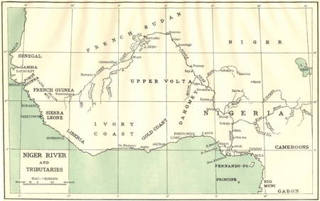
AFRICA. Niger River and Tributaries 1936 old vintage map plan chartJasper524.5(9.8k)See Sold PriceFeb 28, 2024
Rivières de Sanaga & Gambra'. Senegal Gambia rivers. Guinea. BELLIN 1746 mapJasper524.5(9.8k)See Sold PriceFeb 28, 2024
Western coast of Africa… to the River Sanaga. Southern Mauritania LABAT 1745 mapJasper524.5(9.8k)See Sold PriceFeb 28, 2024
Coste d’Afrique…' Guinea-Bissau & Bissagos archipelago. BELLIN/SCHLEY 1747 mapJasper524.5(9.8k)See Sold PriceFeb 28, 2024
After Adrien Persac (Louisiana/France, 1823-1873), "Plantations of the Mississippi River," 20th c.,Crescent City Auction Gallery4.3(229)See Sold PriceMar 08, 2024
John Senex Map of Louisiana & Mississippi RiverWillow Auction House4.5(283)See Sold PriceMar 14, 2024