ATLAS of ANTIENT GEOGRAPHY by SAMUEL BUTLER 1843John McInnis Auctioneers,LLC4.5(505)See Sold PriceFeb 24, 2024
18TH C. ANTIQUE MAP: FRENCH & INDIAN WAR, FRAMEDThomaston Place Auction Galleries4.4(393)See Sold PriceFeb 24, 2024
Rand McNally Railroad Map Cabinet w/ 21 Railroad MapsRail & Road Auctions4.6(165)See Sold PriceMar 08, 2024
Keith Haring - Ink on New York Map, Best Buddies, Inscribed, Signed, and DatedSapphire Auction Gallery4.1(67)See Sold PriceMar 02, 2024
LATE 17TH C. FRENCH MAP OF THE NEW WORLD BY ALEXIS-HUBERT JAILLOT (1632-1712)Thomaston Place Auction Galleries4.4(393)See Sold PriceFeb 24, 2024
Central Railroad of New Jersey Map of Sandy Hook Route-ca. 1903JM Hobby Supply and Railroad Artifact Auctions4.4(127)See Sold PriceFeb 24, 2024
Lot of Six Mixed Atlas Box Cars-HO Scale-New in BoxJM Hobby Supply and Railroad Artifact Auctions4.4(127)See Sold PriceFeb 25, 2024
Rand McNally/Santa Fe Railroad Map of Iowa-1912JM Hobby Supply and Railroad Artifact Auctions4.4(127)See Sold PriceFeb 24, 2024
NICOLAES VISSCHER (NETHERLANDS, 1618-1709) MAP OF THE NEW WORLDThomaston Place Auction Galleries4.4(393)See Sold PriceFeb 24, 2024
17TH C. WORLD MAP BY NICOLAES VISSCHER (NETHERLANDS, 1618-1709)Thomaston Place Auction Galleries4.4(393)See Sold PriceFeb 24, 2024
Lot of Six Mixed Atlas Cabooses-HO Scale-New in BoxJM Hobby Supply and Railroad Artifact Auctions4.4(127)See Sold PriceFeb 25, 2024
SoldGrp: 4 Maps of Eastern Europe Romanian TransylvanGroup of four maps of Eastern Europe. One map by Gerard Valck and Peter Schenk depicting Serbia, Bulgaria, and Romania; one map by Gerard and Leonard Valck depicting Wallachia, Transylvania, and MoldoSee Sold Price
Sold4 Maps: Carolina + Carte de la Virginie + 2 others[East Coast]. 4 Maps. ++ Herman Moll. 2 maps on 1 sheet: Carolina./ A Map of ye Island of Bermudos Divided into its Tribes, wth. The Castles, Forts &c. (nd). "Appears in Atlas Geographicus London. NutSee Sold Price
Sold4 MapsLot consisting of 4 Maps, 3 are of Russia and one is of British Possessions North America – they were in the album Lot # 420 and sell as this lotSee Sold Price
Sold(4) MAPS OF NANTUCKETIncluding: 1852 Sketch of Davis's Sound and Other Dangers 17 x 19 inches. Dept of the Government. framed 25 x 26 inches (overall), A second colored example dated 1853, 1891 Atlas Plate No. 10 Walker aSee Sold Price
Sold4 Maps incl. S. August MitchellIncludes 2 S. August Mitchell maps of the middle states 1852 and 1858, Mitchell map of the U.S. and Texas 1839, and Alaska and part of British America by Mast, Crowell, Kirkpatrick 1905See Sold Price
SoldGrp: 4 Maps of Canada w/ 1 Map of the Indian OceaGroup of four maps of Canada, including "The River St. Lawrence accurately drawn from d'Anville's Map," London: John Harrison, ca. 1780; New York State Library, "Champlain's Map of New France 1632," NSee Sold Price
SoldMAPS OF ROBINSON'S RESEARCHES IN PALESTINE, 4 MAPS,MAPS OF ROBINSON'S RESEARCHES IN PALESTINE, 4 MAPS, SOME TEARS, SEPARATED FROM BOOK. CIRCA 1856.See Sold Price
Sold4 Maps by Covens & Mortier [ca. 1720-1740].[Greece/Persia/Crimea/Europe]. 4 Maps. Engraved Amst: Covens & Mortier, [Ca. 1720 to 1740.] Reworkings from a plate engraved by Guillaume de L’Isle. The first 3 listed have a cartouche title (listedSee Sold Price
Sold4 Maps incl. Division of US Army in Virginia4 Maps Atlas to Accompany the Official Records of Union + Confederate Army's 1861-1865, US Army in Virginia Map Framed with Tear -See Sold Price
Sold4 Maps: Central Europe. Homann, Thomson , de Witt.[Homann/Thomson] 4 Maps. Hand colored. ++ L’Allemagne, distinguee en ses Cercles & subdivisee in ses Etats, contenant son Etendue presente… Mr. Schatz A. 1741 avec Privilege Imperial. Title aboveSee Sold Price
SoldBradford & Leeds 19th Century Lot of 4 MapsExamples by Baedeker, Rapkin and others. Paper Size: Up to 14.5 x 10.5 inch (37 x 27cm) A couple are trimmed. Good condition overallSee Sold Price
SoldAustralia & Pacific 1903 Lot of 4 MapsLithograph Maps Published 1903 by Adam & Charles Black, Edinburgh & London for "Encyclopaedia Brittannica" Tenth Edition. Centre fold as published. Paper Size: 16 x 11.5 inch (41 x 29cm) Good ConditioSee Sold Price
Sold(4) Maps of Palestine 19th c.Includes: A New Map of Palestine of the Holy Land. 12 3/8" x 15" folded, Mitchell 1867. Hocland von Juda 10 5/8" x 16 3/8" Andreas Atlas 1893 (p.109). Palestine 13 5/8" x 20 3/8" folded, Appleton 1891See Sold Price
Sold1805 The Journal of Tour by Thaddeus HarrisA Geographical & Historical Account of the State of Ohio, Includes (4) Maps, Note Book is delicate Spine Wear, Back Cover is Separated, Foxing, Maps have some tears & wear.See Sold Price
SoldSeven Pillars of Wisdom, 1st EditionSeven Pillars of Wisdom, 1st Edition. T.E. Lawrence. Doubleday Doran, 1935. 1st edition. 672 pp. with 53 illustrations and 4 maps. Lawrence of Arabia's epic account of the Arab war against the late OtSee Sold Price
SoldStackhouse: Earliest Independent United States Map 1783Item: Earliest Independent United States Map Maker: Thomas Stackhouse Date: 1783 Measures 16" x 20 1/4" Map fully within boarder. Margin uneven on left side. Strong printing, plate mark easily visibleSee Sold Price
SoldRussell, S. I. 1855 Set of 4 Celestial Maps. Astronomy"Map of the Heavens..." Set of 4 Maps showing the stars observed throughout the year. Steel Engraved Maps Published 1855, London for "The Gallery of Nature" by Thomas Milner. Constructed & Engraved bySee Sold Price
SoldBook - Luftwaffe Strikes! the Air war in PolandThe Luftwaffe participation in the invasion of Poland. History in words and images, with approx. 46 black-and-white photos and 4 maps, of the German-Luftwaffe attack on and in Poland Title: LuftwaffeSee Sold Price
SoldCartography12. Cartography.Group of 4 maps, as listed below. Various sizes; light wear. Vp, vd [75/100]Russia in Europe. Plate 21 of Johnston's National Atlas. 25-1/2 x 21 inches. 1850s * ditto. Plate 55 of MitcSee Sold Price
Sold4 Yale and Connecticut Prints1951 print of Yale College H11-3/4" W13-3/4".Map of Connecticut opening: H 10-7/8", W 16-1/4"; frame size: H 16-12", W 21-1/8". Together with a copy of an early Yale print. Frame size H12-5/8" W16-5/8See Sold Price
Sold"A Plan of the Operations of the British and Reb"A Plan of the Operations of the British and Rebel Army, in the Campaign, 1777", including the Battle of the Brandywine, 9" x 10 1/4", Map shows positions of British Army before the Battle of BrandywiSee Sold Price
SoldCollection of (4) French Map PrintsSeries of four European maps of France, in French, all appear to be hand-colored and framed consistently.Overall size: 19 3/4 x 20 1/4 in. Sight size: 12 x 13 1/2 in. Please note that all sales are fiSee Sold Price
Sold4 Framed Maps, 18th C., Kitchin & JefferysFour 18th C. Small Framed Maps includes Sweden, Denmark, Norway, Finland, Spain and Portugal by Thomas Kitchin and Thomas Jefferys 7 1/2 x 8 1/2 , framed 16 x 17 1/2 CLAN7190/4 MMSee Sold Price
SoldLot Of 4 Vintage Maps Of the AmericasLot includes: Americque Septentrionale Peyrounin Sculpt (frame: 16.5 x 14 1/8" image sight: 11.25" x 8"), Amerique Meridionale, P Mariette (frame: 16.5 x 14 1/8" image sight: 11.25" x 8"), H. Moll NorSee Sold Price
Illinois Central RR October 2, 1901 Public TimetableJM Hobby Supply and Railroad Artifact Auctions4.4(127)See Sold PriceFeb 24, 2024
Illinois Central RR July 24, 1906 Western Lines Public TimetableJM Hobby Supply and Railroad Artifact Auctions4.4(127)See Sold PriceFeb 24, 2024
Oregon Short Line RR April 1899 Public TimetableJM Hobby Supply and Railroad Artifact Auctions4.4(127)See Sold PriceFeb 24, 2024
Union Pacific RR December 14, 1897 Public TimetableJM Hobby Supply and Railroad Artifact Auctions4.4(127)See Sold PriceFeb 24, 2024
Archaeological Books - Déchelette - Manuel D'Archeologie - 3 VolumesTimeLine Auctions Ltd.4.6(183)See Sold PriceMar 06, 2024
General Books - Four Maps of Great Britain Designed by Matthew Paris About A.D. 1250TimeLine Auctions Ltd.4.6(183)See Sold PriceMar 08, 2024
1738 BIBLE in DUTCH ILLUSTRATED w/ MAPS MASSIVE FOLIO in DUTCH antique BIBLIAJasper524.5(9.9k)See Sold PriceFeb 27, 2024
1711 GREEK BIBLE ILLUSTRATED w/ MAPS VELLUM BOUND antique NEW TESTAMENTJasper524.5(9.9k)See Sold PriceFeb 27, 2024
1772 GREEK BIBLE NEW TESTAMENT antique BIBLIA LATIN text MAP NOVUM TESTAMENTUMJasper524.5(9.9k)See Sold PriceFeb 27, 2024
1558 SCANDINAVIA SWEDEN ILLUSTRATED HISTORY Gothorum Sveonumque historia antiqueJasper524.5(9.9k)See Sold PriceFeb 27, 2024
1709 GREEK BIBLE ILLUSTRATED w/ MAPS antique VELLUM BOUND Septuagint editionJasper524.5(9.9k)See Sold PriceFeb 27, 2024
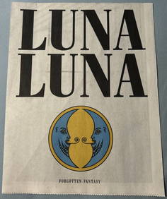
LUNA LUNA - OFFICAL PROGRAM (HARING, BASQUIAT, LICHTENSTEIN, DALI)ArtMeetsStreet x Mercer Auctions4.4(44)See Sold PriceMar 02, 2024
1730 BIBLE in DUTCH ILLUSTRATED w/ MAPS antique MASSIVE FOLIO BIBLIAJasper524.5(9.9k)See Sold PriceFeb 27, 2024
THE ANTIQUE ILLUSTRATED BOOK "1856 ARCTIC EXPLORATIONS: SECOND GIRNEL EXPEDITION 2" BY E. KANENY Elizabeth 4.2(86)See Sold PriceMar 03, 2024
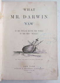
1880 WHAT MR. DARWIN SAW IN SHIP BEAGLE ANTIQUE DURING HIS WORLD TOURNY Elizabeth 4.2(86)See Sold PriceMar 03, 2024
Set of 4 Maps - Netherlands - Seven United Provinces - Germany - Sweden, Denmark, Norway, FinlandProverde Auctions4.3(3)See Sold PriceFeb 28, 2024
Antique Pennsylvania Map Fragment incl Wellersburg and New CentervilleCordier Auctions & Appraisals4.4(1.5k)See Sold PriceMar 02, 2024


![4 Maps by Covens & Mortier [ca. 1720-1740]. (1 of 8)](https://p1.liveauctioneers.com/179/47316/21802731_1_x.jpg?height=282&quality=70&version=1383851649)