ATLAS of ANTIENT GEOGRAPHY by SAMUEL BUTLER 1843John McInnis Auctioneers,LLC4.5(505)See Sold PriceFeb 24, 2024
18TH C. ANTIQUE MAP: FRENCH & INDIAN WAR, FRAMEDThomaston Place Auction Galleries4.4(393)See Sold PriceFeb 24, 2024
Rand McNally Railroad Map Cabinet w/ 21 Railroad MapsRail & Road Auctions4.6(165)See Sold PriceMar 08, 2024
Keith Haring - Ink on New York Map, Best Buddies, Inscribed, Signed, and DatedSapphire Auction Gallery4.1(67)See Sold PriceMar 02, 2024
LATE 17TH C. FRENCH MAP OF THE NEW WORLD BY ALEXIS-HUBERT JAILLOT (1632-1712)Thomaston Place Auction Galleries4.4(393)See Sold PriceFeb 24, 2024
Central Railroad of New Jersey Map of Sandy Hook Route-ca. 1903JM Hobby Supply and Railroad Artifact Auctions4.4(127)See Sold PriceFeb 24, 2024
Lot of Six Mixed Atlas Box Cars-HO Scale-New in BoxJM Hobby Supply and Railroad Artifact Auctions4.4(127)See Sold PriceFeb 25, 2024
Rand McNally/Santa Fe Railroad Map of Iowa-1912JM Hobby Supply and Railroad Artifact Auctions4.4(127)See Sold PriceFeb 24, 2024
NICOLAES VISSCHER (NETHERLANDS, 1618-1709) MAP OF THE NEW WORLDThomaston Place Auction Galleries4.4(393)See Sold PriceFeb 24, 2024
17TH C. WORLD MAP BY NICOLAES VISSCHER (NETHERLANDS, 1618-1709)Thomaston Place Auction Galleries4.4(393)See Sold PriceFeb 24, 2024
Lot of Six Mixed Atlas Cabooses-HO Scale-New in BoxJM Hobby Supply and Railroad Artifact Auctions4.4(127)See Sold PriceFeb 25, 2024
Sold4 Maps incl. S. August MitchellIncludes 2 S. August Mitchell maps of the middle states 1852 and 1858, Mitchell map of the U.S. and Texas 1839, and Alaska and part of British America by Mast, Crowell, Kirkpatrick 1905See Sold Price
Sold4 Court Docs, incl. Manuscript Map, 1736-1806[Massachusetts Court Documents]. 4 Items. ++ State of Connecticut pay order. Dated “New Haven County Sup Court August 11th, 1792.” Signed “Geo. Pitkin Clerk.” 4 ¾” x 6 ¼” form printed bySee Sold Price
SoldLarge Framed 1843 Map of Eastern USA.Published by S. August Mitchell, drawn by J.H. Young, and engraved by J.H. Brightly. Condition (Excellent). Size Framed: 53 - 3/4" x 46".See Sold Price
SoldGood Group of Four American AtlasesGood Group of Four American Atlases, incl. Mitchell's New General Atlas..., Phil., 1874, (15 1/4 in. x 12 1/4 in.); Gray's Atlas of the United States..., Phil. 1875, (17 1/4 in. x 14 3/4 in. ); A NewSee Sold Price
Sold6 Atlases 1844-1911 incl 5 school/biblical atlases[Atlases] 6 Atases. ++ (4 ancient/bible atlases) MITCHELL’S ANCIENT ATLAS, CLASSICAL AND SACRED…Phil: E. H. Butler, (1844). 4to, boards, 12 hand-colored maps, one with penciling. Tears closed on mSee Sold Price
Sold4 Maps incl. Division of US Army in Virginia4 Maps Atlas to Accompany the Official Records of Union + Confederate Army's 1861-1865, US Army in Virginia Map Framed with Tear -See Sold Price
Sold4 Maps incl: AFR: III TAB: [1578 or later].[Africa/England] 4 Maps. ++ AFR: III TAB: [Title in upper margin. Right side of verso: AFRICAE TABULA. III.] Northern Africa. Mountain ridges, cities, and engraved animals. Rectangular image with PtolSee Sold Price
Sold4 Maps incl: MAPPE-MONDE EN DEUX HEMISPHERES...[World/Maryland/Virginia] 4 Maps. ++ MAPPE-MONDE EN DEUX HEMISPHERES, L’ORIENTAL ET L’;OCCIDENTAL. [Paris]: Bonne, 1781. Recognizable as Alaska, with large inlet of water at south-center. Shows thSee Sold Price
Sold4 maps incl 3 by Tavernier. Africae + Hispaniae...[Middle East] 4 Maps. ++ Hispaniae C Plinii Secundi, delineatae a P Bertio. Map of Spain. Below map key: “M. Tavernier sculpsit & excudit.” ++ Euphratis Et Tigris… 1628. From the same source asSee Sold Price
Sold4 Maps incl: Carte de L'Isle de Saint Domingue.[Jamaica/Bermuda]. 4 Maps. ++ Aestivarum Insulae at Barmudas. A derivative of John Speed’s map (of 1627), this marks the locations of tribes on the island of Bermuda, and provide names of islands. ASee Sold Price
Sold4 Maps incl: ANTIQUORUM IMPERIORUM TABULA, 1753.[Mideast/Greece/Dardenelles] 4 Maps. Double-page. ++ Gilles or Didiet Robert de Vaugondy. ANTIQUOR? IMPERIORUM TABULA, in qua prae caeteris, Macedonicum seu Alexandri Magni Imperium et Expeditiones exSee Sold Price
Sold4 Maps incl: Regno Di Danimarca. 1697.[De Rossi] 4 Maps from an edition of Giovanni Giacomo de Rossi’s “Mercurio Geografico Overo Guida Geografica in Tutte le Parti del Mondo.” Double page. Contemp hand colored outline. ++ Le DiecisSee Sold Price
Sold4 Maps, Incl TN, KY1st item: "Colton's Kentucky and Tennessee" Map, by George W. Colton, published by G. W. Colton and C. B. Colton & Co., New York, 1864. From "Colton's Atlas Of The World" By G. W. Colton. Steel plateSee Sold Price
Sold4 TN/KY Maps, incl. Mathew Carey, 1816Two (2) Maps of Tennessee, two (2) maps of Tennessee and Kentucky, 4 items total. 1st item: Tennessee map, from American Pocket Atlas, published by Mathew Carey, Philadelphia, 1816. Copper plate engraSee Sold Price
Sold4 Pocket Maps incl: Pianta Della Citta Di Roma.[Pocket Maps] 4 Pocket Maps. ++ Augusto Fornari. Pianta Della Citta Di Roma. 1864. Shows roads and physical features, labeling place names. 11 insets and floorplans. 23 1/4 x 32 1/8 in. 21 sections onSee Sold Price
SoldTWO MAPS: KANSAS/NEBRASKA 1855, ARIZONA/NEW MEXICO 1882J.H. Colton territories of Nebraska and Kanzas map dated 1855, with proposed routes for the Pacific Railroad, measures 23 x 26 inches overall. _x000D_ _x000D_ Also an 1882 map by S. August Mitchell ofSee Sold Price
SoldBOOKS: (4) Vols art incl Joan Mitchell, TomayoBOOKS: (4) Vols art incl Joan Mitchell, Tomayo, Four volumes: 1) The Paintings of Joan Mitchell, Whitney Museum of Art, New York/University of California Press, 2002, paperback. 2) Octavio Paz and JacSee Sold Price
Sold4 Memphis Related Maps, 1843-1933, incl. Exposition Map 18721st item: SURVEY OF THE HARBOR OF MEMPHIS, TENN, made in obedience to an order from the Secretary of the Navy by Captain L. Rosseau, Commissioner H. A. Adams, and Lieutenant Johnson, U.S. Navy, AprilSee Sold Price
SoldFour 19th Century TN MapsFour (4) 19th Century Tennessee Maps, incl. Thomas G. Bradford, 1838. 1st item: "Tennessee" Map by Thomas G. Bradford, engraved by George W. Boynton, 1838. From "A Comprehensive Atlas, Geographical, HSee Sold Price
SoldMaps 1813-1904 Mixed Lot of 4. Ireland, Canada, AfricaLot of 4 Engraved and Lithographed Maps. Incl Wellington Channel (Canada) Belfast/Cork Town Plans, Parliamentry Map of Ireland and an Untitled Map of Africa. Examples by Bruce, Fullarton and BartholomSee Sold Price
SoldHOOPER, William Hulse.Ten Months Among The Tents Of The Tuski. 8vo. pp. xv, [1], 417, [1], [2]ads. with half-title. 5 plates (incl. 4 tinted lithographs), 2 maps (incl. folding partially coloured lithographed map) & 5 textSee Sold Price
Sold(MAPS) MITCHELL, SAMUEL AUGUSTUS. 4 hand-colored(MAPS) MITCHELL, SAMUEL AUGUSTUS A group of four engraved maps with hand-coloring from varying editions of Mitchell's New General Atlas, including two with the elaborate vine border. (Philadelphia, c.See Sold Price
(4) MITCHELL ATLAS MAPS, PANAMA CANAL, C.1884(lot of 4) Unframed atlas maps, Samuel Augustus Mitchell (United States, 1790-1868), c.1884, including: (1) North and South Carolina, with inset map of Charleston harbor and plan of Charleston, 12.5"hSee Sold Price
(4) MITCHELL ATLAS MAPS, KANSAS, OHIO, MICHIGAN(lot of 4) Unframed atlas maps, Samuel Augustus Mitchell (United States, 1790-1868), drawn and engraved by William H. Gamble (United States, 1827-1892), including: (1) County map of Minnesota, c.1884,See Sold Price
[CURIOSITY—MUMMY]. Wonderful Natural Phenomenon. A Specimen...Potter & Potter Auctions4.6(545)See Sold PriceFeb 24, 2024
1849 Mitchell School ATLAS 24 MAPS America Holy Land France Africa Egypt AsiaSchilb Antiquarian Rare Books4.8(428)See Sold PriceMar 31, 2024
Mitchell - Map of the City of Washington (Washington, DC)Trillium Antique Prints & Rare Books4.5(32)See Sold PriceFeb 24, 2024
1730 BIBLE in DUTCH ILLUSTRATED w/ MAPS antique MASSIVE FOLIO BIBLIAJasper524.5(9.9k)See Sold PriceFeb 27, 2024
Goode, George Brown 1884 Lot of 4 Natural History & Meteorology MapsAlbion Auctions4.7(341)See Sold PriceMar 01, 2024
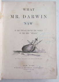
1880 WHAT MR. DARWIN SAW IN SHIP BEAGLE ANTIQUE DURING HIS WORLD TOURNY Elizabeth 4.2(86)See Sold PriceMar 03, 2024
Set of 4 Maps - Netherlands - Seven United Provinces - Germany - Sweden, Denmark, Norway, FinlandProverde Auctions4.3(3)See Sold PriceFeb 28, 2024
Philadelphia Phillies Lot incl Ticket StubsWilliam Bunch Auctions & Appraisals4.6(878)See Sold PriceFeb 27, 2024
Antique Pennsylvania Map Fragment incl Wellersburg and New CentervilleCordier Auctions & Appraisals4.4(1.5k)See Sold PriceMar 02, 2024
6 Pcs incl 4 Section Chinese Snuff BoxCordier Auctions & Appraisals4.4(1.5k)See Sold PriceMar 02, 2024


![4 Maps incl: AFR: III TAB: [1578 or later]. (1 of 4)](https://p1.liveauctioneers.com/179/85723/44107974_1_x.jpg?height=282&quality=70&version=1456876561)


![[CURIOSITY—MUMMY]. Wonderful Natural Phenomenon. A Specimen... (1 of 1)](https://p1.liveauctioneers.com/928/317913/170625951_1_x.jpg?height=282&quality=70&version=1706650066)