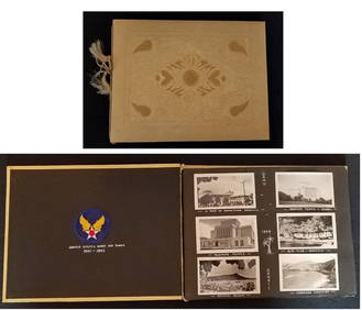
RARE 1930s AUTOGRAPH BOOK FEATURING RUTH & GEHRIGJohn McInnis Auctioneers,LLC4.5(505)See Sold PriceFeb 25, 2024
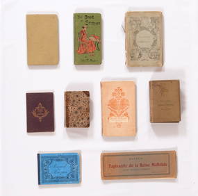
Group of Ten Books: Art of the Embroiderer, Charles Germain de Saint Aubin; Hand Weaving PatternsNazmiyal Auctions4.4(36)See Sold PriceFeb 26, 2024
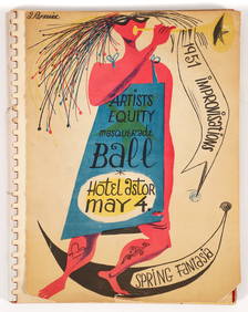
Improvisations II 55 original lithographs Artists Equity Assoc 1951Concept Art Gallery4.7(517)See Sold PriceMar 06, 2024
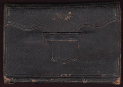
1868 Handwritten diary of Ohio canal boat operator & farmerJasper524.5(9.9k)See Sold PriceFeb 27, 2024
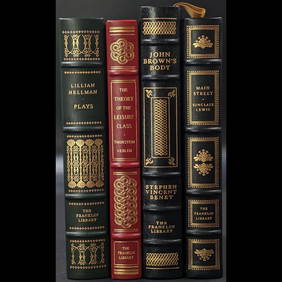
Lot Of 4 Mint Limited Edition Books From The Franklin Library.Rbfinearts4.5(579)See Sold PriceFeb 24, 2024
A Group of Eight Books: Line and Form, Walter Crane (1900); Samplers and Stitches; Designs forNazmiyal Auctions4.4(36)See Sold PriceFeb 26, 2024
First Copy of Gautier's Le Roman de la Momie - 13 Original Watercolors by George Barbier (2 VolumesTrillium Antique Prints & Rare Books4.5(33)See Sold PriceFeb 24, 2024
Group of Nine Books: Handbook of Embroidery; The Book of Stitches, Ellen T. Masters; The Lady'sNazmiyal Auctions4.4(36)See Sold PriceFeb 26, 2024
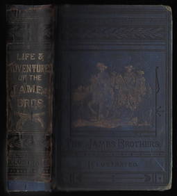
Outlaws of the Border, rare 1882 Jesse James, Younger brothersJasper524.5(9.9k)See Sold PriceFeb 27, 2024
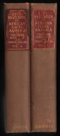
Scarce 1st ed. “Life Histories of African Game Animals?? – T. Roosevelt, E. HellerJasper524.5(9.9k)See Sold PriceFeb 27, 2024
Large lot of exhibition catalogs on CoBrA artistsConcept Art Gallery4.7(517)See Sold PriceMar 06, 2024
18th C Zucchi Engraving w/ Map18th Century engraving by Zucchi showing a map of Netherlands from the German Sea. Fine, measures 7.25 x 11". Please note that this lot has a confidential reserve. When you leave a bid in advance of tSee Sold Price
Sold18th C Engraving Zucchi w/ Map England18th Century engraving by Zucchi showing a map of England and Scotland from the German Sea. Fine ,measures 7.25 x 11". Please note that this lot has a confidential reserve. When you leave a bid in advSee Sold Price
SoldRobert Vaugondy (1723-1786, French) "Romani Imperii,"Robert Vaugondy (1723-1786, French) "Romani Imperii," 18th c., hand colored engraving, Map of Europe, presented in a plastic sleeve, H.- 22 in., W.- 30 3/4 in.See Sold Price
SoldJohann Gabriel Doppelmayr (1677-1750), "HemisphaeriumJohann Gabriel Doppelmayr (1677-1750), "Hemisphaerium Coeli Australe," 18th c., hand colored celestial map copper engraving published by Johan Baptiste Homann, Nuremburg, framed, H.- 20 5/8 in., W.- 2See Sold Price
18th C. Maps, Kent, Surrey, by Emanuel BowenEmanuel Bowen's 18th Century maps of Kent and Surrey are original engravings printed upon eighteenth century, hand-made, laid paper and with full margins as published in London by W. Owen in 1756 forSee Sold Price
SoldTwo Colored Engravings of Maps and CitiesOne depicting three Spanish cities, 18th/19th C., the other a colored lithograph of Meridies Map, of Anjou. Sight size: 13-1/2"h x 18-3/4"w and 14-1/2"h x 19-1/2"wSee Sold Price
Two Colored Engravings of Maps and CitiesOne depicting three Spanish cities, 18th/19th C., the other a colored lithograph of Meridies Map, of Anjou. Sight size: 13-1/2"h x 18-3/4"w and 14-1/2"h x 19-1/2"wSee Sold Price
SoldFour 17th-18th C. Maps: Desing, Manesson-MallettCollection of four 17th and 18th European maps, Item 1: P. A. Desings map of the western hemisphere. Hand colored copper engraving published in 1741. 6 3/8" H x 5 3/4" W. Items 2 and 3: Two Manesson-See Sold Price
SoldPIETER VAN DER AA 18TH C ENGRAVING: MAP OF VENICEPieter Van Der Aa 18th century engraved map of Venice, Italy. Printed circa 1720, Leiden. Titled lower left " Celeberrima Urbs Venetiae", and below "Lugd. Bat. Excudit Petrus Vander Aa.". Matted and uSee Sold Price
Sold18th C Zucchi Engraving Papal Meeting18th Century engraving by Zucchi showing a meeting with the Pope. Fine, measures 7.25 x 11". Please note that this lot has a confidential reserve. When you leave a bid in advance of the auction, submiSee Sold Price
SoldAntique 18th C Hand Colored Engraving Map AntillesAntique 18th Century Hand Colored Engraving Map of Antilles. Depicting the West Indies. Professionally framed and matted. Map measures 19 inches high x 23 inches wide. Frame measures 25.25 inches highSee Sold Price
Sold18th C. Map, Engraving on Paper, Chios Greece18th Century map, engraving on paper, Chios Harbor, Greece, image 12 1/2" x 18 1/4", sheet 19 1/4" x 14 1/4", mounted on paper board. Folded in center; margins soiled; minor surface dirt.See Sold Price
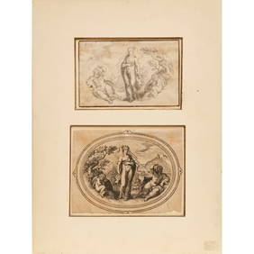
Sold18th C Andrea Zucchi, colored engravingAndrea Zucchi, engraving: "Christ Washing Feet of Disciples"18th C colored engraving.Dimension: image: 22 ½" X 15 ½" frame: 30" X 23 ¼"Condition: no ripsSee Sold Price
Sold18th C Engraving “George Buchanan” w/ Putti18Th C. Engraving Of “George Buchanan” With Putti Figure And Assorted Design Elements 8 ½” X 13 ½” H. In A Cherry Frame With Egg And Dart Carving 11”X15 ½&See Sold Price
SoldTWO 18TH C DUTCH ARCHITECTURAL ENGRAVINGS w COLORTwo hand colored 18th Century copper plate engravings of Dutch architectural scenes of mansions. Circa 1790. Each Image: 11" x 14 1/2". Each silver gilt frame: 17 3/4" x 21 1/4". Total weight: 7 lbs.See Sold Price
Sold(2) 18th C. English Engravings by W. HogarthTwo (2) 18th Century English engravings, engraved by William Hogarth and dated 1747, 10 1/2" x 13 1/2" (sight), in frames 16 3/4" x 19 3/4". Good condition.See Sold Price
Sold18th C. French Map w/ Oiled Paper, ex-Sotheby'sEurope, France, map from 1709 CE, oiled paper overlays from 1756 to 1763 CE, owned by Louis-Alexandre Berthier (1753 to 1815 CE), Marshal, Vice-Constable of France, and Chief of Staff (Major general)See Sold Price
Sold18th C. Cuban Map Engraving on Copper18th C. Cuban Map Engraving on Copper. Image size: 6.5 x 9 inches.See Sold Price
18thc Copper Plate Engraving, Road Map of KentOriginal, antique, copper-plate engraved, double sided Road Map of Kent, England, compiled by John Owen and engraved by Emmanuel Bowen in the 1720 edition of Britannia Depicta or Ogilby Improved. FramSee Sold Price
Pr of 18th c Hand Colored Engravings by WardPr of 18th c hand colored engravings by W. Ward- "A Visit to the Child at Nurse", "A Visit to the Boarding School", some foxing, sight 18 3/4" x 22 1/2"See Sold Price
Sold4 copper engraving maps4 copper engraving maps, 18th C., 1x Rheinverlauf of F. de Wit, cartouche and borders colored, bow folds, approx. 22.5x103cm; Palatinatus Rheni of Janssonius, partially colored, approx. 38x48cm; LineSee Sold Price
SoldRare JOHN BOYDELL 18thC Engraving558. Rare JOHN BOYDELL 18thC Engraving: 22 1/2"W X 18"T with 3" Mat and 1" Frame. John Boydell (1719-1804) Copper Engraving Titled "Saint John Preaching in The Wilderness, 1768". Bear in Mind that allSee Sold Price
Sold18TH C. STYLE ENGRAVING OF ROMAN BUILDING W/DESIGNER MIRRORED FRAME, 24 1/4"H X 17"W SIGHTSee Sold Price
JOHANN MATTHIAS HASE ENGRAVING MAP AFRICA, 18TH C.Unframed map, engraving on paper, "'Africa Secundum Legitimas Projectionis Stereographicae regulas," Johann Matthias Hase (German, 1684-1742), cartouche with title in lower left corner, illustrated wiSee Sold Price
EARLY 18TH C. DUTCH CHART OF PACIFIC OCEAN BY FREDERIK DE WIT (1629-1706) WITH CALIFORNIA AS ANThomaston Place Auction Galleries4.4(394)See Sold PriceFeb 24, 2024
EARLY 18TH C. MAP OF ITALY, FRAMEDThomaston Place Auction Galleries4.4(394)See Sold PriceFeb 24, 2024
18TH C. ANTIQUE MAP: FRENCH & INDIAN WAR, FRAMEDThomaston Place Auction Galleries4.4(394)See Sold PriceFeb 24, 2024
Johann Homann Hand-Colored Map Engraving, c. 1730Auctions at Showplace4.6(744)See Sold PriceMar 17, 2024
Willem Blaeu, Etc. 17th C. Antiquarian Maps, 2Auctions at Showplace4.6(744)See Sold PriceMar 17, 2024
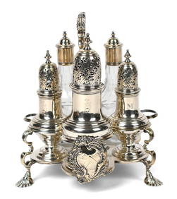
GEORGE II 18TH C. SAMUEL WOOD STERLING CRUET.William Smith Auctions4.6(147)See Sold PriceMar 06, 2024
Chinese Export Porcelain Teapots, Creamer & Plate, Ca. 18th C., H 5.75" W 4.5" L 6" 4 pcsDuMouchelles4.6(833)See Sold PriceMar 14, 2024