ATLAS of ANTIENT GEOGRAPHY by SAMUEL BUTLER 1843John McInnis Auctioneers,LLC4.5(505)See Sold PriceFeb 24, 2024
18TH C. ANTIQUE MAP: FRENCH & INDIAN WAR, FRAMEDThomaston Place Auction Galleries4.4(393)See Sold PriceFeb 24, 2024
Rand McNally Railroad Map Cabinet w/ 21 Railroad MapsRail & Road Auctions4.6(165)See Sold PriceMar 08, 2024
Keith Haring - Ink on New York Map, Best Buddies, Inscribed, Signed, and DatedSapphire Auction Gallery4(67)See Sold PriceMar 02, 2024
LATE 17TH C. FRENCH MAP OF THE NEW WORLD BY ALEXIS-HUBERT JAILLOT (1632-1712)Thomaston Place Auction Galleries4.4(393)See Sold PriceFeb 24, 2024
Central Railroad of New Jersey Map of Sandy Hook Route-ca. 1903JM Hobby Supply and Railroad Artifact Auctions4.4(127)See Sold PriceFeb 24, 2024
Lot of Six Mixed Atlas Box Cars-HO Scale-New in BoxJM Hobby Supply and Railroad Artifact Auctions4.4(127)See Sold PriceFeb 25, 2024
Rand McNally/Santa Fe Railroad Map of Iowa-1912JM Hobby Supply and Railroad Artifact Auctions4.4(127)See Sold PriceFeb 24, 2024
NICOLAES VISSCHER (NETHERLANDS, 1618-1709) MAP OF THE NEW WORLDThomaston Place Auction Galleries4.4(393)See Sold PriceFeb 24, 2024
17TH C. WORLD MAP BY NICOLAES VISSCHER (NETHERLANDS, 1618-1709)Thomaston Place Auction Galleries4.4(393)See Sold PriceFeb 24, 2024
Lot of Six Mixed Atlas Cabooses-HO Scale-New in BoxJM Hobby Supply and Railroad Artifact Auctions4.4(127)See Sold PriceFeb 25, 2024
Sold18th C. Map of Australia w/Strait of Magellan18th c. framed map of Australia w/the Strait of Magellan. Copper engraved map, hand colored, w/ large colored pictorial cartouche, by Bernaidus Joannis Manasterienfis. Visible paper measures approximaSee Sold Price
Sold18th c. Needlepoint MapNeedlepoint map, 18th century, on silk, showing Africa, Middle-East, Europe, Asia, Australia. Framed and with early matting, sight measures 15" x 15", overall with frame 20" x 20". The designation ofSee Sold Price
Sold(18th c) NEW AND ACCURATE MAP OF THE WORLDAs recorded by circum-navigators Ferdinand Magellan, Sir Francis Drake and Commodore Anson by Eman Bowen geographer to His Majisty. Vol. 1 page 6. 16 x 23 inches.See Sold Price
SoldTRANQUILLO MOLLO ATLASTRANQUILLO MOLLO ATLAS; Thirty-four maps out of an original fifty-two include America, United Kingdom, Australia, etc., Vienna, late 18th/early 19th c.; Most maps with color; 15'' x 20''See Sold Price
TWO LATE 18TH C. RIGOBERT BONNE DOUBLE SIDED MAPSTwo Rigobert Bonne (French 1727-1794), double sided maps, late 1780s, etching on paper comprising one map of the Tierra del Fuego and South Atlantic Islands and one map of the Strait of Magellan and TSee Sold Price
SoldHomann Heirs, Charte van AsienHomann Heirs, Charte van Asien, Homann Heirs (18th c.), "Charte von Asien", c. 1793, hand-colored map of the continent including all of South East Asia and the northern tip of Australia, 20.5"h x 24.5See Sold Price
SoldJefferys' 18th Century Map of the Straight of MagellanA Chart of the Straits of Magellan Inlarged from the Chart Published at Madrid in 1769 by Don Juan de la Cruz Cano y Olmedilla. Thomas Jefferys (c. 1719 – 1771). Copperplate engraved map with handcoSee Sold Price
Sold18th C. Map of LouisianaAn 18th C. hand-colored engraved map by Emanuel Bowen, titled "A New and Accurate Map of Louisiana with Part of Florida and Canada, and the Adjacent Countries", Plate 59. Likely from the "Complete AtlSee Sold Price
Sold18th c. "Map of the Southern States of America,"18th c. "Map of the Southern States of America,"copperplate engraving by John Russell, from THE AMERICAN ATLAS (London: H. D. Symonds, 1795-95), shown are Maryland, Virginia, the Carolinas, Georgia, KSee Sold Price
SoldFRAMED RARE 18TH C. MAP OF CORFU BY HOMANNSPlan de la Place de Corfu avec ses Environs Assiegee Par les Infideles, tranchee ouverte le 25me Juillet jusqu'au 22 me d'Aout, Iour de la Fuite des Ottomans". Homann, J. B. Circa 1740. Hand colored cSee Sold Price
Sold18th C Map Ancient World JerusalemEngraved plate showing maps of ancient world including inset of Judea and Samaria and one of Jerusalem. Early 18th century.Very Good, trimmed to plate lines, measures 7 x 5.5". Reserve: $20.00 ShippinSee Sold Price
Sold18th c. map of North America- H. Popple18th c, map by Henry Popple- ''Nova Mappa Geographica Americae Septentrionalis''- engraving with original hand-coloring, minor vertical printer's wrinkle from Central America to Lake Erie, large margiSee Sold Price
Sold18TH C MAP, NORTH AMERICA, UNITED STATES & MEXICOJohann Baptist Homann (German, 1664-1724). "Regni Mexicani seu Novae Hispaniae" - circa 1725, engraving with hand coloring. Approx. 20.75" x 24" (sheet) Item from the Estate of Forest "Tag" Hunter, AtSee Sold Price
Sold17th and 18th C. Maps of Florida and EnglandTwo 17th & 18th century maps. Item 1: Hand-colored and engraved map of West Florida, dated 1772. Titled "A Map of Part of West Florida, from Pensacola to the Mouth of the Iberville River, with a ViewSee Sold Price
SoldHENRY POPPLE 18th C. MAP: BRITISH EMPIRE IN AMERICAA Map of the British Empire in America with the French, Spanish and Hollandish Settlements', by Henry Popple, Covens & Mortier: Two sheets joined at the center, the left hand sheet includes an ornateSee Sold Price
Sold18th c. Map of America- Emanuel Bowen18th c. Map- ''A New and Accurate Map of America''- engraved map, 1748, from John Harris- ''Complete Collection of Voyages and Travels'', short repaired separation at top of centerfold. 14 3/8 x 17 5/See Sold Price
Sold18th c. map of Africa showing known kingdomsHeading: Author: Robert de Vaugondy, Gilles and Didier Title: L'Afrique dressée, sur les relations les plus recentes, et assujettie aux observations astronomiques Place Published: [Paris] Publisher:See Sold Price
Sold18TH C. MAP OF JERUSALEM, UNFRAMED"A New Plan of Old Jerusalem, According to the Author", 1732, by Antoine Augustin Calmet (1672-1757), Leide, hand colored copperplate engraving, on wove paper, unframed, in mat, 13" x 17" image. VerySee Sold Price
Sold18th c. Map of Fantasy Utopia by Johann Baptist HomannsEarly 18th century map titled "Accurata Utopiae Tabula das ist der Neu entdeckten Schalck-Welt oder des so offt benanten..." showing a non-existent fantasy "utopia" by Johann Baptist Homann publishedSee Sold Price
SoldLarge and impressive 18th C. map of the Empire of JapanA large and impressive map of the Empire of Japan, by Mattheus Seuter, Amsterdam, 1720-1740. The title: Empire of Japan in 66 Regions. The land areas fully colored, but title cartouche to Benjamin DutSee Sold Price
Sold3 18th C. maps incl. R. Vaugondy and J. BaylyItem 1: Robert de Vaugondy hand colored map "Amerique septen trionale." French, 1750. 6 3/8" H x 6 1/2" W. Item 2: Robert de Vaugondy hand colored map "Mappe Monde" French, 1750. 6 3/8" H x 12 1/8" W.See Sold Price
EARLY 18TH C. DUTCH CHART OF PACIFIC OCEAN BY FREDERIK DE WIT (1629-1706) WITH CALIFORNIA AS ANThomaston Place Auction Galleries4.4(393)See Sold PriceFeb 24, 2024
EARLY 18TH C. MAP OF ITALY, FRAMEDThomaston Place Auction Galleries4.4(393)See Sold PriceFeb 24, 2024
18TH C. ANTIQUE MAP: FRENCH & INDIAN WAR, FRAMEDThomaston Place Auction Galleries4.4(393)See Sold PriceFeb 24, 2024
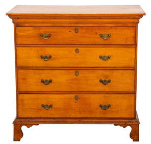
American Federal Period Maple Chest, Late 18th C.Auctions at Showplace4.6(740)See Sold PriceMar 03, 2024
PAIR (18th c) OF FLINTLOCK DUELING PISTOLSJohn McInnis Auctioneers,LLC4.5(505)See Sold PriceFeb 24, 2024
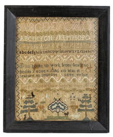
(18th c) SAMPLER by SARAH BROWN born 1780.John McInnis Auctioneers,LLC4.5(505)See Sold PriceFeb 25, 2024
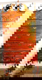
Period 18Th C. Queen Anne Bonnet Top Tiger Maple HighboyRalph Fontaine Heritage Auctions Inc.4.7(236)See Sold PriceFeb 25, 2024
Two (2) Antique 18th C. Copper Engraved Framed Maps - America & EuropeMagnusson Art Group4.5(53)See Sold PriceMar 14, 2024
D'Entrecasteaux - Australia: Coasts of Van Diemen's Land (New Holland). 9Trillium Antique Prints & Rare Books4.5(32)See Sold PriceFeb 24, 2024
D'Entrecasteaux - Tasmania, Australia: Map of the Northern Portion of Recherche Bay. 5Trillium Antique Prints & Rare Books4.5(32)See Sold PriceFeb 24, 2024
D'Entrecasteaux - Australia: Chart of Van Diemen's Land (New Holland). 3Trillium Antique Prints & Rare Books4.5(32)See Sold PriceFeb 24, 2024
D'Entrecasteaux - Map of Australia (New Holland), New Zealand, and southern Asia and surroundingTrillium Antique Prints & Rare Books4.5(32)See Sold PriceFeb 24, 2024
1758 MAP PARTIE DE LA MER GLACIALE contenants La Nouvelle Zemble RUSSIA antiqueJasper524.5(9.9k)See Sold PriceFeb 27, 2024
ANTIQUE ROMAN ARMORIAL VELLUM BINDING, 1744, ILLUSTRATED WITH AN ANTIQUE MAP BY FLORUSNY Elizabeth 4.2(86)See Sold PriceMar 03, 2024
THE WHOLE CHRONICLE OF POLYBIUS ANCIENT IN ENGLISH, 1756NY Elizabeth 4.2(86)See Sold PriceMar 03, 2024