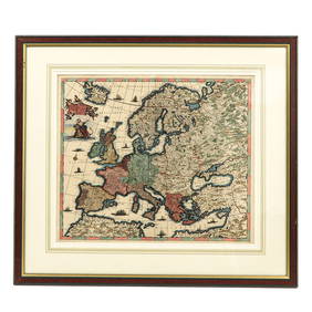
1730 Wetstein Map of Europe During Charlemaigne's Rule
Group of New York Central Railroad Paper - Rule Books, Employee Timetables, Stationary, Log Books,Mar 07, 2024Assortment of Railroad Paper - Rule Books, Stationary, Ink Blotter, Map, Timetables, and MoreMar 07, 2024A MapFeb 27, 2024Johann Homann Hand-Colored Map Engraving, c. 1730Mar 17, 2024Two (2) Antique 18th C. Copper Engraved Framed Maps - America & EuropeMar 14, 2024Chatelain - Map of the Americas and Details and Insets of Government CounselsFeb 24, 2024Chatelain - 3 Maps of IrelandFeb 24, 2024Carey, pub. 1796 - A Chart of the West IndiesFeb 24, 2024Carey, pub. 1796 - Map of the State of MarylandFeb 24, 2024Carey, pub. 1796 - Map of GeorgiaFeb 24, 2024Carey, pub. 1796 - Map of The State of South CarolinaFeb 24, 2024Carey, pub. 1796 - Map of KentuckyFeb 24, 2024Carey, pub. 1796 - Map of the Tennassee State formerly part of North Carolina (Tennessee)Feb 24, 20241816 MAP SOUTHERN PART OF RUSSIA or MUSCOVY in EUROPE copper engraving ANTIQUEFeb 27, 20241704 DESCRIPTION OF ALL THE SEATS OF THE PRESENT WARS OF EUROPE antique w/ MAPSFeb 27, 2024BRAM STOKER'S DRACULA (1992) - Framed Map of Central EuropeMar 13, 2024Railways & Transport.- [Prospectus] The Dorking, Brighton, and Arundel Atmospheric Railway, byFeb 29, 2024Clarke & Neele 1815 Map. Europe - Recent Political ChangesMar 01, 2024Cooke, George 1801 Antique Map. EuropeMar 01, 2024Cooke, George 1801 Antique Map. Turkey in EuropeMar 01, 2024Barclay, James 1808 Antique Map. Russia in EuropeMar 01, 2024Walker, John C1805 Antique Map. EuropeMar 01, 2024CLEMENT XII: (1652-1740)Mar 13, 2024CASTLEREAGH VISCOUNT: (1769-1822)Mar 14, 2024 


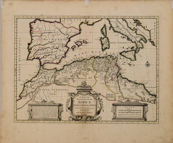
![3 pieces. Hand-Colored Engraved Maps. [Europe]: H (1 of 0)](https://p1.liveauctioneers.com/dist/images/placeholder.jpg?height=282&quality=70)


![Railways & Transport.- [Prospectus] The Dorking, Brighton, and Arundel Atmospheric Railway, by (1 of 1)](https://p1.liveauctioneers.com/5458/319736/171654703_1_x.jpg?height=282&quality=70&version=1708010439)