SoldMoule (Thomas) A group of county mapsMoule (Thomas) A group of county maps,including Hertfordshire, Kent, Buckinghamshire, Cornwall, and Berkshire, all with ornamental borders incorporating vignette views and scenes, hand-coloureSee Sold Price
Moule (Thomas) 50 county maps and city plansMoule (Thomas) a group of 50 county maps and city plans,from The English Counties Delineated, including plans of London, Oxford, Cambridge, Bath and elsewhere, most with decorative borders andSee Sold Price
SoldBENG Moule (Thomas) a group of 15 decorative countBENG Moule (Thomas) a group of 15 decorative county maps,including Surrey, Sussex, Kent, the Isle of Wight, Yorkshire and elsewhere, also plans of Bath, Oxford and Cambridge, engraved maps witSee Sold Price
SoldMoule (Thomas) Warwickshire; ShropshireMoule (Thomas) Warwickshire; Shropshire,county maps, with ornamental borders incorporating vignette views and scenes, the former with a vignette of Shakespeare, 2 engraved maps with full hand-See Sold Price
SoldKitchin (Thomas) - A Group of English County Mapsincluding Monmouthshire, Cambridgeshire, Lincolnshire and others, 7 engraved maps including 1 duplicate, engraved vignettes, occasional browning, central vertical folds, c.225 x 285mm, 1768 ; with a lSee Sold Price
Essex Antique County Map By Thomas Moule, C 1840Essex Antique Hand-coloured County Map By Thomas Moule, C 1840. Size: Approx 12.0 x 17.0cm, 4.75 x 6.75 inches. Antique engraved map. Hand colour Please note that this lot has a confidential reserve.See Sold Price
SoldMoule (Thomas) - A Group of English Country Maps,including Yorkshire, Cornwall, Gloucestershire, Lancashire, 24 engraved maps plus 5 duplicates, 8 hand-coloured, engraved vignettes, each c.270 x 200mm., occasional browning at edges, occasional spottSee Sold Price
SoldBowen & Kitchin. English & Welsh County mapsBowen (Emanuel) and Thomas Kitchin. a good group of county maps of England and Wales,32 maps on 29 sheets, mostly by Bowen, but Warwickshire, Oxfordshire, Hartfordshire, Cornwall, Durham, HampSee Sold Price
SoldMaps: Two engraved and hand coloured county maps afterMaps: Two engraved and hand coloured county maps after Thomas Moule, one depicting Warwickshire with a view of Kenilworth Castle and Warwick Castle; the other depicting Leicestershire with a view of BSee Sold Price
SoldMaps: Two engraved and hand coloured county maps afterMaps: Two engraved and hand coloured county maps after Thomas Moule, one depicting Warwickshire with a view of Kenilworth Castle and Warwick Castle; the other depicting Leicestershire with a view of BSee Sold Price
SoldMaps: Two engraved and hand coloured county maps afterMaps: Two engraved and hand coloured county maps after Thomas Moule, one depicting Warwickshire with a view of Kenilworth Castle and Warwick Castle; the other depicting Leicestershire with a view of BSee Sold Price
SoldA 19thC monochrome engraved county map after ThomasA 19thC monochrome engraved county map after Thomas Moule depicting Hampshire with a vignette view of Southampton. Approx. 8" x 10 1/4"See Sold Price
Sold(3) MAPS OF ENGLAND COUNTIES BY THOMAS MOULE, CIRCA"Cumberland", "Northumberland" and "Westmoreland" by Thomas Moule, published in Barclay's Universal English Dictionary, about 1850. Decorative steel engraved antique map with later hand coloring, haviSee Sold Price
SoldEngland.- A mixed group of county mapsEngland.- A mixed group of county maps,Kent, Herefordshire, Surrey, Westmoreland, Hertfordshire, Worcestershire, by or after Blome, Simpson, Morden, Moule, and Cary, engravings, some hand-coloSee Sold Price
SoldCambridgeshire.- a mixed group of county mapsCambridgeshire.- a mixed group of small county maps,some with inset plans or vignette views and other ornamentation, by, for or after Blome, Cary, Moll, Morden, Moule, Ramble, Rocque, Seller,See Sold Price
SoldMiddlesex.- a good group of county mapsa good group of county maps,including two editions of Moule's map with interesting variants of the vignettes showing the Houses of Parliament before and after the fire, and alternative viewsSee Sold Price
SoldEngland.- a mixed group of county maps of south eaEngland.- a mixed group of county maps of south east England,including Sussex, Kent, Essex, Middlesex, by or after Teesdale, Cary, Moule, and others, engravings, some with outline hand-colouriSee Sold Price
SoldAntique Moule's English Counties Map EngravingHand colored engraving. Thomas Moule, British cartographer. Lord Lonsdale coat of arms, "Reference to the Wards". Refer to photos for frame verso with attached info. Double matted, clean frame. DimensSee Sold Price
SoldCAMBRIDGE. TWO ACKERMANN AQUATINTSCambridge. Two Ackermann aquatints of College gowns; county map by Greenwood (unframed, folded); other maps by Henry Teesdale and Thomas Moule; and a collection of related unframed printsSee Sold Price
SoldAntique Framed Moule's Map of SuffolkPublished 1850 AD. A framed and hand-coloured engraved map of the county of Suffolk by Thomas Moule from Barclay's Universal English Dictionary, including vignettes of Euston Hall and Heveningham HallSee Sold Price
SoldMaps: Two monochrome engraved and hand coloured countyMaps: Two monochrome engraved and hand coloured county maps, one depicting Momouthshire with a view of Chepstow Castle and Tintern Abbey; the other after Thomas Moule depicting Lincolnshire with a vieSee Sold Price
SoldMaps: Two monochrome engraved and hand coloured countyMaps: Two monochrome engraved and hand coloured county maps, one depicting Momouthshire with a view of Chepstow Castle and Tintern Abbey; the other after Thomas Moule depicting Lincolnshire with a vieSee Sold Price
SoldMaps: Two monochrome engraved and hand coloured countyMaps: Two monochrome engraved and hand coloured county maps, one depicting Momouthshire with a view of Chepstow Castle and Tintern Abbey; the other after Thomas Moule depicting Lincolnshire with a vieSee Sold Price
SoldMaps: Two monochrome engraved and hand coloured countyMaps: Two monochrome engraved and hand coloured county maps, one depicting Momouthshire with a view of Chepstow Castle and Tintern Abbey; the other after Thomas Moule depicting Lincolnshire with a vieSee Sold Price
Crams Map of North Dakota-Complete Railroad System and County Map-1907JM Hobby Supply and Railroad Artifact Auctions4.4(126)See Sold PriceFeb 24, 2024
DUNLEVIE c1856 Map Counties Of Gaspe & Bonaventure Quebec Canada SCARCE! #2Luis Porretta Fine Arts4.3(10)See Sold PriceMar 02, 2024
DUNLEVIE c1856 Map Counties Of Gaspe & Bonaventure Quebec Canada SCARCE! #1Luis Porretta Fine Arts4.3(10)See Sold PriceMar 02, 2024
THOMAS MOULE 1837 Colored Map of Warwickshire Framed vgcLuis Porretta Fine Arts4.3(10)See Sold PriceMar 02, 2024
Vintage County Map Of NY State Plate EngravingThe Benefit Shop Foundation Inc.4.3(2.9k)See Sold PriceFeb 28, 2024
Portfolio of 15 County Maps by Robert Morden (English 1650-1703)Nadeau's Auction Gallery4.7(401)See Sold PriceFeb 24, 2024
[ENSLAVEMENT & ABOLITION]. A group of 2 legal documents related to cases involving enslaved persons.Freeman's | Hindman4.4(1.6k)See Sold PriceFeb 27, 2024
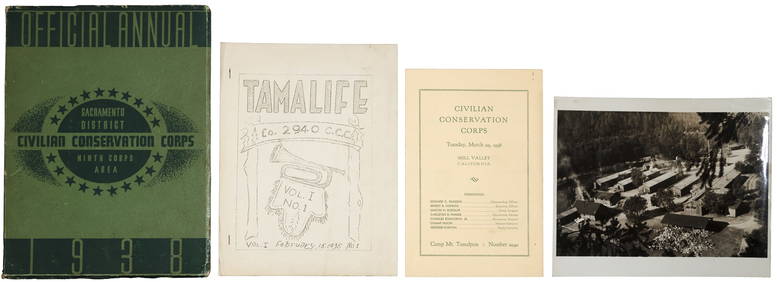
VARIOUS ARTISTS [BRITISH TRAVEL GUIDES]. Group of 6 map booklets and flyers. 1930s.Swann Auction Galleries4.4(65)See Sold PriceFeb 29, 2024
Nottingham.- Brown (Cornelius) Lives of Nottinghamshire Worthies, 1882; and another similar (3).Forum Auctions4.3(52)See Sold PriceFeb 29, 2024
Mary Jane Thomas Stokes - Map of Lighthouses of the Chesapeake Bay. Past and PresentProverde Auctions4.3(3)See Sold PriceFeb 28, 2024
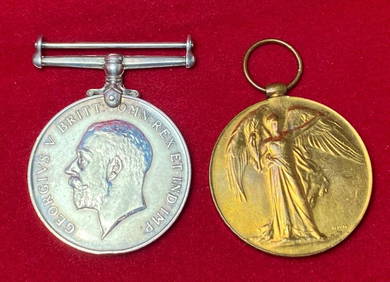
2nd Lieut. F.M. Thomas GroupRapid Estate Liquidators and Auction Gallery4.5(1.1k)See Sold PriceFeb 29, 2024
Ronald Kowalke (American) Etchings on Paper "William Blake; Thomas Merton", Group of Two Prints, HDuMouchelles4.6(825)See Sold PriceMar 15, 2024


![[ENSLAVEMENT & ABOLITION]. A group of 2 legal documents related to cases involving enslaved persons. (1 of 11)](https://p1.liveauctioneers.com/197/319238/171468068_1_x.jpg?height=282&quality=70&version=1707520367)

![VARIOUS ARTISTS [BRITISH TRAVEL GUIDES]. Group of 6 map booklets and flyers. 1930s. (1 of 2)](https://p1.liveauctioneers.com/199/319703/171640571_1_x.jpg?height=282&quality=70&version=1707943705)