SoldEngland.- a mixed group of county maps of south eaEngland.- a mixed group of county maps of south east England,including Sussex, Kent, Essex, Middlesex, by or after Teesdale, Cary, Moule, and others, engravings, some with outline hand-colouriSee Sold Price
SoldEngland- mixed group of county mapsA small, mixed, group of county maps,Leicestershire, Bedfordshire and Cambridgeshire, several of the latter including duplicates, also duplicate city plans of Oxford and a map of England andSee Sold Price
SoldEngland.- A mixed group of county mapsEngland.- A mixed group of county maps,Kent, Herefordshire, Surrey, Westmoreland, Hertfordshire, Worcestershire, by or after Blome, Simpson, Morden, Moule, and Cary, engravings, some hand-coloSee Sold Price
SoldEngland.- a mixed group of county mapsa mixed group of county maps,Bedfordshire, Berkshire, Buckinghamshire, Cumberland, Oxfordshire and Somerset, several versions of the the first three named, by, for or after Archer, Lewis, MurSee Sold Price
SoldEngland.- small, mixed, group of county mapsEngland.- a small, mixed, group of county maps,Leicestershire, Bedfordshire and Cambridgeshire, several of the latter including duplicates, also duplicate city plans of Oxford and a map of EngSee Sold Price
SoldEngland.- a mixed group of county maps of the nortEngland.- a mixed group of county maps of the north of England,including Cheshire, Durham, Nottinghamshire, by or after Scott, Cary, Kitchin, and others, engravings, v.s., occasional surface dSee Sold Price
Sold7 maps of south east EnglandEngland.- A small, mixed group of maps of south east England, including Essex, Surrey (3), Sussex (2), 7 engraved maps, from 380 x 520mm. to 685 x 980mm., dissected and linen-backed, one withSee Sold Price
SoldEngland and Wales.- a small, mixed, group of counA small, mixed, group of county maps,including a small Morden map of Hertfordshire, a Moll map of Cambridgeshire, Owen and Bowen's The Road from Prestain to Carmarthen, and Caermarthen ShireSee Sold Price
SoldA small mixed group of English county maps,comprising Cornwall by Robert Morden for 'New Description and State of England', 1701; Northumbriæ Comitatus by Saxton and Hole, and Huntingdon Comitatus by Saxton and Kip, both for Camden's BritSee Sold Price
A small mixed group of English county maps,comprising Cornwall by Robert Morden for 'New Description and State of England', 1701; Northumbriæ Comitatus by Saxton and Hole, and Huntingdon Comitatus by Saxton and Kip, both for Camden's BritSee Sold Price
A small mixed group of English county maps,comprising Cornwall by Robert Morden for 'New Description and State of England', 1701; Northumbriæ Comitatus by Saxton and Hole, and Huntingdon Comitatus by Saxton and Kip, both for Camden's BritSee Sold Price
SoldA mixed group of maps of the British IslesA large mixed group of maps of the British Isles, including several county maps, small road maps (10), and others of England, Wales, Scotland and Ireland, engravings and lithographs, severalSee Sold Price
SoldBritish Isles.- Mixed group of mapsMixed group of maps of the British Isles,including several of the Ports and Harbours of the Coast of England, by Fullarton, the Channel Isles by Rapkin, county maps by Moule, Cary, and othersSee Sold Price
SoldCambridgeshire.- a mixed group of county mapsCambridgeshire.- a mixed group of small county maps,some with inset plans or vignette views and other ornamentation, by, for or after Blome, Cary, Moll, Morden, Moule, Ramble, Rocque, Seller,See Sold Price
SoldA mixed group of county mapsBritish Isles.- A mixed group of county maps, Worcestershire, Devonshire, Westmoreland, Shropshire, Derbyshire, Middlesex, Northumberland, Durham, Glocestershire, Shropshire, for or by W.Kip,See Sold Price
SoldWales.- A small, mixed group of county mapsWales.- A small, mixed group of county mapsby or after Walker, Weller, Pigot and others, including Monmouthshire, Glamorganshire and elsewhere with a plan of Cardiff, engraved maps, some hand-See Sold Price
Solda mixed group of county mapsa mixed group of county maps,Bedfordshire, Berkshire, Buckinghamshire, Cumberland, Oxfordshire and Somerset, several versions of the the first three named, by, for or after Archer, Lewis, MurSee Sold Price
SoldCambridgeshire.- a mixed group of county maps-. a mixed group of small county maps,including a detailed plan of Bury St Edmunds, by Henshall after Dawson, and the Fens of the Bedford Levels, by R. Walker, some of the county maps with insSee Sold Price
SoldA mixed group of maps of South AmericaA small, mixed group of maps of South America, including British Guiana, Ucayali & Amazon, several of the Falkland Islands, including one plan of Port Louis, lithographs, v.s., from 480 x 600See Sold Price
SoldA mixed group of maps of South Africa-. A mixed group of maps of South Africa, including British Kaffraria, the District of Natal, Transvaal, the Colony of the Cape of Good Hope, and others, by Henry Hall, J. Arrowsmith, V. A. MaSee Sold Price
SoldA mixed group of English county mapsA mixed group of English county maps,including 3 maps by Morden, 2 of Wiltshire, 1 of Hampshire, an Ogilby road map from 'Monmouth to Llanbeder, c.1676, a Bowen map of Middlesex, and 6 othersSee Sold Price
Soldgroup of maps of South & Central AmericaSouth America.- a mixed group of maps of South and Central America,a few of the Western Hemisphere, some with vignette views or costume figures, for, by or after Fullerton, Teesdale, SDUK, RapSee Sold Price
SoldA Mixed Group Of Maps Of N. and S. AmericaA Small, Mixed Group Of Maps Of North and South America, by Thos. Kitchin, J. Migeon, S. Hall and others, engravings and lithographs, v.s., from 180 x 130mm. to 350 x 450mm., several with hanSee Sold Price
SoldA Mixed Group Of National, County, RegionalA Mixed Group of National, County and Regional Maps,including Herefordshire, Yorkshire, Glasgow, and a comparaison sheet of lakes and islands by, for or after Morden, SDUK, Carey and others,See Sold Price
Portfolio of 15 County Maps by Robert Morden (English 1650-1703)Nadeau's Auction Gallery4.7(410)See Sold PriceFeb 24, 2024
Assortment of Railroad Paper - Rule Books, Stationary, Ink Blotter, Map, Timetables, and MoreRail & Road Auctions4.6(165)See Sold PriceMar 07, 2024
Group of Ten Railroad Photographs, Maps, and Prints - New Jersey, Long Island, and New YorkRail & Road Auctions4.6(165)See Sold PriceMar 07, 2024
10 Rare Civil War Leader Cards London England GallerySouth Florida Auction & Estate Sale Services Inc4.5(522)See Sold PriceMar 08, 2024
10 Rare Civil War Leader Cards London England GallerySouth Florida Auction & Estate Sale Services Inc4.5(522)See Sold PriceMar 08, 2024
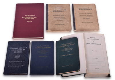
Seven Assorted Railroad Books - Union Pacific Operating Rules and Telegraph Code Book, MilwaukeeRail & Road Auctions4.6(165)See Sold PriceMar 08, 2024
VARIOUS ARTISTS [BRITISH TRAVEL GUIDES]. Group of 6 map booklets and flyers. 1930s.Swann Auction Galleries4.4(71)See Sold PriceFeb 29, 2024


![VARIOUS ARTISTS [BRITISH TRAVEL GUIDES]. Group of 6 map booklets and flyers. 1930s. (1 of 2)](https://p1.liveauctioneers.com/199/319703/171640571_1_x.jpg?height=282&quality=70&version=1707943705)


