ATLAS of ANTIENT GEOGRAPHY by SAMUEL BUTLER 1843John McInnis Auctioneers,LLC4.6(504)See Sold PriceFeb 24, 2024
18TH C. ANTIQUE MAP: FRENCH & INDIAN WAR, FRAMEDThomaston Place Auction Galleries4.4(389)See Sold PriceFeb 24, 2024
Rand McNally Railroad Map Cabinet w/ 21 Railroad MapsRail & Road Auctions4.6(165)See Sold PriceMar 08, 2024
Keith Haring - Ink on New York Map, Best Buddies, Inscribed, Signed, and DatedSapphire Auction Gallery4.1(67)See Sold PriceMar 02, 2024
LATE 17TH C. FRENCH MAP OF THE NEW WORLD BY ALEXIS-HUBERT JAILLOT (1632-1712)Thomaston Place Auction Galleries4.4(389)See Sold PriceFeb 24, 2024
Central Railroad of New Jersey Map of Sandy Hook Route-ca. 1903JM Hobby Supply and Railroad Artifact Auctions4.4(126)See Sold PriceFeb 24, 2024
Lot of Six Mixed Atlas Box Cars-HO Scale-New in BoxJM Hobby Supply and Railroad Artifact Auctions4.4(126)See Sold PriceFeb 25, 2024
Rand McNally/Santa Fe Railroad Map of Iowa-1912JM Hobby Supply and Railroad Artifact Auctions4.4(126)See Sold PriceFeb 24, 2024
NICOLAES VISSCHER (NETHERLANDS, 1618-1709) MAP OF THE NEW WORLDThomaston Place Auction Galleries4.4(389)See Sold PriceFeb 24, 2024
17TH C. WORLD MAP BY NICOLAES VISSCHER (NETHERLANDS, 1618-1709)Thomaston Place Auction Galleries4.4(389)See Sold PriceFeb 24, 2024
Lot of Six Mixed Atlas Cabooses-HO Scale-New in BoxJM Hobby Supply and Railroad Artifact Auctions4.4(126)See Sold PriceFeb 25, 2024
Antique map, DE HAUT RHIN 1787Antique MAP, 1787, NORD ou Septentrion, NORD QUEST, CHOROGRAPHIE, du BAS RHIN, 17in x 11.5 black & white folded; material: paper, Shipping cost: $19, Different rate(s) to California, Alaska Hawaii andSee Sold Price
Antique map, DE HAUT RHIN 1787Antique MAP, 1787, NORD ou Septentrion, NORD QUEST, CHOROGRAPHIE, du BAS RHIN, 17in x 11.5 black & white folded; material: paper, Shipping cost: $19, Different rate(s) to California, Alaska Hawaii andSee Sold Price
Desnos/de la Tour: Antique Map of Germany, 1771TITLE/CONTENT OF MAP: 'Cercles de Westphalie, Haut et Bas Rhin, divisés en toutes leurs Principautés et Provinces, tant Séculières qu'Ecclésiastiques. A Paris, Chéz le Sr. Desnos Ing? Géog? pouSee Sold Price
Antique Folio of Map-- Chorographie du Cercle du HautDescription: Very old double page folio copy of antique map-- Chorographie du Cercle du Haut Rhin d'après G. Valck, F. de Witt, Vischer etc. Directed by Philippe Pretot, of the Academie D'AngerSee Sold Price
Antique Folio of Map-- Chorographie du Cercle du HautDescription: Very old double page folio copy of antique map-- Chorographie du Cercle du Haut Rhin d'après G. Valck, F. de Witt, Vischer etc. Directed by Philippe Pretot, of the Academie D'Angers. LSee Sold Price
Antique Folio of Map-- Chorographie du Cercle du HautDescription: Very old double page folio copy of antique map-- Chorographie du Cercle du Haut Rhin d'après G. Valck, F. de Witt, Vischer etc. Directed by Philippe Pretot, of the Academie D'AngerSee Sold Price
Cercles de Westphalie, Haut et Bas Rhin. Germany.TITLE/CONTENT OF MAP: 'Cercles de Westphalie, Haut et Bas Rhin, divisés en toutes leurs Principautés et Provinces, tant Séculières qu'Ecclésiastiques. A Paris, Chéz le Sr. Desnos Ing? Géog? pouSee Sold Price
SoldMallet: Antique Map of Alsace / Rhine Valley, 1683Title of the Map: 'Cercle d'Alsace ou du Haut-Rhin' ALSACE/RHINE VALLEY Strasbourg Basel Frankfurt Date Printed: 1683 Image Size: Approx Overall page size 13 x 21cm approximately (5 x 8 inches); imageSee Sold Price
ALSACE/RHINE VALLEY Strasbourg Basel Frankfurt 'Cercle d'Alsace' MALLET 1683 mapTITLE OF THE MAP: 'Cercle d'Alsace ou du Haut-Rhin' (De L'Europe) DATE PRINTED: 1683 IMAGE SIZE: Approx Overall page size 13 x 21cm approximately (5 x 8 inches); image size 10.5 x 14.5cm approximatelySee Sold Price
Sold3 PISTOL BARRELS & 5 P-38 SLIDES PLUS RECOILSPRING. 1) Manurhin "0879" stripped slide. Marked on left side "MANUFACTURE DE MACHINES DU HAUT-RHIN" Manurhin logo "Made in France", "PISTOLET P1 9mm x 19". Marked on right side "BUND", "crossed cannSee Sold Price
Levasseur (Victor) Dépt du Haut RhinLevasseur (Victor) Dépt du Haut Rhin; ...de la Loire; ...de la Lozère; ...du Doubs, 4 engraved maps of French regions, with original outline hand-colouring, ornate decorated borders depictingSee Sold Price
Soldde LaPorte: Antique Map of India & Southeast Asia, 1787Map: India into SE Asia by De Laporte Date Printed: 1787 Cartographer: Jospeph De Laporte Material/Medium: Paper Size: 9 1/2" x 7 1/2" Condition: Excellent Published in Paris. Copperplate engraved. GeSee Sold Price
"I. Carte d'Alemagne" by BRION DE LA TOUR. BeneluxTITLE/CONTENT OF MAP: 'I. Carte d'Alemagne, comprenant les Cercles de Westphalie, du Haut et du Bas Rhin; les Pays-bas Autrichiens avec les provinces Unies' Date: 1777 IMAGE SIZE: Approx 18.5 x 16.5cmSee Sold Price
SoldBonne: Antique Map of the Western Hemisphere. 1787Title/Content of Map: Western Hemisphere - Antique 45 Degree Southern Oblique Projection. Mappe-Monde sur le plan Horizontal situe a 45 d. de latitude Sud. Hemisphere Occidental. Date Printed: 1787 CaSee Sold Price
SoldBonne: Antique Map of North America, 1787Very beautiful map of North America Author: Bonne, Rigobert (1727-1794). Atlas: Atlas de toutes parties connues du globe terrestre... Date: 1787 Technique: etching on copper Leaf Dimension: 38x30 cm (See Sold Price
SoldDelaporte: Antique Map of Poland Reserve, 1787Title/Content of Map: Poland Reserve Date Printed: 1787 Cartographer: Joseph Delaporte Material/Medium: Paper Size: 9 1/2" x 7 1/4" From the Atlas Ou Collection De Cartes. Geographiques Pour L'intelliSee Sold Price
Bonne: Antique Map Southern Polar Projection, 1787Title/Content of Map: Antique Pre-Antarctica Southern Polar Projection. Mappe-Monde sur le plan de l' Equateur, Hemisphere Meridional Date Printed: 1787 Cartographer: Bonne, Rigobert Size (inches): 14See Sold Price
SoldBonne: Antique Map of Tartary China Korea Japan, 1787Item: Map of Tartary China Korea Japan 1787 Bonne Etching On Copper Very beautiful map of Tartary, China, Korea and Japan Author: Bonne Rigobert (1727-1794) Atlas: Atlas de toutes parties connues du gSee Sold Price
SoldChastenet-Puysegur: Antique Map of Hispaniola, 1787Map: Carte Réduite de l'Isle de St. Domingue Cartographer: Chastenet-Puységur/Dépôt de la Marine Place & Date: Paris / 1787 Size: 37 1/4" x 23 1/2" Condition: b&w; light overall age toning; left mSee Sold Price
SoldBonne: Antique Map of Asia, 1787Item: Map of Asia 1787 Bonne Etching On Copper Very beautiful map of Asia Author: Bonne Rigobert (1727-1794) Atlas: Atlas de toutes parties connues du globe terrestre... Date: 1787 Technique: etchingSee Sold Price
Bonne: Antique Map of Tartary China Korea Japan, 1787Item: Map of Tartary China Korea Japan 1787 Bonne Etching On Copper Very beautiful map of Tartary, China, Korea and Japan Author: Bonne Rigobert (1727-1794) Atlas: Atlas de toutes parties connues du gSee Sold Price
Sold1787 MAP NORD ou SeptentrionAntique MAP, 1787, NORD ou Septentrion, NORD QUEST, CHOROGRAPHIE, du BAS RHIN, 17in x 11.5 black & white folded; material: paper, Shipping cost: $19, Different rate(s) to California, Alaska Hawaii andSee Sold Price
Chastenet-Puységur: Antique Map of St. Domingue, 1787Title/Content of Map: Carte Réduite de l'Isle de St. Domingue Cartographer: Chastenet-Puységur/Dépôt de la Marine Place & Date: Paris / 1787 Size: 37 1/4" x 23 1/2" Condition: beautifully colored;See Sold Price
Bonne: Antique Map of Martinique & Guadeloupe, 1787Isle de la Martinique/Isles de la Guadeloupe, de Marie Galante, de la Desirade, et celles des Saintes. Two maps, one of Martinique, the other of Guadeloupe and its adjacent islands, on one sheet fromSee Sold Price
17TH C. ANTIQUE MAP SIEGE OF LA ROCHELLE, FRANCE, FRAMEDThomaston Place Auction Galleries4.4(389)See Sold PriceFeb 24, 2024
De Jode, Rare, pub. 1593 - Map of Luxembourg (Lutzenburgii montuosissimi ac saltuosissimi ducatusTrillium Antique Prints & Rare Books4.5(30)See Sold PriceFeb 24, 2024
De Jode, Rare, pub. 1593 - Map of the British Isles [England, Scotland, Ireland] (Angliae Scotiae etTrillium Antique Prints & Rare Books4.5(30)See Sold PriceFeb 24, 2024
De Jode, Rare, pub. 1593 - Map of Italy (Italiae Totius Orbis olim Domatricis Nova ExactissTrillium Antique Prints & Rare Books4.5(30)See Sold PriceFeb 24, 2024
De Jode, Rare, pub. 1593 - Map of the Czech Republic or Kingdom of Bohemia (Chorographia insignisTrillium Antique Prints & Rare Books4.5(30)See Sold PriceFeb 24, 2024
De Jode, Rare, pub. 1593 - Map of the Middle East, Eastern Asia (Primae Partis Asiae accurataTrillium Antique Prints & Rare Books4.5(30)See Sold PriceFeb 24, 2024
De Jode, Rare, pub. 1593 - Map of Africa (Africae Vera Forma, et Situs)Trillium Antique Prints & Rare Books4.5(30)See Sold PriceFeb 24, 2024
Guinea-Bissau Cacheu town Fortaleza de São José da Amura Preparing cassava 1745Jasper524.5(9.8k)See Sold PriceFeb 28, 2024
AFRICA. French West Africa. Rio de Oro Rio Muni Nigeria. BARTHOLOMEW 1952 mapJasper524.5(9.8k)See Sold PriceFeb 28, 2024
La Barbarie de la Nigritie et de la Guinée'. West Africa. DE L’ISLE 1745 mapJasper524.5(9.8k)See Sold PriceFeb 28, 2024
États du Roi de Maroc… d’Alger, Tunis & Tripoli. North Africa. BONNE 1790 mapJasper524.5(9.8k)See Sold PriceFeb 28, 2024
Le Canal de Mosambique, l'Isle de Madagascar… Mozambique. Africa. BONNE 1788 mapJasper524.5(9.8k)See Sold PriceFeb 28, 2024
Barthelemy, Jean 1790 Map. Greece - Essa sur la Bataille de PlateeAlbion Auctions4.6(341)See Sold PriceMar 01, 2024
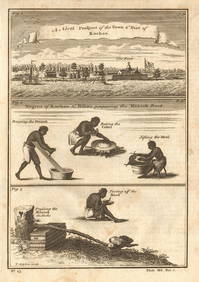
Antique Signed Prince Georges Bibesco Campagne De 1870 HardcoverRapid Estate Liquidators and Auction Gallery4.5(1.1k)See Sold PriceFeb 25, 2024
James Cook - Antique map Australia titled 'Gezigt van het Eil. Suffren'. Antique map of SuffrenProverde Auctions4.3(3)See Sold PriceFeb 28, 2024
Jacques Nicolas Bellin - Antique Map - Vue de la Rade de Tiniam, double antique coast view of theProverde Auctions4.3(3)See Sold PriceFeb 28, 2024
Poster "Les jardins de Paris", illustrated map and plan of Paris with its parcs, gardens, monuments,Proverde Auctions4.3(3)See Sold PriceFeb 28, 2024
Antique Map of Poland, 1700 by Guillaume De Lisle, ParisAntiques Online Auctions4.6(410)See Sold PriceMar 14, 2024


![De Jode, Rare, pub. 1593 - Map of the British Isles [England, Scotland, Ireland] (Angliae Scotiae et (1 of 2)](https://p1.liveauctioneers.com/6581/319571/171593327_1_x.jpg?height=282&quality=70&version=1707853304)