ATLAS of ANTIENT GEOGRAPHY by SAMUEL BUTLER 1843John McInnis Auctioneers,LLC4.6(504)See Sold PriceFeb 24, 2024
18TH C. ANTIQUE MAP: FRENCH & INDIAN WAR, FRAMEDThomaston Place Auction Galleries4.4(389)See Sold PriceFeb 24, 2024
Rand McNally Railroad Map Cabinet w/ 21 Railroad MapsRail & Road Auctions4.6(165)See Sold PriceMar 08, 2024
Keith Haring - Ink on New York Map, Best Buddies, Inscribed, Signed, and DatedSapphire Auction Gallery4.1(67)See Sold PriceMar 02, 2024
LATE 17TH C. FRENCH MAP OF THE NEW WORLD BY ALEXIS-HUBERT JAILLOT (1632-1712)Thomaston Place Auction Galleries4.4(389)See Sold PriceFeb 24, 2024
Central Railroad of New Jersey Map of Sandy Hook Route-ca. 1903JM Hobby Supply and Railroad Artifact Auctions4.4(126)See Sold PriceFeb 24, 2024
Lot of Six Mixed Atlas Box Cars-HO Scale-New in BoxJM Hobby Supply and Railroad Artifact Auctions4.4(126)See Sold PriceFeb 25, 2024
Rand McNally/Santa Fe Railroad Map of Iowa-1912JM Hobby Supply and Railroad Artifact Auctions4.4(126)See Sold PriceFeb 24, 2024
NICOLAES VISSCHER (NETHERLANDS, 1618-1709) MAP OF THE NEW WORLDThomaston Place Auction Galleries4.4(389)See Sold PriceFeb 24, 2024
17TH C. WORLD MAP BY NICOLAES VISSCHER (NETHERLANDS, 1618-1709)Thomaston Place Auction Galleries4.4(389)See Sold PriceFeb 24, 2024
Lot of Six Mixed Atlas Cabooses-HO Scale-New in BoxJM Hobby Supply and Railroad Artifact Auctions4.4(126)See Sold PriceFeb 25, 2024
SoldThree Maps, China & Japan, Brazil, and EuropeComprising, "An Accurate Map of Europe from the latest Observations & Discoveries, Universal Magazine J. Hinton, Newgate Street," "Carte Geographique Statistique et Historique du Bresil," and "China aSee Sold Price
Three Maps, China & Japan, Brazil, and EuropeComprising, "An Accurate Map of Europe from the latest Observations & Discoveries, Universal Magazine J. Hinton, Newgate Street," "Carte Geographique Statistique et Historique du Bresil," and "China aSee Sold Price
Three Maps, China & Japan, Brazil, and EuropeComprising, "An Accurate Map of Europe from the latest Observations & Discoveries, Universal Magazine J. Hinton, Newgate Street," "Carte Geographique Statistique et Historique du Bresil," and "China aSee Sold Price
Sold4 maps c.1636-1800. China & Europe[China/Europe]. 4 Maps, all engraved and with early hand-coloring, three are double-page. ++ Kiangsi, Imperii Sinarum Provincia Octava. Amst: Joannes Blaeu, c.1659-1662. 15 x 19 3/8 in. Browned, narroSee Sold Price
Sold5V Spain Morocco WORLD TRAVEL Japan China EuropeThis auction lot includes the following group of antique titles: - Travels Around the World by William H. Seward - Dated 1873 by D. Appleton and Company - three-quarter leather over marble boards wiSee Sold Price
Three 19th C. Asian Maps, c.1820 & c.1860Three 19th C. Asian Maps, China c.1820 Engraved by Anthony Finley, American, 1784-1836; China and Japan F.R.S.E. (with) Islands of Japan. Engraved & printed by W. & A.K. Johnston, Edinburgh. William BSee Sold Price
Smith: Map of Asia [verso] South Central Europe, 1894Map: 1894 Smith Map of Asia [verso] South Central Europe -- Map of Asia Showing its Geopolitical Divisions, and also the Various Routes of Travel between London & India, China & Japan &c. [verso] AustSee Sold Price
Sold185 19th-20th C. maps: Asia, Pacific, Europe[Asia/Europe]. About 186 Maps, including some 125 maps of countries in Asia and Pacific islands (Turkey, India, China, Japan, Philippines, Guam, and other locales), about 60 maps of Italy, Greece, HunSee Sold Price
SoldSmith: Antique Map of Asia, 1894Map: 1894 Smith Map of Asia [verso] South Central Europe -- Map of Asia Showing its Geopolitical Divisions, and also the Various Routes of Travel between London & India, China & Japan &c. [verso] AustSee Sold Price
Three World War II Rayon Maps and HatThree World War II Rayon Maps: Including an AAF Cloth Map of Eastern China, and Two Pilot/ Navigator Escape Maps: Western Caroline Island and Japan and South China Seas {dimensions 32 x 30 inches}; wiSee Sold Price
SoldMercator maps China in 1627, Grabhorn ptg 1936Title: What Europe knew of China Three Hundred Years Ago. An early Seventeenth Century map of China attributed to Mercator, 1636; with "The Description of the Kingdom of China" from "A Prospect of theSee Sold Price
Smith: Map of Asia [verso] South Central Europe, 1894Map: 1894 Smith Map of Asia [verso] South Central Europe -- Map of Asia Showing its Geopolitical Divisions, and also the Various Routes of Travel between London & India, China & Japan &c. [verso] AustSee Sold Price
Sold3 Engraved maps3 Engraved maps. 1). Europe, Showing its Political Divisions. 2). Asia, Showing It's Political Divisions and also the various /route of Travel between London & India, China and Japan. 3). Oregon, WasiSee Sold Price
Solda mixed group of maps of Europe and Asia,a mixed group of maps of Europe and Asia, national and regional, including China and Japan, France, Spain and Italy, and a few English counties, and Scotland, by Hall, Wyld, Weller, Teesdale,See Sold Price
SoldWhat Europe knew of China 300 Years AgoTitle: What Europe knew of China Three Hundred Years Ago. An early Seventeenth Century map of China attributed to Mercator, 1636; with "The Description of the Kingdom of China" from "A Prospect of theSee Sold Price
SoldBlackie & Weller 1882 Mixed Lot of 5 MapsIncl Japan, France, Central Europe, Spain and Portugal, Brazil. Lithograph Maps Published 1882 by Blackie & Son, London for "The Comprehensive Atlas & Geography of the World" by W. G. Blackie. Maps bySee Sold Price
SoldGeography of China with woodcut maps, 1712Heading: (China) Author: Title: Three volumes on Chinese geography from the Wakan Sansai Zue ("Illustrated Sino-Japanese Encyclopedia") Place Published: Japan Publisher: Date Published: 1712See Sold Price
SoldTimes Atlas 1895 Pair of Maps. China & JapanLithograph Maps Published 1895, London for "The Times Atlas" Paper Size: 16 x 10.5 inch (41 x 27cm) Good ConditionSee Sold Price
Sold53 STEREO CARDS UNDERWOOD MIXEDUnderwood & Underwood mixed - 53 cards - U.S., China, Japan, Europe.See Sold Price
SoldRichard NixonIt may contribute to a better understanding of where we have been, where we are, and where we should go in our relations with the Soviet Union, China, Japan, Europe, and the Third World TLS signed "RNSee Sold Price
Sold1792 Elwe Map of China, Japan, Korea and theTitle/Content of Map: 1792 Elwe Map of China, Japan, Korea and the Philippines -- Partie de la Nouvelle Grande Carte des Indes Orientales Contenant les Empires de la Chine, du Japon, les Isles PhilippSee Sold Price
Sold1831 Teesdale Map of China, Japan and Korea -- ChinaTitle/Content of Map: 1831 Teesdale Map of China, Japan and Korea -- China and Japan Date: 1831, London Cartographer: H Teesdale Size: 13.2 X 17 in. This is a very nice map of China, Korea and Japan.See Sold Price
SoldWWII US AAF SILK MAPS - PHILIPPINES CHINA JAPANLot of 4 cloth maps including 1943 Eastern Asia NK50 Jehol & NK51 Shen-Yang 22" x 24.5", 1943 Eastern Asia NL54 Japan Otomari & NK53 Vladimiro- Aleksandrovskoye Russia - 23" x 24.5", 1943 Luzon IslandSee Sold Price
Sold1782 Bayly Map of China, Japan, Korea -- A New Map ofTitle/Content of Map: 1782 Bayly Map of China, Japan, Korea -- A New Map of China, By J. Bayly, Geographer Cartographer: J Bayly Year/Place: 1782, London Size: 8.7 X 12.5 in. This is a rather attractiSee Sold Price
Byzantine or Merovingian Gold Ring with Emerald and PearlsTimeLine Auctions Ltd.4.6(182)See Sold PriceMar 05, 2024
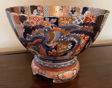
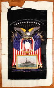
(Early 20th c) MEMENTO of the U.S.S. MONTANAJohn McInnis Auctioneers,LLC4.6(504)See Sold PriceFeb 25, 2024
Republic of China Jie Kan carved natural crystal idle chapter threeJapan Ancient Art Co. LTD4.4(39)See Sold PriceFeb 28, 2024
Perry, Matthew C. 1856 Large Map. Shah Bay, Lew Chew I. JapanAlbion Auctions4.6(341)See Sold PriceMar 01, 2024
ANTIQUE ILLUSTRATED HANDBOOK OF GEOGRAPHY AND TRAVEL IN ASIA, VOLUME 2, 1896NY Elizabeth 4.3(85)See Sold PriceMar 03, 2024
Henri Plon - Set of 20 topographical prints depicting Asia - Japan - China - Religious building -Proverde Auctions4.3(3)See Sold PriceFeb 28, 2024


![Smith: Map of Asia [verso] South Central Europe, 1894 (1 of 2)](https://p1.liveauctioneers.com/5584/103242/52831702_1_x.jpg?height=282&quality=70&version=1493321322)


![Smith: Map of Asia [verso] South Central Europe, 1894 (1 of 2)](https://p1.liveauctioneers.com/5584/105261/53910610_1_x.jpg?height=282&quality=70&version=1497542970)