ATLAS of ANTIENT GEOGRAPHY by SAMUEL BUTLER 1843John McInnis Auctioneers,LLC4.6(502)See Sold PriceFeb 24, 2024
18TH C. ANTIQUE MAP: FRENCH & INDIAN WAR, FRAMEDThomaston Place Auction Galleries4.4(386)See Sold PriceFeb 24, 2024
Rand McNally Railroad Map Cabinet w/ 21 Railroad MapsRail & Road Auctions4.6(165)See Sold PriceMar 08, 2024
Keith Haring - Ink on New York Map, Best Buddies, Inscribed, Signed, and DatedSapphire Auction Gallery4(67)See Sold PriceMar 02, 2024
LATE 17TH C. FRENCH MAP OF THE NEW WORLD BY ALEXIS-HUBERT JAILLOT (1632-1712)Thomaston Place Auction Galleries4.4(386)See Sold PriceFeb 24, 2024
Central Railroad of New Jersey Map of Sandy Hook Route-ca. 1903JM Hobby Supply and Railroad Artifact Auctions4.4(126)See Sold PriceFeb 24, 2024
Lot of Six Mixed Atlas Box Cars-HO Scale-New in BoxJM Hobby Supply and Railroad Artifact Auctions4.4(126)See Sold PriceFeb 25, 2024
Rand McNally/Santa Fe Railroad Map of Iowa-1912JM Hobby Supply and Railroad Artifact Auctions4.4(126)See Sold PriceFeb 24, 2024
NICOLAES VISSCHER (NETHERLANDS, 1618-1709) MAP OF THE NEW WORLDThomaston Place Auction Galleries4.4(386)See Sold PriceFeb 24, 2024
17TH C. WORLD MAP BY NICOLAES VISSCHER (NETHERLANDS, 1618-1709)Thomaston Place Auction Galleries4.4(386)See Sold PriceFeb 24, 2024
Lot of Six Mixed Atlas Cabooses-HO Scale-New in BoxJM Hobby Supply and Railroad Artifact Auctions4.4(126)See Sold PriceFeb 25, 2024
Smith: Map of Asia [verso] South Central Europe, 1894Map: 1894 Smith Map of Asia [verso] South Central Europe -- Map of Asia Showing its Geopolitical Divisions, and also the Various Routes of Travel between London & India, China & Japan &c. [verso] AustSee Sold Price
Smith: Map of Asia [verso] South Central Europe, 1894Map: 1894 Smith Map of Asia [verso] South Central Europe -- Map of Asia Showing its Geopolitical Divisions, and also the Various Routes of Travel between London & India, China & Japan &c. [verso] AustSee Sold Price
SoldSmith: Antique Map of Asia, 1894Map: 1894 Smith Map of Asia [verso] South Central Europe -- Map of Asia Showing its Geopolitical Divisions, and also the Various Routes of Travel between London & India, China & Japan &c. [verso] AustSee Sold Price
SoldSmith: Antique Map of South America, 1894Title/Content of Map: 1894 Smith Map of South America [verso] Columbia, Venezuala, Peru, Equador, Argentina -- Map of South America Showing its Political Divisions [verso] Map of U.S. of Columbia VeneSee Sold Price
Smith: Antique Map of South America, 1894Title/Content of Map: 1894 Smith Map of South America [verso] Columbia, Venezuala, Peru, Equador, Argentina -- Map of South America Showing its Political Divisions [verso] Map of U.S. of Columbia VeneSee Sold Price
Smith: Antique Map of South America, 1894Title/Content of Map: 1894 Smith Map of South America [verso] Columbia, Venezuala, Peru, Equador, Argentina -- Map of South America Showing its Political Divisions [verso] Map of U.S. of Columbia VeneSee Sold Price
-. Verburg (Isaak)/ Wetstein (R. & G.) De Oude Wer-. Verburg (Isaak)/ Wetstein (R. & G.) De Oude Wereldt tot beter verstandt der Oude Geschiedenissenmap of Europe, South-central Asia, and North Africa, with inset maps of Greece and a sectionSee Sold Price
SoldFEUR Verburg (Isaak)/ Wetstein (R. & G.) De OuFEUR Verburg (Isaak)/ Wetstein (R. & G.) De Oude Wereldt tot beter verstandt der Oude Geschiedenissenmap of Europe, South-central Asia, and North Africa, with inset maps of Greece and a seSee Sold Price
SoldOrtelius (Abraham) - Turcici Imperii Descriptio,showing the Turkish Empire, Saudi Arabia, south east Europe and Egypt, large decorative title cartouche lower left, ships and sea monster, engraved map, 410 x 520mm., Latin text on verso, central vertSee Sold Price
SoldRuscelli (Girolamo) - India Tercera Nuova Tavola,South East Asia from the Bay of Bengal to Southern China, including Java and Timor, titled above, engraved map, 185 x 260mm., Italian text verso, slight browning on central vertical fold, Venice, [c.1See Sold Price
Smith: Map of Central Europe, 1850Map: Central Europe Publication Date: 1850 Authors: CADY & BURGESS, STILES/SHERMAN/SMITH/BURGESS Publisher: CADY & BURGESS Size: Quarto – 10.25 H x 8.50 W Inches Polar projected map from the twelfthSee Sold Price
SoldMitchell: Antique Map of Asia Verso Europe, 1852Map: 1852 Mitchell Map of Asia -- Asia. Verso: western Europe -- France, Italy, Spain, Portugal and Greece. Cartographer: S Mitchell Year / Place: 1852, Philadelphia Dimensions: 8.2 x 10.5 in. ConditiSee Sold Price
SoldUNSEARCHED WORLD BANKNOTE CURRENCY LOT OVER 65Big variety of note minimal duplication, Asia, South America, Europe, Central America, Africa, truly unsearched, rare notes have often come from these offeringsSee Sold Price
Mitchell: Map of Asia & Western Europe, 1852Map: 1852 Mitchell Map of Asia -- Asia. Verso: Western Europe -- France, Italy, Spain, Portugal and Greece. Cartographer: S Mitchell Year / Place: 1852, Philadelphia Map Dimensions: 8.2 x 10.5 in. A vSee Sold Price
SoldGoldsmith, J. 1852 Lot of 15 Maps and Prints6 Maps of Africa, Canaan/Palestine, Asia, Central Europe, British Isles, and Europe. Together with 9 Prints showing Astronomy, Brunei/New Zealand/Sydney, Cairo/Egypt/Algiers, New York/North American ISee Sold Price
SoldCornell: Antique Map of West, Central & South EuropeTitle/Content of Map: Western, Central & Southern Continental Europe. Date Printed: 1857 Cartographer: CORNELL, SARAH SOPHIA Publisher: D. APPLETON 1857 NEW YORK Size: Folio – 12.60 H x 20.30 W InchSee Sold Price
A Group of Foreign Coins and Currency,A Group of Foreign Coins and Currency, mostly early 20th century comprising Eastern and Western Europe, Central and South America, Asia, Australia and New Zealand.See Sold Price
A quantity of British and Continental viewsA large quantity of British and Continental views,including views of central Europe and south-east Asia, as well as a quantity of historical plates, steel engravings, c.210 x 285mm., marginalSee Sold Price
Sold1932 Spinning Wheel Map of Asia and Europe on Verso --Title/Content of Map: 1932 Spinning Wheel Map of Asia and Europe on Verso -- Chart of Knowledge Cartographer: S Bocholtz / Chart of Knowledge Co. Year/Place: 1932, Boston Size: 10.2 X 10.2 in. This isSee Sold Price
1932 Spinning Wheel Map of Asia and Europe on Verso --Title/Content of Map: 1932 Spinning Wheel Map of Asia and Europe on Verso -- Chart of Knowledge Date: 1932, Boston Cartographer: S Bocholtz / Chart of Knowledge Co. Size: 10.2 X 10.2 in. This is a rarSee Sold Price
INT'L FIRE DEPARTMENT PATCHES EUROPE ASIA AFRICA & MOREINT'L FIRE DEPARTMENT PATCHES EUROPE ASIA AFRICA & MORE 180 International Fire Department patches Europe, Asia, Central America, South America, and Africa.See Sold Price
Sold12V James Bell A SYSTEM OF GEOGRAPHY 1839‐12V James Bell A SYSTEM OF GEOGRAPHY 1839‐1840 Complete Set Antique Engraved Folding Maps Plates Illustrated History Europe Asia South America Asia Minor Islands Australia North America CartSee Sold Price
SoldBartholomew, John 1889 Lot of 5 Continents MapsCommercial Continent Maps of Asia, Africa, Europe, North & South America. Lithograph Maps Published 1889, Cambridge for "Atlas of Commercial Geography" by John George Bartholomew. Paper Size: 12 x 10See Sold Price
1858 Mitchell Map of South America [verso] Europe --Title/Content of Map: 1858 Mitchell Map of South America [verso] Europe -- No.19 Map of South America [verso] No. 21 Map of Europe Date: 1858, Philadelphia Cartographer: S Mitchell Size: 10.4 x 8 in.See Sold Price
Soren Bjulf (Danish,Dutch,1890-1958) oil paintingBroward Auction Gallery4.8(277)See Sold PriceMar 17, 2024
A Fine RARE Antique Woven ikat Pictorial TextilePremier Auction Galleries4.3(329)See Sold PriceMar 09, 2024
Group of Ten Railroad Photographs, Maps, and Prints - New Jersey, Long Island, and New YorkRail & Road Auctions4.6(165)See Sold PriceMar 07, 2024
Jean Hugo (French, 1894–1984) - Les Sorcières, WarwickFreeman's | Hindman4.5(158)See Sold PriceFeb 28, 2024
[ENSLAVEMENT & ABOLITION]. A group of 3 prints related to the Atlantic slave trade, including plansFreeman's | Hindman4.4(1.6k)See Sold PriceFeb 27, 2024
Catherwood - General View of Uxmal, Taken from the Archway of Las Monjas, Looking SouthTrillium Antique Prints & Rare Books4.5(30)See Sold PriceFeb 24, 2024
Carey, pub. 1796 - A Chart of the West IndiesTrillium Antique Prints & Rare Books4.5(30)See Sold PriceFeb 24, 2024
Carey, pub. 1796 - Map of the State of MarylandTrillium Antique Prints & Rare Books4.5(30)See Sold PriceFeb 24, 2024
Carey, pub. 1796 - Map of GeorgiaTrillium Antique Prints & Rare Books4.5(30)See Sold PriceFeb 24, 2024
Carey, pub. 1796 - Map of The State of South CarolinaTrillium Antique Prints & Rare Books4.5(30)See Sold PriceFeb 24, 2024
Carey, pub. 1796 - Map of KentuckyTrillium Antique Prints & Rare Books4.5(30)See Sold PriceFeb 24, 2024
Carey, pub. 1796 - Map of the Tennassee State formerly part of North Carolina (Tennessee)Trillium Antique Prints & Rare Books4.5(30)See Sold PriceFeb 24, 2024
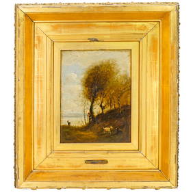
Attrib. Jean Baptiste Camille Corot (French, 1796-1875) Oil on Canvas PaintingAkiba Galleries4.7(1.7k)See Sold PriceFeb 29, 2024


![Smith: Map of Asia [verso] South Central Europe, 1894 First Image](https://p1.liveauctioneers.com/5584/103242/52831702_1_x.jpg?height=282&quality=95&version=1493321322&width=282)

![Smith: Map of Asia [verso] South Central Europe, 1894 First Image](https://p1.liveauctioneers.com/5584/103242/52831702_1_x.jpg?height=282&quality=1&version=1493321322&width=282)


![Smith: Map of Asia [verso] South Central Europe, 1894 (1 of 2)](https://p1.liveauctioneers.com/5584/103242/52831702_1_x.jpg?height=282&quality=70&version=1493321322)
![Smith: Map of Asia [verso] South Central Europe, 1894 (1 of 2)](https://p1.liveauctioneers.com/5584/105261/53910610_1_x.jpg?height=282&quality=70&version=1497542970)


![1858 Mitchell Map of South America [verso] Europe -- (1 of 2)](https://p1.liveauctioneers.com/5584/164510/83043463_1_x.jpg?height=282&quality=70&version=1585094571)


![[ENSLAVEMENT & ABOLITION]. A group of 3 prints related to the Atlantic slave trade, including plans (1 of 3)](https://p1.liveauctioneers.com/197/319238/171468007_1_x.jpg?height=282&quality=70&version=1707520367)